Execution Version AMENDED AND RESTATED MASTER LEASE ACTIVE/103726432.5 US- DOCS\116344257.8
TABLE OF CONTENTS TO AMENDED AND RESTATED MASTER LEASE Page ARTICLE I 1.1 Leased Property. ................................................................................................................. 1 1.2 Single, Indivisible Lease. .................................................................................................... 2 1.3 Term. ................................................................................................................................... 2 1.4 Renewal Terms. .................................................................................................................. 2 ARTICLE II 2.1 Definitions........................................................................................................................... 3 ARTICLE III 3.1 Rent. .................................................................................................................................. 27 3.2 Late Payment of Rent........................................................................................................ 27 3.3 Method of Payment of Rent. ............................................................................................. 27 3.4 Net Lease. ......................................................................................................................... 28 ARTICLE IV 4.1 Impositions. ....................................................................................................................... 28 4.2 Utilities. ............................................................................................................................. 29 4.3 Impound Account. ............................................................................................................. 30 ARTICLE V 5.1 No Termination, Abatement, etc. ...................................................................................... 30 ARTICLE VI 6.1 Ownership of the Leased Property. ................................................................................... 31 6.2 Tenant’s Property. ............................................................................................................. 32 6.3 Guarantors; Tenant’s Property. ......................................................................................... 33 ARTICLE VII 7.1 Condition of the Leased Property. .................................................................................... 33 7.2 Use of the Leased Property. .............................................................................................. 33 7.3 Competing Business.......................................................................................................... 34 i ACTIVE/103726432.5 US-DOCS\116344257.8
ARTICLE VIII 8.1 Representations and Warranties. ....................................................................................... 35 8.2 Compliance with Legal and Insurance Requirements, etc. ............................................... 35 8.3 Zoning and Uses. .............................................................................................................. 37 8.4 Compliance with Ground Lease. ....................................................................................... 37 ARTICLE IX 9.1 Maintenance and Repair. .................................................................................................. 38 9.2 Encroachments, Restrictions, Mineral Leases, etc. ........................................................... 40 ARTICLE X 10.1 Construction of Capital Improvements to the Leased Property. ....................................... 41 10.2 Construction Requirements for All Capital Improvements. ............................................. 42 10.3 Landlord’s Right of First Offer to Fund. .......................................................................... 43 ARTICLE XI 11.1 Liens. ................................................................................................................................. 45 ARTICLE XII 12.1 Permitted Contests. ........................................................................................................... 47 ARTICLE XIII 13.1 General Insurance Requirements. ..................................................................................... 48 13.2 Maximum Foreseeable Loss. ............................................................................................ 50 13.3 Additional Insurance. ........................................................................................................ 50 13.4 Waiver of Subrogation. ..................................................................................................... 50 13.5 Policy Requirements. ........................................................................................................ 50 13.6 Increase in Limits. ............................................................................................................. 51 13.7 Blanket Policy. .................................................................................................................. 51 13.8 No Separate Insurance. ..................................................................................................... 51 ARTICLE XIV 14.1 Property Insurance Proceeds. ............................................................................................ 52 14.2 Tenant’s Obligations Following Casualty. ....................................................................... 52 14.3 No Abatement of Rent. ..................................................................................................... 53 14.4 Waiver. .............................................................................................................................. 53 14.5 Insurance Proceeds Paid to Facility Mortgagee. ............................................................... 53 14.6 Termination of Master Lease; Abatement of Rent. .......................................................... 54 ii ACTIVE/103726432.5 US-DOCS\116344257.8
ARTICLE XV 15.1 Condemnation. .................................................................................................................. 55 15.2 Award Distribution. .......................................................................................................... 55 15.3 Temporary Taking. ........................................................................................................... 56 15.4 Condemnation Awards Paid to Facility Mortgagee. ......................................................... 56 15.5 Termination of Master Lease; Abatement of Rent. .......................................................... 56 ARTICLE XVI 16.1 Events of Default. ............................................................................................................. 56 16.2 Certain Remedies. ............................................................................................................. 59 16.3 Damages. ........................................................................................................................... 60 16.4 Receiver. ........................................................................................................................... 61 16.5 Waiver. .............................................................................................................................. 61 16.6 Application of Funds......................................................................................................... 61 ARTICLE XVII 17.1 Permitted Leasehold Mortgagees. ..................................................................................... 61 17.2 Landlord’s Right to Cure Tenant’s Default. ..................................................................... 69 17.3 Landlord’s Right to Cure Debt Agreement. ...................................................................... 69 ARTICLE XVIII 18.1 Sale of the Leased Property. ............................................................................................. 70 ARTICLE XIX 19.1 Holding Over. ................................................................................................................... 71 ARTICLE XX 20.1 Risk of Loss. ..................................................................................................................... 71 ARTICLE XXI 21.1 General Indemnification. .................................................................................................. 71 ARTICLE XXII 22.1 Xxxxxxxxxx and Assignment. .............................................................................................. 72 22.2 Permitted Assignments. .................................................................................................... 72 22.3 Permitted Sublease Agreements. ...................................................................................... 75 22.4 Required Assignment and Subletting Provisions. ............................................................. 76 22.5 Costs. ................................................................................................................................. 76 22.6 No Release of Tenant’s Obligations; Exception. .............................................................. 77 22.7 Replacement Property Transaction. .................................................................................. 77 iii ACTIVE/103726432.5 US-DOCS\116344257.8
41.9 Counterparts. ................................................................................................................... 107 41.10 Interpretation. .................................................................................................................. 107 41.11 Time of Essence. ............................................................................................................. 108 41.12 Further Assurances.......................................................................................................... 108 41.13 Gaming Regulations. ....................................................................................................... 108 41.14 Certain Provisions of Nevada Law. ................................................................................ 108 41.15 Certain Provisions of Louisiana Law. ............................................................................. 109 41.16 Certain Provisions of New Jersey Law ........................................................................... 109 41.17 Conditions to this Master Lease. ..................................................................................... 111 vi ACTIVE/103726432.5 US-DOCS\116344257.8
EXHIBITS AND SCHEDULES EXHIBIT A – LIST OF FACILITIES EXHIBIT B – LEGAL DESCRIPTIONS EXHIBIT C – GAMING LICENSES EXHIBIT D – FORM OF GUARANTY EXHIBIT E – FORM OF NONDISTURBANCE AND ATTORNMENT AGREEMENT EXHIBIT F – FORM OF SUBORDINATION, NONDISTURBANCE AND ATTORNMENT AGREEMENT SCHEDULE A – DISCLOSURE ITEMS SCHEDULE B – PROPERTY AGREEMENTS SCHEDULE C – PROPERTY VALUES SCHEDULE D – 2019 FACILITY ADJUSTED REVENUE SCHEDULE 1.1 – EXCLUSIONS FROM LEASED PROPERTY SCHEDULE 6.3 – GUARANTORS UINDER THE MASTER LEASE vii ACTIVE/103726432.5 US-DOCS\116344257.8
AMENDED AND RESTATED MASTER LEASE This AMENDED AND RESTATED MASTER LEASE (the “Master Lease”) is entered into as of June 15, 2020 (the “Effective Date”), by and among GLP CAPITAL, L.P. (together with its permitted successors and assigns, “Landlord”), and TROPICANA ENTERTAINMENT, INC., a Delaware corporation (together with its permitted successors and assigns, “Tenant”). RECITALS A. On October 1, 2018 (the “Original Effective Date”), Landlord, Tropicana AC Sub Corp., as co-landlord, Tenant and Tropicana Atlantic City Corp., as co-tenant, entered into that certain Master Lease, as amended by that certain Partial Termination of and First Amendment to Master Lease, dated as of June 9, 2019 and as modified by that certain Waiver to Master Lease, dated as of March 31, 2020 (as so amended and modified, the “Original Master Lease”) pursuant to which Landlord leased the Leased Property to Tenant. B. A list of the five (5) facilities covered by this Master Lease as of the Commencement Date and as of the Effective Date is attached hereto as Exhibit A (each a “Facility,” and collectively, the “Facilities”). C. Landlord and Tenant hereby wish to amend and restate the Original Master Lease in its entirety pursuant to the terms hereof. D. Capitalized terms used in this Master Lease and not otherwise defined herein are defined in Article II hereof. NOW, THEREFORE, for good and valuable consideration, the receipt and sufficiency of which are hereby acknowledged, the parties agree as follows: ARTICLE I 1.1 Leased Property. Upon and subject to the terms and conditions hereinafter set forth, Landlord leases to Tenant and Tenant leases from Landlord all of Landlord’s rights and interest in and to the following with respect to each of the Facilities (collectively, the “Leased Property”): (a) the real property or properties described in Exhibit B attached hereto (collectively, the “Land”); (b) all buildings, structures, barges, riverboats, Fixtures (as hereinafter defined) and other improvements of every kind now or hereafter located on the Land or connected thereto including, but not limited to, alleyways and connecting tunnels, sidewalks, utility pipes, conduits and lines (on-site and off-site to the extent Landlord has obtained any interest in the same), parking areas and roadways appurtenant to such buildings and structures of each such Facility (collectively, the “Leased Improvements”); ACTIVE/103726432.5 US-DOCS\116344257.8
Adjusted Revenue: For any Test Period, Net Revenue (i) minus expenses other than Specified Expenses and (ii) plus Specified Proceeds, if any; provided, however, that for purposes of calculating Adjusted Revenue, Net Revenue shall not include Gaming Revenues, Retail Sales or Promotional Allowances of any subtenants of Tenant or any deemed payments under subleases of this Master Lease, licenses or other access rights from Tenant to its operating subsidiaries. Adjusted Revenue for the Leased Property shall be calculated on a pro forma basis to give effect to any increase or decrease in Rent as a result of the addition or removal of Leased Property to this Master Lease since the beginning of any Test Period of Tenant as if each such increase or decrease had been effected on the first day of such Test Period. For purposes of calculating Adjusted Revenue to Rent Ratio, (a) subject to clause (b) below, if any Facility is closed to the public for more than fifteen (15) days as a result of an Unavoidable Delay during any fiscal quarter of any Test Period, then (i) the Adjusted Revenue attributable to such Facility in respect of such fiscal quarter shall be excluded from the calculation of Adjusted Revenue for such Test Period and (ii) the Adjusted Revenue attributable to such Facility during any fiscal quarters of such Test Period during which such Facility is not closed to the public for more than fifteen (15) days shall be annualized as follows for purposes of calculating Adjusted Revenue for such Test Period: (A) if such Facility is not closed to the public for more than fifteen (15) days in any of the remaining three (3) fiscal quarters of such Test Period, then the aggregate Adjusted Revenue attributable to such Facility for such quarters shall be multiplied by 4/3, (B) if such Facility is not closed to the public for more than fifteen (15) days in only two (2) fiscal quarters of such Test Period, then the aggregate Adjusted Revenue attributable to such Facility for such quarters shall be multiplied by 2 and (C) if such Facility is not closed to the public for more than fifteen (15) days in only one (1) fiscal quarter of such Test Period, then the Adjusted Revenue attributable to such Facility for such quarter shall be multiplied by 4 and (b) notwithstanding clause (a) above, for purposes of calculating the Adjusted Revenue from and after any Covenant Resumption Date, (i) the Adjusted Revenue for the Test Period ending on the last day of the fiscal quarter in which the Covenant Resumption Date occurs (the “Initial Test Period”) shall be deemed to be the Adjusted Revenue for the last fiscal quarter of the Initial Test Period, in each case, multiplied by 4, (ii) the Adjusted Revenue for the first Test Period ending after the Initial Test Period (the “Second Test Period”) shall be deemed to be the Adjusted Revenue for the last two fiscal quarters of the Second Test Period, in each case, multiplied by 2 and (iii) the Adjusted Revenue for the second Test Period ending after the Initial Test Period (the “Third Test Period”) shall be deemed to be the Adjusted Revenue for the last three fiscal quarters of the Third Test Period, in each case, multiplied by 4/3. Adjusted Revenue Pool: As of any date of determination, the aggregate amount of the Facility Adjusted Revenue of Tenant for all of the Facilities that are included in this Master Lease. Adjusted Revenue to Rent Ratio: As at any date of determination, the ratio for any period of Adjusted Revenue to Rent. For purposes of calculating the Adjusted Revenue to Rent Ratio, Adjusted Revenue shall be calculated on a pro forma basis (and shall be calculated to give effect to (x) pro forma adjustments reasonably contemplated by Tenant and (y) such other pro forma adjustments consistent with Regulation S-X under the Securities Act) to give effect to any material acquisitions and material asset sales consummated by the Tenant or any Guarantor during any Test Period of Tenant as if each such material acquisition had been effected on the first day of such Test Period and as if each such material asset sale had been consummated on the day prior to 4 ACTIVE/103726432.5 US-DOCS\116344257.8
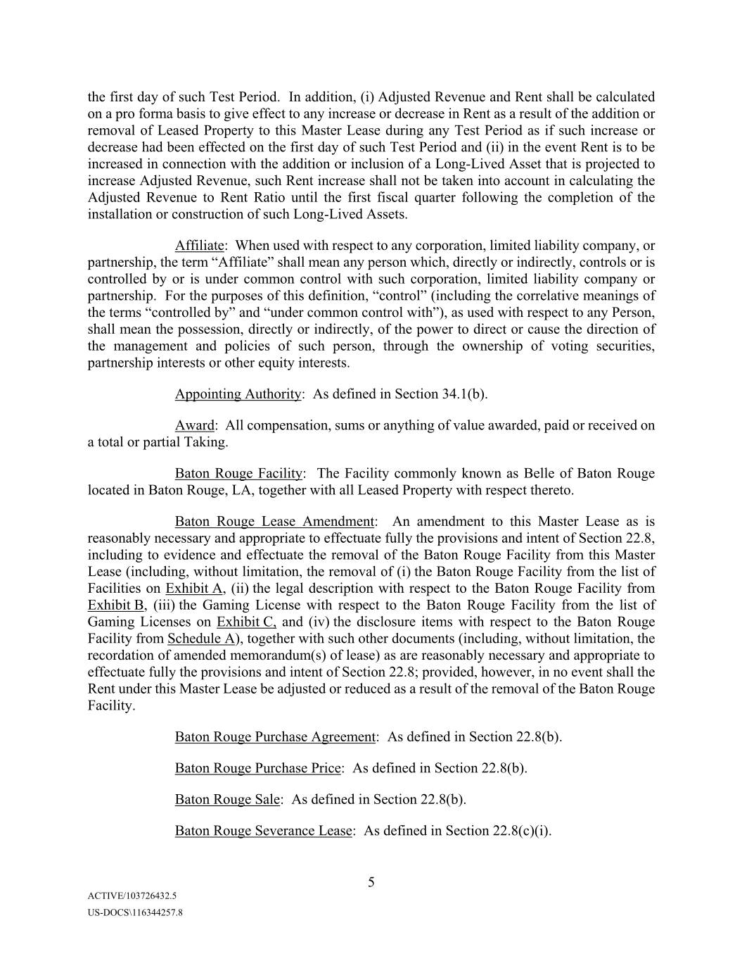
the first day of such Test Period. In addition, (i) Adjusted Revenue and Rent shall be calculated on a pro forma basis to give effect to any increase or decrease in Rent as a result of the addition or removal of Leased Property to this Master Lease during any Test Period as if such increase or decrease had been effected on the first day of such Test Period and (ii) in the event Rent is to be increased in connection with the addition or inclusion of a Long-Lived Asset that is projected to increase Adjusted Revenue, such Rent increase shall not be taken into account in calculating the Adjusted Revenue to Rent Ratio until the first fiscal quarter following the completion of the installation or construction of such Long-Lived Assets. Affiliate: When used with respect to any corporation, limited liability company, or partnership, the term “Affiliate” shall mean any person which, directly or indirectly, controls or is controlled by or is under common control with such corporation, limited liability company or partnership. For the purposes of this definition, “control” (including the correlative meanings of the terms “controlled by” and “under common control with”), as used with respect to any Person, shall mean the possession, directly or indirectly, of the power to direct or cause the direction of the management and policies of such person, through the ownership of voting securities, partnership interests or other equity interests. Appointing Authority: As defined in Section 34.1(b). Award: All compensation, sums or anything of value awarded, paid or received on a total or partial Taking. Baton Rouge Facility: The Facility commonly known as Belle of Baton Rouge located in Baton Rouge, LA, together with all Leased Property with respect thereto. Baton Rouge Lease Amendment: An amendment to this Master Lease as is reasonably necessary and appropriate to effectuate fully the provisions and intent of Section 22.8, including to evidence and effectuate the removal of the Baton Rouge Facility from this Master Lease (including, without limitation, the removal of (i) the Baton Rouge Facility from the list of Facilities on Exhibit A, (ii) the legal description with respect to the Baton Rouge Facility from Exhibit B, (iii) the Gaming License with respect to the Baton Rouge Facility from the list of Gaming Licenses on Exhibit C, and (iv) the disclosure items with respect to the Baton Rouge Facility from Schedule A), together with such other documents (including, without limitation, the recordation of amended memorandum(s) of lease) as are reasonably necessary and appropriate to effectuate fully the provisions and intent of Section 22.8; provided, however, in no event shall the Rent under this Master Lease be adjusted or reduced as a result of the removal of the Baton Rouge Facility. Baton Rouge Purchase Agreement: As defined in Section 22.8(b). Baton Rouge Purchase Price: As defined in Section 22.8(b). Baton Rouge Sale: As defined in Section 22.8(b). Baton Rouge Severance Lease: As defined in Section 22.8(c)(i). 5 ACTIVE/103726432.5 US-DOCS\116344257.8
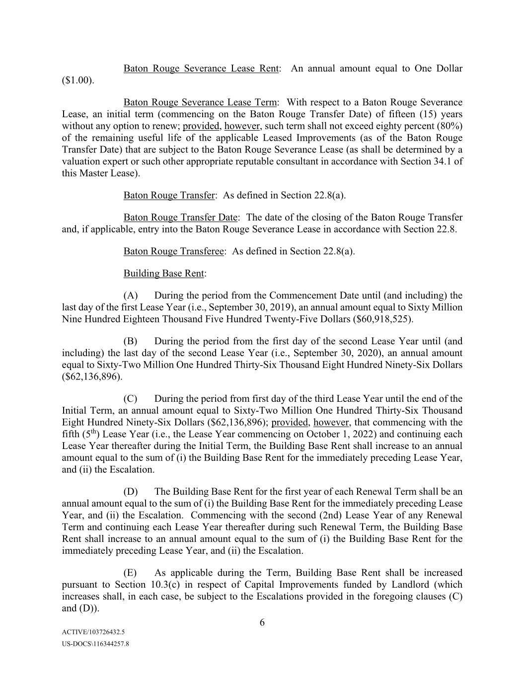
Baton Rouge Severance Lease Rent: An annual amount equal to One Dollar ($1.00). Baton Rouge Severance Lease Term: With respect to a Baton Rouge Severance Lease, an initial term (commencing on the Baton Rouge Transfer Date) of fifteen (15) years without any option to renew; provided, however, such term shall not exceed eighty percent (80%) of the remaining useful life of the applicable Leased Improvements (as of the Baton Rouge Transfer Date) that are subject to the Baton Rouge Severance Lease (as shall be determined by a valuation expert or such other appropriate reputable consultant in accordance with Section 34.1 of this Master Lease). Baton Rouge Transfer: As defined in Section 22.8(a). Baton Rouge Transfer Date: The date of the closing of the Baton Rouge Transfer and, if applicable, entry into the Baton Rouge Severance Lease in accordance with Section 22.8. Baton Rouge Transferee: As defined in Section 22.8(a). Building Base Rent: (A) During the period from the Commencement Date until (and including) the last day of the first Lease Year (i.e., September 30, 2019), an annual amount equal to Sixty Million Nine Hundred Eighteen Thousand Five Hundred Twenty-Five Dollars ($60,918,525). (B) During the period from the first day of the second Lease Year until (and including) the last day of the second Lease Year (i.e., September 30, 2020), an annual amount equal to Sixty-Two Million One Hundred Thirty-Six Thousand Eight Hundred Ninety-Six Dollars ($62,136,896). (C) During the period from first day of the third Lease Year until the end of the Initial Term, an annual amount equal to Sixty-Two Million One Hundred Thirty-Six Thousand Eight Hundred Ninety-Six Dollars ($62,136,896); provided, however, that commencing with the fifth (5th) Lease Year (i.e., the Lease Year commencing on October 1, 2022) and continuing each Lease Year thereafter during the Initial Term, the Building Base Rent shall increase to an annual amount equal to the sum of (i) the Building Base Rent for the immediately preceding Lease Year, and (ii) the Escalation. (D) The Building Base Rent for the first year of each Renewal Term shall be an annual amount equal to the sum of (i) the Building Base Rent for the immediately preceding Lease Year, and (ii) the Escalation. Commencing with the second (2nd) Lease Year of any Renewal Term and continuing each Lease Year thereafter during such Renewal Term, the Building Base Rent shall increase to an annual amount equal to the sum of (i) the Building Base Rent for the immediately preceding Lease Year, and (ii) the Escalation. (E) As applicable during the Term, Building Base Rent shall be increased pursuant to Section 10.3(c) in respect of Capital Improvements funded by Landlord (which increases shall, in each case, be subject to the Escalations provided in the foregoing clauses (C) and (D)). 6 ACTIVE/103726432.5 US-DOCS\116344257.8
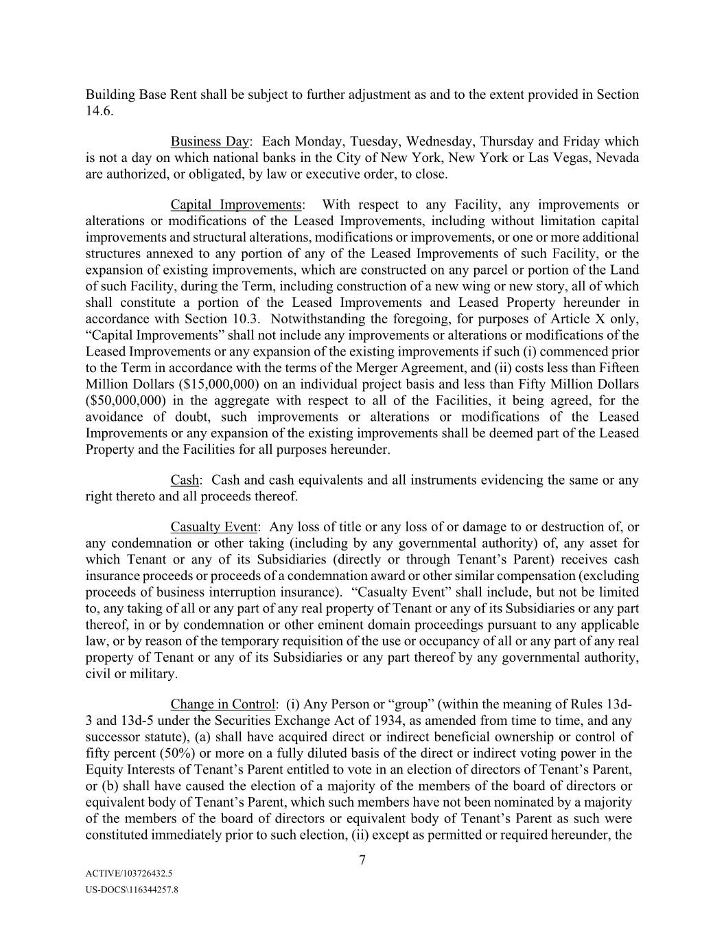
Building Base Rent shall be subject to further adjustment as and to the extent provided in Section 14.6. Business Day: Each Monday, Tuesday, Wednesday, Thursday and Friday which is not a day on which national banks in the City of New York, New York or Las Vegas, Nevada are authorized, or obligated, by law or executive order, to close. Capital Improvements: With respect to any Facility, any improvements or alterations or modifications of the Leased Improvements, including without limitation capital improvements and structural alterations, modifications or improvements, or one or more additional structures annexed to any portion of any of the Leased Improvements of such Facility, or the expansion of existing improvements, which are constructed on any parcel or portion of the Land of such Facility, during the Term, including construction of a new wing or new story, all of which shall constitute a portion of the Leased Improvements and Leased Property hereunder in accordance with Section 10.3. Notwithstanding the foregoing, for purposes of Article X only, “Capital Improvements” shall not include any improvements or alterations or modifications of the Leased Improvements or any expansion of the existing improvements if such (i) commenced prior to the Term in accordance with the terms of the Merger Agreement, and (ii) costs less than Fifteen Million Dollars ($15,000,000) on an individual project basis and less than Fifty Million Dollars ($50,000,000) in the aggregate with respect to all of the Facilities, it being agreed, for the avoidance of doubt, such improvements or alterations or modifications of the Leased Improvements or any expansion of the existing improvements shall be deemed part of the Leased Property and the Facilities for all purposes hereunder. Cash: Cash and cash equivalents and all instruments evidencing the same or any right thereto and all proceeds thereof. Casualty Event: Any loss of title or any loss of or damage to or destruction of, or any condemnation or other taking (including by any governmental authority) of, any asset for which Tenant or any of its Subsidiaries (directly or through Tenant’s Parent) receives cash insurance proceeds or proceeds of a condemnation award or other similar compensation (excluding proceeds of business interruption insurance). “Casualty Event” shall include, but not be limited to, any taking of all or any part of any real property of Tenant or any of its Subsidiaries or any part thereof, in or by condemnation or other eminent domain proceedings pursuant to any applicable law, or by reason of the temporary requisition of the use or occupancy of all or any part of any real property of Tenant or any of its Subsidiaries or any part thereof by any governmental authority, civil or military. Change in Control: (i) Any Person or “group” (within the meaning of Rules 13d- 3 and 13d-5 under the Securities Exchange Act of 1934, as amended from time to time, and any successor statute), (a) shall have acquired direct or indirect beneficial ownership or control of fifty percent (50%) or more on a fully diluted basis of the direct or indirect voting power in the Equity Interests of Tenant’s Parent entitled to vote in an election of directors of Tenant’s Parent, or (b) shall have caused the election of a majority of the members of the board of directors or equivalent body of Tenant’s Parent, which such members have not been nominated by a majority of the members of the board of directors or equivalent body of Xxxxxx’s Parent as such were constituted immediately prior to such election, (ii) except as permitted or required hereunder, the 7 ACTIVE/103726432.5 US-DOCS\116344257.8
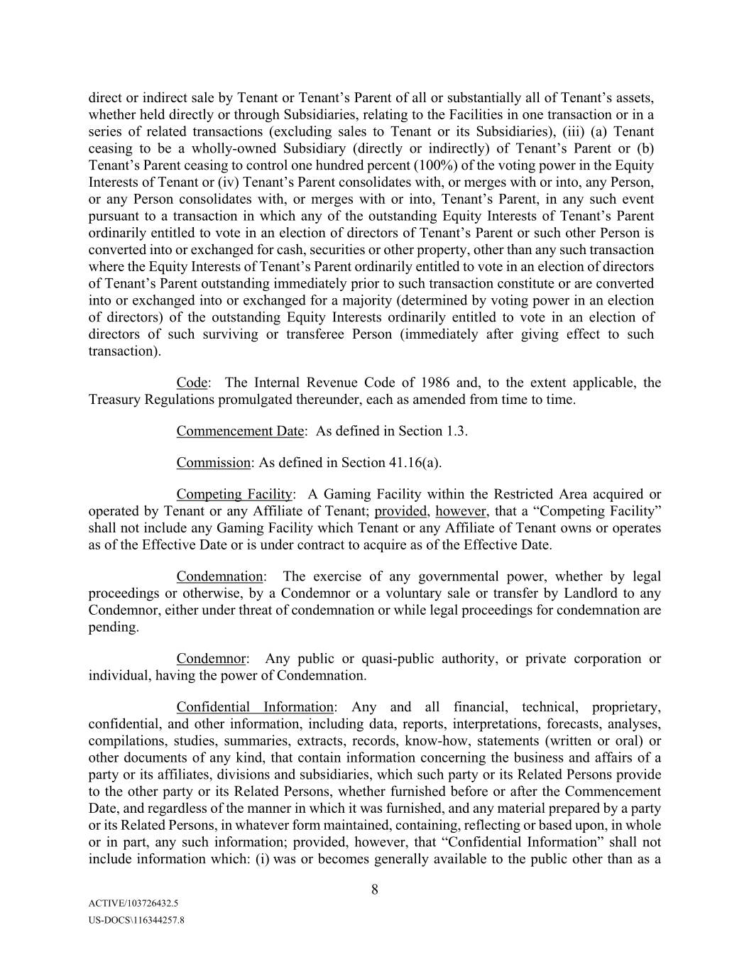
direct or indirect sale by Tenant or Tenant’s Parent of all or substantially all of Tenant’s assets, whether held directly or through Subsidiaries, relating to the Facilities in one transaction or in a series of related transactions (excluding sales to Tenant or its Subsidiaries), (iii) (a) Tenant ceasing to be a wholly-owned Subsidiary (directly or indirectly) of Tenant’s Parent or (b) Tenant’s Parent ceasing to control one hundred percent (100%) of the voting power in the Equity Interests of Tenant or (iv) Tenant’s Parent consolidates with, or merges with or into, any Person, or any Person consolidates with, or merges with or into, Xxxxxx’s Parent, in any such event pursuant to a transaction in which any of the outstanding Equity Interests of Tenant’s Parent ordinarily entitled to vote in an election of directors of Tenant’s Parent or such other Person is converted into or exchanged for cash, securities or other property, other than any such transaction where the Equity Interests of Tenant’s Parent ordinarily entitled to vote in an election of directors of Tenant’s Parent outstanding immediately prior to such transaction constitute or are converted into or exchanged into or exchanged for a majority (determined by voting power in an election of directors) of the outstanding Equity Interests ordinarily entitled to vote in an election of directors of such surviving or transferee Person (immediately after giving effect to such transaction). Code: The Internal Revenue Code of 1986 and, to the extent applicable, the Treasury Regulations promulgated thereunder, each as amended from time to time. Commencement Date: As defined in Section 1.3. Commission: As defined in Section 41.16(a). Competing Facility: A Gaming Facility within the Restricted Area acquired or operated by Tenant or any Affiliate of Tenant; provided, however, that a “Competing Facility” shall not include any Gaming Facility which Tenant or any Affiliate of Tenant owns or operates as of the Effective Date or is under contract to acquire as of the Effective Date. Condemnation: The exercise of any governmental power, whether by legal proceedings or otherwise, by a Condemnor or a voluntary sale or transfer by Landlord to any Condemnor, either under threat of condemnation or while legal proceedings for condemnation are pending. Condemnor: Any public or quasi-public authority, or private corporation or individual, having the power of Condemnation. Confidential Information: Any and all financial, technical, proprietary, confidential, and other information, including data, reports, interpretations, forecasts, analyses, compilations, studies, summaries, extracts, records, know-how, statements (written or oral) or other documents of any kind, that contain information concerning the business and affairs of a party or its affiliates, divisions and subsidiaries, which such party or its Related Persons provide to the other party or its Related Persons, whether furnished before or after the Commencement Date, and regardless of the manner in which it was furnished, and any material prepared by a party or its Related Persons, in whatever form maintained, containing, reflecting or based upon, in whole or in part, any such information; provided, however, that “Confidential Information” shall not include information which: (i) was or becomes generally available to the public other than as a 8 ACTIVE/103726432.5 US-DOCS\116344257.8
result of a disclosure by the other party or its Related Persons in breach of this Master Lease; (ii) was or becomes available to the other party or its Related Persons on a non-confidential basis prior to its disclosure hereunder as evidenced by the written records of the other party or its Related Persons, provided that the source of the information is not bound by a confidentiality agreement or otherwise prohibited from transmitting such information by a contractual, legal or fiduciary duty; or (iii) was independently developed by the other party without the use of any Confidential Information, as evidenced by the written records of the other party. Consolidated Interest Expense: For any period, interest expense of Tenant and its Subsidiaries that are Guarantors for such period as determined on a consolidated basis for Tenant and its Subsidiaries that are Guarantors in accordance with GAAP. Covenant Resumption Date: The first day following the end of a Covenant Suspension Period. Covenant Suspension Period: If on the last day of any Test Period more than 75% of the Facilities under this Master Lease are closed to the public, and have been closed for a period of more than fifteen (15) days, in each case due to an Unavoidable Delay, then the period commencing on (and including) the last day of any such Test Period and continuing until (but excluding) the last day of the second full consecutive fiscal quarter throughout which at least 25% of the Facilities under this Master Lease have remained open to the public. Notwithstanding the foregoing, Tenant may, in its sole discretion, elect that any Covenant Suspension Period end on any date prior to the date that such Covenant Suspension Period would otherwise end absent such election. CPI: The United States Department of Labor, Bureau of Labor Statistics Revised Consumer Price Index for All Urban Consumers (1982-84=100), U.S. City Average, All Items, or, if that index is not available at the time in question, the index designated by such Department as the successor to such index, and if there is no index so designated, an index for an area in the United States that most closely corresponds to the entire United States, published by such Department, or if none, by any other instrumentality of the United States. CPI Increase: The product of (i) the CPI published for the beginning of each Lease Year, divided by (ii) the CPI published for the beginning of the first Lease Year. If the product is less than one, the CPI Increase shall be equal to one. CPR Institute: As defined in Section 34.1(b). Date of Taking: The date the Condemnor has the right to possession of the property being condemned. Debt Agreement: If designated by Tenant to Landlord in writing to be included in the definition of “Debt Agreement,” one or more (A) debt facilities or commercial paper facilities, providing for revolving credit loans, term loans, receivables financing (including through the sale of receivables to lenders or to special purpose entities formed to borrow from lenders against such receivables) or letters of credit, (B) debt securities, indentures or other forms of debt financing (including convertible or exchangeable debt instruments or bank guarantees or bankers’ 9 ACTIVE/103726432.5 US-DOCS\116344257.8
acceptances), or (C) instruments or agreements evidencing any other indebtedness, in each case, with the same or different borrowers or issuers and, in each case, (i) entered into from time to time by Tenant and/or its Affiliates (including Tenant’s Parent), (ii) as amended, supplemented, modified, extended, restructured, renewed, refinanced, restated, replaced or refunded in whole or in part from time to time, (iii) which may be secured by assets of Tenant and its Subsidiaries, including, but not limited to, their Cash, Accounts, Tenant’s Property, real property and leasehold estates in real property (including this Master Lease), and (iv) which shall provide Landlord, in accordance with Section 17.3 hereof, the right to receive copies of notices of Specified Debt Agreement Defaults thereunder and opportunity to cure any breaches or defaults by Tenant thereunder within the cure period, if any, that exists under such Debt Agreement. For the avoidance of doubt, that certain Credit Agreement, dated as of April 17, 2017, by and among Eagle II Acquisition Company LLC (to be succeeded on the Closing Date by Eldorado Resorts, Inc.), as Borrower, JPMorgan Chase Bank, N.A., as Administrative Agent, Swingline Lender and Issuing Lender, and the Lenders and other parties named therein (as the same may be amended, restated, amended and restated, replaced, refinanced, supplemented or otherwise modified from time to time, the “Credit Agreement”) is a Debt Agreement. Dollars and $: The lawful money of the United States. Discretionary Transferee: A transferee that meets all of the following requirements set forth in clauses (a) through (d) below: (a) such transferee has (1) at least five (5) years of experience (directly or through one or more of its Subsidiaries) operating or managing one or more casinos with revenues in the immediately preceding fiscal year of at least Seven Hundred Fifty Million Dollars ($750,000,000) in the aggregate (or retains a manager with such qualifications, which manager shall not be replaced other than in accordance with Article XXII hereof) that is not in the business, and that does not have an Affiliate in the business, of leasing properties to gaming operators, or (2) in the case of a Permitted Leasehold Mortgagee Foreclosing Party only, agreement(s) in place in a form reasonably satisfactory to Landlord to retain for a period of eighteen (18) months (or more) after the effective time of the transfer at least (i) eighty percent (80%) of Tenant and its Subsidiaries’ personnel employed at the Facilities who have employment contracts as of the date of the relevant agreement to transfer and (ii) seventy percent (70%) of Tenant’s and Tenant’s Parent’s ten (in the aggregate between both Tenant and Tenant’s Parent) most highly compensated corporate employees as of the date of the relevant agreement to transfer based on total compensation determined in accordance with Item 402 of Regulation S-K of the Securities and Exchange Act of 1934, as amended; (b) such transferee (directly or through one or more of its Subsidiaries) is licensed or certified by each gaming authority with jurisdiction over any portion of the Leased Property as of the date of any proposed assignment or transfer to such entity (or will be so licensed upon its assumption of the Master Lease); (c) such transferee is Solvent, and, other than in the case of a Permitted Leasehold Mortgagee Foreclosing Party, if such transferee has a Parent Company, the Parent Company of such transferee is Solvent, and (d) (i) other than in the case of a Permitted Leasehold Mortgagee Foreclosing Party, (x) the Parent Company of such transferee or, if such transferee does not have a Parent Company, such transferee, has sufficient assets so that, after giving effect to its assumption of Tenant’s obligations hereunder or the applicable assignment (including pursuant to a Change in Control under Section 22.2(iii)(b) or Section 22.2(iii)(c)), its Indebtedness to EBITDA Ratio on a consolidated basis in accordance with GAAP is less than 7:1 on a pro forma basis based on projected earnings and after giving effect to the proposed transaction or (y) an entity that has an investment grade credit rating from a 10 ACTIVE/103726432.5 US-DOCS\116344257.8
nationally recognized rating agency with respect to such entity’s long term, unsecured debt has provided a Guaranty, or (ii) in the case of a Permitted Leasehold Mortgagee Foreclosing Party, (x) Tenant has an Indebtedness to EBITDA Ratio of less than 8:1 on a pro forma basis based on projected earnings and after giving effect to the proposed transaction or (y) an entity that has an investment grade credit rating from a nationally recognized rating agency with respect to such entity’s long term, unsecured debt has provided a Guaranty. Division: As defined in Section 41.16(a). EBITDA: For any Test Period, the consolidated net income or loss of the Parent Company of a Discretionary Transferee (or, in the case of (x) a Permitted Leasehold Mortgagee Foreclosing Party, such Permitted Leasehold Mortgagee Foreclosing Party or (y) a Discretionary Transferee that does not have a Parent Company, such Discretionary Transferee) on a consolidated basis for such period, determined in accordance with GAAP, adjusted by excluding (1) income tax expense, (2) consolidated interest expense (net of interest income), (3) depreciation and amortization expense, (4) any income, gains or losses attributable to the early extinguishment or conversion of indebtedness or cancellation of indebtedness, (5) gains or losses on discontinued operations and asset sales, disposals or abandonments, (6) impairment charges or asset write-offs including, without limitation, those related to goodwill or intangible assets, long-lived assets, and investments in debt and equity securities, in each case, in accordance with GAAP, (7) any non- cash items of expense (other than to the extent such non-cash items of expense require or result in an accrual or reserve for future cash expenses), (8) extraordinary gains or losses and (9) unusual or non-recurring gains or items of income or loss. Effective Date: As defined in the preamble. Encumbrance: Any mortgage, deed of trust, lien, encumbrance or other matter affecting title to any of the Leased Property, or any portion thereof or interest therein. End of Term Gaming Asset Transfer Notice: As defined in Section 36.1. Environmental Costs: As defined in Section 32.4. Environmental Laws: Any and all applicable federal, state, municipal and local laws, statutes, ordinances, rules, regulations, guidances, policies, orders, codes, decrees or judgments, whether statutory or common law, as amended from time to time, now or hereafter in effect, pertaining to the environment, public health and safety and industrial hygiene, including the use, generation, manufacture, production, storage, release, discharge, disposal, handling, treatment, removal, decontamination, cleanup, transportation or regulation of any Hazardous Substance, including, without limitation, the New Jersey Industrial Site Recovery Act, the Clean Air Act, the Clean Water Act, the Toxic Substances Control Act, the Comprehensive Environmental Response Compensation and Liability Act, the Resource Conservation and Recovery Act, the Federal Insecticide, Fungicide, Rodenticide Act, the Safe Drinking Water Act and the Occupational Safety and Health Act. Equity Interests: With respect to any Person, any and all shares, interests, participations or other equivalents, including membership interests (however designated, whether 11 ACTIVE/103726432.5 US-DOCS\116344257.8
other documents or instruments evidencing, securing or otherwise relating to the loan made, credit extended, or lease or other financing vehicle entered into pursuant thereto. Facility Mortgage Reserve Account: As defined in Section 31.3(b). Facility Mortgagee: As defined in Section 13.1. Financial Statements: (i) For a Fiscal Year, consolidated statements of Tenant’s Parent and its consolidated subsidiaries (as defined by GAAP) of income, stockholders’ equity and comprehensive income and cash flows for such period and for the period from the beginning of the Fiscal Year to the end of such period and the related consolidated balance sheet as at the end of such period, together with the notes thereto, all in reasonable detail and setting forth in comparative form the corresponding figures for the corresponding period in the preceding Fiscal Year and prepared in accordance with GAAP and audited by a “big four” or other nationally recognized accounting firm, and (ii) for a fiscal quarter, consolidated statements of Tenant’s Parent’s income, stockholders’ equity and comprehensive income and cash flows for such period and for the period from the beginning of the Fiscal Year to the end of such period and the related consolidated balance sheet as at the end of such period, together with the notes thereto, all in reasonable detail and setting forth in comparative form the corresponding figures for the corresponding period in the preceding Fiscal Year and prepared in accordance with GAAP. Fiscal Year: The annual period commencing January 1 and terminating December 31 of each year. Fixtures: As defined in Section 1.1(d). Foreclosure Assignment: As defined in Section 22.2(iii)(d). Foreclosure COC: As defined in Section 22.2(iii)(d). Foreclosure Purchaser: As defined in Section 31.1. GAAP: Generally accepted accounting principles consistently applied in the preparation of financial statements, as in effect from time to time (except with respect to any financial ratio defined or described herein or the components thereof, for which purposes GAAP shall refer to such principles as in effect as of the Commencement Date). Gaming Assets FMV: As defined in Section 36.1. Gaming Facility: A facility at which there are operations of slot machines, table games or pari-mutuel wagering. Gaming License: Any license, permit, approval, finding of suitability or other authorization issued by a state regulatory agency to operate, carry on or conduct any gambling game, gaming device, slot machine, race book or sports pool on the Leased Property, or required by any Gaming Regulation, including each of the licenses, permits or other authorizations set forth on Exhibit C, as amended from time to time, and those related to any Facilities that are added to this Master Lease after the Commencement Date. 13 ACTIVE/103726432.5 US-DOCS\116344257.8
Gaming Regulation(s): Any and all laws, statutes, ordinances, rules, regulations, policies, orders, codes, decrees or judgments, and Gaming License conditions or restrictions, as amended from time to time, now or hereafter in effect or promulgated, pertaining to the operation, control, maintenance or Capital Improvement of a Gaming Facility or the conduct of a person or entity holding a Gaming License, including, without limitation, any requirements imposed by a regulatory agency, commission, board or other governmental body pursuant to the jurisdiction and authority granted to it under applicable law. Gaming Revenues: As defined in the definition of Net Revenue. GLP: Gaming and Leisure Properties, Inc. Greenfield Project: As defined in Section 7.3(a). Greenville Facility: The Facility commonly known as Tropicana Greenville located in Greenville, MS, together with all Leased Property with respect thereto. Ground Leased Property: The real property leased pursuant to a Ground Lease. Ground Lease: That certain lease with respect to real property that is a portion of the Leased Property, pursuant to which Landlord is a tenant and which lease has either been approved by Tenant or is in existence as of the Commencement Date, each of which leases is listed on Schedule A hereto. Ground Lessor: As defined in Section 8.4(a). Guarantor: Any entity that guaranties the payment or collection of all or any portion of the amounts payable by Tenant, or the performance by Tenant of all or any of its obligations, under this Master Lease, including any replacement guarantor consented to by Landlord in connection with the assignment of the Master Lease or a sublease of Leased Property pursuant to Article XXII. Guaranty: That certain Guaranty of Master Lease dated as of the Commencement Date, a form of which is attached as Exhibit D hereto, as the same may be amended, supplemented or replaced from time to time, by and between Tenant’s Parent, Landlord and certain Subsidiaries of Tenant from time to time party thereto, and any other guaranty in form and substance reasonably satisfactory to the Landlord executed by a Guarantor in favor of Landlord (as the same may be amended, supplemented or replaced from time to time) pursuant to which such Guarantor agrees to guaranty all of the obligations of Tenant hereunder. Handling: As defined in Section 32.4. Hazardous Substances: Collectively, any petroleum, petroleum product or by product, polychlorinated biphenyls, asbestos, lead-based paint, mold or any other contaminant, pollutant or hazardous or toxic substance, material or waste regulated or listed pursuant to any Environmental Law. 14 ACTIVE/103726432.5 US-DOCS\116344257.8
Immaterial Subsidiary Guarantor: Any Subsidiary of Tenant having assets with an aggregate fair market value of less than twenty-five million Dollars ($25.0 million) as of the most recent date on which Financial Statements have been delivered to Landlord pursuant to Section 23.1(b); provided, however, that in no event shall the aggregate fair market value of the assets of all Immaterial Subsidiary Guarantors exceed fifty million Dollars ($50.0 million) as of the most recent date on which Financial Statements have been delivered to Landlord pursuant to Section 23.1(b). Impartial Appraiser: As defined in Section 13.2. Impositions: Collectively, all taxes, including capital stock, franchise, margin and other state taxes of Landlord, ad valorem, sales, use, gross receipts, transaction privilege, rent or similar taxes; assessments including assessments for public improvements or benefits, whether or not commenced or completed prior to the Commencement Date and whether or not to be completed within the Term; ground rents (pursuant to the Ground Leases); all obligations of Landlord and its Affiliates under the documents listed on Schedule B hereto; water, sewer and other utility levies and charges; excise tax levies; fees including license, permit, inspection, authorization and similar fees; and all other governmental charges, in each case whether general or special, ordinary or extraordinary, or foreseen or unforeseen, of every character in respect of the Leased Property and/or the Rent and Additional Charges and all interest and penalties thereon attributable to any failure in payment by Xxxxxx (other than failures arising from the acts or omissions of Landlord) which at any time prior to, during or in respect of the Term hereof may be assessed or imposed on or in respect of or be a lien upon (i) Landlord or Landlord’s interest in the Leased Property, (ii) the Leased Property or any part thereof or any rent therefrom or any estate, right, title or interest therein, or (iii) any occupancy, operation, use or possession of, or sales from or activity conducted on or in connection with the Leased Property or the leasing or use of the Leased Property or any part thereof; provided, however, that Impositions shall not include and nothing contained in this Master Lease shall be construed to require Tenant to pay (a) any tax based on net or overall gross income (whether denominated as a franchise or capital stock or other tax) imposed on Landlord or any other Person, (b) any transfer, or net revenue tax of Landlord or any other Person except Tenant and its successors, (c) any tax imposed with respect to the sale, exchange or other disposition by Landlord of any Leased Property or the proceeds thereof, or (d) any principal, interest or other amounts due on, or any mortgage recording taxes or other amounts relating to the incurrence of, any indebtedness on or secured by the Leased Property owed to a Facility Mortgagee for which Landlord or its Subsidiaries is the obligor; provided, further, Impositions shall include any tax, assessment, tax levy or charge set forth in clause (a) or (b) that is levied, assessed or imposed in lieu of, or as a substitute for, any Imposition. Indebtedness: Of any Person, without duplication, (a) all indebtedness of such Person for borrowed money, whether or not evidenced by bonds, debentures, notes or similar instruments, (b) all obligations of such Person as lessee under capital leases which have been or should be recorded as liabilities on a balance sheet of such Person in accordance with GAAP, (c) all obligations of such Person to pay the deferred purchase price of property or services (excluding trade accounts payable in the ordinary course of business), (d) all indebtedness secured by a lien on the property of such Person, whether or not such indebtedness shall have been assumed by such Person, (e) all obligations, contingent or otherwise, with respect to the face amount of all letters of credit (whether or not drawn) and banker’s acceptances issued for the account of such 15 ACTIVE/103726432.5 US-DOCS\116344257.8
Person, (f) all obligations under any agreement with respect to any swap, forward, future or derivative transaction or option or similar arrangement involving, or settled by reference to, one or more rates, currencies, commodities, equity or debt instruments or securities or economic, financial or pricing indices or measures of economic, financial or pricing risk or value or any similar transaction or combination of transactions, (g) all guarantees by such Person of any of the foregoing and (h) all indebtedness of the nature described in the foregoing clauses (a)-(g) of any partnership of which such Person is a general partner. Indebtedness to EBITDA Ratio: As at any date of determination, the ratio of (a) Indebtedness of the applicable (x) Discretionary Transferee or Parent Company of the Discretionary Transferee or (y) in the case of a Permitted Leasehold Mortgagee Foreclosing Party, the Permitted Leasehold Mortgagee Foreclosing Party (such Discretionary Transferee, Parent Company or Permitted Leasehold Mortgagee Foreclosing Party, as applicable the “Relevant Party”) on a consolidated basis, as of such date (excluding Indebtedness of the type referenced in clauses (e) or (f) of the definition of Indebtedness or Indebtedness referred to in clauses (d) or (g) of the definition of Indebtedness to the extent relating to Indebtedness of the type referenced in clauses (e) or (f) of the definition of Indebtedness), to (b) EBITDA for the Test Period most recently ended prior to such date for which financial statements are available. For purposes of calculating the Indebtedness to EBITDA Ratio, EBITDA shall be calculated on a pro forma basis (and shall be calculated, except for pro forma adjustments reasonably contemplated by the potential transferee which may be included in such calculations, otherwise in accordance with Regulation S-X under the Securities Act) to give effect to any material acquisitions and material asset sales consummated by the Relevant Party and its Subsidiaries since the beginning of any Test Period of the Relevant Party as if each such material acquisition had been effected on the first day of such Test Period and as if each such material asset sale had been consummated on the day prior to the first day of such period. In addition, for the avoidance of doubt, (i) if the Relevant Party or any Subsidiary of the Relevant Party has incurred any Indebtedness or repaid, repurchased, acquired, defeased or otherwise discharged any Indebtedness since the end of the most recent Test Period for which financial statements are available, Indebtedness shall be calculated (for purposes of this definition) after giving effect on a pro forma basis to such incurrence, repayment, repurchase, acquisition, defeasance or discharge and the applications of any proceeds thereof as if it had occurred prior to the first day of such Test Period and (ii) the Indebtedness to EBITDA Ratio shall give pro forma effect to the transactions whereby the applicable Discretionary Transferee becomes party to the Master Lease or the Change in Control transactions permitted under Section 22.2(iii) and shall include the Indebtedness and EBITDA of Tenant and its Subsidiaries for the relevant period. Initial Term: As defined in Section 1.3. Insurance Requirements: The terms of any insurance policy required by this Master Lease and all requirements of the issuer of any such policy and of any insurance board, association, organization or company necessary for the maintenance of any such policy. Investment Fund: A bona fide private equity fund or bona fide investment vehicle arranged by and managed by or controlled by, or under common control with, a private equity fund (excluding any private equity fund investment vehicle the primary assets of which are Tenant and its Subsidiaries and/or this Master Lease and assets related thereto) that is engaged in making, 16 ACTIVE/103726432.5 US-DOCS\116344257.8
not less than fifteen (15) years as initially reflected on the books and records of Xxxxxx’s Parent at or about the time of acquisition thereof or (ii) with respect to those assets purchased, replaced or otherwise maintained by Tenant after the Commencement Date, such asset capitalized in accordance with GAAP with an expected life of not less than fifteen (15) years as of or about the time of the acquisition thereof, as classified by Tenant in accordance with GAAP. Lumiere Loan Documents: the Loan Agreement dated as of the Commencement Date by and between Landlord, as lender, and Tropicana St. Louis RE LLC, as borrower, together with any and all deeds of trusts, promissory notes, guaranties, indentures, collateral assignment instruments, indemnity agreements and other documents or instruments evidencing, securing or otherwise related to the loan made or credit extended pursuant thereto. Master Lease: As defined in the preamble. Material Indebtedness: At any time, Indebtedness of any one or more of the Tenant (and its Subsidiaries) and any Guarantor in an aggregate principal amount exceeding ten percent (10%) of Adjusted Revenue of Tenant and the Guarantors that are Subsidiaries of Tenant on a consolidated basis over the most recent Test Period for which financial statements are available. As of the Commencement Date, until financial statements are available for the initial Test Period, such amount shall be Seventeen Million Six Hundred Forty Three Thousand Dollars ($17,643,000). Maximum Foreseeable Loss: As defined in Section 13.2. Merger Agreement: That certain Agreement and Plan of Merger dated as of April 15, 2018 by and among Tenant’s Parent, Delta Merger Sub, Inc., Landlord and Tenant. Net Revenue: With respect to any Facility, the sum of, without duplication, (i) the amount received by Tenant (and its Subsidiaries and its subtenants) from patrons at such Facility for gaming, less refunds and free promotional play provided to the customers and invitees of Tenant (and its Subsidiaries and subtenants) pursuant to a rewards, marketing, and/or frequent users program, and less amounts returned to patrons through winnings at such Facility (the amounts in this clause (i), “Gaming Revenues”); and (ii) the gross receipts of Tenant (and its Subsidiaries and subtenants) for all goods and merchandise sold, the charges for all services performed, or any other revenues generated by Tenant (and its Subsidiaries and subtenants) in, at, or from such Facility for cash, credit, or otherwise (without reserve or deduction for uncollected amounts), but excluding any Gaming Revenues (the amounts in this clause (ii), “Retail Sales”); less (iii) the retail value of accommodations, food and beverage, and other services furnished without charge to guests of Tenant (and its Subsidiaries and subtenants) at such Facility (the amounts in this clause (iii), “Promotional Allowance”). For the avoidance of doubt, gaming taxes and casino operating expenses (such as salaries, income taxes, employment taxes, supplies, equipment, cost of goods and inventory, rent, office overhead, marketing and advertising and other general administrative costs) will not be deducted in arriving at Net Revenue. Net Revenue will be calculated on an accrual basis for these purposes, as required under GAAP. For the absence of doubt, if Gaming Revenues, Retail Sales or Promotional Allowances of a Subsidiary or subtenant, as applicable, are taken into account for purposes of calculating Net Revenue, any rent received by Tenant from such Subsidiary or subtenant, as applicable, pursuant to any sublease with such 18 ACTIVE/103726432.5 US-DOCS\116344257.8
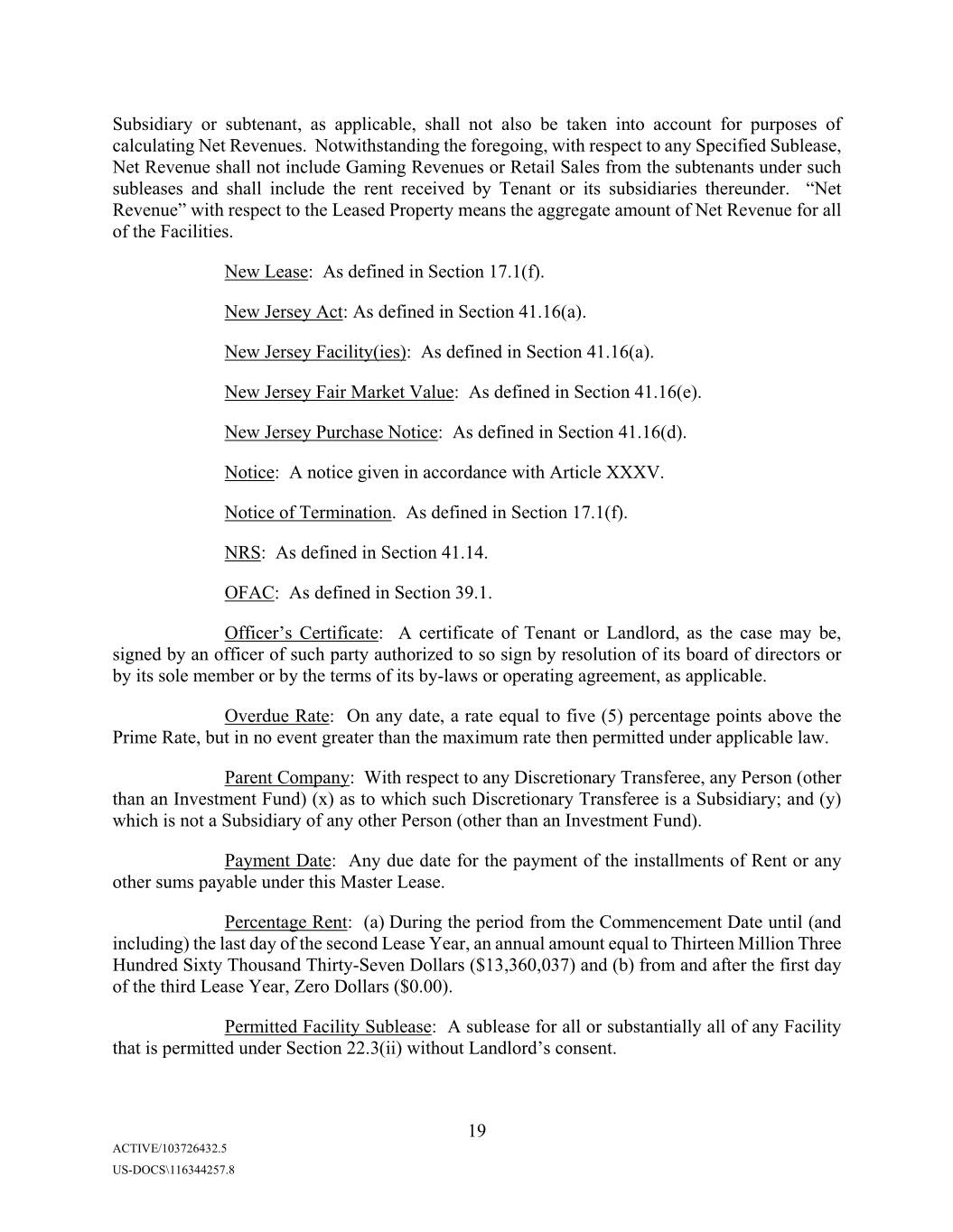
Subsidiary or subtenant, as applicable, shall not also be taken into account for purposes of calculating Net Revenues. Notwithstanding the foregoing, with respect to any Specified Sublease, Net Revenue shall not include Gaming Revenues or Retail Sales from the subtenants under such subleases and shall include the rent received by Tenant or its subsidiaries thereunder. “Net Revenue” with respect to the Leased Property means the aggregate amount of Net Revenue for all of the Facilities. New Lease: As defined in Section 17.1(f). New Jersey Act: As defined in Section 41.16(a). New Jersey Facility(ies): As defined in Section 41.16(a). New Jersey Fair Market Value: As defined in Section 41.16(e). New Jersey Purchase Notice: As defined in Section 41.16(d). Notice: A notice given in accordance with Article XXXV. Notice of Termination. As defined in Section 17.1(f). NRS: As defined in Section 41.14. OFAC: As defined in Section 39.1. Officer’s Certificate: A certificate of Tenant or Landlord, as the case may be, signed by an officer of such party authorized to so sign by resolution of its board of directors or by its sole member or by the terms of its by-laws or operating agreement, as applicable. Overdue Rate: On any date, a rate equal to five (5) percentage points above the Prime Rate, but in no event greater than the maximum rate then permitted under applicable law. Parent Company: With respect to any Discretionary Transferee, any Person (other than an Investment Fund) (x) as to which such Discretionary Transferee is a Subsidiary; and (y) which is not a Subsidiary of any other Person (other than an Investment Fund). Payment Date: Any due date for the payment of the installments of Rent or any other sums payable under this Master Lease. Percentage Rent: (a) During the period from the Commencement Date until (and including) the last day of the second Lease Year, an annual amount equal to Thirteen Million Three Hundred Sixty Thousand Thirty-Seven Dollars ($13,360,037) and (b) from and after the first day of the third Lease Year, Zero Dollars ($0.00). Permitted Facility Sublease: A sublease for all or substantially all of any Facility that is permitted under Section 22.3(ii) without Landlord’s consent. 19 ACTIVE/103726432.5 US-DOCS\116344257.8
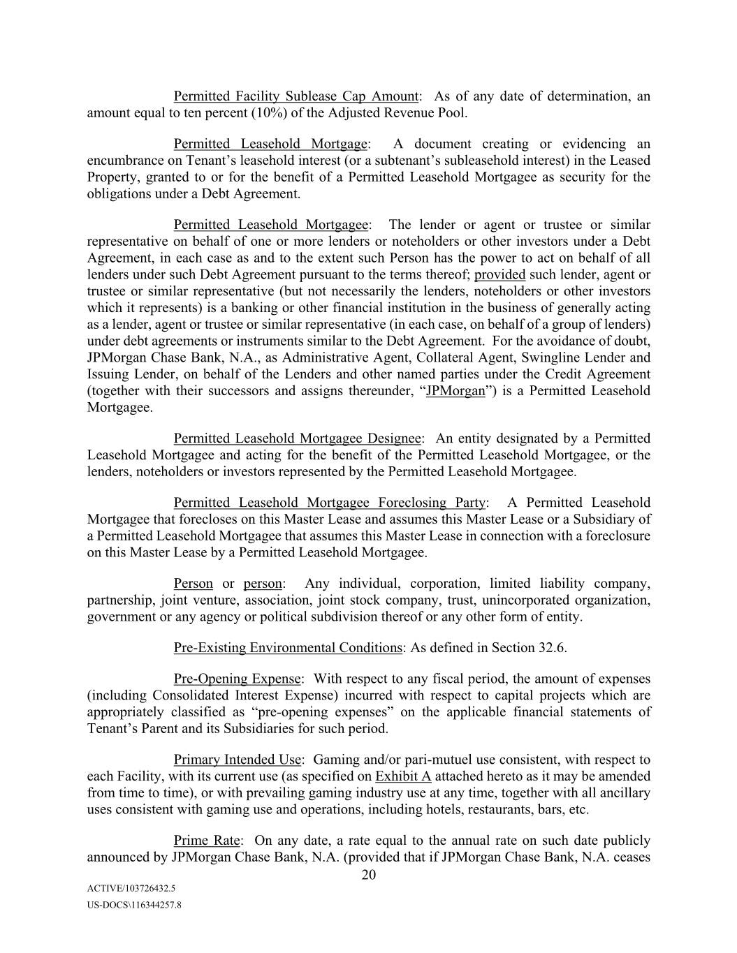
Permitted Facility Sublease Cap Amount: As of any date of determination, an amount equal to ten percent (10%) of the Adjusted Revenue Pool. Permitted Leasehold Mortgage: A document creating or evidencing an encumbrance on Tenant’s leasehold interest (or a subtenant’s subleasehold interest) in the Leased Property, granted to or for the benefit of a Permitted Leasehold Mortgagee as security for the obligations under a Debt Agreement. Permitted Leasehold Mortgagee: The lender or agent or trustee or similar representative on behalf of one or more lenders or noteholders or other investors under a Debt Agreement, in each case as and to the extent such Person has the power to act on behalf of all lenders under such Debt Agreement pursuant to the terms thereof; provided such lender, agent or trustee or similar representative (but not necessarily the lenders, noteholders or other investors which it represents) is a banking or other financial institution in the business of generally acting as a lender, agent or trustee or similar representative (in each case, on behalf of a group of lenders) under debt agreements or instruments similar to the Debt Agreement. For the avoidance of doubt, JPMorgan Chase Bank, N.A., as Administrative Agent, Collateral Agent, Swingline Lender and Issuing Lender, on behalf of the Lenders and other named parties under the Credit Agreement (together with their successors and assigns thereunder, “JPMorgan”) is a Permitted Leasehold Mortgagee. Permitted Leasehold Mortgagee Designee: An entity designated by a Permitted Leasehold Mortgagee and acting for the benefit of the Permitted Leasehold Mortgagee, or the lenders, noteholders or investors represented by the Permitted Leasehold Mortgagee. Permitted Leasehold Mortgagee Foreclosing Party: A Permitted Leasehold Mortgagee that forecloses on this Master Lease and assumes this Master Lease or a Subsidiary of a Permitted Leasehold Mortgagee that assumes this Master Lease in connection with a foreclosure on this Master Lease by a Permitted Leasehold Mortgagee. Person or person: Any individual, corporation, limited liability company, partnership, joint venture, association, joint stock company, trust, unincorporated organization, government or any agency or political subdivision thereof or any other form of entity. Pre-Existing Environmental Conditions: As defined in Section 32.6. Pre-Opening Expense: With respect to any fiscal period, the amount of expenses (including Consolidated Interest Expense) incurred with respect to capital projects which are appropriately classified as “pre-opening expenses” on the applicable financial statements of Tenant’s Parent and its Subsidiaries for such period. Primary Intended Use: Gaming and/or pari-mutuel use consistent, with respect to each Facility, with its current use (as specified on Exhibit A attached hereto as it may be amended from time to time), or with prevailing gaming industry use at any time, together with all ancillary uses consistent with gaming use and operations, including hotels, restaurants, bars, etc. Prime Rate: On any date, a rate equal to the annual rate on such date publicly announced by JPMorgan Chase Bank, N.A. (provided that if JPMorgan Chase Bank, N.A. ceases 20 ACTIVE/103726432.5 US-DOCS\116344257.8
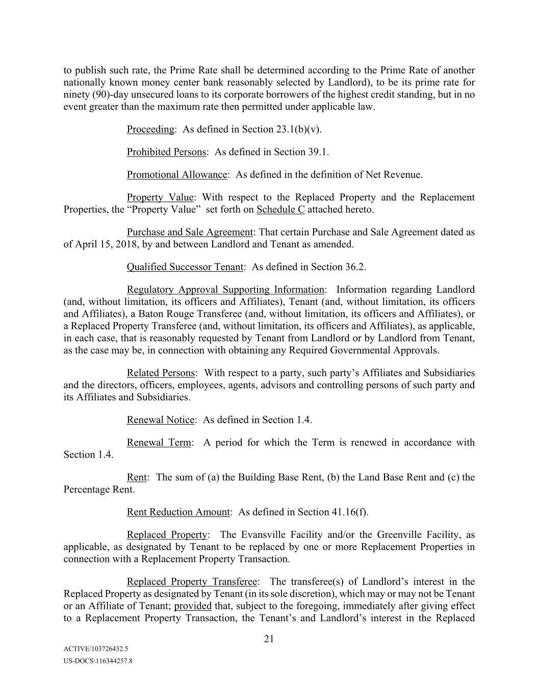
to publish such rate, the Prime Rate shall be determined according to the Prime Rate of another nationally known money center bank reasonably selected by Landlord), to be its prime rate for ninety (90)-day unsecured loans to its corporate borrowers of the highest credit standing, but in no event greater than the maximum rate then permitted under applicable law. Proceeding: As defined in Section 23.1(b)(v). Prohibited Persons: As defined in Section 39.1. Promotional Allowance: As defined in the definition of Net Revenue. Property Value: With respect to the Replaced Property and the Replacement Properties, the “Property Value” set forth on Schedule C attached hereto. Purchase and Sale Agreement: That certain Purchase and Sale Agreement dated as of April 15, 2018, by and between Landlord and Tenant as amended. Qualified Successor Tenant: As defined in Section 36.2. Regulatory Approval Supporting Information: Information regarding Landlord (and, without limitation, its officers and Affiliates), Tenant (and, without limitation, its officers and Affiliates), a Baton Rouge Transferee (and, without limitation, its officers and Affiliates), or a Replaced Property Transferee (and, without limitation, its officers and Affiliates), as applicable, in each case, that is reasonably requested by Tenant from Landlord or by Landlord from Tenant, as the case may be, in connection with obtaining any Required Governmental Approvals. Related Persons: With respect to a party, such party’s Affiliates and Subsidiaries and the directors, officers, employees, agents, advisors and controlling persons of such party and its Affiliates and Subsidiaries. Renewal Notice: As defined in Section 1.4. Renewal Term: A period for which the Term is renewed in accordance with Section 1.4. Rent: The sum of (a) the Building Base Rent, (b) the Land Base Rent and (c) the Percentage Rent. Rent Reduction Amount: As defined in Section 41.16(f). Replaced Property: The Evansville Facility and/or the Greenville Facility, as applicable, as designated by Tenant to be replaced by one or more Replacement Properties in connection with a Replacement Property Transaction. Replaced Property Transferee: The transferee(s) of Landlord’s interest in the Replaced Property as designated by Tenant (in its sole discretion), which may or may not be Tenant or an Affiliate of Tenant; provided that, subject to the foregoing, immediately after giving effect to a Replacement Property Transaction, the Tenant’s and Landlord’s interest in the Replaced 21 ACTIVE/103726432.5 US-DOCS\116344257.8
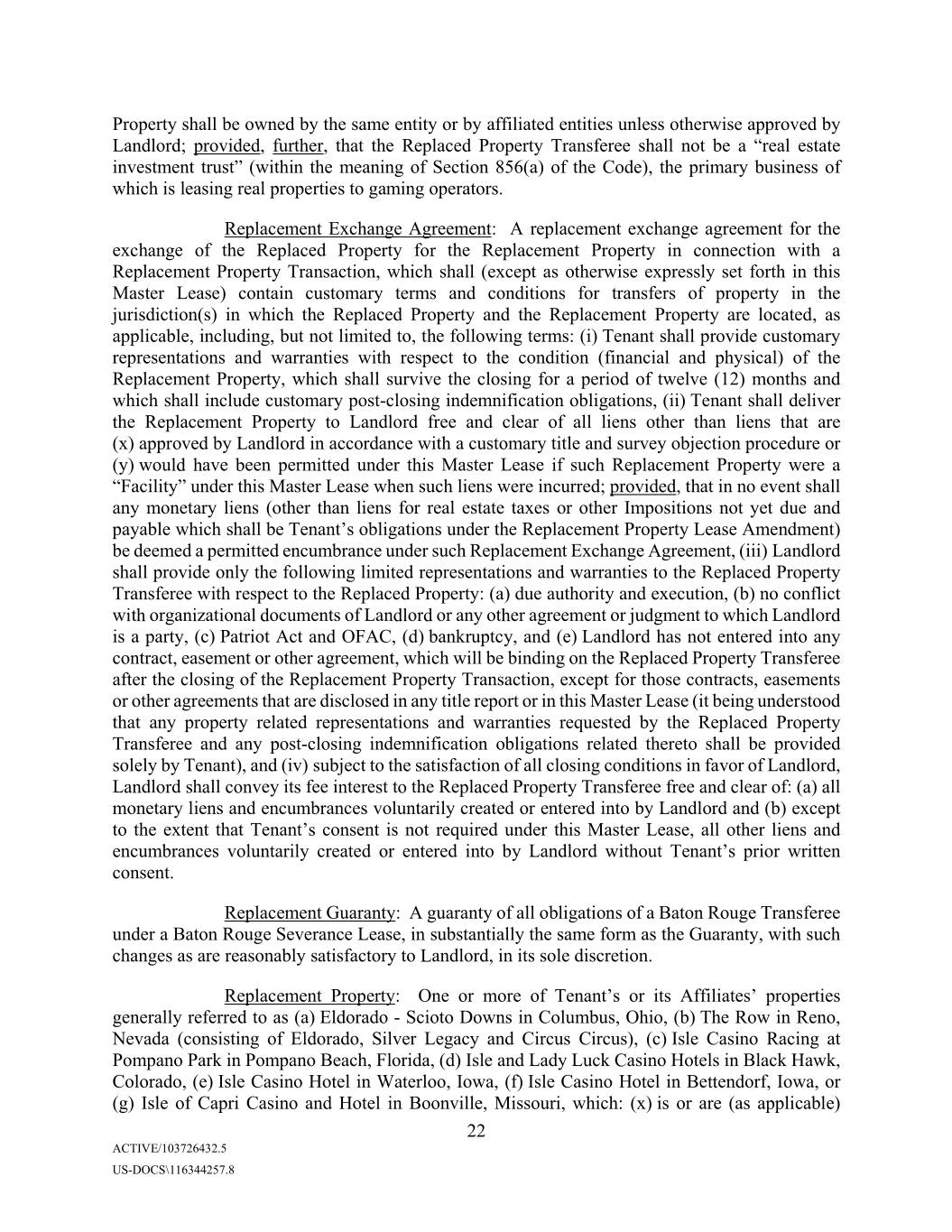
Property shall be owned by the same entity or by affiliated entities unless otherwise approved by Landlord; provided, further, that the Replaced Property Transferee shall not be a “real estate investment trust” (within the meaning of Section 856(a) of the Code), the primary business of which is leasing real properties to gaming operators. Replacement Exchange Agreement: A replacement exchange agreement for the exchange of the Replaced Property for the Replacement Property in connection with a Replacement Property Transaction, which shall (except as otherwise expressly set forth in this Master Lease) contain customary terms and conditions for transfers of property in the jurisdiction(s) in which the Replaced Property and the Replacement Property are located, as applicable, including, but not limited to, the following terms: (i) Tenant shall provide customary representations and warranties with respect to the condition (financial and physical) of the Replacement Property, which shall survive the closing for a period of twelve (12) months and which shall include customary post-closing indemnification obligations, (ii) Tenant shall deliver the Replacement Property to Landlord free and clear of all liens other than liens that are (x) approved by Landlord in accordance with a customary title and survey objection procedure or (y) would have been permitted under this Master Lease if such Replacement Property were a “Facility” under this Master Lease when such liens were incurred; provided, that in no event shall any monetary liens (other than liens for real estate taxes or other Impositions not yet due and payable which shall be Tenant’s obligations under the Replacement Property Lease Amendment) be deemed a permitted encumbrance under such Replacement Exchange Agreement, (iii) Landlord shall provide only the following limited representations and warranties to the Replaced Property Transferee with respect to the Replaced Property: (a) due authority and execution, (b) no conflict with organizational documents of Landlord or any other agreement or judgment to which Landlord is a party, (c) Patriot Act and OFAC, (d) bankruptcy, and (e) Landlord has not entered into any contract, easement or other agreement, which will be binding on the Replaced Property Transferee after the closing of the Replacement Property Transaction, except for those contracts, easements or other agreements that are disclosed in any title report or in this Master Lease (it being understood that any property related representations and warranties requested by the Replaced Property Transferee and any post-closing indemnification obligations related thereto shall be provided solely by Tenant), and (iv) subject to the satisfaction of all closing conditions in favor of Landlord, Landlord shall convey its fee interest to the Replaced Property Transferee free and clear of: (a) all monetary liens and encumbrances voluntarily created or entered into by Landlord and (b) except to the extent that Xxxxxx’s consent is not required under this Master Lease, all other liens and encumbrances voluntarily created or entered into by Landlord without Xxxxxx’s prior written consent. Replacement Guaranty: A guaranty of all obligations of a Baton Rouge Transferee under a Baton Rouge Severance Lease, in substantially the same form as the Guaranty, with such changes as are reasonably satisfactory to Landlord, in its sole discretion. Replacement Property: One or more of Tenant’s or its Affiliates’ properties generally referred to as (a) Eldorado - Scioto Downs in Columbus, Ohio, (b) The Row in Reno, Nevada (consisting of Eldorado, Silver Legacy and Circus Circus), (c) Isle Casino Racing at Pompano Park in Pompano Beach, Florida, (d) Isle and Lady Luck Casino Hotels in Black Hawk, Colorado, (e) Isle Casino Hotel in Waterloo, Iowa, (f) Isle Casino Hotel in Bettendorf, Iowa, or (g) Isle of Capri Casino and Hotel in Boonville, Missouri, which: (x) is or are (as applicable) 22 ACTIVE/103726432.5 US-DOCS\116344257.8
Required Governmental Approvals: All Gaming Licenses and other necessary approvals from all gaming authorities and other governmental authorities required under applicable law (including applicable Gaming Regulations) for (as applicable) (a) the consummation of a Baton Rouge Transfer, a Baton Rouge Sale and/or the execution and implementation of a Baton Rouge Severance Lease, or (b) the exercise of the Replacement Property Right and the consummation of the transactions contemplated thereby. Restricted Area: The geographical area that at any time during the Term is within a sixty (60) mile radius of any Facility covered under this Master Lease at such time. Restricted Information: As defined in Section 23.1(c). Restricted Payment: Dividends (in cash, property or obligations) on, or other payments or distributions on account of, or the setting apart of money for a sinking or other analogous fund for, or the purchase, redemption, retirement, repurchase or other acquisition of, any Equity Interests or Equity Rights (other than outstanding securities convertible into Equity Interests) of Tenant, but excluding dividends, payments or distributions paid through the issuance of additional shares of Equity Interests and any redemption, retirement or exchange of any Equity Interest through, or with the proceeds of, the issuance of Equity Interests of Tenant. Retail Sales: As defined in the definition of Net Revenue. SEC: The United States Securities and Exchange Commission. Securities Act: The Securities Act of 1933, as amended, or any successor statute, and the rules and regulations promulgated thereunder. Severance Lease: A separate lease with respect to a New Jersey Facility, created when Landlord transfers a specific Facility (Facilities), which lease shall provide that the rent payable under the Severance Lease at the time of commencement of such Severance Lease shall be equal to the amount of the Rent Reduction Amount for the applicable Leased Property to be subject to such Severance Lease. Solvent: With respect to any Person on a particular date, that on such date (a) the fair value of the property of such Person, on a going-concern basis, is greater than the total amount of liabilities (including contingent liabilities) of such Person, (b) the present fair salable value of the assets of such Person, on a going-concern basis, is not less than the amount that will be required to pay the probable liability of such Person on its debts (including contingent liabilities) as they become absolute and matured, (c) such Person has not incurred, and does not intend to, and does not believe that it will, incur, debts or liabilities beyond such Person’s ability to pay such debts and liabilities as they mature, (d) such Person is not engaged in business or a transaction, and is not about to engage in business or a transaction, for which such Person’s property would constitute an unreasonably small capital and (e) such Person is “solvent” within the meaning given that term and similar terms under applicable laws relating to fraudulent transfers and conveyances. For purposes of this definition, the amount of any contingent liability shall be computed as the amount that, in light of all the facts and circumstances existing at such time, represents the amount that can reasonably be expected to become an actual or matured liability (irrespective of whether such 24 ACTIVE/103726432.5 US-DOCS\116344257.8
Specified Sublease: Any lease in effect on the Commencement Date constituting part of the Leased Property with respect to which Tenant is a sublessor, substantially as in effect on the Commencement Date, a list of which is attached on Schedule A hereto. State: With respect to each Facility, the state or commonwealth in which such Facility is located. Subsidiary: As to any Person, (i) any corporation more than fifty percent (50%) of whose stock of any class or classes having by the terms thereof ordinary voting power to elect a majority of the directors of such corporation (irrespective of whether or not at the time stock of any class or classes of such corporation shall have or might have voting power by reason of the happening of any contingency) is at the time of determination owned by such Person and/or one or more Subsidiaries of such Person, and (ii) any partnership, limited liability company, association, joint venture or other entity in which such person and/or one or more Subsidiaries of such person has more than a fifty percent (50%) equity interest at the time of determination. Unless otherwise qualified, all references to a “Subsidiary” or to “Subsidiaries” in this Master Lease shall refer to a Subsidiary or Subsidiaries of Tenant. Successor Tenant: As defined in Section 36.1. Successor Tenant Rent: As defined in Section 36.2. Taking: As defined in Section 15.1(a). Tenant: As defined in the preamble. Tenant Capital Improvement: A Capital Improvement funded by Tenant, as compared to Landlord. Tenant COC: As defined in Section 22.2(iii). Tenant Parent COC: As defined in Section 22.2(iii). Tenant Representatives: As defined in Section 23.4. Tenant’s Parent: Eldorado Resorts, Inc., and any permitted successor thereto. Tenant’s Property: With respect to each Facility, all assets (other than the Leased Property and property owned by a third party) primarily related to or used in connection with the operation of the business conducted on or about the Leased Property, together with all replacements, modifications, additions, alterations and substitutes therefor. Term: As defined in Section 1.3. Termination Notice: As defined in Section 17.1(d). Test Period: With respect to any Person, for any date of determination, the period of the four (4) most recently ended consecutive fiscal quarters of such Person. 26 ACTIVE/103726432.5 US-DOCS\116344257.8
Improvements thereto) and Tenant’s Property whether or not compliance therewith may require structural changes in any of the Leased Improvements or interfere with the use and enjoyment of the Leased Property, and (b) procure, maintain and comply in all material respects with all Gaming Regulations and Gaming Licenses, and other authorizations required for the use of the Leased Property (including all Capital Improvements) and Tenant’s Property for the applicable Primary Intended Use and any other use of the Leased Property (including Capital Improvements then being made) and Tenant’s Property, and for the proper erection, installation, operation and maintenance of the Leased Property and Tenant’s Property. In an emergency or in the event of a breach by Tenant of its obligations under this Section 8.2 which is not cured within any applicable cure period, Landlord may, but shall not be obligated to, enter upon the Leased Property and take such reasonable actions and incur such reasonable costs and expenses to effect such compliance as it deems advisable to protect its interest in the Leased Property, and Tenant shall reimburse Landlord for all such reasonable costs and expenses incurred by Landlord in connection with such actions. Tenant covenants and agrees that the Leased Property and Xxxxxx’s Property shall not be used for any unlawful purpose. In the event that a regulatory agency, commission, board or other governmental body notifies Tenant that it is in jeopardy of losing a Gaming License material to the continued operation of a Facility, and, assuming no Event of Default has occurred and is continuing, Tenant shall be given reasonable time to address the regulatory issue, after which period (but in all events prior to an actual revocation of such Gaming License) Tenant shall be required to sell (i) if permitted by applicable law, the Gaming License, and to the extent such sale is not permitted by applicable law Tenant shall use reasonable best efforts to transfer the applicable Gaming License or to cause the issuance of a new or replacement Gaming License, pursuant to the procedures permitted by applicable state law, and (ii) Tenant’s Property related to such Facility to a successor operator of such Facility determined by Landlord choosing one and Tenant choosing three (for a total of four) potential operators and Landlord indicating the reasonable, market terms under which it would agree to lease such Facility to such potential operators, which in Landlord’s reasonable discretion may contain reasonable variations in terms to the extent required to account for credit quality differences among the potential operators (e.g., Landlord may require different letter of credit terms and amounts, but may not set different rent terms). Tenant will then be entitled to auction off Tenant’s Property relating to such Facility and Landlord will thereafter be entitled to lease the Facility to the potential successor that is the successful bidder. In the event of a new lease from Landlord to the successor, the Leased Property relating to such Facility shall be severed from the Leased Property hereunder and thereafter Rent shall be reduced based on the formula set forth in Section 14.6 hereof. Landlord shall comply with any Gaming Regulations or other regulatory requirements required of it as owner of the Facilities taking into account its Primary Intended Use (except to the extent Tenant fulfills or is required to fulfill any such requirements hereunder). In the event that a regulatory agency, commission, board or other governmental body notifies Landlord that it is in jeopardy of failing to comply with any such Gaming Regulation or other regulatory requirements material to the continued operation of a Facility for its Primary Intended Use, Landlord shall be given reasonable time to address the regulatory issue, after which period (but in all events prior to an actual cessation of the use of the Facility for its Primary Intended Use as a result of the failure by Landlord to comply with such regulatory requirements) Landlord shall be required to sell the Leased Property relating to such Facility to the highest bidder (and Tenant shall be entitled to be one of the bidders) who would agree to lease such Facility to Tenant on terms substantially the same as the terms hereof (including rent calculated in the manner provided pursuant to Section 14.6 hereof, an identical amount of 36 ACTIVE/103726432.5 US-DOCS\116344257.8
Lease, Tenant shall likewise obtain Ground Lessor’s written consent to alterations of or the subleasing of all or any portion of the Ground Leased Property (and Landlord will use commercially reasonable efforts to submit such requests to Ground Lessor and cooperate, at no cost or expense to Landlord, with the reasonable requests of Tenant and Ground Lessor to facilitate such requests), and (iii) Tenant shall carry and maintain general liability, automobile liability, property and casualty, worker’s compensation and employer’s liability insurance in amounts and with policy provisions, coverages and certificates as required of Landlord as tenant under the Ground Lease. (b) In the event of cancellation or termination of the Ground Lease for any reason whatsoever whether voluntary or involuntary (by operation of law or otherwise) prior to the expiration date of this Master Lease, including extensions and renewals granted thereunder, then, at Ground Lessor’s option, Tenant shall make full and complete attornment to Ground Lessor with respect to the obligations of Landlord to Ground Lessor in connection with the Ground Leased Property for the balance of the term of the Ground Lease (notwithstanding that this Master Lease shall have expired with respect to the Ground Leased Property as a result of the cancellation or termination of the Ground Lease). Tenant’s attornment shall be evidenced by a written agreement which shall provide that the Tenant is in direct privity of contract with Ground Lessor (i.e., that all obligations previously owed to Landlord under this Master Lease with respect to the Ground Lease or the Ground Leased Property shall be obligations owed to Ground Lessor for the balance of the term of this Master Lease, notwithstanding that this Master Lease shall have expired with respect to the Ground Leased Property as a result of the cancellation or termination of the Ground Lease) and which shall otherwise be in form and substance reasonably satisfactory to Ground Lessor. Tenant shall execute and deliver such written attornment within thirty (30) days after request by Ground Lessor. Unless and until such time as an attornment agreement is executed by Tenant pursuant to this Section 8.4(b), nothing contained in this Master Lease shall create, or be construed as creating, any privity of contract or privity of estate between Ground Lessor and Tenant. (c) Nothing contained in this Master Lease amends, or shall be construed to amend, any provision of the Ground Lease. ARTICLE IX 9.1 Maintenance and Repair. (a)Tenant, at its expense and without the prior consent of Landlord, shall maintain the Leased Property and Tenant’s Property, and every portion thereof, and all private roadways, sidewalks and curbs appurtenant to the Leased Property, and which are under Tenant’s control in good order and repair whether or not the need for such repairs occurs as a result of Tenant’s use, any prior use, the elements or the age of the Leased Property and Tenant’s Property, and, with reasonable promptness, make all reasonably necessary and appropriate repairs thereto of every kind and nature, including those necessary to ensure continuing compliance with all Legal Requirements, whether interior or exterior, structural or non-structural, ordinary or extraordinary, foreseen or unforeseen or arising by reason of a condition existing prior to the Commencement Date. All repairs shall be at least equivalent in quality to the original work. Tenant will not take or omit to take any action the taking or omission of which would reasonably be expected to materially impair the value or the usefulness of the Leased Property or any part thereof or any Capital Improvement thereto for its Primary Intended Use. 38 ACTIVE/103726432.5 US-DOCS\116344257.8
(b) Landlord shall not under any circumstances be required to (i) build or rebuild any improvements on the Leased Property; (ii) make any repairs, replacements, alterations, restorations or renewals of any nature to the Leased Property, whether ordinary or extraordinary, structural or non-structural, foreseen or unforeseen, or to make any expenditure whatsoever with respect thereto; or (iii) maintain the Leased Property in any way. Tenant hereby waives, to the extent permitted by law, the right to make repairs at the expense of Landlord pursuant to any law in effect at the time of the execution of this Master Lease or hereafter enacted. (c) Nothing contained in this Master Lease and no action or inaction by Landlord shall be construed as (i) constituting the consent or request of Landlord, expressed or implied, to any contractor, subcontractor, laborer, materialman or vendor to or for the performance of any labor or services or the furnishing of any materials or other property for the construction, alteration, addition, repair or demolition of or to the Leased Property or any part thereof or any Capital Improvement thereto; or (ii) giving Tenant any right, power or permission to contract for or permit the performance of any labor or services or the furnishing of any materials or other property in such fashion as would permit the making of any claim against Landlord in respect thereof or to make any agreement that may create, or in any way be the basis for, any right, title, interest, lien, claim or other encumbrance upon the estate of Landlord in the Leased Property, or any portion thereof or upon the estate of Landlord in any Capital Improvement thereto. (d) Tenant shall, upon the expiration or earlier termination of the Term, vacate and surrender the Leased Property (including all Capital Improvements, subject to the provisions of Article X), in each case with respect to such Facility, to Landlord in the condition in which such Leased Property was originally received from Landlord and Capital Improvements were originally introduced to such Facility, except as repaired, rebuilt, restored, altered or added to as permitted or required by the provisions of this Master Lease (including Section 14.2 and 15.1) and except for ordinary wear and tear. (e) Without limiting Tenant’s obligations to maintain the Leased Property and Tenant’s Property under this Master Lease, within thirty (30) days after the end of each calendar year (commencing with the calendar year ending December 31, 2018), Tenant shall provide Landlord with evidence satisfactory to Landlord in the reasonable exercise of Landlord’s discretion that Tenant has in such calendar year spent, with respect to the Leased Property and Tenant’s Property, an aggregate amount equal to at least 1% of its actual Net Revenue from the Facilities for such calendar year on installation or restoration and repair or other improvement of items, which installations, restorations and repairs and other improvements are capitalized in accordance with GAAP with an expected life of not less than three (3) years; provided that, in the event an Unavoidable Delay occurs during the time during which Tenant is required to make the foregoing expenditures and such Unavoidable Delay actually prevents or delays Tenant’s performance of such installations, restorations, repairs or other improvements, then the relevant period in which Tenant was obligated to perform such installations, restorations, repairs or other improvements shall be extended, on a day-for-day basis, for the same amount of time that such Unavoidable Delay actually delayed Tenant’s ability to perform such installations, restorations, repairs or other improvements; provided, further, that with respect to the installations, restorations, repairs or other improvements required to be made during the calendar year ending December 31, 2020, Tenant shall be required to make such installations, restorations, repairs or other improvements no later than June 30, 2021. If Xxxxxx fails to make at least the above amount of 39 ACTIVE/103726432.5 US-DOCS\116344257.8
funding will be made available by Tenant, including, but not limited to, the mutual approval of a litigation budget. ARTICLE X 10.1 Construction of Capital Improvements to the Leased Property. Tenant shall, with respect to any Facility, have the right to make a Capital Improvement, including, without limitation, any Capital Improvement required by Section 8.2 or 9.1(a), without the consent of Landlord if the Capital Improvement (i) is of equal or better quality than the existing Leased Improvements it is improving, altering or modifying, (ii) does not consist of adding new structures or enlarging existing structures, and (iii) does not have an adverse effect on the structure of any existing Leased Improvements. Tenant shall provide Landlord copies of the plans and specifications in respect of all Capital Improvements, which plans and specifications shall be prepared in a high-grade professional manner and shall adequately demonstrate compliance with clauses (i)-(iii) of the preceding sentence with respect to projects that do not require Landlord’s written consent and shall be in such form as Landlord may reasonably require for any other projects. All other Capital Improvements shall be subject to Landlord’s review and approval, which approval shall not be unreasonably withheld. For any Capital Improvement which does not require the approval of Landlord, Tenant shall, prior to commencing construction of such Capital Improvement, provide to Landlord a written description of such Capital Improvement and on an ongoing basis supply Landlord with related documentation and information as Landlord may reasonably request (including plans and specifications of any such Capital Improvements). If Tenant desires to make a Capital Improvement for which Landlord’s approval is required, Tenant shall submit to Landlord in reasonable detail a general description of the proposal, the projected cost of construction and such plans and specifications, permits, licenses, contracts and other information concerning the proposal as Landlord may reasonably request. Such description shall indicate the use or uses to which such Capital Improvement will be put and the impact, if any, on current and forecasted gross revenues and operating income attributable thereto. It shall be reasonable for Landlord to condition its approval of any Capital Improvement upon any or all of the following terms and conditions: (a) Such construction shall be effected pursuant to detailed plans and specifications approved by Landlord, which approval shall not be unreasonably withheld; (b) Such construction shall be conducted under the supervision of a licensed architect or engineer selected by Tenant and approved by Landlord, which approval shall not be unreasonably withheld; (c) Xxxxxxxx’s receipt, from the general contractor and, if reasonably requested by Landlord, a major subcontractor(s) of a performance and payment bond (or, if Tenant elects in lieu of performance and payment bond covering any major subcontractor, Sub-guard insurance, which policy shall be in form reasonably satisfactory to Landlord and which shall include a financial interest endorsement naming Landlord as a beneficiary) for the full value of such construction, which such bond shall name Landlord as an additional obligee and otherwise be in form and substance and issued by a Person reasonably satisfactory to Landlord; 41 ACTIVE/103726432.5 US-DOCS\116344257.8
(a) any information, certificates, licenses, permits or documents reasonably requested by Landlord which are necessary and obtainable to confirm that Tenant will be able to use the Capital Improvement upon completion thereof in accordance with the Primary Intended Use, including all required federal, state or local government licenses and approvals; (b) an Officer’s Certificate and, if requested, a certificate from Tenant’s architect providing appropriate backup information, setting forth in reasonable detail the projected or actual costs related to such Capital Improvements; (c) an amendment to this Master Lease (and any development or funding agreement agreed to in accordance with this Section 10.3), in a form reasonably agreed to by Landlord and Tenant, which may include, among other things, an increase in the Rent in amounts as agreed upon by the parties hereto pursuant to the agreed funding proposal terms described above and other provisions as may be necessary or appropriate; (d) a deed conveying title to Landlord to any land acquired for the purpose of constructing the Capital Improvement free and clear of any liens or encumbrances except those approved by Landlord, and accompanied by an ALTA survey thereof satisfactory to Landlord; (e) for each advance, endorsements to any outstanding policy of title insurance covering the Leased Property or commitments therefor reasonably satisfactory in form and substance to Landlord (i) updating the same without any additional exception except those that do not materially affect the value of such land and do not interfere with the use of the Leased Property or as may be approved by Landlord, which approval shall not be unreasonably withheld, and (ii) increasing the coverage thereof by an amount equal to the cost of the Capital Improvement, except to the extent covered by the owner’s policy of title insurance referred to in paragraph (f) below; (f) if appropriate, an owner’s policy of title insurance insuring the fair market value of fee simple title to any land and improvements conveyed to Landlord free and clear of all liens and encumbrances except those that do not materially affect the value of such land and do not interfere with the use of the Leased Property or are approved by Landlord, which approval shall not be unreasonably withheld, provided that if the requirement in this paragraph (f) is not satisfied (or waived by Landlord), Tenant shall be entitled to seek third party financing or use available financing in lieu of seeking such advance from Landlord; (g) if requested by Landlord, an appraisal by a member of the Appraisal Institute of the Leased Property indicating that the fair market value of the Leased Property upon completion of the Capital Improvement will exceed the fair market value of the Leased Property immediately prior thereto by an amount not less than ninety-five percent (95%) of the cost of the Capital Improvement, provided that if the requirement in this paragraph (g) is not satisfied (or waived by Landlord), Tenant shall be entitled to seek third party financing or use available financing in lieu of seeking such advance from Landlord; and (h) such other billing statements, invoices, certificates, endorsements, opinions, site assessments, surveys, resolutions, ratifications, lien releases and waivers and other instruments and information reasonably required by Landlord. 44 ACTIVE/103726432.5 US-DOCS\116344257.8
ARTICLE XI 11.1 Liens. Subject to the provisions of Article XII relating to permitted contests, Tenant will not directly or indirectly create or allow to remain and will promptly discharge at its expense any lien, encumbrance, attachment, title retention agreement or claim upon the Leased Property or any Capital Improvement thereto or upon the Gaming Licenses (including indirectly through a pledge of shares in the direct or indirect entity owning an interest in the Gaming Licenses) or any attachment, levy, claim or encumbrance in respect of the Rent, excluding, however, (i) this Master Lease; (ii) the matters that existed as of the Commencement Date with respect to such Facility and disclosed on Schedule A; (iii) restrictions, liens and other encumbrances which are consented to in writing by Landlord (such consent not to be unreasonably withheld); (iv) liens for Impositions which Tenant is not required to pay hereunder; (v) subleases permitted by Article XXII; (vi) liens for Impositions not yet delinquent or being contested in accordance with Article XII, provided that Tenant has provided appropriate reserves as required under GAAP and any foreclosure or similar remedies with respect to such Impositions have not been instituted and no notice as to the institution or commencement thereof has been issued except to the extent such institution or commencement is stayed no later than the earlier of (x) ten (10) Business Days after such notice is issued or (y) five (5) Business Days prior to the institution or commencement thereof; (vii) liens of mechanics, laborers, materialmen, suppliers or vendors for sums either disputed or not yet due, provided that (1) the payment of such sums shall not be postponed under any related contract for more than sixty (60) days after the completion of the action giving rise to such lien unless being contested in accordance with Article XII and such reserve or other appropriate provisions as shall be required by law or GAAP shall have been made therefor and no foreclosure or similar remedies with respect to such liens has been instituted and no notice as to the institution or commencement thereof have been issued except to the extent such institution or commencement is stayed no later than the earlier of (x) ten (10) Business Days after such notice is issued or (y) five (5) Business Days prior to the institution or commencement thereof; or (2) any such liens are in the process of being contested as permitted by Article XII; (viii) any liens created by Landlord; (ix) liens related to equipment leases or equipment financing for Tenant’s Property which are used or useful in Tenant’s business on the Leased Property, provided that the payment of any sums due under such equipment leases or equipment financing shall either (1) be paid as and when due in accordance with the terms thereof, or (2) be in the process of being contested as permitted by Article XII and provided that a xxxx xxxxxx’x removal of any such Tenant’s Property from the Leased Property shall be made in accordance with the requirements set forth in this Section 11.1; (x) liens granted as security for the obligations of Tenant and its Affiliates under a Debt Agreement; provided, however, in no event shall the foregoing be deemed or construed to permit Tenant to encumber its leasehold interest (or a subtenant to encumber its subleasehold interest) in the Leased Property or its direct or indirect interest (or the interest of any of its Subsidiaries) in the Gaming Licenses (other than, in each case, to a Permitted Leasehold Mortgagee, for which no consent shall be required), without the prior written consent of Landlord, which consent may be granted or withheld in Landlord’s sole discretion; and provided, further, that Tenant shall be required to provide Landlord with fully executed copies of any and all Permitted Leasehold Mortgages and related principal Debt Agreements; (xi) easements, rights-of-way, restrictions (including zoning restrictions), covenants, encroachments, protrusions and other similar charges or encumbrances, and minor title deficiencies on or with respect to any Leased Property, in each case whether now or hereafter in existence, not individually or in the aggregate materially interfering with the conduct of the 45 ACTIVE/103726432.5 US-DOCS\116344257.8
business on the Leased Property, taken as a whole; and (xii) liens granted as security for the obligations of Landlord and its Affiliates under any Facility Mortgage. For the avoidance of doubt, the parties acknowledge and agree that Xxxxxx has not granted any liens in favor of Landlord as security for its obligations hereunder (except to the extent contemplated in the final paragraph of this Section 11.1) and nothing contained herein shall be deemed or construed to prohibit the issuance of a lien on the Equity Interests in Tenant (it being agreed that any foreclosure by a lien holder on such interests in Tenant shall be subject to the restriction on Change in Control set forth in Article XXII) or to prohibit Tenant from pledging its Accounts and other Tenant’s Property and other property of Tenant, including fixtures and equipment installed by Tenant at the Facilities, as collateral in connection with financings from equipment lenders (or to Permitted Leasehold Mortgagees); provided that Tenant shall in no event pledge to any Person that is not granted a Permitted Leasehold Mortgage hereunder any of the Gaming Licenses or other of Tenant’s Property to the extent that such Tenant’s Property cannot be removed from the Leased Property without damaging or impairing the Leased Property (other than in a de minimis manner). For the further avoidance of doubt, by way of example, Tenant shall not grant to any lender (other than a Permitted Leasehold Mortgagee) a lien on, and any and all lien holders (including a Permitted Leasehold Mortgagee) shall not have the right to remove, carpeting, internal wiring, elevators, or escalators at the Leased Property, but lien holders may have the right to remove (and Tenant shall have the right to xxxxx x xxxx on) manual or electronic gaming machines and other gaming equipment (including, without limitation, electronic equipment used to monitor and/or operate gaming machines and other gaming equipment) and electronic or other equipment used to operate player affinity systems, even if the removal thereof from the Leased Property could result in damage; provided any such damage is repaired by the lien holder or Tenant in accordance with the terms of this Master Lease. Landlord and Xxxxxx intend that this Master Lease be an indivisible true lease that affords the parties hereto the rights and remedies of landlord and tenant hereunder and does not represent a financing arrangement. This Master Lease is not an attempt by Landlord or Tenant to evade the operation of any aspect of the law applicable to any of the Leased Property. Except as otherwise required by a change in tax law or any change in accounting rules or regulations or a “determination” within the meaning of Section 1313(a) of the Code (or similar provision of state or local law), Landlord and Tenant hereby acknowledge and agree that this Master Lease shall be treated as an operating lease for all purposes and not as a synthetic lease, financing lease or loan and that Landlord shall be entitled to all the benefits of ownership of the Leased Property, including depreciation for all federal, state and local tax purposes. If, notwithstanding (a) the form and substance of this Master Lease and (b) the intent of the parties, and the language contained herein providing that this Master Lease shall at all times be construed, interpreted and applied to create an indivisible lease of all of the Leased Property, any court of competent jurisdiction finds that this Master Lease is a financing arrangement, this Master Lease shall be considered a secured financing agreement and Landlord’s title to the Leased Property shall constitute a perfected first priority lien in Landlord’s favor on the Leased Property to secure the payment and performance of all the obligations of Tenant hereunder (and to that end, Tenant hereby grants, assigns and transfers to the Landlord a security interest in all right, title or interest in or to any and all of the Leased Property, as security for the prompt and complete payment and performance when due of Tenant’s obligations hereunder). Tenant authorizes Landlord, at the expense of Xxxxxx, to make any filings or take other actions as Landlord 46 ACTIVE/103726432.5 US-DOCS\116344257.8
reasonably determines are necessary or advisable in order to effect fully this Master Lease or to more fully perfect or renew the rights of the Landlord, and to subordinate to the Landlord the lien of any Permitted Leasehold Mortgagee, with respect to the Leased Property (it being understood that nothing herein shall affect the rights of a Permitted Leasehold Mortgagee under Article XVII hereof). At any time and from time to time upon the request of the Landlord, and at the expense of the Tenant, Tenant shall promptly execute, acknowledge and deliver such further documents and do such other acts as the Landlord may reasonably request in order to effect fully this Master Lease or to more fully perfect or renew the rights of the Landlord with respect to the Leased Property. Upon the exercise by the Landlord of any power, right, privilege or remedy pursuant to this Master Lease which requires any consent, approval, recording, qualification or authorization of any governmental authority, Tenant will execute and deliver, or will cause the execution and delivery of, all applications, certifications, instruments and other documents and papers that Landlord may be required to obtain from Tenant for such consent, approval, recording, qualification or authorization. ARTICLE XII 12.1 Permitted Contests. Tenant, upon prior written notice to Landlord, on its own or in Landlord’s name, at Tenant’s expense, may contest, by appropriate legal proceedings conducted in good faith and with due diligence, the amount, validity or application, in whole or in part, of any licensure or certification decision (including pursuant to any Gaming Regulation), Imposition, Legal Requirement, Insurance Requirement, lien, attachment, levy, encumbrance, charge or claim; provided, however, that (i) in the case of an unpaid Imposition, lien, attachment, levy, encumbrance, charge or claim, the commencement and continuation of such proceedings shall suspend the collection thereof from Landlord and from the Leased Property or any Capital Improvement thereto; (ii) neither the Leased Property or any Capital Improvement thereto, the Rent therefrom nor any part or interest in either thereof would be in any danger of being sold, forfeited, attached or lost pending the outcome of such proceedings; (iii) in the case of a Legal Requirement, neither Landlord nor Tenant would be in any danger of civil or criminal liability for failure to comply therewith pending the outcome of such proceedings; (iv) if any such contest shall involve a sum of money or potential loss in excess of Five Hundred Thousand Dollars ($500,000), upon request of Landlord, Tenant shall deliver to Landlord an opinion of counsel reasonably acceptable to Landlord to the effect set forth in clauses (i), (ii) and (iii) above, to the extent applicable (it being agreed that the matters set forth in clause (i) can be addressed by Xxxxxx paying the contested amount prior to any such contest); (v) in the case of a Legal Requirement, Imposition, lien, encumbrance or charge, Tenant shall give such reasonable security as may be required by Landlord to prevent any sale or forfeiture of the Leased Property or any Capital Improvement thereto or the Rent by reason of such non-payment or noncompliance; (vi) in the case of an Insurance Requirement, the coverage required by Article XIII shall be maintained; (vii) Tenant shall keep Landlord reasonably informed as to the status of the proceedings; and (viii) if such contest be finally resolved against Landlord or Tenant, Tenant shall promptly pay the amount required to be paid, together with all interest and penalties accrued thereon, or comply with the applicable Legal Requirement or Insurance Requirement. Landlord, at Xxxxxx’s expense, shall execute and deliver to Tenant such authorizations and other documents as may reasonably be required in any such contest, and, if reasonably requested by Tenant or if Landlord so desires, Landlord shall join as a party therein. The provisions of this Article XII shall not be construed to 47 ACTIVE/103726432.5 US-DOCS\116344257.8
permit Tenant to contest the payment of Rent or any other amount (other than Impositions or Additional Charges which Tenant may from time to time be required to impound with Landlord) payable by Tenant to Landlord hereunder. Tenant shall indemnify, defend, protect and save Landlord harmless from and against any liability, cost or expense of any kind that may be imposed upon Landlord in connection with any such contest and any loss resulting therefrom, except in any instance where Xxxxxxxx opted to join and joined as a party in the proceeding despite Xxxxxx’s having sent written notice to Landlord of Tenant’s preference that Landlord not join in such proceeding. ARTICLE XIII 13.1 General Insurance Requirements. During the Term, Tenant shall at all times keep the Leased Property, and all property located in or on the Leased Property, including Capital Improvements, the Fixtures and Tenant’s Property, insured with the kinds and amounts of insurance described below. Each element of insurance described in this Article XIII shall be maintained with respect to the Leased Property of each Facility and Tenant’s Property and operations thereon. Such insurance shall be written by companies permitted to conduct business in the applicable State. All third party liability type policies must name Landlord as an “additional insured.” All property policies shall name Landlord as “loss payee” for its interests in each Facility. All business interruption policies shall name Landlord as “loss payee” with respect to Rent only. Property losses shall be payable to Landlord and/or Tenant as provided in Article XIV. In addition, the policies, as appropriate, shall name as an “additional insured” and/or “loss payee” each Permitted Leasehold Mortgagee and as an “additional insured” or “loss payee” the holder of any mortgage, deed of trust or other security agreement (“Facility Mortgagee”) securing any indebtedness or any other Encumbrance placed on the Leased Property in accordance with the provisions of Article XXXI (“Facility Mortgage”) by way of a standard form of mortgagee’s loss payable endorsement. Except as otherwise set forth herein, any property insurance loss adjustment settlement shall require the written consent of Landlord, Tenant, and each Facility Mortgagee (to the extent required under the applicable Facility Mortgage Documents) unless the amount of the loss net of the applicable deductible is less than Five Million Dollars ($5,000,000) in which event no consent shall be required. Evidence of insurance shall be deposited with Landlord and, if requested, with any Facility Mortgagee(s). The insurance policies required to be carried by Tenant hereunder shall insure against all the following risks with respect to each Facility: (a) Loss or damage by fire, vandalism, collapse and malicious mischief, extended coverage perils commonly known as “All Risk,” and all physical loss perils normally included in such All Risk insurance, including, but not limited to, sprinkler leakage and windstorm, in an amount not less than the insurable value on a Maximum Foreseeable Loss (as defined below in Section 13.2) basis and including a building ordinance coverage endorsement; provided, that Tenant shall have the right (i) to limit maximum insurance coverage for loss or damage by earthquake (including earth movement) to a minimum amount of Two Hundred Million Dollars ($200,000,000) or as may be reasonably requested by Landlord and commercially available, and (ii) to limit maximum insurance coverage for loss or damage by windstorm (including but not limited to named windstorms) to a minimum amount of Two Hundred Million Dollars ($200,000,000) or as may be reasonably requested by Landlord and commercially available; provided, further, that in the event the premium cost of any or all of earthquake, flood, windstorm 48 ACTIVE/103726432.5 US-DOCS\116344257.8
(including named windstorm) or terrorism coverages are available only for a premium that is more than 2.5 times the average premium paid by Tenant (or prior operator of Facilities) over the preceding three years for the insurance policy contemplated by this Section 13.1(a), then Tenant shall be entitled and required to purchase the maximum insurance coverage it deems most efficient and prudent to purchase and Tenant shall not be required to spend additional funds to purchase additional coverages insuring against such risks; and provided, further, that some property coverages might be sub-limited in an amount less than the Maximum Foreseeable Loss as long as the sub-limits are commercially reasonable and prudent as deemed by Tenant; (b) Loss or damage by explosion of steam boilers, pressure vessels or similar apparatus, now or hereafter installed in each Facility, in such limits with respect to any one accident as may be reasonably requested by Landlord from time to time; (c) Flood (when any of the improvements comprising the Leased Property of a Facility is located in whole or in part within a designated 100-year flood plain area) in an amount not less than the greater of (i) probable maximum loss of a 250 year event, and (ii) One Hundred Million Dollars ($100,000,000), and such other hazards and in such amounts as may be customary for comparable properties in the area; (d) Loss of rental value in an amount not less than twelve (12) months’ Rent payable hereunder or business interruption in an amount not less than twelve (12) months of income and normal operating expenses including 90-days ordinary payroll and Rent payable hereunder with an extended period of indemnity coverage of at least ninety (90) days necessitated by the occurrence of any of the hazards described in Sections 13.1(a), 13.1(b) or 13.1(c), provided that Tenant may self-insure specific Facilities for the insurance contemplated under this Section 13.1(d), provided that (i) such Facilities that Tenant chooses to self-insure are not expected to generate more than ten percent (10%) of Net Revenues anticipated to be generated from all the Facilities and (ii) Tenant deposits in any impound account created under Section 4.3 hereof an amount equal to the product of (1) the sum of (A) the insurance premiums paid by Tenant for such period under this Section 13.1(d) to insurance companies and (B) the amount deposited by Tenant in an impound account pursuant to this provision, and (2) the percentage of Net Revenues that are anticipated to be generated by the Facilities that are being self-insured by Tenant under this provision; (e) Claims for personal injury or property damage under a policy of comprehensive general public liability insurance with amounts not less than One Hundred Million Dollars ($100,000,000) each occurrence and One Hundred Million Dollars ($100,000,000) in the annual aggregate, provided that such requirements may be satisfied through the purchase of a primary general liability policy and excess liability policies; (f) During such time as Tenant is constructing any improvements, Tenant, at its sole cost and expense, shall carry, or cause to be carried (i) workers’ compensation insurance and employers’ liability insurance covering all persons employed in connection with the improvements in statutory limits, (ii) a completed operations endorsement to the commercial general liability insurance policy referred to above, (iii) builder’s risk insurance, completed value form (or its equivalent), covering all physical loss, in an amount and subject to policy conditions satisfactory to Landlord, and (iv) such other insurance, in such amounts, as Landlord deems 49 ACTIVE/103726432.5 US-DOCS\116344257.8
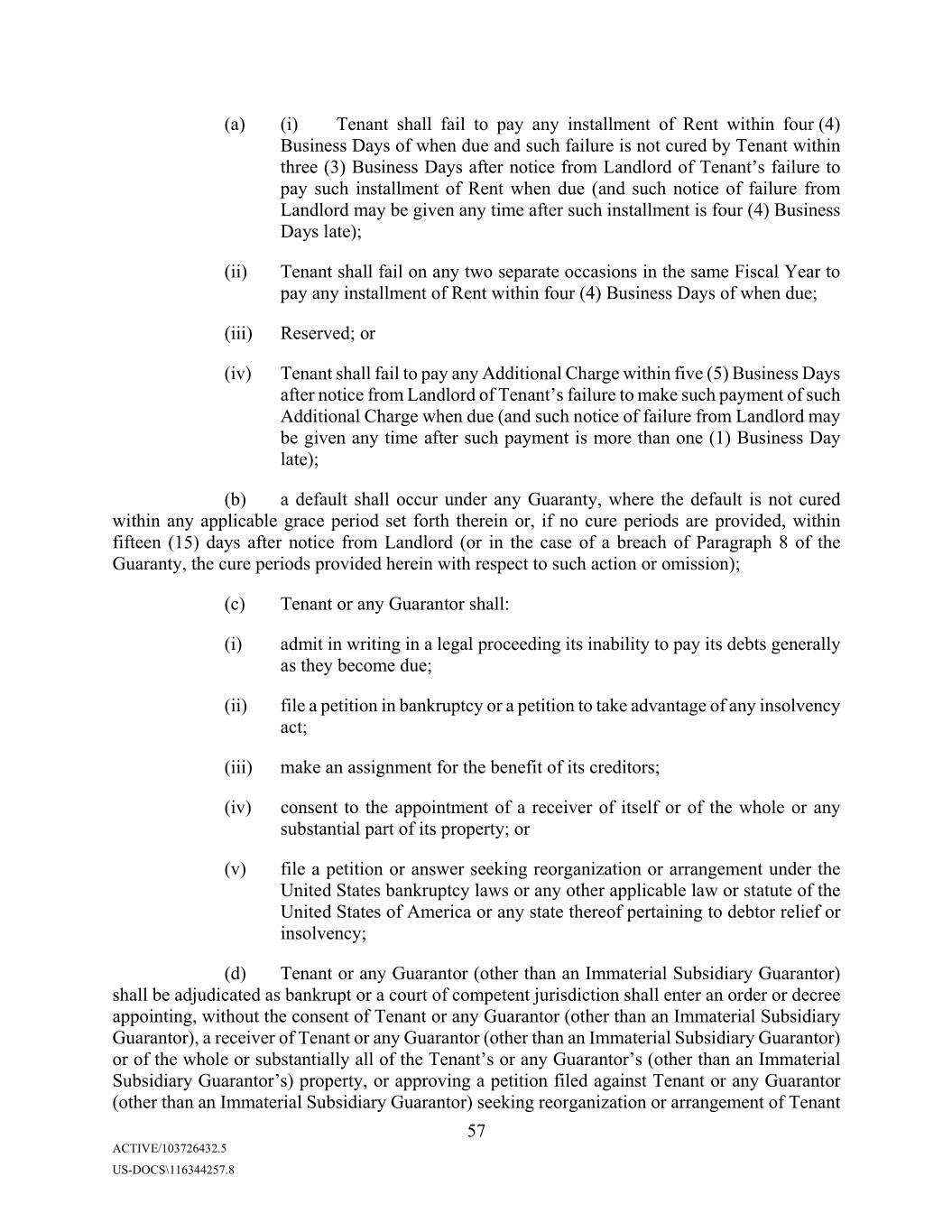
(a) (i) Tenant shall fail to pay any installment of Rent within four (4) Business Days of when due and such failure is not cured by Tenant within three (3) Business Days after notice from Landlord of Tenant’s failure to pay such installment of Rent when due (and such notice of failure from Landlord may be given any time after such installment is four (4) Business Days late); (ii) Tenant shall fail on any two separate occasions in the same Fiscal Year to pay any installment of Rent within four (4) Business Days of when due; (iii) Reserved; or (iv) Tenant shall fail to pay any Additional Charge within five (5) Business Days after notice from Landlord of Tenant’s failure to make such payment of such Additional Charge when due (and such notice of failure from Landlord may be given any time after such payment is more than one (1) Business Day late); (b) a default shall occur under any Guaranty, where the default is not cured within any applicable grace period set forth therein or, if no cure periods are provided, within fifteen (15) days after notice from Landlord (or in the case of a breach of Paragraph 8 of the Guaranty, the cure periods provided herein with respect to such action or omission); (c) Tenant or any Guarantor shall: (i) admit in writing in a legal proceeding its inability to pay its debts generally as they become due; (ii) file a petition in bankruptcy or a petition to take advantage of any insolvency act; (iii) make an assignment for the benefit of its creditors; (iv) consent to the appointment of a receiver of itself or of the whole or any substantial part of its property; or (v) file a petition or answer seeking reorganization or arrangement under the United States bankruptcy laws or any other applicable law or statute of the United States of America or any state thereof pertaining to debtor relief or insolvency; (d) Tenant or any Guarantor (other than an Immaterial Subsidiary Guarantor) shall be adjudicated as bankrupt or a court of competent jurisdiction shall enter an order or decree appointing, without the consent of Tenant or any Guarantor (other than an Immaterial Subsidiary Guarantor), a receiver of Tenant or any Guarantor (other than an Immaterial Subsidiary Guarantor) or of the whole or substantially all of the Tenant’s or any Guarantor’s (other than an Immaterial Subsidiary Guarantor’s) property, or approving a petition filed against Tenant or any Guarantor (other than an Immaterial Subsidiary Guarantor) seeking reorganization or arrangement of Tenant 57 ACTIVE/103726432.5 US-DOCS\116344257.8
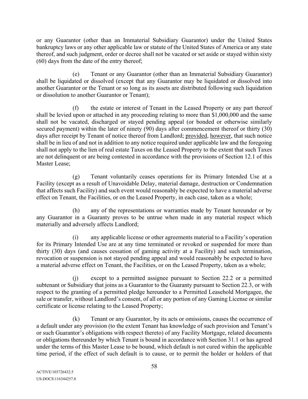
or any Guarantor (other than an Immaterial Subsidiary Guarantor) under the United States bankruptcy laws or any other applicable law or statute of the United States of America or any state thereof, and such judgment, order or decree shall not be vacated or set aside or stayed within sixty (60) days from the date of the entry thereof; (e) Tenant or any Guarantor (other than an Immaterial Subsidiary Guarantor) shall be liquidated or dissolved (except that any Guarantor may be liquidated or dissolved into another Guarantor or the Tenant or so long as its assets are distributed following such liquidation or dissolution to another Guarantor or Tenant); (f) the estate or interest of Tenant in the Leased Property or any part thereof shall be levied upon or attached in any proceeding relating to more than $1,000,000 and the same shall not be vacated, discharged or stayed pending appeal (or bonded or otherwise similarly secured payment) within the later of ninety (90) days after commencement thereof or thirty (30) days after receipt by Tenant of notice thereof from Landlord; provided, however, that such notice shall be in lieu of and not in addition to any notice required under applicable law and the foregoing shall not apply to the lien of real estate Taxes on the Leased Property to the extent that such Taxes are not delinquent or are being contested in accordance with the provisions of Section 12.1 of this Master Lease; (g) Tenant voluntarily ceases operations for its Primary Intended Use at a Facility (except as a result of Unavoidable Delay, material damage, destruction or Condemnation that affects such Facility) and such event would reasonably be expected to have a material adverse effect on Tenant, the Facilities, or on the Leased Property, in each case, taken as a whole; (h) any of the representations or warranties made by Tenant hereunder or by any Guarantor in a Guaranty proves to be untrue when made in any material respect which materially and adversely affects Landlord; (i) any applicable license or other agreements material to a Facility’s operation for its Primary Intended Use are at any time terminated or revoked or suspended for more than thirty (30) days (and causes cessation of gaming activity at a Facility) and such termination, revocation or suspension is not stayed pending appeal and would reasonably be expected to have a material adverse effect on Tenant, the Facilities, or on the Leased Property, taken as a whole; (j) except to a permitted assignee pursuant to Section 22.2 or a permitted subtenant or Subsidiary that joins as a Guarantor to the Guaranty pursuant to Section 22.3, or with respect to the granting of a permitted pledge hereunder to a Permitted Leasehold Mortgagee, the sale or transfer, without Landlord’s consent, of all or any portion of any Gaming License or similar certificate or license relating to the Leased Property; (k) Tenant or any Guarantor, by its acts or omissions, causes the occurrence of a default under any provision (to the extent Tenant has knowledge of such provision and Tenant’s or such Guarantor’s obligations with respect thereto) of any Facility Mortgage, related documents or obligations thereunder by which Tenant is bound in accordance with Section 31.1 or has agreed under the terms of this Master Lease to be bound, which default is not cured within the applicable time period, if the effect of such default is to cause, or to permit the holder or holders of that 58 ACTIVE/103726432.5 US-DOCS\116344257.8
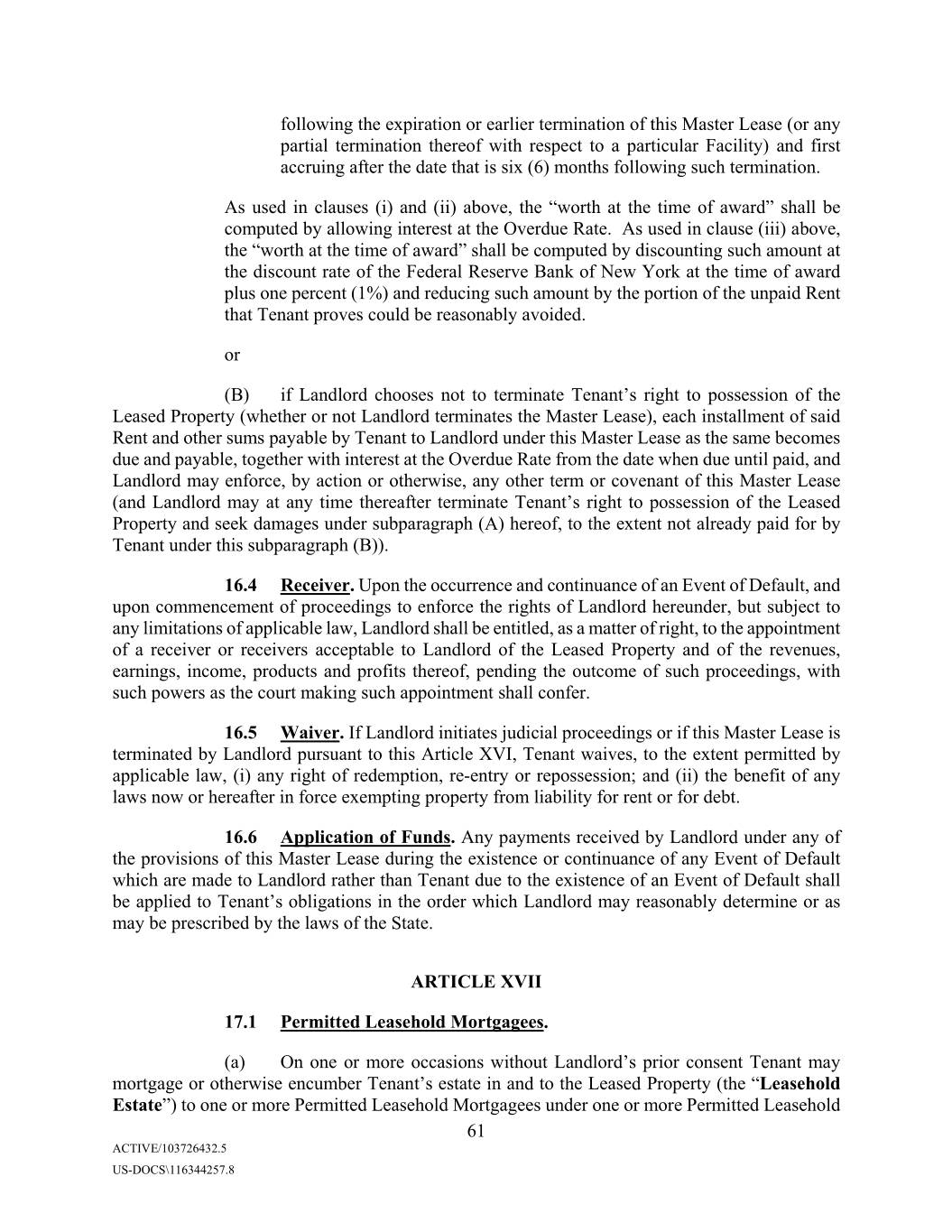
following the expiration or earlier termination of this Master Lease (or any partial termination thereof with respect to a particular Facility) and first accruing after the date that is six (6) months following such termination. As used in clauses (i) and (ii) above, the “worth at the time of award” shall be computed by allowing interest at the Overdue Rate. As used in clause (iii) above, the “worth at the time of award” shall be computed by discounting such amount at the discount rate of the Federal Reserve Bank of New York at the time of award plus one percent (1%) and reducing such amount by the portion of the unpaid Rent that Xxxxxx proves could be reasonably avoided. or (B) if Landlord chooses not to terminate Tenant’s right to possession of the Leased Property (whether or not Landlord terminates the Master Lease), each installment of said Xxxx and other sums payable by Tenant to Landlord under this Master Lease as the same becomes due and payable, together with interest at the Overdue Rate from the date when due until paid, and Landlord may enforce, by action or otherwise, any other term or covenant of this Master Lease (and Landlord may at any time thereafter terminate Xxxxxx’s right to possession of the Leased Property and seek damages under subparagraph (A) hereof, to the extent not already paid for by Tenant under this subparagraph (B)). 16.4 Receiver. Upon the occurrence and continuance of an Event of Default, and upon commencement of proceedings to enforce the rights of Landlord hereunder, but subject to any limitations of applicable law, Landlord shall be entitled, as a matter of right, to the appointment of a receiver or receivers acceptable to Landlord of the Leased Property and of the revenues, earnings, income, products and profits thereof, pending the outcome of such proceedings, with such powers as the court making such appointment shall confer. 16.5 Waiver. If Landlord initiates judicial proceedings or if this Master Lease is terminated by Landlord pursuant to this Article XVI, Tenant waives, to the extent permitted by applicable law, (i) any right of redemption, re-entry or repossession; and (ii) the benefit of any laws now or hereafter in force exempting property from liability for rent or for debt. 16.6 Application of Funds. Any payments received by Landlord under any of the provisions of this Master Lease during the existence or continuance of any Event of Default which are made to Landlord rather than Tenant due to the existence of an Event of Default shall be applied to Tenant’s obligations in the order which Landlord may reasonably determine or as may be prescribed by the laws of the State. ARTICLE XVII 17.1 Permitted Leasehold Mortgagees. (a) On one or more occasions without Xxxxxxxx’s prior consent Tenant may mortgage or otherwise encumber Tenant’s estate in and to the Leased Property (the “Leasehold Estate”) to one or more Permitted Leasehold Mortgagees under one or more Permitted Leasehold 61 ACTIVE/103726432.5 US-DOCS\116344257.8
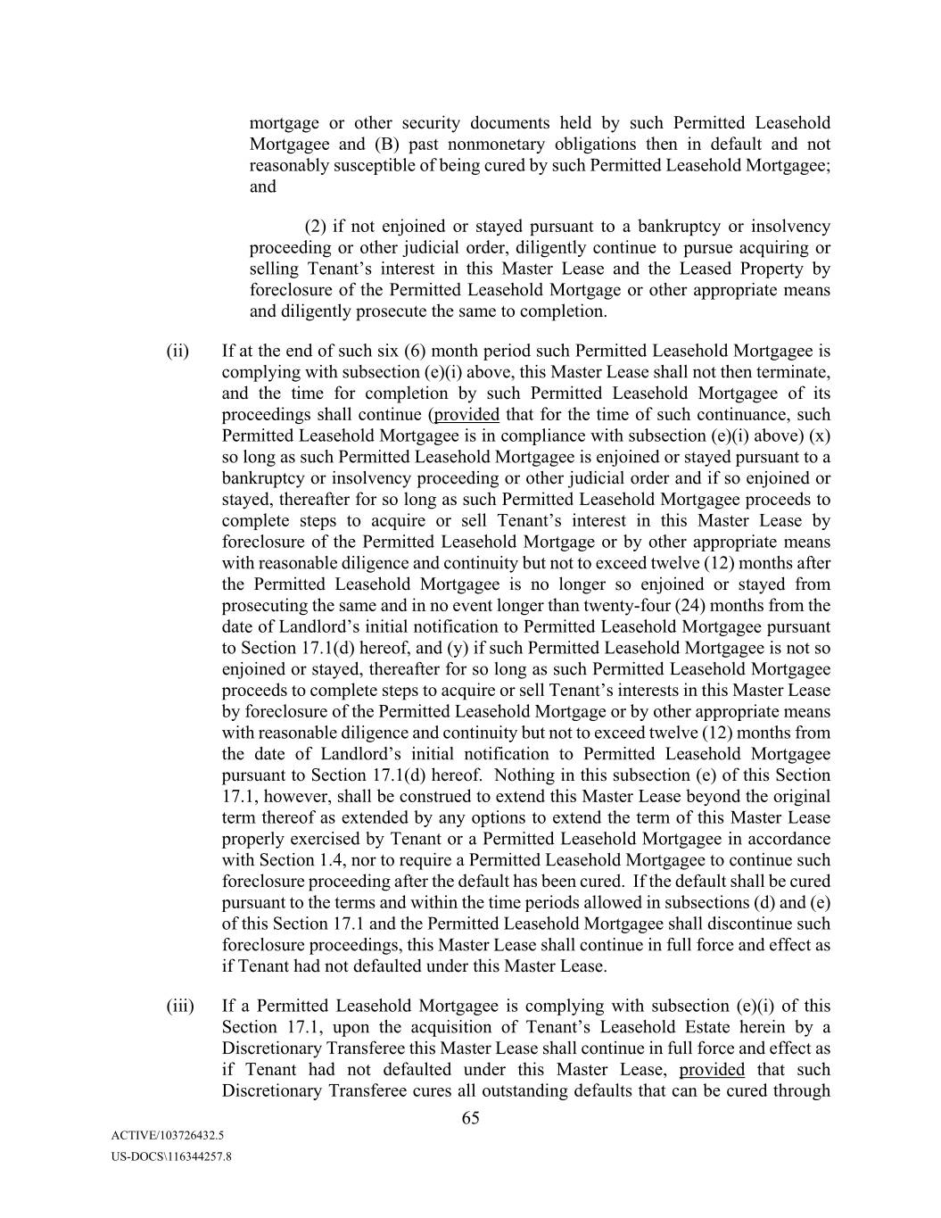
mortgage or other security documents held by such Permitted Leasehold Mortgagee and (B) past nonmonetary obligations then in default and not reasonably susceptible of being cured by such Permitted Leasehold Mortgagee; and (2) if not enjoined or stayed pursuant to a bankruptcy or insolvency proceeding or other judicial order, diligently continue to pursue acquiring or selling Tenant’s interest in this Master Lease and the Leased Property by foreclosure of the Permitted Leasehold Mortgage or other appropriate means and diligently prosecute the same to completion. (ii) If at the end of such six (6) month period such Permitted Leasehold Mortgagee is complying with subsection (e)(i) above, this Master Lease shall not then terminate, and the time for completion by such Permitted Leasehold Mortgagee of its proceedings shall continue (provided that for the time of such continuance, such Permitted Leasehold Mortgagee is in compliance with subsection (e)(i) above) (x) so long as such Permitted Leasehold Mortgagee is enjoined or stayed pursuant to a bankruptcy or insolvency proceeding or other judicial order and if so enjoined or stayed, thereafter for so long as such Permitted Leasehold Mortgagee proceeds to complete steps to acquire or sell Tenant’s interest in this Master Lease by foreclosure of the Permitted Leasehold Mortgage or by other appropriate means with reasonable diligence and continuity but not to exceed twelve (12) months after the Permitted Leasehold Mortgagee is no longer so enjoined or stayed from prosecuting the same and in no event longer than twenty-four (24) months from the date of Landlord’s initial notification to Permitted Leasehold Mortgagee pursuant to Section 17.1(d) hereof, and (y) if such Permitted Leasehold Mortgagee is not so enjoined or stayed, thereafter for so long as such Permitted Leasehold Mortgagee proceeds to complete steps to acquire or sell Tenant’s interests in this Master Lease by foreclosure of the Permitted Leasehold Mortgage or by other appropriate means with reasonable diligence and continuity but not to exceed twelve (12) months from the date of Landlord’s initial notification to Permitted Leasehold Mortgagee pursuant to Section 17.1(d) hereof. Nothing in this subsection (e) of this Section 17.1, however, shall be construed to extend this Master Lease beyond the original term thereof as extended by any options to extend the term of this Master Lease properly exercised by Tenant or a Permitted Leasehold Mortgagee in accordance with Section 1.4, nor to require a Permitted Leasehold Mortgagee to continue such foreclosure proceeding after the default has been cured. If the default shall be cured pursuant to the terms and within the time periods allowed in subsections (d) and (e) of this Section 17.1 and the Permitted Leasehold Mortgagee shall discontinue such foreclosure proceedings, this Master Lease shall continue in full force and effect as if Tenant had not defaulted under this Master Lease. (iii) If a Permitted Leasehold Mortgagee is complying with subsection (e)(i) of this Section 17.1, upon the acquisition of Tenant’s Leasehold Estate herein by a Discretionary Transferee this Master Lease shall continue in full force and effect as if Tenant had not defaulted under this Master Lease, provided that such Discretionary Transferee cures all outstanding defaults that can be cured through 65 ACTIVE/103726432.5 US-DOCS\116344257.8
(a) undergo a Change in Control of the type referred to in clause (i)(a) of the definition of Change in Control (such Change in Control, a “Tenant Parent COC”) if a Person acquiring such beneficial ownership or control is (1) a Discretionary Transferee and (2) the Parent Company of such Discretionary Transferee, if any, has become a Guarantor and provided a Guaranty on terms substantially similar to the Guaranty or otherwise reasonably satisfactory to Landlord or, if such Discretionary Transferee does not have a Parent Company, such Discretionary Transferee has become a Guarantor and provided a Guaranty on terms substantially similar to the Guaranty or otherwise reasonably satisfactory to Landlord; (b) undergo a Change in Control whereby a Person acquires beneficial ownership and control of 100% of the Equity Interests in Tenant in connection with a Change in Control that does not constitute a Tenant Parent COC or a Foreclosure COC (such Change in Control, a “Tenant COC”) if (1) such Person is a Discretionary Transferee, (2) the Parent Company of such Discretionary Transferee, if any, has become a Guarantor and provided a Guaranty on terms substantially similar to the Guaranty or otherwise reasonably satisfactory to Landlord or, if such Discretionary Transferee does not have a Parent Company, such Discretionary Transferee has become a Guarantor and provided a Guaranty on terms reasonably satisfactory to Landlord, and (3) the Adjusted Revenue to Rent Ratio with respect to all of the Facilities (determined at the proposed effective time of the Change in Control) for the then most recently preceding four (4) fiscal quarters for which financial statements are available is at least 1.4:1; (c) assign this Master Lease to any Person in an assignment that does not constitute a Foreclosure Assignment if (1) such Person is a Discretionary Transferee, (2) such Discretionary Transferee agrees in writing to assume the obligations of the Tenant under this Master Lease without amendment or modification other than as provided below, (3) the Parent Company of such Discretionary Transferee, if any, has become a Guarantor and provided a Guaranty on terms substantially similar to the Guaranty or otherwise reasonably satisfactory to Landlord or, if such Discretionary Transferee does not have a Parent Company, such Discretionary Transferee has become a Guarantor and provided a Guaranty on terms substantially similar to the Guaranty or otherwise reasonably satisfactory to Landlord, and (4) the Adjusted Revenue to Rent Ratio with respect to all of the Facilities (determined at the proposed effective time of the assignment) for the then most recently preceding four (4) fiscal quarters for which financial statements are available is at least 1.4:1; or (d) (i) assign this Master Lease by way of foreclosure of the Leasehold Estate, an assignment-in-lieu of foreclosure to any Person or an assignment (by sale or through a plan of reorganization) pursuant to any applicable bankruptcy or insolvency law to any Person, (any such assignment, a “Foreclosure Assignment”) or (ii) undergo a Change in Control whereby a Person acquires beneficial ownership and control of 100% of the Equity Interests in Tenant as a result of the purchase at a foreclosure on a permitted pledge of, or an assignment (by sale or through a plan 73 ACTIVE/103726432.5 US-DOCS\116344257.8
of reorganization) pursuant to any applicable bankruptcy or insolvency law to any Person of, the Equity Interests in Tenant or an assignment in lieu of such foreclosure (a “Foreclosure COC”) or (iii) effect the first subsequent sale or assignment of the Leasehold Estate or Change in Control after a Foreclosure Assignment or a Foreclosure COC whereby a Person so acquires the Leasehold Estate or beneficial ownership and control of 100% of the Equity Interests in Tenant or the Person who acquired the Leasehold Estate in connection with the Foreclosure Assignment, in each case, effected by a Permitted Leasehold Mortgagee or a Permitted Leasehold Mortgagee Foreclosing Party, to the extent such Permitted Leasehold Mortgagee or Permitted Leasehold Mortgagee Designee has been diligently attempting to expedite such first subsequent sale from the time it has initiated foreclosure proceedings taking into account the interest of such Permitted Leasehold Mortgagee or Permitted Leasehold Mortgagee Designee in maximizing the proceeds of such disposition if (1) such Person is a Discretionary Transferee, (2) in the case of any Foreclosure Assignment, if such Discretionary Transferee is not a Permitted Leasehold Mortgagee Designee such Discretionary Transferee agrees in writing to assume the obligations of the Tenant under this Master Lease without amendment or modification other than as provided below (which written assumption, in the case of a Permitted Leasehold Mortgagee Foreclosing Party, may be made by a Subsidiary of a Permitted Leasehold Mortgagee or a Permitted Leasehold Mortgagee Designee) and (3) if such Discretionary Transferee is not a Permitted Leasehold Mortgagee Foreclosing Party, the Parent Company of such Discretionary Transferee, if any, has become a Guarantor and provided a Guaranty on terms substantially similar to the Guaranty or otherwise reasonably satisfactory to Landlord or, if such Discretionary Transferee does not have a Parent Company, such Discretionary Transferee has become a Guarantor and provided a Guaranty on terms substantially similar to the Guaranty or otherwise reasonably satisfactory to Landlord; provided that no such Change in Control or assignment referred to in this Section 22.2(iii) shall be permitted without Landlord’s prior written consent unless, and in which case such consent shall not be unreasonably withheld, (A) the use of the Leased Property at the time of such Change in Control or assignment and immediately after giving effect thereto is permitted by Section 7.2 hereof, and (B) Landlord in its reasonable discretion shall have approved the form and content of all documents for such assignment and assumption and received an executed counterpart thereof (provided no such approval shall be required in the case of a Tenant Parent COC or a Tenant COC, so long as (A) Tenant remains obligated under the Master Lease and the Guaranty remains in effect except with respect to any release of Tenant’s Parent permitted thereunder, (B) the requirements for a Guaranty from the Parent Company or Discretionary Transferee under clause (a) or (b) above are met, and (C) any modifications to this Master Lease required pursuant to the next succeeding paragraph are made); and (iv) without Landlord’s prior written consent, pledge or mortgage its Leasehold Estate to a Permitted Leasehold Mortgagee and permit a pledge of the equity interests in Tenant to be pledged to a Permitted Leasehold Mortgagee. 74 ACTIVE/103726432.5 US-DOCS\116344257.8
and (iii) advise Tenant as to whether an Event of Default has occurred and is continuing thereby prohibiting Tenant from exercising its Replacement Property Right (in which case Landlord shall have no obligation to proceed with a Replacement Property Transaction until Tenant cures such Event of Default to Landlord’s reasonable satisfaction). Subject to no Event of Default having occurred and being continuing, Landlord and Tenant shall thereafter negotiate in good faith to reconcile any applicable issues(s) and use commercially reasonable efforts to enter into the Replacement Exchange Agreement as soon as reasonably practicable thereafter. (d) In the event the Property Value of the Replacement Property is greater than the Property Value of the Replaced Property (it being understood that in no event shall the Landlord be obligated to engage in a Replacement Property Transaction if the Property Value of the Replacement Property (in the aggregate) is less than the Property Value of the Replaced Property), then upon the consummation of the closing under the Replacement Exchange Agreement and entry into the Replacement Property Lease Amendment (i) Landlord shall pay to Tenant in cash an amount equal to such excess and (ii) Building Base Rent and Land Base Rent under this Master Lease shall increase by an annual amount equal to one-eleventh of such excess, with such increase being split between Building Base Rent and Land Base Rent in the same proportion as Building Base Rent and Land Base Rent bear to one another at the time the Replacement Property Lease Amendment is executed. In the event that the Property Value of the Replacement Property is equal to the Property Value of the Replaced Property, then there shall be no payment from Landlord to Tenant on account thereof and there shall be no adjustment to the amount of Rent due from Tenant under this Master Lease. (e) The consummation of the closing under the Replacement Exchange Agreement shall be subject to obtaining all Required Governmental Approvals by Tenant, Landlord and/or the Replaced Property Transferee (and each of their respective applicable Affiliates) in accordance with applicable law (including applicable Gaming Regulations). Each of Landlord and Tenant shall, and shall cause its Affiliates to, (a) file or cause to be filed, as promptly as practicable, and in any event no later than ten (10) days, following the date on which Landlord and Tenant execute such Replacement Exchange Agreement, all applications and supporting documentation necessary to obtain all Required Governmental Approvals for the Replacement Property Transaction, (b) use commercially reasonable efforts in order to obtain such Required Governmental Approvals as promptly as practicable, and (c) use commercially reasonable efforts in order to assist the other party in its efforts to obtain such Required Governmental Approvals as promptly as practicable. Landlord, at no cost or expense to Landlord, agrees to reasonably cooperate with Xxxxxx and use commercially reasonable efforts to provide Regulatory Approval Supporting Information that is reasonably requested by Tenant in connection with the Replacement Property Transaction, in Xxxxxx’s efforts to obtain any Required Governmental Approvals. (f) Upon the consummation of the closing under the Replacement Exchange Agreement, Landlord and Tenant shall execute the Replacement Property Lease Amendment, and upon the execution of the Replacement Property Lease Amendment, this Master Lease shall terminate with respect to the Replaced Property, the Replaced Property shall cease to constitute Leased Property hereunder, neither Tenant nor Landlord shall have any further liabilities or obligations under this Master Lease, from and after the consummation of the closing under the Replacement Exchange Agreement, in respect of the Replaced Property, and the Guaranty shall automatically, and without further action by any party, cease to apply with respect to any 78 ACTIVE/103726432.5 US-DOCS\116344257.8
Obligations (as defined in the Guaranty) with respect to the Replaced Property to the extent arising from and after the consummation of the closing under the Replacement Exchange Agreement and the execution of the Replacement Property Lease Amendment (provided that any such Obligations arising prior to such closing date shall not be terminated, limited or affected by or upon the closing under the Replacement Exchange Agreement). (g) Upon the consummation of the closing under the Replacement Exchange Agreement and the entry into the Replacement Property Lease Amendment, this Master Lease shall apply to the Replacement Property, the Replacement Property shall constitute Leased Property and a Facility hereunder, each of Tenant’s and Landlord’s obligations under this Master Lease in respect of the Leased Property and the Facilities shall apply to the Replacement Property, and the Guaranty shall automatically, and without further action by any party, apply with respect to any Obligations (as defined in the Guaranty) with respect to the Replacement Property to the extent arising from and after the consummation of the closing under the Replacement Exchange Agreement. (h) Each of Tenant and Landlord (at no cost or expense to Landlord) shall furnish to the other party Regulatory Approval Supporting Information and reasonable assistance as such party may reasonably request in connection with obtaining the Required Governmental Approvals. Subject to Section 23.2 and applicable laws relating to the exchange of information, outside counsel for Landlord and Tenant shall have the right to review in advance, and to the extent practicable each party shall consult with the other in connection with, all of the information relating to Landlord or Tenant, as the case may be, and any of their respective subsidiaries, that appears in any filing made with, or written materials submitted to, any Person and/or any governmental authority in connection with the Replacement Property Transaction; provided, that the foregoing shall not apply to applications made with respect to Gaming Licenses and other gaming approvals required under applicable Gaming Regulations that include personal identifying information or other similarly sensitive information (as reasonably determined by such party in good faith). In exercising the foregoing rights, each of Landlord and Tenant shall act reasonably and as promptly as practicable. Subject to applicable law and the instructions of any governmental authority, Landlord and Tenant shall keep the other party reasonably apprised of the status of matters relating to the completion of the Replacement Property Transaction, including promptly furnishing the other party with copies of notices or other written substantive communications received from any governmental authority and/or other Person with respect to the Replacement Property Transaction and, to the extent practicable under the circumstances, shall provide the other party with the opportunity to participate in any meeting with any governmental authority in respect of any substantive filing, investigation or other inquiry in connection with the Replacement Property Transaction. (i) If Tenant exercises the Replacement Property Right, Tenant and Landlord shall use commercially reasonable efforts to effectuate the Replacement Property Transaction and minimize all costs, fees (including consent fees), taxes and expenses incurred by Tenant and Landlord in consummating the Replacement Property Transaction. All reasonable, documented out-of-pocket costs and expenses relating to an exercise of the Replacement Property Right and/or otherwise in connection with any transfer or proposed transfer pursuant to this Section 22.7 (including reasonable, documented attorneys’ fees and other reasonable, documented out-of- 79 ACTIVE/103726432.5 US-DOCS\116344257.8
closing of the Baton Rouge Transfer, (ii) on the Baton Rouge Transfer Date, Landlord shall convey its fee interest to the Baton Rouge Transferee free and clear of (1) all monetary liens and encumbrances voluntarily created or entered into by Landlord and (2) except for any liens that did not require Tenant’s consent under this Master Lease, all other liens and encumbrances voluntarily created or entered into by Landlord without Tenant’s prior written consent, (iii) Landlord shall provide only the following limited representations and warranties to the Baton Rouge Transferee: (a) due authority and execution, (b) no conflict with the organizational documents of Landlord or any other agreement or judgment to which Landlord is a party, (c) Patriot Act and OFAC, (d) bankruptcy, and (e) Landlord has not entered into any contract, easement or other agreement, which will be binding on the Baton Rouge Transferee after the closing of the Baton Rouge Sale, except for those contracts, easements or other agreements that are disclosed in any title report or in this Master Lease (it being understood that any property related representations and warranties requested by the Baton Rouge Transferee and any post-closing indemnification obligations related thereto shall be provided solely by Tenant). At the closing of the Baton Rouge Sale, (i) Landlord and Tenant shall enter into the Baton Rouge Lease Amendment, (ii) Landlord shall receive the net proceeds of the Baton Rouge Sale and (iii) Tenant shall receive the net proceeds of the Baton Rouge Transfer. (c) In the event that Landlord does not elect to proceed with a Baton Rouge Sale, at the closing of any Baton Rouge Transfer, Landlord and Tenant shall enter into the Baton Rouge Lease Amendment and Tenant shall cause the Baton Rouge Transferee to deliver a Replacement Guaranty (if required hereunder) and enter into a Baton Rouge Severance Lease with Landlord, in accordance with the following: (i) At the closing of the Baton Rouge Transfer, Landlord shall enter into a separate lease for the Baton Rouge Facility with the Baton Rouge Transferee, which lease shall be on substantially the same terms and provisions as this Master Lease (a “Baton Rouge Severance Lease”), subject to the following modifications: (A) The term of the Baton Rouge Severance Lease shall be the Baton Rouge Severance Lease Term determined in accordance with the definition thereof; (B) The rent initially payable under the Baton Rouge Severance Lease as of the Baton Rouge Transfer Date will be equal to the Baton Rouge Severance Lease Rent, and shall thereafter be subject to escalation and adjustment consistent with the provisions of this Master Lease (as if this Master Lease shall have commenced on the Baton Rouge Transfer Date), modified to reflect that the rent payable under the Baton Rouge Severance Lease will be calculated on a stand-alone basis with respect to the Baton Rouge Facility only; (C) The Baton Rouge Severance Lease shall contain minimum capital expenditure requirements consistent with the capital expenditure requirements in Section 9.1(e) of this Master Lease, modified to reflect that such minimum capital expenditure requirements will apply to the Baton Rouge Severance Lease on a stand-alone basis; and (D) Sections 22.7 and 22.8 of this Master Lease shall be omitted in their entirety from the Baton Rouge Severance Lease and Section 22.3 in the Baton Rouge Severance Lease shall be consistent with the Section 22.3 of the Original Master Lease. 81 ACTIVE/103726432.5 US-DOCS\116344257.8
(ii) As a condition to the effectiveness of any Baton Rouge Transfer (except in the event Landlord has elected to proceed with a Baton Rouge Sale in accordance with Section 22.8(b) above), Tenant shall require and cause the Parent Company of such Baton Rouge Transferee, or if such Baton Rouge Transferee does not have a Parent Company, the Baton Rouge Transferee, to deliver to Landlord a Replacement Guaranty; provided, however, if as of the Baton Rouge Transfer Date such Baton Rouge Transferee, the Parent Company of such Baton Rouge Transferee or any of their respective Affiliates is the tenant under any lease under which Landlord or any of its Affiliates is the landlord and any such lease does not require the tenant or the Parent Company of the tenant thereunder to have delivered a guaranty of such lease, then neither the Parent Company of such Baton Rouge Transferee nor the Baton Rouge Transferee shall be required to deliver a Replacement Guaranty with respect to the Baton Rouge Severance Lease. (iii) If Landlord has any comments or revisions that are commercially reasonable or required to cause the proposed Baton Rouge Severance Lease and/or the Baton Rouge Lease Amendment to comply with the provisions of this Master Lease, then Landlord shall notify Tenant thereof within fifteen (15) days after Landlord’s receipt of the proposed Baton Rouge Severance Lease and the Baton Rouge Lease Amendment. In such event, Tenant and Landlord shall negotiate in good faith to reconcile the applicable issue(s) and use commercially reasonable efforts to enter into, and cause the Baton Rouge Transferee and its Parent Company to enter into, the Baton Rouge Lease Amendment, the Baton Rouge Severance Lease and a Replacement Guaranty (if required hereunder), as applicable, as soon as reasonably practicable thereafter. (iv) Upon the execution and delivery of the Baton Rouge Severance Lease, the Baton Rouge Lease Amendment and the Replacement Guaranty (if applicable) in accordance with this Section 22.8, this Master Lease shall be terminated with respect to the Baton Rouge Facility, the Baton Rouge Facility shall cease to constitute Leased Property hereunder, neither Tenant nor Landlord shall have any further liabilities or obligations under this Master Lease, from and after the Baton Rouge Transfer Date, with respect to the Baton Rouge Facility, and the Guaranty shall automatically, and without further action by any party, cease to apply with respect to any Obligations (as defined in the Guaranty) with respect to the Baton Rouge Facility to the extent arising from and after the Baton Rouge Transfer Date (provided that any such Obligations arising prior to the Baton Rouge Transfer Date shall not be terminated, limited or affected by or upon entry into the Baton Rouge Severance Lease or the Baton Rouge Lease Amendment). Landlord and Tenant expressly acknowledge and agree that (a) there shall be no reduction in the Rent under this Master Lease as a result of the removal of the Baton Rouge Facility from this Master Lease or otherwise as a result of a Baton Rouge Transfer or a Baton Rouge Sale and (b) Tenant shall be entitled to all of the proceeds from any Baton Rouge Transfer (excluding any proceeds attributable to a Baton Rouge Sale). (v) The execution and implementation of the Baton Rouge Transfer and/or Baton Rouge Sale shall be subject to obtaining all Required Governmental Approvals by Tenant and/or the Baton Rouge Transferee (and each of their respective applicable Affiliates) in accordance with applicable law (including applicable Gaming Regulations). Each of Landlord and Tenant shall, and shall cause its Affiliates to, (a) file or cause to be filed, as promptly as practicable, and in any event no later than ten (10) days, following the date on which Landlord and Tenant agree on the form of the Baton Rouge Severance Lease or a Baton Rouge Purchase Agreement, as 82 ACTIVE/103726432.5 US-DOCS\116344257.8
applicable, all applications and supporting documentation necessary to obtain all Required Governmental Approvals for the Baton Rouge Severance Lease, the Baton Rouge Transfer and/or the Baton Rouge Sale, as applicable, (b) use commercially reasonable efforts in order to obtain such Required Governmental Approvals as promptly as practicable, and (c) use commercially reasonable efforts in order to assist the other party in its efforts to obtain such Required Governmental Approvals as promptly as practicable. Landlord, at no cost or expense to Landlord, agrees to reasonably cooperate with Xxxxxx and use commercially reasonable efforts to provide Regulatory Approval Supporting Information that is reasonably requested by Tenant in connection with the Baton Rouge Transfer and/or Baton Rouge Sale, in Tenant’s or the Baton Rouge Transferee’s efforts to obtain any Required Governmental Approvals. (vi) Each of Tenant and Landlord shall furnish to the other party Regulatory Approval Supporting Information and reasonable assistance as such party may reasonably request in connection with obtaining the Required Governmental Approvals. Subject to Section 23.2 and applicable laws relating to the exchange of information, outside counsel for Landlord and Tenant shall have the right to review in advance, and to the extent practicable each party shall consult with the other in connection with, all of the information relating to Landlord or Tenant, as the case may be, and any of their respective subsidiaries, that appears in any filing made with, or written materials submitted to, any Person and/or any governmental authority in connection with the Baton Rouge Transfer or a Baton Rouge Sale; provided, that the foregoing shall not apply to applications made with respect to Gaming Licenses and other gaming approvals required under applicable Gaming Regulations that include personal identifying information or other similarly sensitive information (as reasonably determined by such party in good faith). In exercising the foregoing rights, each of Landlord and Tenant shall act reasonably and as promptly as practicable. Subject to applicable law and the instructions of any governmental authority, Landlord and Tenant shall keep the other party reasonably apprised of the status of matters relating to the completion of the Baton Rouge Transfer and/or Baton Rouge Sale, including promptly furnishing the other party with copies of notices or other written substantive communications received from any governmental authority and/or other Person with respect to the Baton Rouge Transfer and/or Baton Rouge Sale and, to the extent practicable under the circumstances, shall provide the other party with the opportunity to participate in any meeting with any governmental authority in respect of any substantive filing, investigation or other inquiry in connection with the Baton Rouge Transfer and/or Baton Rouge Sale. (vii) In the event Tenant desires to effectuate a Baton Rouge Transfer, Tenant and Landlord shall use commercially reasonable efforts to effectuate the Baton Rouge Transfer and any Baton Rouge Sale, if applicable, and minimize all costs, fees (including consent fees), taxes and expenses incurred by Tenant and Landlord in consummating the Baton Rouge Transfer and Baton Rouge Sale. All reasonable, documented out-of-pocket costs and expenses relating to a Baton Rouge Transfer (but not the Baton Rouge Sale) (including reasonable, documented attorneys’ fees and other reasonable, documented out-of-pocket costs incurred by Landlord for outside counsel, if any) shall be borne by Tenant and not Landlord. Landlord and Tenant shall each be responsible for their own costs and expenses incurred in connection with any Baton Rouge Sale. 83 ACTIVE/103726432.5 US-DOCS\116344257.8
going concern and scope of audit of Tenant’s Parent and its Subsidiaries (excluding any qualification as to going concern relating to any debt maturities in the twelve month period following the date of such audit or any projected financial performance or covenant default in any Material Indebtedness or this Master Lease in such twelve month period) and shall provide in substance that (a) such consolidated financial statements present fairly the consolidated financial position of Tenant’s Parent and its Subsidiaries as at the dates indicated and the results of their operations and cash flow for the periods indicated in conformity with GAAP and (b) that the examination by Tenant’s Parent’s accountants in connection with such Financial Statements has been made in accordance with generally accepted auditing standards; (ii) Within forty-five (45) days after the end of each of the first three (3) fiscal quarters of the Tenant’s Parent’s Fiscal Year (commencing with the fiscal quarter ending June 30, 2018) or concurrently with the filing by Xxxxxx’s Parent of its quarterly report on Form 10-Q with the SEC, whichever is earlier, a copy of Tenant’s Parent’s Financial Statements for such period, together with a certificate, executed by the chief financial officer or treasurer of Tenant’s Parent (i) certifying that no default has occurred or, if such a default has occurred, specifying the nature and extent thereof and any corrective action taken or proposed to be taken with respect thereto, (ii) setting forth the calculation of the financial covenants set forth in Section 23.3 hereof in reasonable detail as of such quarter, to the extent one complete Test Period has been completed which has commenced following the Commencement Date and (iii) certifying that such Financial Statements fairly present, in all material respects, the financial position and results of operations of Tenant’s Parent and its Subsidiaries on a consolidated basis in accordance with GAAP (subject to normal year-end audit adjustments and the absence of footnotes); (iii) Promptly following Landlord’s request from time to time, (a) five-year forecasts of Tenant’s income statement and balance sheet covering such quarterly and annual periods as may be reasonably requested by Landlord, and in a format consistent with Tenant Parent’s quarterly and annual financial statements filed with the SEC, and such additional financial information and projections as may be reasonably requested by Landlord in connection with syndications, private placements, or public offerings of GLP’s or Landlord’s debt securities or loans or equity or hybrid securities and (b) such additional information and unaudited quarterly financial information concerning the Leased Property and Tenant as Landlord or GLP may require for its ongoing filings with the SEC under both the Securities Act and the Securities Exchange Act of 1934, as amended, including, but not limited to 10-Q Quarterly Reports, 10-K Annual Reports and registration statements to be filed by Landlord or GLP during the Term of this Master Lease, the Internal Revenue Service (including in respect of GLP’s qualification as a “real estate investment trust” (within the meaning of Section 856(a) of the Code)) and any other federal, state or local regulatory agency with jurisdiction over GLP or its Subsidiaries subject to Section 23.1(c) below; (iv) Within thirty-five (35) days after the end of each calendar month, a copy of Xxxxxx’s income statement for such month and Xxxxxx’s balance sheet as of the end of such month (which may be subject to quarterly and year-end adjustments and the absence of footnotes); provided, however, that with respect to each calendar quarter, Tenant shall 85 ACTIVE/103726432.5 US-DOCS\116344257.8
provide such financial reports for the final month thereof as soon as is reasonably practicable following the closing of the books for such month and in sufficient time so that Landlord or its Affiliate is able to include the operational results for the entire quarter in its current Form 10-Q or Form 10-K (or supplemental report filed in connection therewith); (v) Prompt Notice to Landlord of any action, proposal or investigation by any agency or entity, or complaint to such agency or entity, (any of which is called a “Proceeding”), known to Tenant, the result of which Proceeding would reasonably be expected to be to revoke or suspend or terminate or modify in a way adverse to Tenant, or fail to renew or fully continue in effect, any license or certificate or operating authority pursuant to which Tenant carries on any part of the Primary Intended Use of all or any portion of the Leased Property; (vi) As soon as it is prepared and in no event later than sixty (60) days after the end of each Fiscal Year, a capital and operating budget for each Facility for the Fiscal Year in which it is delivered; and (vii) Tenant further agrees to provide the financial and operational reports to be delivered to Landlord under this Master Lease in such electronic format(s) as may reasonably be required by Landlord from time to time in order to (i) facilitate Landlord’s internal financial and reporting database and (ii) permit Landlord to calculate any rent, fee or other payments due under Ground Leases. Xxxxxx also agrees that Landlord shall have audit rights with respect to such information to the extent required to confirm Tenant’s compliance with the Master Lease terms (including, without limitation, calculation of Net Revenues). (c) Notwithstanding the foregoing provisions of Section 23.1, Tenant shall not be obligated (1) to provide information that is subject to the quality assurance immunity or is subject to attorney-client privilege or the attorney work product doctrine or (2) to provide information or assistance that could give Landlord or its Affiliates a “competitive” advantage with respect to markets in which GLP, Landlord or any of Landlord’s Affiliates and Tenant, Tenant’s Parent or any of Tenant’s Affiliates might be competing at any time (“Restricted Information”) it being understood that Restricted Information shall not include revenue and expense information relevant to Landlord’s calculation and verification of (i) the Escalation amount hereunder and (ii) Tenant’s compliance with Section 23.3(a) hereof, provided that the foregoing information shall be provided on a portfolio wide (as opposed to Facility by Facility) basis, except where required by Landlord to be able to make submissions to, or otherwise to comply with requirements of, gaming and other regulatory authorities, in which case such additional information (including Facility by Facility performance information) will be provided by Tenant to Landlord to the extent so required (provided that Landlord shall in such instance first execute a nondisclosure agreement in a form reasonably satisfactory to Tenant with respect to such information). Landlord shall retain audit rights with respect to Restricted Information to the extent required to confirm Tenant’s compliance with the Master Lease terms (and GLP’s compliance with SEC, Internal Revenue Service and other legal and regulatory requirements) and provided that appropriate measures are in place to ensure that only Landlord’s auditors and attorneys (and not Landlord or GLP or any of Landlord’s other Affiliates) are provided access to such information. In addition, Landlord shall not disclose any Restricted Information to any Person or any employee, officer or director of any Person (other than 86 ACTIVE/103726432.5 US-DOCS\116344257.8
this Master Lease or may not properly be performed by Tenant, Tenant shall cooperate with and assist Landlord, at Landlord’s expense, in the performance thereof (other than payment of any indebtedness evidenced or secured thereby); provided, however, notwithstanding the foregoing, (A) this Section 31.3(a) shall not be deemed to, and shall not, impose on Tenant obligations which (i) increase Tenant’s monetary obligations under this Master Lease, (ii) adversely increase Tenant’s non-monetary obligations under this Master Lease in any material respect, or (iii) diminish Tenant’s rights or remedies under this Master Lease in any material respect and (B) in the event of a conflict between the obligations, duties, rights and/or remedies of Tenant hereunder or under the Facility Mortgage Documents, this Master Lease shall govern. For purposes of the foregoing, any proposed implementation of new financial covenants shall be deemed to diminish Tenant’s rights under this Master Lease in a material respect (it being understood that Landlord may agree to such financial covenants in any Facility Mortgage Documents and such financial covenants will not impose obligations on Tenant). If any new Facility Mortgage Documents to be executed by Landlord or any Affiliate of Landlord would impose on Tenant any obligations under this Section 31.3(a), Landlord shall provide copies of the same to Tenant for informational purposes (but not for Tenant’s approval) prior to the execution and delivery thereof by Landlord or any Affiliate of Landlord; provided, however, that neither Landlord nor its Affiliates shall enter into any new Facility Mortgage Documents imposing obligations on Tenant with respect to impounds that are more restrictive than obligations imposed on Tenant pursuant to this Master Lease. (b) Without limiting or expanding Tenant’s obligations pursuant to Section 31.3(a), during the Term of this Master Lease, Tenant acknowledges and agrees that, except as expressly provided elsewhere in this Master Lease, it shall undertake at its own cost and expense the performance of any and all repairs, replacements, capital improvements, maintenance items and all other requirements relating to the condition of a Facility that are required by any Facility Mortgage Documents or by Facility Mortgagee, and Tenant shall be solely responsible and hereby covenants to fund and maintain any and all impound, escrow or other reserve or similar accounts required under any Facility Mortgage Documents as security for or otherwise relating to any operating expenses of a Facility, including any capital repair or replacement reserves and/or impounds or escrow accounts for taxes or insurance premiums (each a “Facility Mortgage Reserve Account”); provided, however, this Section 31.3(b) shall not (i) increase Tenant’s monetary obligations under this Master Lease, (ii) adversely increase Tenant’s non-monetary obligations under this Master Lease in any material respect, (iii) diminish Tenant’s rights or remedies under this Master Lease in any material respect, or (iv) impose obligations to fund such reserve or similar accounts in excess of amounts required under this Master Lease in respect of reserve or similar accounts under the circumstances required under this Master Lease; and provided, further, that any amounts which Tenant is required to fund into a Facility Mortgage Reserve Account with respect to satisfaction of any repair or replacement reserve requirements imposed by a Facility Mortgagee or Facility Mortgage Documents shall be credited on a dollar for dollar basis against the mandatory expenditure obligations of Tenant for such applicable Facility(ies) under Section 9.1(e) and, if Landlord defaults under such Facility Mortgage and such amounts funded into a Facility Mortgage Reserve Account are applied by the Facility Mortgagee for purposes other than their intended purposes for such operating expenses, such amounts shall be credited on a dollar for dollar basis against Rents next coming due. During the Term of this Master Lease and provided that no Event of Default shall have occurred and be continuing hereunder, Tenant shall, subject to the terms and conditions of such Facility Mortgage Reserve 93 ACTIVE/103726432.5 US-DOCS\116344257.8
To Tenant: Tropicana Entertainment, Inc. Tropicana Atlantic City Corp. c/o Eldorado Resorts, Inc. 000 Xxxx Xxxxxxx Xxxxxx Xxxxx 0000 Xxxx, Xxxxxx 00000 Attention: Xxxxxx X. Xxxx Facsimile No.: 000-000-0000 With a copy to: Milbank, Tweed, Xxxxxx & XxXxxx LLP (that shall not 2029 Century Park East constitute notice) Floor 33 Los Angeles, California 90067 Attention: Xxxxxxx X. Xxxxxx Xxxxxxxxx No.: 000-000-0000 To Landlord: GLP Capital, L.P. GLP Capital, L.P. Tropicana AC Sub Corp. c/o Gaming and Leisure Properties, Inc. 000 Xxxxxxxxx Xxxx., Xxxxx 000 Xxxxxxxxxx, Xxxxxxxxxxxx 19610 Attention: Chief Executive Officer Facsimile: (000) 000-0000 And with copy to Xxxxxxx Procter LLP (which shall not The New York Times Building constitute notice): 000 Xxxxxx Xxxxxx Xxx Xxxx, Xxx Xxxx 00000 Attention: Xxxx Xxxxx, Esq. Facsimile: (000) 000-0000 or to such other address as either party may hereafter designate. Notice shall be deemed to have been given on the date of delivery if such delivery is made on a Business Day, or if not, on the first Business Day after delivery. If delivery is refused, Notice shall be deemed to have been given on the date delivery was first attempted. Notice sent by facsimile transmission shall be deemed given upon confirmation that such Notice was received at the number specified above or in a Notice to the sender. ARTICLE XXXVI 36.1 Transfer of Tenant’s Property and Operational Control of the Facilities. Upon the written request (an “End of Term Gaming Asset Transfer Notice”) of Landlord either immediately prior to or in connection with the expiration or earlier termination of 100 ACTIVE/103726432.5 US-DOCS\116344257.8
41.2 Severability. If any term or provision of this Master Lease or any application thereof shall be held invalid or unenforceable, the remainder of this Master Lease and any other application of such term or provision shall not be affected thereby. 41.3 Non-Recourse; Consequential Damages. Tenant specifically agrees to look solely to the Leased Property for recovery of any judgment from Landlord (and Landlord’s liability hereunder shall be limited solely to its interest in the Leased Property, and no recourse under or in respect of this Master Lease shall be had against any other assets of Landlord whatsoever). It is specifically agreed that (a) no constituent partner or shareholder in Landlord or officer or employee of Landlord shall ever be personally liable for any such judgment or for the payment of any monetary obligation to Tenant and (b) no shareholder that is an individual, officer or employee of Tenant shall ever be personally liable for any such judgment or for payment of any monetary obligation to Landlord. The provision contained in the foregoing sentence is not intended to, and shall not, limit any right that Tenant might otherwise have to obtain injunctive relief against Landlord, or any action not involving the personal liability of Landlord. Furthermore, except as otherwise expressly provided herein, in no event shall either party ever be liable to the other party for any indirect or consequential damages suffered by the claiming party from whatever cause. 41.4 Successors and Assigns. This Master Lease shall be binding upon Landlord and its successors and assigns and, subject to the provisions of Article XXII, upon Xxxxxx and its successors and assigns. 41.5 Governing Law. THIS MASTER XXXXX WAS NEGOTIATED IN THE STATE OF NEW YORK, WHICH STATE THE PARTIES AGREE HAS A SUBSTANTIAL RELATIONSHIP TO THE PARTIES AND TO THE UNDERLYING TRANSACTION EMBODIED HEREBY. ACCORDINGLY, IN ALL RESPECTS THIS MASTER LEASE (AND ANY AGREEMENT FORMED PURSUANT TO THE TERMS HEREOF) SHALL BE GOVERNED BY, AND CONSTRUED AND ENFORCED IN ACCORDANCE WITH, THE INTERNAL LAWS OF THE STATE OF NEW YORK (WITHOUT REGARD TO PRINCIPLES OR CONFLICTS OF LAW) AND ANY APPLICABLE LAWS OF THE UNITED STATES OF AMERICA, EXCEPT THAT ALL PROVISIONS HEREOF RELATING TO THE CREATION OF THE LEASEHOLD ESTATE AND ALL REMEDIES SET FORTH IN ARTICLE XVI RELATING TO RECOVERY OF POSSESSION OF THE LEASED PROPERTY OF ANY FACILITY (SUCH AS AN ACTION FOR UNLAWFUL DETAINER, IN REM ACTION OR OTHER SIMILAR ACTION) SHALL BE CONSTRUED AND ENFORCED ACCORDING TO, AND GOVERNED BY, THE LAWS OF THE STATE IN WHICH THE LEASED PROPERTY IS LOCATED. 41.6 Waiver of Trial by Jury. EACH OF LANDLORD AND TENANT ACKNOWLEDGES THAT IT HAS HAD THE ADVICE OF COUNSEL OF ITS CHOICE WITH RESPECT TO ITS RIGHTS TO TRIAL BY JURY UNDER THE CONSTITUTION OF THE UNITED STATES AND THE STATE. EACH OF LANDLORD AND TENANT HEREBY EXPRESSLY WAIVES ANY RIGHT TO TRIAL BY JURY OF ANY CLAIM, DEMAND, ACTION OR CAUSE OF ACTION (i) ARISING UNDER THIS MASTER LEASE (OR ANY AGREEMENT FORMED PURSUANT TO THE TERMS HEREOF) OR (ii) IN ANY MANNER CONNECTED WITH OR RELATED OR INCIDENTAL TO THE DEALINGS OF LANDLORD 106 ACTIVE/103726432.5 US-DOCS\116344257.8
AND TENANT WITH RESPECT TO THIS MASTER LEASE (OR ANY AGREEMENT FORMED PURSUANT TO THE TERMS HEREOF) OR ANY OTHER INSTRUMENT, DOCUMENT OR AGREEMENT EXECUTED OR DELIVERED IN CONNECTION HEREWITH, OR THE TRANSACTIONS RELATED HERETO OR THERETO, IN EACH CASE WHETHER NOW EXISTING OR HEREINAFTER ARISING, AND WHETHER SOUNDING IN CONTRACT OR TORT OR OTHERWISE; EACH OF LANDLORD AND TENANT HEREBY AGREES AND CONSENTS THAT ANY SUCH CLAIM, DEMAND, ACTION OR CAUSE OF ACTION SHALL BE DECIDED BY A COURT TRIAL WITHOUT A JURY, AND THAT EITHER PARTY MAY FILE A COPY OF THIS SECTION WITH ANY COURT AS CONCLUSIVE EVIDENCE OF THE CONSENT OF EACH SUCH PARTY TO THE WAIVER OF ITS RIGHT TO TRIAL BY JURY. 41.7 Amendment and Restatement; Entire Agreement. This Master Lease hereby amends and restates the Original Master Lease in its entirety, and Landlord and Tenant hereby adopt this Master Lease in full substitution of the Original Master Lease. This Master Lease and the Exhibits and Schedules hereto constitute the entire and final agreement of the parties with respect to the subject matter hereof, and may not be changed or modified except by an agreement in writing signed by the parties and, with respect to the provisions set forth in Section 40.1, no such change or modification shall be effective without the explicit reference to such section by number and paragraph. Landlord and Xxxxxx hereby agree that all prior or contemporaneous oral understandings, agreements or negotiations relative to the leasing of the Leased Property, including, but not limited to, the Original Master Lease, are merged into and revoked by this Master Lease. 41.8 Headings. All titles and headings to sections, subsections, paragraphs or other divisions of this Master Lease are only for the convenience of the parties and shall not be construed to have any effect or meaning with respect to the other contents of such sections, subsections, paragraphs or other divisions, such other content being controlling as to the agreement among the parties hereto. 41.9 Counterparts. This Master Lease may be executed in any number of counterparts, each of which shall be a valid and binding original, but all of which together shall constitute one and the same instrument. The words “execution,” “execute,” “signed,” “signature,” and words of like import in or related to any document to be signed in connection with this Master Lease and the transactions contemplated hereby shall be deemed to include electronic signatures, which shall be of the same legal effect, validity or enforceability as a manually executed signature to the extent and as provided for in any applicable law, including the Federal Electronic Signatures in Global and National Commerce Act, the New York State Electronic Signatures and Records Act or any other similar state laws based on the Uniform Electronic Transactions Act. 41.10 Interpretation. Both Landlord and Xxxxxx have been represented by counsel and this Master Lease and every provision hereof has been freely and fairly negotiated. Consequently, all provisions of this Master Lease shall be interpreted according to their fair meaning and shall not be strictly construed against any party. 107 ACTIVE/103726432.5 US-DOCS\116344257.8
without liability on the part of Tenant or Landlord, if the Division or Commission disapproves of its terms, including the terms of compensation, or of the qualifications of Landlord or Tenant, their respective owners, officers, directors or employees based on the standards contained in N.J.S.A. 5:12-86. (d) In accordance with the requirements of N.J.S.A. 5:12-82c(5), if at any time during the Term (so long as a New Jersey Facility remains a Facility under this Master Lease), Landlord or any person associated with Landlord (other than Tenant or any subtenant thereof), is found by the Commission or the Director of the Division, as applicable, to be unsuitable to be associated with a casino enterprise in New Jersey, and is not removed from such association in a manner acceptable to the Commission or the Director of the Division, as applicable, then upon written notice delivered by Tenant to Landlord (the “New Jersey Purchase Notice”), following such final unstayed decision of the Commission or Director of the Division, as applicable, which provides that a purchase of Landlord’s interest in a New Jersey Facility is required, Tenant may elect either (a) to require Landlord to sell all (but not less than all) of Landlord’s interest in such New Jersey Facility (but no other Facility under the Master Lease) to a third party pursuant to a Severance Lease provided, that the Commission or Director of the Division, as applicable, does not object, or (b); to purchase all (but not less than all) of Landlord’s interest in an applicable New Jersey Facility (but no other Facility under the Lease) for an amount equal to one hundred percent (100%) of the New Jersey Fair Market Value (as finally determined in accordance with paragraph (e) of this Section 41.16 below), which amount shall be payable in cash. (e) The “New Jersey Fair Market Value” shall be an amount equal to the fair market value of an applicable New Jersey Facility based on the amount that would be paid by a willing purchaser to a willing seller if neither were under any compulsion to buy or sell. If the parties are unable to mutually agree upon the New Jersey Fair Market Value within thirty (30) days after delivery of the New Jersey Purchase Notice, the New Jersey Fair Market Value will be determined by Experts appointed in accordance with Section 34.1 in which case Landlord and Tenant shall each submit to the Experts their respective determinations of the New Jersey Fair Market Value. The Experts may only select either the New Jersey Fair Market Value set forth by Landlord or by Tenant and may not select any other amount or make any other determination (and the Experts shall be so instructed). The Experts shall notify the parties in writing within thirty (30) days of the submission of the matter to the Experts of their selection of either Tenant’s or Landlord’s determination of the New Jersey Fair Market Value as the conclusive determination of the New Jersey Fair Market Value. (f) In the event that Xxxxxx has elected to purchase a New Jersey Facility, the closing of the purchase and a sale of such New Jersey Facility shall occur not later than ninety (90) days after the determination of the New Jersey Fair Market Value, or such other time as may be directed by the New Jersey Gaming Authorities. At such closing, Landlord shall deliver to Tenant all fee and leasehold title to the applicable New Jersey Facility, free and clear of any liens, claims or other encumbrances other than (A) any liens and encumbrances created to or in place as of the Commencement Date and (B) any liens and encumbrances caused by Tenant or as permitted by the Master Lease. Landlord shall use all its commercially reasonable efforts to deliver title to the applicable New Jersey Facility in the condition required in this Section 41.16(f). All closing costs and expenses, including any applicable real property transfer taxes or fees, of conveying a New Jersey Facility to Tenant shall be allocated between Landlord and Tenant in the manner as the 110 ACTIVE/103726432.5 US-DOCS\116344257.8
TENANT: TROPICANA ENTERTAINMENT, INC., a Delaware corporation By:___________________ Name: Title: TROPICANA ATLANTIC CITY CORP., a New Jersey corporation By:___________________ Name: Title S-2 ACTIVE/103726432.5 US-DOCS\116344257.8
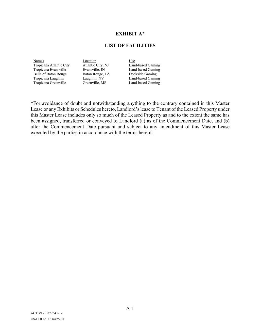
EXHIBIT A* LIST OF FACILITIES Names Location Use Tropicana Atlantic City Atlantic City, NJ Land-based Gaming Tropicana Evansville Evansville, IN Land-based Gaming Belle of Baton Rouge Baton Rouge, LA Dockside Gaming Tropicana Xxxxxxxx Laughlin, NV Land-based Gaming Tropicana Greenville Greenville, MS Land-based Gaming *For avoidance of doubt and notwithstanding anything to the contrary contained in this Master Lease or any Exhibits or Schedules hereto, Landlord’s lease to Tenant of the Leased Property under this Master Lease includes only so much of the Leased Property as and to the extent the same has been assigned, transferred or conveyed to Landlord (a) as of the Commencement Date, and (b) after the Commencement Date pursuant and subject to any amendment of this Master Lease executed by the parties in accordance with the terms hereof. A-1 ACTIVE/103726432.5 US-DOCS\116344257.8
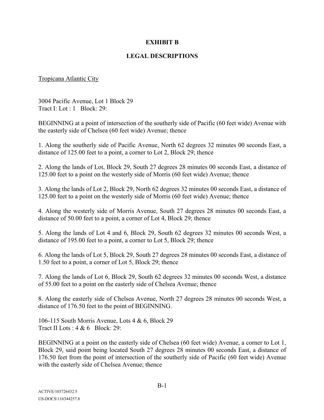
EXHIBIT B LEGAL DESCRIPTIONS Tropicana Atlantic City 0000 Xxxxxxx Xxxxxx, Lot 1 Block 29 Tract I: Lot : 1 Block: 29: BEGINNING at a point of intersection of the southerly side of Pacific (60 feet wide) Avenue with the easterly side of Chelsea (60 feet wide) Avenue; thence 1. Along the southerly side of Pacific Avenue, North 62 degrees 32 minutes 00 seconds East, a distance of 125.00 feet to a point, a corner to Lot 2, Block 29; thence 2. Along the lands of Lot, Block 29, South 27 degrees 28 minutes 00 seconds East, a distance of 125.00 feet to a point on the westerly side of Xxxxxx (60 feet wide) Avenue; thence 3. Along the lands of Lot 2, Block 29, North 62 degrees 32 minutes 00 seconds East, a distance of 125.00 feet to a point on the westerly side of Xxxxxx (60 feet wide) Avenue; thence 4. Along the westerly side of Xxxxxx Avenue, South 27 degrees 28 minutes 00 seconds East, a distance of 50.00 feet to a point, a corner of Lot 4, Block 29; thence 5. Along the lands of Lot 4 and 6, Block 29, South 62 degrees 32 minutes 00 seconds West, a distance of 195.00 feet to a point, a corner to Lot 5, Block 29; thence 6. Along the lands of Lot 5, Block 29, South 27 degrees 28 minutes 00 seconds East, a distance of 1.50 feet to a point, a corner of Lot 5, Block 29; thence 7. Along the lands of Lot 6, Block 29, South 62 degrees 32 minutes 00 seconds West, a distance of 55.00 feet to a point on the easterly side of Chelsea Avenue; thence 8. Along the easterly side of Chelsea Avenue, North 27 degrees 28 minutes 00 seconds West, a distance of 176.50 feet to the point of BEGINNING. 000-000 Xxxxx Xxxxxx Xxxxxx, Lots 4 & 6, Block 29 Tract II Lots : 4 & 6 Block: 29: BEGINNING at a point on the easterly side of Chelsea (60 feet wide) Avenue, a corner to Lot 1, Block 29, said point being located South 27 degrees 28 minutes 00 seconds East, a distance of 176.50 feet from the point of intersection of the southerly side of Pacific (60 feet wide) Avenue with the easterly side of Chelsea Avenue; thence B-1 ACTIVE/103726432.5 US-DOCS\116344257.8
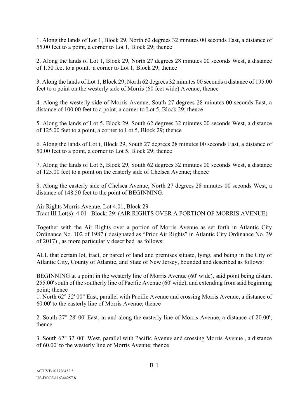
1. Along the lands of Lot 1, Block 29, North 62 degrees 32 minutes 00 seconds East, a distance of 55.00 feet to a point, a corner to Lot 1, Block 29; thence 2. Along the lands of Lot 1, Block 29, North 27 degrees 28 minutes 00 seconds West, a distance of 1.50 feet to a point, a corner to Lot 1, Block 29; thence 3. Along the lands of Lot 1, Block 29, North 62 degrees 32 minutes 00 seconds a distance of 195.00 feet to a point on the westerly side of Xxxxxx (60 feet wide) Avenue; thence 4. Along the westerly side of Xxxxxx Avenue, South 27 degrees 28 minutes 00 seconds East, a distance of 100.00 feet to a point, a corner to Lot 5, Block 29; thence 5. Along the lands of Lot 5, Block 29, South 62 degrees 32 minutes 00 seconds West, a distance of 125.00 feet to a point, a corner to Lot 5, Block 29; thence 6. Along the lands of Lot t, Block 29, South 27 degrees 28 minutes 00 seconds East, a distance of 50.00 feet to a point, a corner to Lot 5, Block 29; thence 7. Along the lands of Lot 5, Block 29, South 62 degrees 32 minutes 00 seconds West, a distance of 125.00 feet to a point on the easterly side of Chelsea Avenue; thence 8. Along the easterly side of Chelsea Avenue, North 27 degrees 28 minutes 00 seconds West, a distance of 148.50 feet to the point of BEGINNING. Air Rights Xxxxxx Avenue, Lot 4.01, Block 29 Tract III Lot(s): 4.01 Block: 29: (AIR RIGHTS OVER A PORTION OF XXXXXX AVENUE) Together with the Air Rights over a portion of Xxxxxx Avenue as set forth in Atlantic City Ordinance No. 102 of 1987 ( designated as “Prior Air Rights” in Atlantic City Ordinance No. 39 of 2017) , as more particularly described as follows: ALL that certain lot, tract, or parcel of land and premises situate, lying, and being in the City of Atlantic City, County of Atlantic, and State of New Jersey, bounded and described as follows: BEGINNING at a point in the westerly line of Xxxxxx Avenue (60' wide), said point being distant 255.00' south of the southerly line of Pacific Avenue (60' wide), and extending from said beginning point; thence 1. North 62° 32' 00" East, parallel with Pacific Avenue and crossing Xxxxxx Avenue, a distance of 60.00' to the easterly line of Xxxxxx Avenue; thence 2. South 27° 28' 00' East, in and along the easterly line of Xxxxxx Avenue, a distance of 20.00'; thence 3. South 62° 32' 00" West, parallel with Pacific Avenue and crossing Xxxxxx Avenue , a distance of 60.00' to the westerly line of Xxxxxx Avenue; thence B-1 ACTIVE/103726432.5 US-DOCS\116344257.8
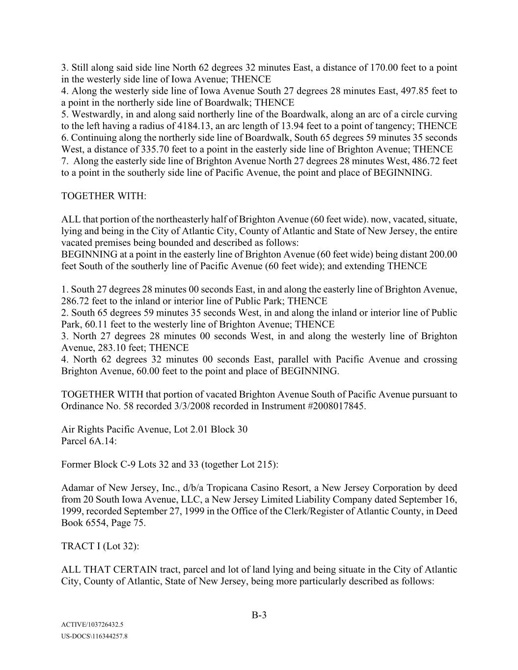
3. Still along said side line North 62 degrees 32 minutes East, a distance of 170.00 feet to a point in the westerly side line of Iowa Avenue; THENCE 4. Along the westerly side line of Iowa Avenue South 27 degrees 28 minutes East, 497.85 feet to a point in the northerly side line of Boardwalk; THENCE 5. Westwardly, in and along said northerly line of the Boardwalk, along an arc of a circle curving to the left having a radius of 4184.13, an arc length of 13.94 feet to a point of tangency; THENCE 6. Continuing along the northerly side line of Boardwalk, South 65 degrees 59 minutes 35 seconds West, a distance of 335.70 feet to a point in the easterly side line of Brighton Avenue; THENCE 7. Along the easterly side line of Brighton Avenue North 27 degrees 28 minutes West, 486.72 feet to a point in the southerly side line of Pacific Avenue, the point and place of BEGINNING. TOGETHER WITH: ALL that portion of the northeasterly half of Brighton Avenue (60 feet wide). now, vacated, situate, lying and being in the City of Atlantic City, County of Atlantic and State of New Jersey, the entire vacated premises being bounded and described as follows: BEGINNING at a point in the easterly line of Brighton Avenue (60 feet wide) being distant 200.00 feet South of the southerly line of Pacific Avenue (60 feet wide); and extending THENCE 1. South 27 degrees 28 minutes 00 seconds East, in and along the easterly line of Brighton Avenue, 286.72 feet to the inland or interior line of Public Park; THENCE 2. South 65 degrees 59 minutes 35 seconds West, in and along the inland or interior line of Public Park, 60.11 feet to the westerly line of Brighton Avenue; THENCE 3. North 27 degrees 28 minutes 00 seconds West, in and along the westerly line of Brighton Avenue, 283.10 feet; THENCE 4. North 62 degrees 32 minutes 00 seconds East, parallel with Pacific Avenue and crossing Brighton Avenue, 60.00 feet to the point and place of BEGINNING. TOGETHER WITH that portion of vacated Brighton Avenue South of Pacific Avenue pursuant to Ordinance No. 58 recorded 3/3/2008 recorded in Instrument #2008017845. Air Rights Pacific Avenue, Lot 2.01 Block 30 Parcel 6A.14: Former Block C-9 Lots 32 and 33 (together Lot 215): Adamar of New Jersey, Inc., d/b/a Tropicana Casino Resort, a New Jersey Corporation by deed from 00 Xxxxx Xxxx Xxxxxx, LLC, a New Jersey Limited Liability Company dated September 16, 1999, recorded September 27, 1999 in the Office of the Clerk/Register of Atlantic County, in Deed Book 6554, Page 75. TRACT I (Lot 32): ALL THAT CERTAIN tract, parcel and lot of land lying and being situate in the City of Atlantic City, County of Atlantic, State of New Jersey, being more particularly described as follows: B-3 ACTIVE/103726432.5 US-DOCS\116344257.8
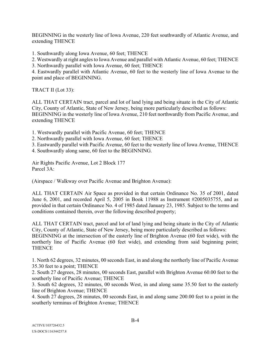
BEGINNING in the westerly line of Iowa Avenue, 220 feet southwardly of Atlantic Avenue, and extending THENCE 1. Southwardly along Iowa Avenue, 60 feet; THENCE 2. Westwardly at right angles to Iowa Avenue and parallel with Atlantic Avenue, 60 feet; THENCE 3. Northwardly parallel with Iowa Avenue, 60 feet; THENCE 4. Eastwardly parallel with Atlantic Avenue, 60 feet to the westerly line of Iowa Avenue to the point and place of BEGINNING. TRACT II (Lot 33): ALL THAT CERTAIN tract, parcel and lot of land lying and being situate in the City of Atlantic City, County of Atlantic, State of New Jersey, being more particularly described as follows: BEGINNING in the westerly line of Iowa Avenue, 210 feet northwardly from Pacific Avenue, and extending THENCE 1. Westwardly parallel with Pacific Avenue, 60 feet; THENCE 2. Northwardly parallel with Iowa Avenue, 60 feet; THENCE 3. Eastwardly parallel with Pacific Avenue, 60 feet to the westerly line of Iowa Avenue, THENCE 4. Southwardly along same, 60 feet to the BEGINNING. Air Rights Pacific Avenue, Lot 2 Block 177 Parcel 3A: (Airspace / Walkway over Pacific Avenue and Brighton Avenue): ALL THAT CERTAIN Air Space as provided in that certain Ordinance No. 35 of 2001, dated June 6, 2001, and recorded April 5, 2005 in Book 11988 as Instrument #2005035755, and as provided in that certain Ordinance No. 4 of 1985 dated January 23, 1985. Subject to the terms and conditions contained therein, over the following described property; ALL THAT CERTAIN tract, parcel and lot of land lying and being situate in the City of Atlantic City, County of Atlantic, State of New Jersey, being more particularly described as follows: BEGINNING at the intersection of the easterly line of Brighton Avenue (60 feet wide), with the northerly line of Pacific Avenue (60 feet wide), and extending from said beginning point; THENCE 1. North 62 degrees, 32 minutes, 00 seconds East, in and along the northerly line of Pacific Avenue 35.30 feet to a point; THENCE 2. South 27 degrees, 28 minutes, 00 seconds East, parallel with Brighton Avenue 60.00 feet to the southerly line of Pacific Avenue; THENCE 3. South 62 degrees, 32 minutes, 00 seconds West, in and along same 35.50 feet to the easterly line of Brighton Avenue; THENCE 4. South 27 degrees, 28 minutes, 00 seconds East, in and along same 200.00 feet to a point in the southerly terminus of Brighton Avenue; THENCE B-4 ACTIVE/103726432.5 US-DOCS\116344257.8
5. South 62 degrees, 32 minutes, 00 seconds West, in and along same parallel with Pacific Avenue 60.00 feet to the westerly line of Brighton Avenue; THENCE 6. North 27 degrees, 28 minutes, 00 seconds West, in and along same 200.00 feet to the southerly line of Pacific Avenue; THENCE 7. South 62 degrees, 32 minutes, 00 seconds West, in and along same 28.40 feet to a point; THENCE 8. North 27 degrees, 28 minutes, 00 seconds West, parallel with Brighton Avenue 60.00 feet to the northerly line of Pacific Avenue; THENCE 9. North 62 degrees, 32 minutes, 00 seconds East in and along same 28.40 feet to the westerly line of Brighton Avenue; THENCE 10. North 27 degrees, 28 seconds, 00 seconds West, in and along same 250.00 feet to a point; THENCE 11. North 62 degrees, 32 minutes, 00 seconds East, parallel with Pacific Avenue 60.00 feet to the easterly line of Brighton Avenue; THENCE 12. South 27 degrees 28 minutes, 00 seconds East in and along same 250.00 feet to the point and place of BEGINNING. Air Rights Brighton Avenue, Lot 15, Block 175 Parcel 3B: (Airspace / Walkway over Brighton Avenue): ALL THAT CERTAIN Air Space as provided in that certain Ordinance No. 35 of 2001, dated June 6, 2001 recorded April 5, 2005 in Book 11988 as Instrument #2005035755, Subject to the terms and conditions contained therein, over the following described property: ALL THAT CERTAIN tract, parcel and lot of land lying and being situate in the City of Atlantic City, County of Atlantic, State of New Jersey, being more particularly described as follows: BEGINNING at a point in the easterly line of Brighton Avenue (60 feet wide), South 27 degrees, 28 minutes, 00 seconds East 231.00 feet from the southerly line of Atlantic Avenue (100 feet wide), and extending from said beginning point; THENCE 1. South 27 degrees, 28 minutes, 00 seconds East, in and along the easterly line of Brighton Avenue 17.00 feet to a point; THENCE 2. South 62 degrees, 32 minutes, 00 seconds West, parallel with Atlantic Avenue 60.00 feet to the westerly line of Brighton Avenue; THENCE 3. North 27 degrees, 28 minutes, 00 seconds West, in and along same 17.00 feet to a point; THENCE 4. North 62 degrees, 32 minutes, 00 seconds East, parallel with Atlantic Avenue 60.00 feet to the point and place of BEGINNING. A portion of 0000 Xxxxxxx Xxxxxx, Lot 1 (portion of) Block 177 Former Lot 8, Block C-8 ALL THAT CERTAIN lot, tract or parcel of land and premises situate, lying and being in the City of Atlantic City, County of Atlantic, State of New Jersey, bounded and described as follows: B-5 ACTIVE/103726432.5 US-DOCS\116344257.8
BEGINNING at a point in the easterly line of Xxxxxx Avenue 275 feet northwardly of Pacific Avenue; and extending THENCE 1. Eastwardly, parallel with Pacific Avenue, 125; THENCE 2. Northwardly, parallel with Xxxxxx Avenue, 50 feet; THENCE 3. Westwardly, parallel with Pacific Avenue, 125 feet to the easterly line of Xxxxxx Avenue; THENCE 4. Southwardly, along same, 50 feet to the place of BEGINNING. Former Lot 9, Block C-8 ALLTHAT CERTAIN lot, tract or parcel of land and premises situate, lying and being in the City of Atlantic City, County of Atlantic, State of New Jersey, bounded and described as follows: BEGINNING at a point in the easterly line of Xxxxxx Avenue 225 feet northwardly from Pacific Avenue; and extending THENCE 1. Eastwardly, parallel with Pacific Avenue, 125 feet; THENCE 2. Northwardly, parallel with Xxxxxx Avenue, 50 feet; THENCE 3. Westwardly, parallel with Pacific Avenue, 125 feet to the easterly line of Xxxxxx Avenue; THENCE 4. Southwardly, along the same, 50 feet to the point and place of BEGINNING. Former Lot 11, Block C-8 ALL THAT CERTAIN lot, tract or parcel of land and premises situate, lying and being in the City of Atlantic City, County of Atlantic, State of New Jersey, bounded and described as follows: BEGINNING in the easterly line of Xxxxxx Avenue 125 feet northwardly from the corner formed by the intersection of the northerly line of Pacific Avenue and the easterly line of Xxxxxx Avenue; and extending THENCE 1. Eastwardly, parallel with Pacific Avenue, 125 feet; THENCE 2. Northwardly, parallel with Xxxxxx Avenue, 50 feet; THENCE 3. Westwardly, parallel with Pacific Avenue, 125 feet to the easterly line of Xxxxxx Avenue; THENCE 4. Southwardly, along the same 50 feet to the place of BEGINNING. Former Lot 13, Block C-8 ALL THAT CERTAIN lot, tract or parcel of land and premises situate, lying and being in the City of Atlantic City, County of Atlantic, State of New Jersey, bounded and described as follows: BEGINNING at a point in the westerly line of Brighton Avenue, 275 feet northwardly of Pacific Avenue; and extending THENCE 1. Westwardly, parallel with Pacific Avenue, 125 feet; THENCE 2. Northwardly, parallel with Brighton Avenue, 50 feet; THENCE B-6 ACTIVE/103726432.5 US-DOCS\116344257.8
3. Eastwardly, parallel with Pacific Avenue, 125 feet to the westerly line of Brighton Avenue; THENCE 4. Southwardly, along the same, 50 feet to the place of BEGINNING. Former Lot 10, Block C-8 ALL THAT CERTAIN lot, tract or parcel of land and premises situate, lying and being in the City of Atlantic City, County of Atlantic, State of New Jersey, bounded and described as follows: BEGINNING in the easterly line of Xxxxxx Avenue 175 feet northwardly of Pacific Avenue; and extending THENCE 1. Eastwardly, parallel with Pacific Avenue 125; THENCE 2. Northwardly, parallel with Xxxxxx Avenue 50 feet; THENCE 3. Westwardly, parallel with Pacific Avenue 125 feet to the easterly line of Xxxxxx Avenue; THENCE 4. Southwardly, along the easterly line of Xxxxxx Avenue 50 feet to the place of BEGINNING. Former Lot 23, Block C-8 ALL THAT CERTAIN lot, tract or parcel of land and premises situate, lying and being in the City of Atlantic City, County of Atlantic, State of New Jersey, bounded and described as follows: TRACT I: BEGINNING in the westerly line of Brighton Avenue corner to 12 feet wide alley 125 feet South of the South line of Atlantic Avenue and runs THENCE 1. Westwardly in the southerly line of said 12 feet wide alley, parallel with Atlantic Avenue, 125 feet; THENCE 2. Southwardly parallel with Brighton Avenue and 100 feet; THENCE 3. Eastwardly, and parallel with Atlantic Avenue, 125 feet to the westerly line of Brighton Avenue; THENCE 4. Northwardly, along the westerly line of Brighton Avenue, 100 feet to the place of BEGINNING. TRACT II: BEGINNING at a point in the easterly line of Xxxxxx Avenue 125 feet southwardly from Atlantic Avenue; and extending THENCE 1. Eastwardly along the southerly line of a 12 feet wide alley and parallel with Atlantic Avenue 125 feet; THENCE 2. Southwardly parallel with Xxxxxx Avenue 50 feet; THENCE 3. Westwardly parallel with Atlantic Avenue 125 feet to the easterly line of Xxxxxx Avenue; THENCE 4. Northwardly along same 50 feet to the place of BEGINNING. B-7 ACTIVE/103726432.5 US-DOCS\116344257.8
Former Lot 7, Block C-8 ALL THAT CERTAIN lot, tract or parcel of land and premises situate, lying and being in the City of Atlantic City, County of Atlantic, State of New Jersey, bounded and described as follows: BEGINNING in the easterly line of Xxxxxx Avenue 175 feet southwardly from Atlantic Avenue; and extending THENCE 1. Eastwardly, parallel with Atlantic Avenue 125 feet; THENCE 2. Southwardly, parallel with Xxxxxx Avenue 50 feet; THENCE 3. Westwardly, parallel with Atlantic Avenue, 125 feet to the easterly line of Xxxxxx Avenue; THENCE 4. Northwardly, along same, 50 feet to the BEGINNING. Former Lot 17, Block C-8 ALL THAT CERTAIN lot, tract or parcel of land and premises situate, lying and being in the City of Atlantic City, County of Atlantic, State of New Jersey, bounded and described as follows: BEGINNING at the northeasterly corner of Xxxxxx and Pacific Avenue; and extending THENCE 1. Eastwardly, along the northerly line of Pacific Avenue, 65 feet; THENCE 2. Northwardly, parallel with Xxxxxx Avenue, 125 feet; THENCE 3. Westwardly, parallel with Pacific Avenue, 65 feet to the easterly line of Xxxxxx Avenue; THENCE 4. Southwardly, along the easterly line of Xxxxxx Avenue, 125 feet to the place of BEGINNING. Former Lot 16, Block C8 ALL THAT CERTAIN lot, tract or parcel of land and premises situate, lying and being in the City of Atlantic City, County of Atlantic, State of New Jersey, bounded and described as follows: BEGINNING in the westerly line of Brighton Avenue, 325 feet southwardly of the southerly line of Atlantic Avenue; and extending THENCE 1. Westwardly, parallel with Atlantic Avenue, 125 feet; THENCE 2. Southwardly, parallel with Brighton Avenue, 50 feet; THENCE 3. Eastwardly, and parallel with Atlantic Avenue, 125 feet to the westerly line of Brighton Avenue; THENCE 4. Northwardly, along same, 50 feet to BEGINNING. Former Lot 15, Block C-8 ALL THAT CERTAIN lot, tract or parcel of land and premises situate, lying and being in the City of Atlantic city, County of Atlantic, State of New Jersey, bounded and described as follows: B-8 ACTIVE/103726432.5 US-DOCS\116344257.8
BEGINNING at a point in the westerly line of Brighton Avenue, 125 feet northwardly from Pacific Avenue; and extending THENCE 1. Westwardly, parallel with Pacific Avenue, 125 feet; THENCE 2. Northwardly, parallel with Brighton Avenue, 50 feet; THENCE 3. Eastwardly, parallel with Pacific Avenue, 125 feet to the westerly line of Brighton Avenue; THENCE 4. Southwardly, along the same, 50 feet to the point and place of BEGINNING. Together with the nonexclusive beneficial easement rights as set forth in Easement Agreement between B and B Limited Partnership and Barbun Corporation, dated September 18, 1985 and recorded September 20, 1985 and recorded September 20, 1985 in Deed Book 4126, page 150 in and to the following described land: ALL THAT CERTAIN tract, parcel and lot of land lying and being situate in the City of Atlantic City, County of Atlantic, State of New Jersey, being more particularly described as follows: BEGINNING at a point in the easterly line of Xxxxxx Avenue (60.00 feet wide) said point being distant 150.85 feet North of the northerly line of Pacific Avenue (60.00 feet wide); and extending THENCE 1. North 62 degrees 32 minutes 00 seconds East, in and along the existing parking garage structure and parallel with Pacific Avenue, a distance of 118.50 feet; THENCE 2. North 27 degrees 28 minutes 00 seconds West, in and along the existing parking garage structure, and parallel with Xxxxxx Avenue, a distance of 131.70 feet; THENCE 3. North 62 degrees 32 minutes 00 seconds East, in and along the existing parking garage structure, and parallel with Pacific Avenue, a distance of 28.00 feet; THENCE 4. North 27 degrees 28 minutes 00 seconds West, in and along the existing parking garage structure, and parallel with Xxxxxx Avenue, a distance of 19.75 feet; THENCE 5. North 62 degrees 32 minutes 00 seconds East, in and along the existing parking garage structure, and parallel with Pacific Avenue, a distance of 103.50 feet to the westerly line of Brighton Avenue; THENCE 6. North 27 degrees 28 minutes 00 seconds West, in and along the westerly line of Brighton Avenue, a distance of 122.70 feet to the southerly line of a 12.00 foot wide alley; THENCE 7. South 62 degrees 32 minutes 00 seconds West, in and along the southerly line of said 12.00 foot wide alley, a distance of 250.00 feet to the easterly line of Xxxxxx Avenue; THENCE 8. South 27 degrees 28 minutes 00 seconds East, in and along the easterly line of Xxxxxx Avenue, a distance of 274.15 feet to the point and place of BEGINNING. EASEMENT interest as more particularly set forth in agreement of easements, covenants and restrictions for Transportation Center and hotel by and between B and B Limited Partnership and Adamar of New Jersey, Inc., dated September 18, 1985 and recorded September 20, 1985 in Deed Book 4126, Page 67, in and to the following described land: ALL THAT CERTAIN lot, tract or parcel of real property and premises situate, lying between 119 feet 6 inches above mean sea level datum and 400 feet, above mean sea Level Datum, and being B-9 ACTIVE/103726432.5 US-DOCS\116344257.8
in the City of Atlantic City, County of Atlantic, State of New Jersey, being more particularly described as follows: BEGINNING at the northwesterly corner of Pacific Avenue (60 feet wide) and Brighton Avenue (60.00 feet wide); and extending THENCE 1. South 62 degrees 32 minutes 00 seconds west, in and along the northerly line of Pacific Avenue, a distance of 250.00 feet to the easterly line of Xxxxxx Avenue; THENCE 2. North 27 degrees 28 minutes 00 seconds West, in and along the easterly line of Xxxxxx Avenue, a distance of 150.85 feet to the existing parking garage structure; THENCE 3. North 62 degrees 32 minutes 00 seconds East, in and along the existing parking garage structure, a distance of 118.50 feet; THENCE 4. North 27 degrees 28 minutes 00 seconds West, in and along the existing Parking Garage Structure, a distance of 131.70 feet; THENCE 5. North 62 degrees 32 minutes 00 seconds East, and along the existing parking structure, a distance of 28.00 feet; THENCE 6. North 27 degrees 28 minutes 00 seconds West, in and along the existing parking garage structure, a distance of 19.75 feet; THENCE 7. North 62 degrees 32 minutes 00 seconds East, in and along the existing parking garage structure, a distance of 103.50 feet to the westerly line of Brighton Avenue; THENCE 8. South 27 degrees 28 minutes 00 seconds East, in and along the westerly line of Brighton Avenue, a distance of 302.30 feet to the point and place of BEGINNING. A portion of 0000 Xxxxxxx Xxxxxx, Lot 3 (portion of) Block 175 Former Block C-9 Lot 7 ALL THAT CERTAIN tract, parcel and lot of land lying and being situate in the City of Atlantic City, County of Atlantic, State of New Jersey, being more particularly described as follows: BEGINNING at a point in the easterly line of Brighton Avenue, 175 feet northwardly of Pacific Avenue; and extending THENCE 1. Eastwardly parallel with Pacific Avenue, 125 feet; THENCE 2. Northwardly parallel with Brighton Avenue, 50 feet; THENCE 3. Westwardly parallel with Pacific Avenue, 125 feet to the easterly line of Brighton Avenue; THENCE 4. Southwardly along the easterly line of Brighton Avenue, 50 feet to the place of BEGINNING. BEING further described as follows: ALL THAT CERTAIN tract, parcel and lot of land lying and being situate in the City of Atlantic City, County of Atlantic, State of New Jersey, being more particularly described as follows: BEGINNING at a point in the East line of Brighton Avenue (60 feet wide), said point being 175.00 feet North of the North line of Pacific Avenue (60 feet wide) and extending; THENCE B-10 ACTIVE/103726432.5 US-DOCS\116344257.8
1. North 27 degrees 28 minutes 00 seconds West, in and along the East line of Brighton Avenue, a distance of 50.00 feet to a point; THENCE 2. North 62 degrees 32 minutes 00 seconds East, parallel with Pacific Avenue, a distance of 125.00 feet to a point; THENCE 3. South 27 degrees 28 minutes 00 seconds East, parallel with Brighton Avenue, a distance of 50.00 feet to a point; THENCE 4. South 62 degrees 32 minutes 00 seconds West, parallel with Pacific Avenue, a distance of 125.00 feet to the point and place of BEGINNING. Parcel 6C.1 Former Lot 13, Block C - 9: BEGINNING at a point in the westerly line of Stenton Place distant 100 feet southwardly of the southerly line of Atlantic Avenue; THENCE 1. Westwardly parallel with Atlantic Avenue, 54 feet; THENCE 2. Southwardly parallel with Stenton Place, 60 feet; THENCE 3. Eastwardly parallel with Atlantic Avenue, 54 to the westerly line of Stenton Place; THENCE 4. Northwardly along said line of Stenton Place 60 feet to the place of BEGINNING. Parcel 6C.2 Former Lot 14, Block C - 9: BEGINNING at a point in the westerly line of Stenton Place, distant one hundred and sixty feet southwardly from the southerly line of Atlantic Avenue, and runs THENCE 1. Southwardly, along and in the said westerly line of Stenton Place, sixty feet; THENCE 2. Westwardly, parallel with Atlantic Avenue, fifty-four feet; THENCE 3. Northwardly, parallel with Stenton Place, sixty feet; THENCE 4. Eastwardly, parallel with Atlantic Avenue fifty-four feet to the place of BEGINNING. Parcel 6C.3 Former Lot 17, Block C - 9: BEGINNING at a point in the westerly line of Stenton Place (50 feet wide), distant 150 feet North of the northerly line of Pacific Avenue (60 feet wide), when measured in and along the aforesaid westerly line of Stenton Place, and extending from said beginning point; THENCE 1. South 62 degrees 32 minutes 00 seconds West, parallel with Pacific Avenue, a distance of 54 feet to a point; THENCE 2. North 27 degrees 28 minutes 00 seconds West, parallel with Stenton Place, a distance of 60 feet to a point; THENCE B-11 ACTIVE/103726432.5 US-DOCS\116344257.8
3. North 62 degrees 32 minutes 00 seconds East, parallel with Pacific Avenue, a distance of 54 feet to a point in the aforesaid westerly line of Stenton Place; THENCE 4. South 27 degrees 28 minutes 00 seconds East, in and along the westerly line of Stenton Place, a distance of 60 feet to the point and place of BEGINNING. Parcel 6C.4 Former Lot 18, Block C - 9: BEGINNING at a point in the westerly line of Stenton Place 400 feet southwardly of the southerly line of Atlantic Avenue; THENCE 1. Southwardly along said westerly line of Stenton Place 60 feet; THENCE 2. Westwardly parallel with Atlantic Avenue, 54 feet; THENCE 3. Northwardly parallel with Stenton Place, 60 feet; THENCE 4. Eastwardly parallel with Atlantic Avenue, 54 feet to point and place of BEGINNING. Parcel 6C.5 Former Lot 26, Block C - 9: BEGINNING at a point in the easterly line of Stenton Place, distance 280 feet South from the southerly line of Atlantic Avenue; 1. Eastwardly parallel with Atlantic Avenue, 60 feet; THENCE 2. Southwardly parallel with Stenton Place, 60 feet; THENCE 3. Westwardly parallel with Atlantic Avenue, 60 feet to the easterly line of Stenton Place; THENCE 4. Northwardly along said easterly line of Stenton Place, 60 feet to the place of BEGINNING. FORMER bed of the vacated portion of Stenton Place being the southerly 450 feet of Stenton Place vacated by Ordinance No. 14 recorded 08/26/1998 in Vacation Book 19 Page 179: BEGINNING at the intersection of the northerly line of Pacific Avenue (60 feet wide), with the easterly line of Stenton Place (50 feet wide), and extending from said beginning point; THENCE 1. South 62 degrees, 32 minutes 00 seconds West in and along the northerly line of Pacific Avenue, 50.00 feet to the westerly line of Stenton Place; THENCE 2. North 27 degrees 28 minutes 00 seconds West in and along the westerly line of Stenton Place, 450.00 feet to a point being the Southeast corner of Lot 41 in Block C-9, said point being 100.00 feet South of the South line of Atlantic Avenue (100 feet wide); THENCE 3. North 62 degrees 32 minutes 00 seconds East, crossing Stenton Place, 50.00 feet to the easterly line of Stenton Place, said point being the southwesterly corner of Lot 21 in Block C-9; THENCE 4. South 27 degrees 28 minutes 00 seconds East in and along the easterly line of Stenton Place, 450.00 feet to the point and place of BEGINNING. B-12 ACTIVE/103726432.5 US-DOCS\116344257.8
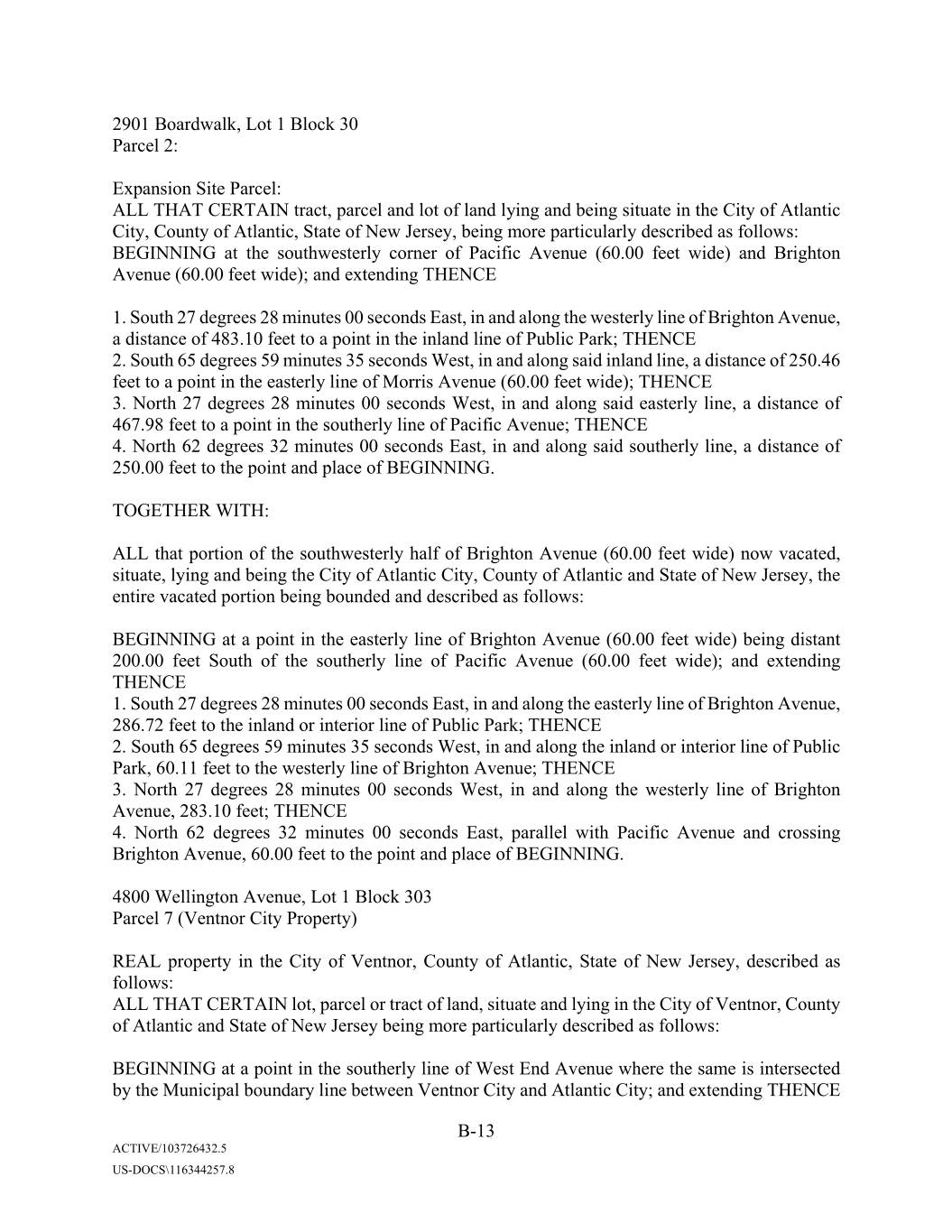
0000 Xxxxxxxxx, Lot 1 Block 30 Parcel 2: Expansion Site Parcel: ALL THAT CERTAIN tract, parcel and lot of land lying and being situate in the City of Atlantic City, County of Atlantic, State of New Jersey, being more particularly described as follows: BEGINNING at the southwesterly corner of Pacific Avenue (60.00 feet wide) and Brighton Avenue (60.00 feet wide); and extending THENCE 1. South 27 degrees 28 minutes 00 seconds East, in and along the westerly line of Brighton Avenue, a distance of 483.10 feet to a point in the inland line of Public Park; THENCE 2. South 65 degrees 59 minutes 35 seconds West, in and along said inland line, a distance of 250.46 feet to a point in the easterly line of Xxxxxx Avenue (60.00 feet wide); THENCE 3. North 27 degrees 28 minutes 00 seconds West, in and along said easterly line, a distance of 467.98 feet to a point in the southerly line of Pacific Avenue; THENCE 4. North 62 degrees 32 minutes 00 seconds East, in and along said southerly line, a distance of 250.00 feet to the point and place of BEGINNING. TOGETHER WITH: ALL that portion of the southwesterly half of Brighton Avenue (60.00 feet wide) now vacated, situate, lying and being the City of Atlantic City, County of Atlantic and State of New Jersey, the entire vacated portion being bounded and described as follows: BEGINNING at a point in the easterly line of Brighton Avenue (60.00 feet wide) being distant 200.00 feet South of the southerly line of Pacific Avenue (60.00 feet wide); and extending THENCE 1. South 27 degrees 28 minutes 00 seconds East, in and along the easterly line of Brighton Avenue, 286.72 feet to the inland or interior line of Public Park; THENCE 2. South 65 degrees 59 minutes 35 seconds West, in and along the inland or interior line of Public Park, 60.11 feet to the westerly line of Brighton Avenue; THENCE 3. North 27 degrees 28 minutes 00 seconds West, in and along the westerly line of Brighton Avenue, 283.10 feet; THENCE 4. North 62 degrees 32 minutes 00 seconds East, parallel with Pacific Avenue and crossing Brighton Avenue, 60.00 feet to the point and place of BEGINNING. 0000 Xxxxxxxxxx Xxxxxx, Lot 1 Block 303 Parcel 7 (Ventnor City Property) REAL property in the City of Ventnor, County of Atlantic, State of New Jersey, described as follows: ALL THAT CERTAIN lot, parcel or tract of land, situate and lying in the City of Ventnor, County of Atlantic and State of New Jersey being more particularly described as follows: BEGINNING at a point in the southerly line of West End Avenue where the same is intersected by the Municipal boundary line between Ventnor City and Atlantic City; and extending THENCE B-13 ACTIVE/103726432.5 US-DOCS\116344257.8
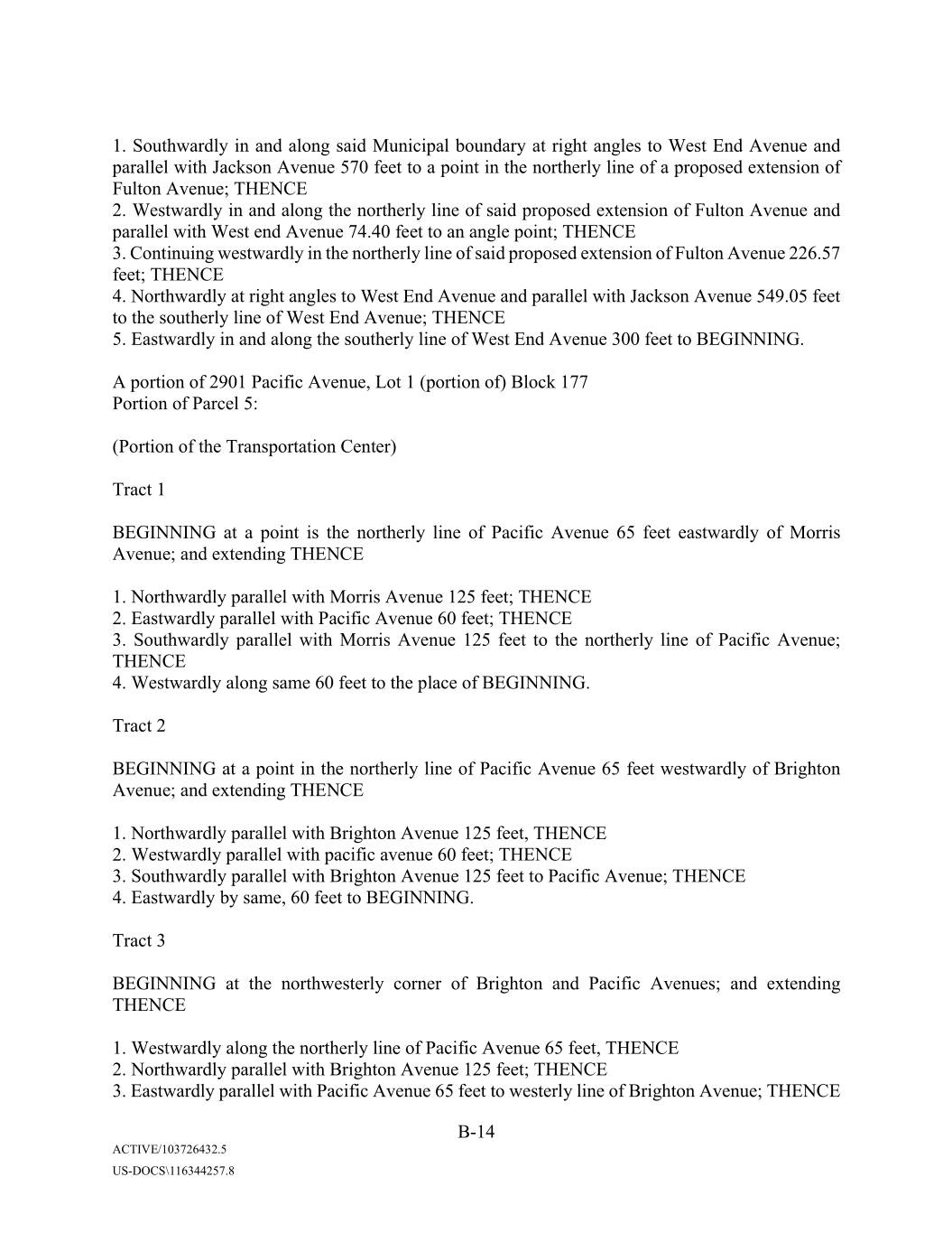
1. Southwardly in and along said Municipal boundary at right angles to West End Avenue and parallel with Xxxxxxx Avenue 570 feet to a point in the northerly line of a proposed extension of Xxxxxx Avenue; THENCE 2. Westwardly in and along the northerly line of said proposed extension of Xxxxxx Avenue and parallel with West end Avenue 74.40 feet to an angle point; THENCE 3. Continuing westwardly in the northerly line of said proposed extension of Xxxxxx Avenue 226.57 feet; THENCE 4. Northwardly at right angles to West End Avenue and parallel with Xxxxxxx Avenue 549.05 feet to the southerly line of West End Avenue; THENCE 5. Eastwardly in and along the southerly line of West End Avenue 300 feet to BEGINNING. A portion of 0000 Xxxxxxx Xxxxxx, Lot 1 (portion of) Block 177 Portion of Parcel 5: (Portion of the Transportation Center) Tract 1 BEGINNING at a point is the northerly line of Pacific Avenue 65 feet eastwardly of Xxxxxx Avenue; and extending THENCE 1. Northwardly parallel with Xxxxxx Avenue 125 feet; THENCE 2. Eastwardly parallel with Pacific Avenue 60 feet; THENCE 3. Southwardly parallel with Xxxxxx Avenue 125 feet to the northerly line of Pacific Avenue; THENCE 4. Westwardly along same 60 feet to the place of BEGINNING. Tract 2 BEGINNING at a point in the northerly line of Pacific Avenue 65 feet westwardly of Brighton Avenue; and extending THENCE 1. Northwardly parallel with Brighton Avenue 125 feet, THENCE 2. Westwardly parallel with pacific avenue 60 feet; THENCE 3. Southwardly parallel with Brighton Avenue 125 feet to Pacific Avenue; THENCE 4. Eastwardly by same, 60 feet to BEGINNING. Tract 3 BEGINNING at the northwesterly corner of Brighton and Pacific Avenues; and extending THENCE 1. Westwardly along the northerly line of Pacific Avenue 65 feet, THENCE 2. Northwardly parallel with Brighton Avenue 125 feet; THENCE 3. Eastwardly parallel with Pacific Avenue 65 feet to westerly line of Brighton Avenue; THENCE B-14 ACTIVE/103726432.5 US-DOCS\116344257.8
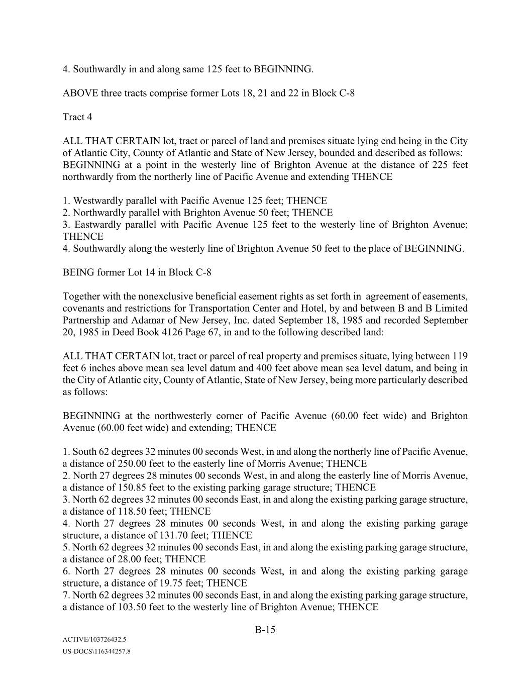
4. Southwardly in and along same 125 feet to BEGINNING. ABOVE three tracts comprise former Lots 18, 21 and 22 in Block C-8 Tract 4 ALL THAT CERTAIN lot, tract or parcel of land and premises situate lying end being in the City of Atlantic City, County of Atlantic and State of New Jersey, bounded and described as follows: BEGINNING at a point in the westerly line of Brighton Avenue at the distance of 225 feet northwardly from the northerly line of Pacific Avenue and extending THENCE 1. Westwardly parallel with Pacific Avenue 125 feet; THENCE 2. Northwardly parallel with Brighton Avenue 50 feet; THENCE 3. Eastwardly parallel with Pacific Avenue 125 feet to the westerly line of Brighton Avenue; THENCE 4. Southwardly along the westerly line of Brighton Avenue 50 feet to the place of BEGINNING. BEING former Lot 14 in Block C-8 Together with the nonexclusive beneficial easement rights as set forth in agreement of easements, covenants and restrictions for Transportation Center and Hotel, by and between B and B Limited Partnership and Adamar of New Jersey, Inc. dated September 18, 1985 and recorded September 20, 1985 in Deed Book 4126 Page 67, in and to the following described land: ALL THAT CERTAIN lot, tract or parcel of real property and premises situate, lying between 119 feet 6 inches above mean sea level datum and 400 feet above mean sea level datum, and being in the City of Atlantic city, County of Atlantic, State of New Jersey, being more particularly described as follows: BEGINNING at the northwesterly corner of Pacific Avenue (60.00 feet wide) and Brighton Avenue (60.00 feet wide) and extending; THENCE 1. South 62 degrees 32 minutes 00 seconds West, in and along the northerly line of Pacific Avenue, a distance of 250.00 feet to the easterly line of Xxxxxx Avenue; THENCE 2. North 27 degrees 28 minutes 00 seconds West, in and along the easterly line of Xxxxxx Avenue, a distance of 150.85 feet to the existing parking garage structure; THENCE 3. North 62 degrees 32 minutes 00 seconds East, in and along the existing parking garage structure, a distance of 118.50 feet; THENCE 4. North 27 degrees 28 minutes 00 seconds West, in and along the existing parking garage structure, a distance of 131.70 feet; THENCE 5. North 62 degrees 32 minutes 00 seconds East, in and along the existing parking garage structure, a distance of 28.00 feet; THENCE 6. North 27 degrees 28 minutes 00 seconds West, in and along the existing parking garage structure, a distance of 19.75 feet; THENCE 7. North 62 degrees 32 minutes 00 seconds East, in and along the existing parking garage structure, a distance of 103.50 feet to the westerly line of Brighton Avenue; THENCE B-15 ACTIVE/103726432.5 US-DOCS\116344257.8
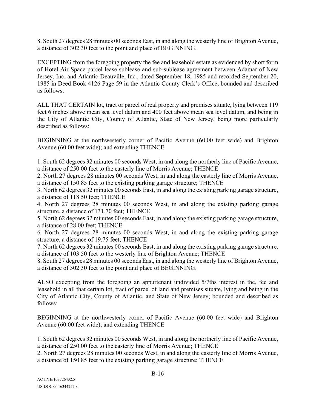
8. South 27 degrees 28 minutes 00 seconds East, in and along the westerly line of Brighton Avenue, a distance of 302.30 feet to the point and place of BEGINNING. EXCEPTING from the foregoing property the fee and leasehold estate as evidenced by short form of Hotel Air Space parcel lease sublease and sub-sublease agreement between Adamar of New Jersey, Inc. and Atlantic-Deauville, Inc., dated September 18, 1985 and recorded September 20, 1985 in Deed Book 4126 Page 59 in the Atlantic County Clerk’s Office, bounded and described as follows: ALL THAT CERTAIN lot, tract or parcel of real property and premises situate, lying between 119 feet 6 inches above mean sea level datum and 400 feet above mean sea level datum, and being in the City of Atlantic City, County of Atlantic, State of New Jersey, being more particularly described as follows: BEGINNING at the northwesterly corner of Pacific Avenue (60.00 feet wide) and Brighton Avenue (60.00 feet wide); and extending THENCE 1. South 62 degrees 32 minutes 00 seconds West, in and along the northerly line of Pacific Avenue, a distance of 250.00 feet to the easterly line of Xxxxxx Avenue; THENCE 2. North 27 degrees 28 minutes 00 seconds West, in and along the easterly line of Xxxxxx Avenue, a distance of 150.85 feet to the existing parking garage structure; THENCE 3. North 62 degrees 32 minutes 00 seconds East, in and along the existing parking garage structure, a distance of 118.50 feet; THENCE 4. North 27 degrees 28 minutes 00 seconds West, in and along the existing parking garage structure, a distance of 131.70 feet; THENCE 5. North 62 degrees 32 minutes 00 seconds East, in and along the existing parking garage structure, a distance of 28.00 feet; THENCE 6. North 27 degrees 28 minutes 00 seconds West, in and along the existing parking garage structure, a distance of 19.75 feet; THENCE 7. North 62 degrees 32 minutes 00 seconds East, in and along the existing parking garage structure, a distance of 103.50 feet to the westerly line of Brighton Avenue; THENCE 8. South 27 degrees 28 minutes 00 seconds East, in and along the westerly line of Brighton Avenue, a distance of 302.30 feet to the point and place of BEGINNING. ALSO excepting from the foregoing an appurtenant undivided 5/7ths interest in the, fee and leasehold in all that certain lot, tract of parcel of land and premises situate, lying and being in the City of Atlantic City, County of Atlantic, and State of New Jersey; bounded and described as follows: BEGINNING at the northwesterly corner of Pacific Avenue (60.00 feet wide) and Brighton Avenue (60.00 feet wide); and extending THENCE 1. South 62 degrees 32 minutes 00 seconds West, in and along the northerly line of Pacific Avenue, a distance of 250.00 feet to the easterly line of Xxxxxx Avenue; THENCE 2. North 27 degrees 28 minutes 00 seconds West, in and along the easterly line of Xxxxxx Avenue, a distance of 150.85 feet to the existing parking garage structure; THENCE B-16 ACTIVE/103726432.5 US-DOCS\116344257.8
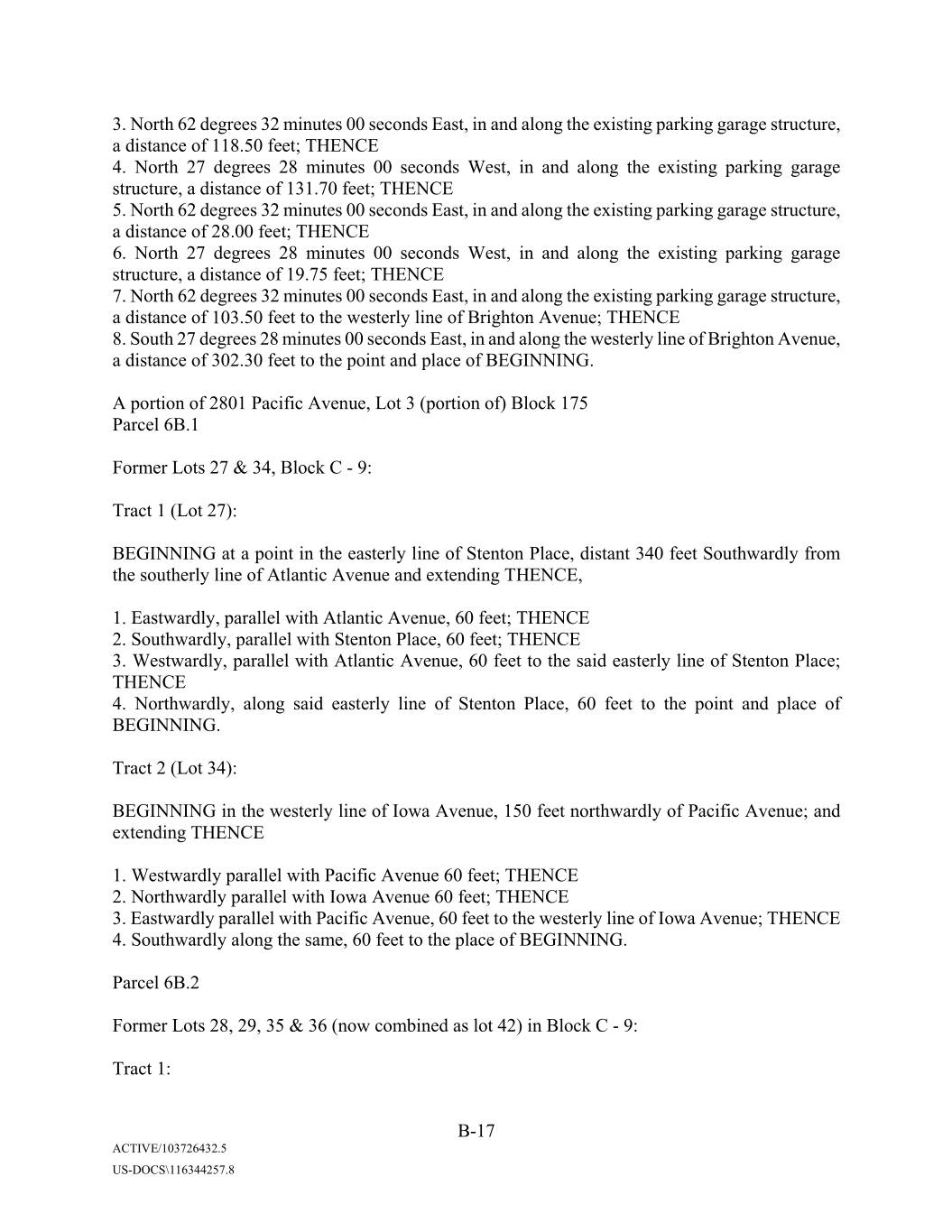
3. North 62 degrees 32 minutes 00 seconds East, in and along the existing parking garage structure, a distance of 118.50 feet; THENCE 4. North 27 degrees 28 minutes 00 seconds West, in and along the existing parking garage structure, a distance of 131.70 feet; THENCE 5. North 62 degrees 32 minutes 00 seconds East, in and along the existing parking garage structure, a distance of 28.00 feet; THENCE 6. North 27 degrees 28 minutes 00 seconds West, in and along the existing parking garage structure, a distance of 19.75 feet; THENCE 7. North 62 degrees 32 minutes 00 seconds East, in and along the existing parking garage structure, a distance of 103.50 feet to the westerly line of Brighton Avenue; THENCE 8. South 27 degrees 28 minutes 00 seconds East, in and along the westerly line of Brighton Avenue, a distance of 302.30 feet to the point and place of BEGINNING. A portion of 0000 Xxxxxxx Xxxxxx, Lot 3 (portion of) Block 175 Parcel 6B.1 Former Lots 27 & 34, Block C - 9: Tract 1 (Lot 27): BEGINNING at a point in the easterly line of Stenton Place, distant 340 feet Southwardly from the southerly line of Atlantic Avenue and extending THENCE, 1. Eastwardly, parallel with Atlantic Avenue, 60 feet; THENCE 2. Southwardly, parallel with Stenton Place, 60 feet; THENCE 3. Westwardly, parallel with Atlantic Avenue, 60 feet to the said easterly line of Stenton Place; THENCE 4. Northwardly, along said easterly line of Stenton Place, 60 feet to the point and place of BEGINNING. Tract 2 (Lot 34): BEGINNING in the westerly line of Iowa Avenue, 150 feet northwardly of Pacific Avenue; and extending THENCE 1. Westwardly parallel with Pacific Avenue 60 feet; THENCE 2. Northwardly parallel with Iowa Avenue 60 feet; THENCE 3. Eastwardly parallel with Pacific Avenue, 60 feet to the westerly line of Iowa Avenue; THENCE 4. Southwardly along the same, 60 feet to the place of BEGINNING. Parcel 6B.2 Former Lots 28, 29, 35 & 36 (now combined as lot 42) in Block C - 9: Tract 1: B-17 ACTIVE/103726432.5 US-DOCS\116344257.8
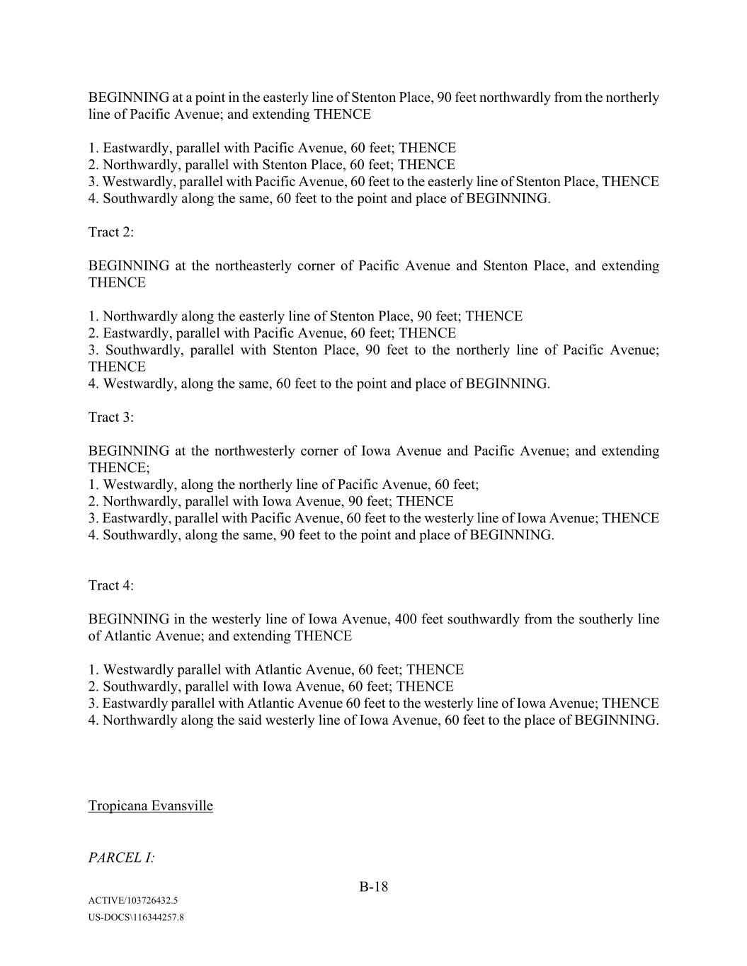
BEGINNING at a point in the easterly line of Stenton Place, 90 feet northwardly from the northerly line of Pacific Avenue; and extending THENCE 1. Eastwardly, parallel with Pacific Avenue, 60 feet; THENCE 2. Northwardly, parallel with Stenton Place, 60 feet; THENCE 3. Westwardly, parallel with Pacific Avenue, 60 feet to the easterly line of Stenton Place, THENCE 4. Southwardly along the same, 60 feet to the point and place of BEGINNING. Tract 2: BEGINNING at the northeasterly corner of Pacific Avenue and Stenton Place, and extending THENCE 1. Northwardly along the easterly line of Stenton Place, 90 feet; THENCE 2. Eastwardly, parallel with Pacific Avenue, 60 feet; THENCE 3. Southwardly, parallel with Stenton Place, 90 feet to the northerly line of Pacific Avenue; THENCE 4. Westwardly, along the same, 60 feet to the point and place of BEGINNING. Tract 3: BEGINNING at the northwesterly corner of Iowa Avenue and Pacific Avenue; and extending THENCE; 1. Westwardly, along the northerly line of Pacific Avenue, 60 feet; 2. Northwardly, parallel with Iowa Avenue, 90 feet; THENCE 3. Eastwardly, parallel with Pacific Avenue, 60 feet to the westerly line of Iowa Avenue; THENCE 4. Southwardly, along the same, 90 feet to the point and place of BEGINNING. Tract 4: BEGINNING in the westerly line of Iowa Avenue, 400 feet southwardly from the southerly line of Atlantic Avenue; and extending THENCE 1. Westwardly parallel with Atlantic Avenue, 60 feet; THENCE 2. Southwardly, parallel with Iowa Avenue, 60 feet; THENCE 3. Eastwardly parallel with Atlantic Avenue 60 feet to the westerly line of Iowa Avenue; THENCE 4. Northwardly along the said westerly line of Iowa Avenue, 60 feet to the place of BEGINNING. Tropicana Evansville PARCEL I: B-18 ACTIVE/103726432.5 US-DOCS\116344257.8
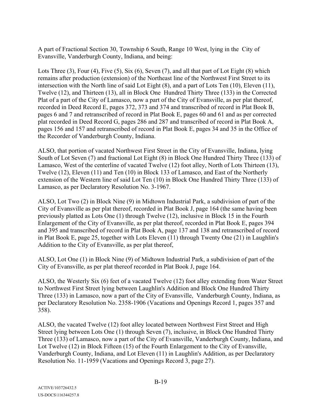
A part of Fractional Section 30, Township 6 South, Range 10 West, lying in the City of Evansville, Vanderburgh County, Indiana, and being: Lots Three (3), Four (4), Five (5), Six (6), Seven (7), and all that part of Lot Eight (8) which remains after production (extension) of the Northeast line of the Northwest First Street to its intersection with the North line of said Lot Eight (8), and a part of Lots Ten (10), Eleven (11), Twelve (12), and Thirteen (13), all in Block One Hundred Thirty Three (133) in the Corrected Plat of a part of the City of Lamasco, now a part of the City of Evansville, as per plat thereof, recorded in Deed Record E, pages 372, 373 and 374 and transcribed of record in Plat Book B, pages 6 and 7 and retranscribed of record in Plat Book E, pages 60 and 61 and as per corrected plat recorded in Deed Record G, pages 286 and 287 and transcribed of record in Plat Book A, pages 156 and 157 and retranscribed of record in Plat Book E, pages 34 and 35 in the Office of the Recorder of Vanderburgh County, Indiana. ALSO, that portion of vacated Northwest First Street in the City of Evansville, Indiana, lying South of Lot Seven (7) and fractional Lot Eight (8) in Block One Hundred Thirty Three (133) of Lamasco, West of the centerline of vacated Twelve (12) foot alley, North of Lots Thirteen (13), Twelve (12), Eleven (11) and Ten (10) in Block 133 of Lamasco, and East of the Northerly extension of the Western line of said Lot Ten (10) in Block One Hundred Thirty Three (133) of Lamasco, as per Declaratory Resolution No. 3-1967. ALSO, Lot Two (2) in Block Nine (9) in Midtown Industrial Park, a subdivision of part of the City of Evansville as per plat thereof, recorded in Plat Book J, page 164 (the same having been previously platted as Lots One (1) through Twelve (12), inclusive in Block 15 in the Fourth Enlargement of the City of Evansville, as per plat thereof, recorded in Plat Book E, pages 394 and 395 and transcribed of record in Plat Book A, page 137 and 138 and retranscribed of record in Plat Book E, page 25, together with Lots Eleven (11) through Twenty One (21) in Xxxxxxxx'x Addition to the City of Evansville, as per plat thereof, ALSO, Lot One (1) in Block Nine (9) of Midtown Industrial Park, a subdivision of part of the City of Evansville, as per plat thereof recorded in Plat Book J, page 164. ALSO, the Westerly Six (6) feet of a vacated Twelve (12) foot alley extending from Water Street to Northwest First Street lying between Xxxxxxxx'x Addition and Block One Hundred Thirty Three (133) in Lamasco, now a part of the City of Evansville, Vanderburgh County, Indiana, as per Declaratory Resolution No. 2358-1906 (Vacations and Openings Record 1, pages 357 and 358). ALSO, the vacated Twelve (12) foot alley located between Northwest First Street and High Street lying between Lots One (1) through Seven (7), inclusive, in Block One Hundred Thirty Three (133) of Lamasco, now a part of the City of Evansville, Vanderburgh County, Indiana, and Lot Twelve (12) in Block Fifteen (15) of the Fourth Enlargement to the City of Evansville, Vanderburgh County, Indiana, and Lot Eleven (11) in Xxxxxxxx'x Addition, as per Declaratory Resolution No. 11-1959 (Vacations and Openings Record 3, page 27). B-19 ACTIVE/103726432.5 US-DOCS\116344257.8
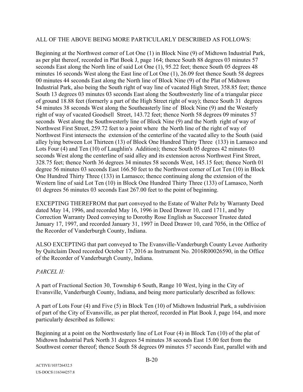
ALL OF THE ABOVE BEING MORE PARTICULARLY DESCRIBED AS FOLLOWS: Beginning at the Northwest corner of Lot One (1) in Block Nine (9) of Midtown Industrial Park, as per plat thereof, recorded in Plat Book J, page 164; thence South 88 degrees 03 minutes 57 seconds East along the North line of said Lot One (1), 95.22 feet; thence South 05 degrees 48 minutes 16 seconds West along the East line of Lot One (1), 26.09 feet thence South 58 degrees 00 minutes 44 seconds East along the North line of Block Nine (9) of the Plat of Midtown Industrial Park, also being the South right of way line of vacated High Street, 358.85 feet; thence South 13 degrees 03 minutes 03 seconds East along the Southwesterly line of a triangular piece of ground 18.88 feet (formerly a part of the High Street right of way); thence South 31 degrees 54 minutes 38 seconds West along the Southeasterly line of Block Nine (9) and the Westerly right of way of vacated Xxxxxxxx Street, 143.72 feet; thence North 58 degrees 09 minutes 57 seconds West along the Southwesterly line of Block Nine (9) and the North right of way of Northwest First Street, 259.72 feet to a point where the North line of the right of way of Northwest First intersects the extension of the centerline of the vacated alley to the South (said alley lying between Lot Thirteen (13) of Block One Hundred Thirty Three (133) in Lamasco and Lots Four (4) and Ten (10) of Xxxxxxxx'x Addition); thence South 05 degrees 42 minutes 03 seconds West along the centerline of said alley and its extension across Northwest First Street, 328.75 feet; thence North 36 degrees 34 minutes 58 seconds West, 145.15 feet; thence North 01 degree 56 minutes 03 seconds East 166.50 feet to the Northwest corner of Lot Ten (10) in Block One Hundred Thirty Three (133) in Lamasco; thence continuing along the extension of the Western line of said Lot Ten (10) in Block One Hundred Thirty Three (133) of Lamasco, North 01 degrees 56 minutes 03 seconds East 267.00 feet to the point of beginning. EXCEPTING THEREFROM that part conveyed to the Estate of Xxxxxx Xxxx by Xxxxxxxx Xxxx dated May 14, 1996, and recorded May 16, 1996 in Deed Drawer 10, card 1711, and by Correction Warranty Deed conveying to Xxxxxxx Xxxx Xxxxxxx as Successor Trustee dated January 17, 1997, and recorded January 31, 1997 in Deed Drawer 10, card 7056, in the Office of the Recorder of Vanderburgh County, Indiana. ALSO EXCEPTING that part conveyed to The Evansville-Vanderburgh County Levee Authority by Quitclaim Deed recorded October 17, 2016 as Instrument No. 2016R00026590, in the Office of the Recorder of Vanderburgh County, Indiana. PARCEL II: A part of Fractional Section 30, Township 6 South, Range 10 West, lying in the City of Evansville, Vanderburgh County, Indiana, and being more particularly described as follows: A part of Lots Four (4) and Five (5) in Block Ten (10) of Midtown Industrial Park, a subdivision of part of the City of Evansville, as per plat thereof, recorded in Plat Book J, page 164, and more particularly described as follows: Beginning at a point on the Northwesterly line of Lot Four (4) in Block Ten (10) of the plat of Midtown Industrial Park North 31 degrees 54 minutes 38 seconds East 15.00 feet from the Southwest corner thereof; thence South 58 degrees 09 minutes 57 seconds East, parallel with and B-20 ACTIVE/103726432.5 US-DOCS\116344257.8
15 feet North of the South line of Lot Four (4) in Block Ten (10) in Midtown Industrial Park, 135.00 feet; thence South 31 degrees 54 minutes 38 seconds West 169.70 feet to a point on the North right of way line of Northwest First Street (said line being 35 feet West of and parallel with the East line of Lot Four (4) and Five (5) of Block Ten (10) of Midtown Industrial Park); thence North 58 degrees 09 minutes 57 seconds West along the Southwesterly line of Lot Five (5) and the North right of way of Northwest First Street, 135.00 feet; thence North 31 degrees 54 minutes 38 seconds East along the Northwesterly line of Lots Four (4) and Five (5) in Block Ten (10) and the right of way of vacated Xxxxxxxx Street, 169.70 feet to the point of beginning. [EXCEPTING THEREFROM THAT PORTION CONVEYED TO AMERICAN GENERAL FINANCE MANAGEMENT CORPORATION, PURSUANT TO QUITCLAIM DEED DATED DECEMBER 18, 2007 AND RECORDED DECEMBER 20, 2007 AS INSTRUMENT NO. 2007R00039107, MORE PARTICULARLY DESCRIBED AS FOLLOWS: A part of Lot 4 in Block 10 in Mid-Town Industrial Park, an Addition to the City of Evansville, as per plat thereof recorded in Plat Book J, page 164, in the Office of the Recorder of Vanderburgh County, Indiana, described as follows: Commencing at a point on the West line of said Lot 4, which point is 93.2 feet South of the Northwest corner of said Lot; thence continuing South 31 degrees 01 minutes 30 seconds West along said West line 15 feet; thence South 59 degrees 4 minutes East 170.0 feet to the East line of said Lot 4; thence North 31 degrees 01 minute 30 seconds East along said East line of said Lot 15 feet; thence North 59 degrees 4 minutes West 170.0 feet to the Place of Beginning.] PARCEL III: Lots Thirty Four (34) to Thirty Seven (37) inclusive and part of Lots Thirty One (31), Thirty Two (32) and Thirty Three (33) in Xxxxxxxx'x Addition to the City of Evansville, as per plat recorded in Plat Book B, pages 44 and 45 in the Office of the Recorder of Vanderburgh County, Indiana; also all of a Twelve (12) foot ally Southwesterly of and adjacent to said Lots Thirty One (31) and Thirty Seven (37) as vacated by Resolution No. 4-1913 and recorded in Vacation Record 1, page 452; also part of Lots Eighteen (18) and Nineteen (19) in Hornby's Enlargement of the City of Evansville as per plat recorded in Plat Book A, page 33 and retranscribed of record in Plat Book E, page 66 in the Office of the Recorder of Vanderburgh County, Indiana, also all of that part of the Xxxxxx Ranger Tract lying Southwesterly of the above described Lots, as shown on the plat of Xxxxxxxx'x Addition; also all of Lots Five (5) to Ten (10) inclusive and part of Lots One (1) to Four (4) inclusive in Xxxxxxxx'x Addition to the City of Evansville as per the recorded plat thereof, and all of the vacated Thirty Six (36) foot wide street adjoining said Lots One (1) to Four (4) and Five (5) and Ten (10); also 1/2 of the vacated alley, Twelve (12) feet in width, adjoining said Lots Four (4) and Ten (10); also that portion of Xxxxxxxx Street vacated by deed recorded in Drawer 3, card 8302. ALL OF THE ABOVE DESCRIBED REAL ESTATE BEING MORE PARTICULARLY DESCRIBED AS FOLLOWS: B-21 ACTIVE/103726432.5 US-DOCS\116344257.8
Beginning at a 5/8" rebar (LS0006) at the Northerly most corner of Lot Thirty Seven (37) in said Xxxxxxxx'x Addition; thence along the Northeast line of Lots Thirty Three (33) to Thirty Seven (37) in said Xxxxxxxx'x Addition, also being the Southwest right of way of First Street, 1) South 59 degrees 11 minutes 26 seconds East 114.95 feet to a PK Nail in the Westerly right of way line of the Evansville-Vanderburgh Levee Authority right of way, Fifty (50) feet in width; thence along said right of way for the following Four (4) courses; 2) South 28 degrees 50 minutes 03 seconds West 23.95 feet to a flush 5/8" rebar (LS0006); 3) South 59 degrees 11 minutes 26 seconds East 62.07 feet to a flush 5/8" rebar (LS0006); 4) South 28 degrees 50 minutes 03 seconds West 149.33 feet to a flush 5/8" rebar (LS0006); 5) South 59 degrees 10 minutes 26 seconds East 73.98 feet to a flush 5/8" rebar (LS0006) in the Southeast line of Lot Eighteen (18) in Hornby's Enlargement; thence along said Southeast line; 6) South 28 degrees 50 minutes 03 seconds West 126.95 feet to a flush 5/8" rebar (LS0006) at the Southerlymost corner of Lot Eighteen (18) in said Xxxxxx'x Enlargement; thence along the Southwest line of Lots Eighteen (18) and Nineteen (19) in said Xxxxxx'x Enlargement and the Xxxxxx Ranger Tract, said line also being the Northeast right of way line of Riverside Drive; 7) North 59 degrees 10 minutes 26 seconds West 261 feet to a PK Nail at the intersection of the Northeast right of way of Riverside Drive and the Southeast right of way of vacated Xxxxxxxx Street; thence along the Northeast right of way of Riverside Drive for the following two (2) courses; 8) North 60 degrees 05 minutes 56 seconds West 53.71 feet to a 5/8" iron rod (LS0006); 9) Northwesterly 105.54 feet through a central angle of 17 degrees 19 minutes 39 seconds along a tangent curve to the right having a radius of 348.97 feet to a 5/8" inch iron rod (LS0006) in the centerline of a vacated alley; thence along said centerline; 10) North 05 degrees 04 minutes 41 seconds East 257.64 feet to a PK Nail at the Northernmost corner of Lot Ten (10) in said Xxxxxxxx'x Addition; thence along the Northeast line of Lots Nine (9) and Ten (10) in Xxxxxxxx'x Addition, also being the Southwest right of way of First Street; 11) South 59 degrees 16 minutes 55 seconds East 234.65 feet to a 3/4" iron rod at the Easterly most corner of said Lot Nine (9); 12) South 59 degrees 14 minutes 11 seconds East 60 feet to the point of beginning. PARCEL IV: Part of Lots Seven (7) and Eight (8) in Lower (or McGary's) Enlargement of the City of Evansville, as per plat thereof, recorded in Deed Record A, page 136, and transcribed of record in Plat Book A, page 120 and restranscribed of record in Plat Book E, page 24 in the Office of the Recorder of Vanderburgh County, Indiana, also including that part of a Twelve (12) foot wide and a Fourteen (14) foot wide alley as vacated by the Board of Public Works of the City of Evansville by Declaratory Resolution No. 10-1957, all being more particularly described as follows: Commencing at the Southwest corner of said Lot Eight (8); thence along the Northwest line of said Lot Eight (8) and the Southeast Thirty (30) foot right of way line of Third Avenue North 37 degrees 42 minutes 33 seconds East 80.05 feet to the North corner of a tract of land conveyed to Xxxxxx Enterprises, Inc., in Deed Drawer 1, card 659, in the Office of the Recorder of Vanderburgh County, Indiana, said point being the true point of beginning; thence continue along the Northwest line of said Lot Eight (8) and the Southeast Thirty (30) foot right of way line of Third Avenue, North 37 degrees 42 minutes 33 seconds East 67.64 feet to a corner of a tract of land conveyed to the Levee Authority District in Deed Record 450, page 483, in the Office of said Recorder; thence along the Southwest line of said Levee Authority tract South 52 degrees 17 minutes 28 seconds East 98.73 feet; thence continue along said Levee Authority tract B-22 ACTIVE/103726432.5 US-DOCS\116344257.8
South 12 degrees 36 minutes 38 seconds East 16.26 feet to a point on the East line of the West Half of Lot Seven (7) in said Lower Enlargement; thence along said East line South 37 degrees 39 minutes 02 seconds West 57.26 feet to the East corner of said tract of land conveyed to Xxxxxx Enterprises, Inc.; thence along the Northeast line of said Xxxxxx Enterprises, Inc., tract North 52 degrees 17 minutes 28 seconds West 111.30 feet to the true point of beginning. PARCEL V: The following described six (6) tracts of real estate, all of which are located in the Lower Enlargement of the City of Evansville, also known as McGary's Enlargement of the City of Evansville, as per plat thereof, recorded in Deed Record A, page 138, and transcribed of record in Plat Book A, page 120 and retranscribed of record in Plat Book E, page 24, in the Office of the Recorder of Vanderburgh County, Indiana: TRACT 1: Lots One (1), Two (2), Three (3) and Four (4) (including with the Northwesterly One-half (1/2) of said Lot Four (4), Lots One (1), Two (2), Three (3) and Four (4) in the subdivision of said Northwesterly One-half (1/2) of said Lot Four (4), as per plat thereof, recorded in Deed Record 15, page 312, in the Office of the Recorder of Vanderburgh County, Indiana), and Lots Eleven (11), Twelve (12), Thirteen (13), Fourteen (14), Fifteen (15) and Sixteen (16). TRACT 2: All of vacated Xxxxx Street which lies between the Southwesterly line of Northwest First Street and the Northeasterly line of Northwest Riverside Drive, as vacated by the Board of Public Works of the City of Evansville, pursuant to Declaratory Resolution No. 12-1967. TRACT 3: All of the vacated Twelve (12) foot alley lying between said Lots Fourteen (14) and Fifteen (15) as vacated by the Board of Public Works of the City of Evansville, pursuant to Declaratory Resolution No. 51-1901. TRACT 4: All of the vacated Twelve (12) foot alley lying between said Lots One (1), Two (2), Three (3) and Four (4) and said Lots Thirteen (13), Fourteen (14), Fifteen (15) and Sixteen (16) as vacated by the Board of Public Works of the City of Evansville, pursuant to Declaratory Resolution No. 2-1952. TRACT 5: B-23 ACTIVE/103726432.5 US-DOCS\116344257.8
Lot Five (5), EXCEPTING THEREFROM the following: Beginning at a point on the Southwesterly line of said Lot Five (5) 52.125 feet Northwesterly of the most Southerly corner of said Lot; thence at right angles Northeasterly and along a line parallel with Xxxxx Street (now vacated), 99.5 feet; thence at right angles in a Northwesterly direction, 22.1215 feet to the Northwesterly boundary line of said Lot; thence Southwesterly along said boundary line to the most Westerly corner of said Lot; thence Southeasterly to the point of beginning. ALSO EXCEPT THE FOLLOWING DESCRIBED REAL ESTATE: That part conveyed to the State of Indiana by Xxxxxxxx Xxxx recorded December 15, 1965 in Deed Record 484, page 222 in the Office of the Recorder of Vanderburgh County. TRACT 6: All of the vacated Twelve (12) foot alley extending in a Northwesterly-Southeasterly direction along and immediately adjacent to the Northeast line of all of said Lot Five (5) (said alley also adjoining said Lot Twelve (12) and a part of said Lot Eleven (11) as vacated by the Board of Public Works of the City of Evansville, pursuant to Declaratory Resolution No. 12-1967. PARCEL VI: That portion of the First Block of Xxxxx Street running Easterly and Westerly and extending to the Northerly right of way line of Court Street and being adjacent to Lots One (1) and Sixteen (16) of Lower Enlargement of the City of Evansville also known as McGary's Enlargement of the City of Evansville, as per plat thereof, recorded in Deed Record A, page 138, and transcribed of record in Plat Book E, page 24, in the Office of the Recorder of Vanderburgh County, Indiana, said portion being more particularly described as that part of Xxxxx Street vacated by an Ordinance No. G-84-40, for the Common Council of the City of Evansville, Indiana, and recorded in the Office of the Recorder of Vanderburgh County, Indiana, in Deed Drawer 1, card 21496. Being more particularly described by metes and bounds as follows: Commencing at a 5/8 inch rod marking the intersection of Court Street and First Street thence along the centerline of Court Street South 57 degrees 32 minutes 53 seconds West 33.32 feet; thence North 32 degrees 27 minutes 06 seconds East 30.00 feet to the point of intersection of the Southwest right of way line of First Street and the Northwest right of way line of Court Street, said point being the point of beginning; thence along said Court Street right of way line South 57 degrees 32 minutes 53 seconds West 307.36 feet to a point on the Northwest right of way line of vacated Xxxxx Street; thence along said right of way South 37 degrees 43 minutes 21 seconds West.71 feet to a point on the Northeast right of way line of Riverside Drive; thence along said right of way line North 52 degrees 16 minutes 39 seconds West 408.64 feet to a point on the right of way conveyed to the State of Indiana per deed recorded in Deed Record 484, page 222; B-24 ACTIVE/103726432.5 US-DOCS\116344257.8
thence along said right of way South 88 degrees 16 minutes 44 seconds East 1.50 feet; thence continue along said right of way North 51 degrees 38 minutes 54 seconds West 1.70 feet; thence North 37 degrees 43 minutes 21 seconds East 98.60 feet; thence North 52 degrees 16 minutes 39 seconds West 22.13 feet; thence North 37 degrees 43 minutes 21 seconds East 61.00 feet to the North line of a vacated alley per Declaratory Resolution 12-1967; thence along said alley North 52 degrees 16 minutes 39 seconds West 68.25 feet; thence North 37 degrees 43 minutes 21 seconds East 148.50 feet to the Southeast right of way line of First Street; thence along said right of way line South 52 degrees 16 minutes 39 seconds East 499.50 feet to the Northwest right of way line of vacated Xxxxx Street per Ordinance G-84-40; thence along said vacated Xxxxx Street South 44 degrees 25 minutes 42 seconds East 60.57 feet to the Northwest corner of Fractional Lot No. 1; thence along said North line South 38 degrees 27 minutes 41 seconds East 45.56 feet to the point of beginning. PARCEL VII: Leasehold Estate created by and between the City of Evansville, Indiana, acting by and through the Redevelopment Commission of City of Evansville as Lessor and Aztar Indiana Gaming Corporation, an Indiana corporation as lessee as evidenced by Xxxxx entered into as of May 2, 1995 and recorded May 5, 1995, in Lease Drawer 2, card 2189, for a demised term as defined in said Lease, as assigned by Assignment and Assumption Agreement dated as of December 27, 1999 and recorded December 29, 1999, in Lease Drawer 2, card 2687 by and between Aztar Gaming Company, LLC, an Indiana limited liability company and Aztar Indiana Gaming Corporation, an Indiana corporation, in and to the following described real estate: Part of Fractional Lot No. 3 in the Lower Enlargement of the City of Evansville, as per plat thereof, recorded in Deed Record A, page 138 and transcribed of record in Plat Book A, page 120, and re-transcribed of record in Plat Book E, page 24, as recorded in the Office of the Recorder of Vanderburgh County, Indiana; also part of Xxxxx Xxxxxx'x Wharf in the Plat of Hornby's Enlargement of the City of Evansville, as per plat thereof recorded in Plat Book A, page 33 and transcribed of record in Plat Book E, page 66 in the Office of the said Recorder; also part of the Laughlin Wharf in the Plat of Xxxxxxxx'x Addition to the City of Lamasco, as per plat thereof, recorded in Plat Book B, pages 44 and 45 in the Office of said Recorder; also, part of Lamasco as shown on the plat of the City of Lamasco, as per plat thereof, recorded in Plat book B, pages 10 and 11 in the Office of said Recorder and being more particularly described by metes and bounds as follows: Commencing at a 5/8 inch diameter iron rod marking the centerline intersection of First Street and Court Street (formerly known as Division Street), said point being South 38 degrees 27 minutes 41 seconds East (assumed bearing) from a 5/8 inch diameter iron rod marking the centerline intersection of First Street and Xxxxx Street (formerly known as Elm Street); thence along the centerline of Court Street South 57 degrees 32 minutes 53 seconds West 515.44 feet to a point on the Westerly right of way of Service Road No. 3, U.S. 41 Business Route, Project No. U-887 (4) commonly referred to as Southlane Drive, said point being the true point of beginning; thence continue South 57 degrees 32 minutes 53 seconds West 380.62 feet to the state boundary line between Indiana and Kentucky as established by the Supreme Court of the United States, B-25 ACTIVE/103726432.5 US-DOCS\116344257.8
No. 81, Original, October 1985 session; thence along said boundary line North 47 degrees 50 minutes 24 seconds West 221.79 feet; thence continue along said boundary line North 51 degrees 46 minutes 58 seconds West 188.49 feet; thence continue along said boundary line North 50 degrees 26 minutes 20 seconds West 464.82 feet to the point of intersection with the East line of a tract of land conveyed to the State of Indiana per deed recorded in Deed Drawer 1, card 9135 in the Office of said Recorder; thence along the East line thereof North 01 degrees 08 minutes 42 seconds East 477.54 feet to the Southwesterly right of way line of said Southlane Drive; thence along said right of way described by the following courses: South 25 degrees 17 minutes 22 seconds East 64.85 feet; thence South 56 degrees 33 minutes 35 seconds East 169.23 feet; thence South 59 degrees 04 minutes 30 seconds East 399.98 feet to the point of curvature of a curve right, concave to the Southwest having a central angle of 08 degrees 22 minutes 48 seconds and a radius of 903.93 feet from which the chord bears South 54 degrees 53 minutes 05 seconds East 132.09 feet; thence along the arc of said curve 132.21 feet to the point of tangency; thence South 50 degrees 41 minutes 41 seconds East 163.36 feet; thence South 39 degrees 19 minutes 03 seconds West 17.31 feet; thence South 52 degrees 16 minutes 39 seconds East 253.28 feet; thence South 39 degrees 27 minutes 27 seconds East 109.03 feet to a Westerly right of way of said Service Road No. 3, and point being on a curve to the left, concave to the East having a central angle of 22 degrees 27 minutes 27 seconds and a radius of 130.00 feet from which the chord bears South 26 degrees 35 minutes 42 seconds West 50.63 feet; thence along the arc of said curve 50.95 feet to the true point of beginning. PARCEL VIII: Lots Nine (9), Ten (10), Eleven (11), Twelve (12), Thirteen (13), and Fourteen (14) in Hornby's Enlargement of the City of Evansville, as per plat thereof, recorded in Plat Book A, page 33 and transcribed of record in Plat Book E, page 66 in the Office of the Recorder of Vanderburgh County, Indiana. PARCEL IX: Lot Ten (10) EXCEPT Twenty One and Five Tenths (21.5) feet off the Northwesterly side thereof adjoining Lot Nine (9) in the Lower (McGary's) Enlargement of the City of Evansville, as per plat thereof, recorded in Deed Record A, page 138 and transcribed of record in Plat Book E, page 24 in the Office of the Recorder of Vanderburgh County, Indiana. ALSO, part of a Twelve (12) foot wide alley lying Southeast of Lot Ten (10) and Northwest of Lot Eleven (11) in the Lower Enlargement of the City of Evansville, also known as McGary's Enlargement, as per plat thereof, recorded in Plat Book A, page 120 and retranscribed of record in Plat Book E, page 24 in the Office of the Recorder of Vanderburgh County, Indiana described as follows: Beginning at the East corner of said Lot Ten (10), said point being located on the Southwest right of way line of Northwest First Street; thence along the Southwest line of said First Street South 52 degrees 14 minutes 2 seconds East 12 feet to the North corner of said Lot Eleven (11); thence along the Northwest line of said Lot Eleven (11) South 37 degrees 27 minutes 48 seconds West B-26 ACTIVE/103726432.5 US-DOCS\116344257.8
132.16 feet to a point on the extended Northeast line of Parcel 2 of a tract of land conveyed to Evansville-Vanderburgh Levee Authority District (EVLAD) recorded in Deed Record 450, page 360 in the Office of said Recorder; thence along the extended Northeast line of said EVLAD tract North 52 degrees 14 minutes 42 seconds West 12 feet to a point on the Southeast line of said Lot Ten (10) and being the East corner of said EVLAD tract; thence along the Southeast line of said Lot Ten (10) North 37 degrees 27 minutes 48 seconds Eat 132.16 feet to the point of beginning. EXCEPT all that part of the above described real estate conveyed to Evansville-Vanderburgh Levee Authority District by Xxxxxxxx Xxxx recorded February 19, 1963 in Deed Record 450, page 360 in the office of the Recorder of Vanderburgh County, Indiana. PARCEL X: All that part of Lots 18 and 19 in Hornby's Enlargement to the City of Evansville, Vanderburgh County, Indiana, and that part of Lots 30, 31 32 and 33 of Xxxxxxxx'x Addition to the City of Evansville, Vanderburgh County, Indiana and that part of the Xxxxxx Ranger's purchase as shown on the plat of Xxxxxxxx'x Addition as recorded April 4, 1865 and the part of the vacated alley lying between Xxxxxxxx Street and the East line of Xxxxxxxx'x Addition, described and bounded as follows, to-wit: Commencing at the Northeast corner of said Lot 18 in Hornby's Enlargement; thence Southwesterly along the easterly line of said Lot 18 a distance of 17.05 feet; thence North 59 degrees 12 minutes West a distance of 73.98 feet to a point which is 29.98 feet Northwesterly of the most easterly line of said Xxxxxxxx'x Addition; thence North 29 degrees 36 minutes East a distance of 146.39 feet; thence North 60 degrees 28 minutes 30 seconds West a distance of 62.07 feet; thence North 29 degrees 36 minutes East a distance of 23.95 feet to the line of First Street; thence Southeasterly along First Street to the Northeast corner of said Lot 30; thence Southwesterly along the Easterly line of Xxxxxxxx'x Addition a distance of 155.93 feet to the southerly line of the alley and extension thereof, as platted in said Xxxxxx'x Enlargement; thence Southwesterly along the south line of said alley a distance of 56.0 feet to the place of beginning. PARCEL XI: That part of the said Mid-Town Industrial Park and designated as Evansville Levee Right of Way lying South of and adjacent to Lots 4 and 5 in Block 8, in said Mid-Town Industrial Park, more particularly described as follows: Beginning at the Southwest corner of said Lot 4, Block 8 and running Southeasterly along the South Boundary line of said Lots 4 and 5 a distance of 250.88 feet to the Southeast corner of said Lot 5; thence along a line perpendicular to the said South boundary line 17.13 feet to a point; thence Northwesterly along a line parallel to the South boundary line of said Lots 4 and 5 a distance of 250.94 feet; thence Northeasterly 18.84 feet to the place of beginning. PARCEL XII: B-27 ACTIVE/103726432.5 US-DOCS\116344257.8
Part of Lots 4 and 5 in Block 10 in Midtown Industrial Park, recorded in Plat Record J. Page 164, in the Office of the Recorder of Vanderburgh County, Indiana, described as follows: Beginning on the west line of Lot 4 Block 10 in Midtown Industrial Park a distance of 15.0 feet North 31 degrees 01 minute 30 seconds East of the Southwest corner thereof; thence South 59 degrees 04 minutes East and parallel to the South line of Lot 4 a distance of 135.0 feet; thence South 31 degrees 01 minutes 30 seconds West and parallel to the East line of Lots 4 and 5 a distance of 169.7 feet to the North line of First Street; thence South 59 degrees 04 minutes East along First Street a distance of 35.0 feet to the Southeast corner of Lot 5; thence North 31 degrees 01 minute 30 seconds East along the East line of Lots 4 and 5 a distance of 204.7 feet; thence North 59 degrees 04 minutes West and parallel to the South line of Lot 4 a distance of 170.0 feet to the east line of Xxxxxxxx Street; thence South 31 degrees 01 minute 30 seconds West along the East line of Xxxxxxxx Street 35.0 feet to the place of beginning. Except all that part conveyed to American General Finance Management Corporation by Quitclaim Deed recorded January 28, 2006 as Instrument No. 2006R00003796, in the Office of the Recorder of Vanderburgh County, Indiana. Further except all that part conveyed to American General Finance Management Corporation by Quitclaim Deed recorded December 20, 2007 as Instrument No. 2007R00038107, in the Office of the Recorder of Vanderburgh County, Indiana. PARCEL XIII: A strip of land thirty (30) feet in uniform width off the South side of High Street and extending from the West line of Good sell Street West to the East line of Lot two (2) Block 133 in Lamas co, an addition to the City of Evansville, Vanderburgh Country, Indiana and more particularly described as lying immediately north of and abutting Lots 1 to 12 inclusive in Block 15 in the Fourth enlargement of the City of Evansville, Vanderburgh County, Indiana, together with twelve (12) feet of a vacated alley between the west line of said Lot 12 in Block 15 in the Fourth Enlargement of the City of Evansville, Vanderburgh County, Indiana and the east line of said Lot 2 in Block 133 in Lamasco, an addition to the City of Evansville, Vanderburgh County, Indiana and more particularly described as lying immediately South of and abutting the remaining North part of said High Street and lots 11 to 20 inclusive in Block 16 Fourth Enlargement of the City of Evansville, Vanderburgh County, Indiana, Fourth Avenue and Lot 13 in Block 20 Fourth Enlargement of the City of Evansville, Vanderburgh County, Indiana. Parcel XIV: Part of Fractional Section 30, Township 6 South, Range 10 West in the City of Evansville, Vanderburgh County, Indiana and being: That portion of vacated High Street in the City of Evansville, being 30 feet in uniform width off the South side of High Street extending from the West line of Xxxxxxxx Street West to the East B-28 ACTIVE/103726432.5 US-DOCS\116344257.8
line of Lot 2 in Block 133 in Lamasco, an Addition to the City of Evansville as per Declaratory Resolution No. 14-1959 [Vacation and Openings Record 3, page 29]. Also vacated Xxxxxxxx Street located between the North line of Northwest First Street and the South line of vacated High Street in the City of Evansville, Vanderburgh County, Indiana together with a small triangular shaped piece of land lying near the Southwest corner of the intersection of Xxxxxxxx Street and High Street designated as Evansville Flood Protection Levee right of way as shown on the Midtown Industrial Park plat recorded in Plat Book J, page 164 in the Office of the Recorder of Vanderburgh County, Indiana; Also an additional segment of Xxxxxxxx Street lying North of the South line of High Street approximately 77.7 feet in length as per Declaratory Resolution No. 16-1964. All of the above described as follows: Beginning at the Northeast corner of the intersection of Northwest First Street and vacated Xxxxxxxx Street; thence North 58 degrees 09 minutes 57 seconds West 60 feet to the Northwest corner of the intersection of Northwest First Street and vacated Xxxxxxxx Street; thence North 31 degrees 54 minutes 38 seconds East along the Westerly line of Xxxxxxxx Street; thence North 31 degrees 54 minutes 38 seconds East along the Westerly line of Xxxxxxxx Street 143.72 feet; thence North 13 degrees 03 minutes 03 seconds West 18.88 feet; thence North 38 degrees 00 minutes 44 seconds West along the Southerly line of vacated High Street 358.85 feet; thence North 05 degrees 48 minutes 16 seconds East along a portion of the East line of Lot 1 in Block 9 in the Plat of Midtown Industrial Park 26.09 feet; thence South 88 degrees 03 minutes 57 seconds East 13.15 feet; thence South 58 degrees 00 minutes 44 seconds East 372.29 feet along a line which is 30 feet North of and parallel to the South line of vacated High Street to the intersection of said North line of the Northwesterly line of a portion of Xxxxxxxx Street; thence North 31 degrees 54 minutes 38 seconds East along the West right of way line of vacated Xxxxxxxx Street 47.71 feet; thence South 55 degrees 42 minutes 48 seconds East 60.05 feet; thence South 31 degrees 54 minutes 38 seconds West along the East right of way of vacated Xxxxxxxx Street 232.21 feet to the Point of Beginning. Except all that part conveyed to City of Evansville by and through its Redevelopment Commission by Corrective Quitclaim Deed recorded February 9, 2007 as Instrument No. 2007R00004075 in the Office of the Recorder of Vanderburgh County, Indiana. Further except that part conveyed to the Estate of Xxxxxx Xxxx by Quit Claim deed dated May 14, 1996 and recorded May 16, 1996 in Deed Drawer 10, Card 1710 as Instrument No. 96-11900; Grantee corrected to Xxxxxxx Xxxx Xxxxxxx as Successor Trustee under the testamentary trust created under the Last Will and Testament of Xxxxxx Xxxx by Correction Quit Claim Deed dated January 17, 1997 and recorded January 31, 1997 in Deed Drawer 10, Card 7055 as Instrument No. 97-02363, all in the Office of the Recorder of Vanderburgh County, Indiana. PARCEL XV: That portion of vacated First Street in the City of Evansville as per Ordinance No. G-95-10 recorded October 26, 1995 in Deed Drawer 9, Card 7932 in the Office of the Recorder of Vanderburgh County, Indiana described as follows: B-29 ACTIVE/103726432.5 US-DOCS\116344257.8
All that part of the First Street right of way lying Southwest of Lot 2 in Block 9 and a portion of Lot 5 in Block 10 of Midtown Industrial Park, an Addition to the City of Evansville, as per plat thereof recorded in Plat Book J, page 164 in the Office of the Recorder of Vanderburgh County, Indiana and lying Northeast of Lots 9 and 10 in Xxxxxxxx'x Addition to the City of Evansville, as per plat thereof recorded in Plat Book B, pages 44 and 45 in the Office of said Recorder; and Lots 31 through 37 inclusive in Xxxxxxxx'x Addition to the City of Evansville, being 60 feet in width and running Easterly from a point on the Easterly line of Block 133 in the plat of the City of Lamasco, as recorded in Plat Book A, page 156 in the Office of said Recorder contiguous to that portion of First Street previously vacated as recorded in Deed Record 500, page 405 in the Office of said Recorder to the Southeasterly line of a parcel conveyed to the Evansville- Vanderburgh Levee Authority District as recorded in Deed Record 464, page 473 in the Office of said Recorder across said First Street right of way, said parcel being more particularly described as follows: Commencing at an iron pin on the North line of Fractional Section 30 originally situated in the center of the intersection of Pennsylvania Street and Xxxxxxxx Street, as described in Xxxx transferred in Deed Record 662, page 314 in the Office of said Recorder; thence along the following calls as stated in said Warranty Deed; thence from said iron pin extending Southwesterly along a line marking an interior angle of 89 degrees 07 minutes with the North line of said Fractional Section 30, 822.9 feet; thence Southwesterly along the centerline of Xxxxxxxx Street, which line makes an interior angle of 150 degrees 43 minutes with the preceding line 509.9 feet; thence Southeasterly along a line making an interior angle of 90 degrees 04 minutes with the preceding line, 30 feet to the Northwest corner of Lot 37 in Xxxxxxxx'x Addition, being the Southeast corner of the intersection of First and Xxxxxxxx Street and also being the Point of Beginning of this description; thence North 58 degrees 09 minutes 57 seconds West along that portion of vacated Xxxxxxxx Street as recorded in Deed Drawer 3, Card 8302 in the Office of said Recorder and the Northeasterly line of Lots 9 and 10 in Xxxxxxxx'x Addition, 296.91 feet to a point on the Easterly line of Block 133 of Lamasco and that part of First Street previously vacated, across which Southern Indiana Gas and Electric was granted an easement as described in Deed Record 500, page 405 in the Office of said Recorder; thence North 05 degrees 42 minutes 03 seconds East along the Easterly end of the previously vacated First Street, 66.83 feet; thence South 58 degrees 09 minutes 57 seconds East along the Southwesterly line of Lot 2 in Block 9 in Midtown Industrial Park, the Southerly end of that portion of Xxxxxxxx Street quitclaimed to Boetticher & Xxxxxxx Inc. in Deed Record 464, page 423, in the Office of said Recorder and continuing along the Southwesterly line of Lot 5 in Block 10 in Midtown Industrial Park, 496.43 feet; thence South 31 degrees 54 minutes 38 seconds West 60.01 feet to a point on the North line of Lot 31 in Xxxxxxxx'x Addition; thence North 58 degrees 09 minutes 57 seconds West along the North line of Lots 31 through 37 in Xxxxxxxx'x Addition, 170 feet to the Point of Beginning. ALSO that portion of vacated First Street in the City of Evansville as per Ordinance No. G-2006- 1 Amended recorded January 25, 2006 as Instrument No. 2006R00004986 in the Office of the Recorder of Vanderburgh County, Indiana, described as follows: All that part of the First Street right of way lying Southwest of Lot 8 in Block 10 in Midtown Industrial Park, an Addition to the City of Evansville, as per plat thereof recorded in Plat Book J, B-30 ACTIVE/103726432.5 US-DOCS\116344257.8
page 164, and lying Northeast of Lots 9, 10, 11, 12, 13 and 14 in Hornby's Enlargement to the City of Evansville, as per plat thereof recorded in Plat Book A, page 33, and transcribed of record in Plat Book E, page 66, in the Office of said Recorder; the vacated alley that lies between Lot 9 in Hornby's Enlargement and Lot 30 in the adjoining Xxxxxxxx'x Addition to the City of Evansville, as per plat thereof recorded in Plat Book B, pages 44 and 45 in the office of said Recorder; and also Lot 30 and a portion of Lot 31 in Xxxxxxxx'x Addition, being 60 feet in width and running Easterly from the Westerly line of Lot 8 in Block 10 in Midtown Industrial Park extended across the First Street right of way, also being the easterly line of that portion of First Street previously vacated as recorded in Deed Record 9, Card 7932 in the Office of said Recorder and the southeasterly line of a parcel conveyed to the Evansville-Vanderburgh Levee Authority District as recorded in Volume 464, page 473 in the Office of said Recorder, across said First Street right of way to the Southwesterly right of way of Third Avenue, said parcel being more particularly described as follows: Commencing at an iron pin on the North line of Fractional Section 30 originally situated in the center of the intersection of Pennsylvania Street and Xxxxxxxx Street, as described in Deed transferred in Deed Record 662, page 314, in the Office of said Recorder; thence along the following calls as stated in said Warranty Deed; thence from said iron pin extending Southwesterly along a line marking an interior angle of 89 degrees 70 minutes with the North line of said Fractional Section 30, 822.9 feet; thence Southwesterly along the centerline of Xxxxxxxx Street, which line makes an interior angle of 150 degrees 43 minutes with the preceding line 509.9 feet; thence Southeasterly along a line making an interior angle of 90 degrees 04 minutes with the preceding line 30 feet to the Northwest corner of Lot 37 in Xxxxxxxx'x Addition, being the Southeast corner of the intersection of First and Xxxxxxxx Street; thence continue South 58 degrees 09 minutes 57 seconds East 170 feet along the North lines of Lots 37, 36, 35, 34 33, 32 and a portion of Lot 31 in Xxxxxxxx'x Addition to the Point of Beginning; thence North 31 degrees 54 minutes 38 seconds East 60 feet to a point where the North right of way of First Street intersects the Southwest corner of Lot 8 in Block 10 in Midtown Industrial Park, said line also being contiguous to that portion of First Street previously vacated as recorded in Deed Drawer 9, Card 7932 in the Office of the Recorder of Vanderburgh County, Indiana; thence South 58 degrees 09 minutes 57 seconds East 193.01 feet; thence 29.19 feet along a curve to the left, concave to the Northwest, said curve having a radius of 20 feet and a chord of 26.66 feet bearing North 80 degrees 02 minutes 38 seconds East to a point on the Northwesterly right of way line of Third Avenue; thence South 38 degrees 13 minutes 04 seconds West 78.25 feet along said right of way to the Northeast corner of Lot 14 in Hornby's Enlargement; thence North 58 degrees 09 minutes 57 seconds West 204.28 feet along the North line of Lot 14, 13, 12, 11, 10 and 9 in Hornby's Enlargement, the adjoining alley, and Lot 30 and a portion of Lot 31 in Xxxxxxxx'x Addition to the Point of Beginning. COMBINED PARCELS I, II, III, VIII, X, XII, XIII, XIV AND XV: A part of Fractional Section 30, Township 6 South, Range 10 West of the Second Principal Meridian, Vanderburgh County, Indiana, being also a part of Blocks 9 and 10 of Mid-Town Industrial Park, a part of Block 133 of Lamasco, a part of Xxxxxxxx'x Addition, a part of Hornby's B-31 ACTIVE/103726432.5 US-DOCS\116344257.8
Enlargement, and portions of vacated streets and alleys within or adjoining said platted tracts, being more particularly described as follows: Commencing at the northwest corner of Lot 1 in block 9 of Mid-town Industrial Park, the plat of which is recorded in Plat Book J, page 164, in the Office of the Recorder of said county; thence South 88 degrees 03 minutes 57 seconds East 95.22 feet along the north line of said Lot 1 to the northeast corner of said Lot 1; thence South 5 degrees 48 minutes 16 seconds West 10.72 feet along the east line of said Lot 1 to the southwest corner of the 389 square foot parcel of land described in Deed Drawer 10, Card 7055 in the office of said Recorder and the point of beginning of this description; thence South 74 degrees 11 minutes 08 seconds East 35.33 feet along the southern line of said 389 square foot parcel to the western face of an existing wall; thence North 5 degrees 36 minutes 07 seconds East 7.10 feet along said western face to the northeastern line of the parcel of land described as Parcel 4 in Deed Drawer 13, Card 2229 in the office of said Recorder; thence South 58 degrees 00 minutes 44 seconds East 1.19 feet said northeast line the eastern face of said existing wall; thence south 5 degrees 34 minutes 37 seconds West 5.85 feet along said eastern face to a corner of said wall; thence the following six courses along the northeastern face of said wall; South 57 degrees 53 minutes 59 seconds East 60.02 feet; thence North 32 degrees 06 minutes 01 seconds East 4.00 feet; thence south 57 degrees 53 minutes 59 seconds East 6.20 feet; thence South 32 degrees 06 minutes 01 second West 4.00 feet; thence South 57 degrees 53 minutes 59 seconds East 338.16 feet; thence South 57 degrees 54 minutes 52 seconds East 145.81 feet (145.75 feet by Document 2006R00003796) to a corner of said wall; thence south 31 degrees 54 minutes 02 seconds West 180.23 feet (180.45 feet by Document 2006R00003796) along the southeastern face of said wall to the southwestern line of Block 10 of said Mid-Town Industrial Park; thence south 58 degrees 09 minutes 58 seconds East 217.18 feet along said southwestern line; thence along the southern boundary of said block 10 Northeasterly 29.06 feet along an arc to the left and having a radius of 20.00 feet and subtended by a long chord having a bearing of North 80 degrees 12 minutes 18 seconds East and a length of 26.57 feet to the northwestern boundary of Third Avenue; thence South 38 degrees 34 minutes 09 seconds West 78.19 feet along said northwestern boundary and along the southeastern boundary to First Street as vacated by Instrument 2006R0004986 to the eastern corner of Lot 14 of Hornby's enlargement, the plat of which is retranscribed of record in Plat Book E, page 66 in the Office of said Recorder; thence South 38 degrees 34 minutes 09 seconds West 145.00 feet along the southeastern line of said Lot 14 to the southern corner of said Lot 14; thence North 58 degrees 09 minutes 57 seconds West 145.17 feet along the southwestern line of said Lots 9 thru 14 inclusive of Hornby's Enlargement to the southeastern line of said Xxxxxxxx'x Addition; thence South 30 degrees 00 minutes 03 seconds West 12.01 feet along said southeastern line of Xxxxxxxx'x Addition to the Northern corner of Lot 19 in said Xxxxxx'x Enlargement; thence South 58 degrees 09 minutes 57 seconds East 44.00 feet (southwesterly 56.0 feet (sic) by Document 2005R00027607) along the Northeastern line of Lots 18 and 19 of said Xxxxxx'x Enlargement to the eastern corner of said Lot 18; thence South 30 degrees 00 minutes 03 seconds West 144.07 feet, along the southeastern line of said Lot 18 to the southern corner of said Lot 18; thence North 58 degrees 09 minutes 58 seconds West 261.00 feet along the southwestern line of said Lots 18 and 19 and the southwestern line of the Xxxxxx Ranger Tract as shown on the plat of said Xxxxxxxx'x Addition to the western corner of said Xxxxxx Ranger Tract; thence North 40 degrees 12 minutes 52 seconds West 60.88 feet along the northeastern boundary of Riverside Drive (formerly Southlane Drive) and Xxxxxx Avenue, being B-32 ACTIVE/103726432.5 US-DOCS\116344257.8
the northeastern right-of-way of Indiana State Highway Project U-887(4); thence North 36 degrees 34 minutes 52 seconds West 270.46 feet along said northeastern boundary to the prolongation of the west line of Lot 10 in Block 133 of the Correct Plat of a part of the City of Lamasco, the plat of which is retranscribed of record in Plat Book E, pages 60 and 61 in the office of said Recorder; thence North 1 degree 56 minutes 04 seconds East 403.48 feet along the west line of Lots 3 thru 10 inclusive and the prolongation thereof and along the west line of the aforesaid Lot 1 in Block 9 of Mid-Towns Industrial Park to the southwest corner of the 2796 square foot parcel of land described in Deed Drawer 10, Card 7056; thence South 88 degrees 03 minutes 57 seconds East 87.69 feet along the south line of said 2796 square foot parcel to a corner of said parcel; thence North 31 degrees 52 minutes 55 seconds East 12.50 feet along the southeastern line of said parcel to the aforesaid east line of Lot 1 in Block 9 of Mid-town Industrial Park; thence North 5 degrees 48 minutes 21 seconds East 8.50 feet along said east line to the point of beginning, containing 7.75 acres, more or less. Parcel IV: A part of Fractional Section 30, Township 6 South, Range 10 West of the Second Principal Meridian, Vanderburgh County, Indiana, being also a part of Lots 7 and 8 in the Lower (or McGary's) Enlargement to the City of Evansville, the plat of which is retranscribed of record in Plat Book E, page 24 in the office of the Recorder of said county, being more particularly described as follows: Commencing at the western corner of said Lot 8; thence North 38 degrees 34 minutes 09 seconds East 80.05 feet (80 feet by the plat of Xxxxxxxx'x Subdivision, Plat Book E, page 151) along the northwestern line of said Lot 8 to the northern corner of the tract of land described in Deed Drawer 1, card 659 in the office of said Recorder (being also the northern corner of Lot 5 in Xxxxxxxx'x Subdivision) and the POINT OF BEGINNING of this description; thence North 38 degrees 34 minutes 09 seconds East 67.64 feet along the northwestern line of said Lot 8 to the western corner of the tract of land described in Deed Record 450, page 483 in the office of said Recorder, which corner is 0.81 feet southwesterly of the northern corner of said Lot 8; thence South 51 degrees 25 minutes 52 seconds East 98.73 feet along the southwestern line of said tract to a corner of said tract; thence South 11 degrees 45 minutes 02 seconds East 16.26 feet (17.4 feet by Deed Record 450, page 483) along a western line of said tract to the southern corner of said tract, which corner is on the southeastern line of the northwestern half of said Lot 7; thence South 38 degrees 30 minutes 38 seconds West 57.26 feet along said southeastern line to the eastern corner of the aforesaid tract described in Deed Drawer 1, card 659 (being the eastern corner of Lot 1 in Xxxxxxxx'x Subdivision); thence North 51 degrees 25 minutes 52 seconds West 111.30 feet along the northeastern line of said tract (northeastern line of Lots 1 thru 5 inclusive of Xxxxxxxx'x Subdivision) to the point of beginning and containing 0.17 acres, more or less. Combined Parcels V, VI, and IX: A part of Fractional Section 30, Township 6 South, Range 10 West of the Second Principal Meridian, Vanderburgh County, Indiana, being also a part of the Lower (or McGary's) Enlargement to the City of Evansville, the plat of which is retranscribed of record in Plat Book B-33 ACTIVE/103726432.5 US-DOCS\116344257.8
E, page 24 in the office of the Recorder of said county, and portions of vacated streets and alleys within or adjoining said Lower Enlargement, being more particularly described as follows: Commencing at a 5/8" iron rod marking the centerline intersection of Court Street and First Street; thence South 58 degrees 22 minutes 18 seconds West 33.32 feet along the platted centerline of said Court Street; thence North 31 degrees 37 minutes 42 seconds West 30.00 feet to the eastern corner of Fractional Lot 2 of said Lower Enlargement, which corner is the intersection of the southwestern boundary of First Street and the northwestern boundary of Court Street, and being the POINT OF BEGINNING of this description; thence South 58 degrees 22 minutes 18 seconds West 307.36 feet along the southeastern line of said Fractional Lot 2 and the prolongation thereof to the southeastern line of Lot 1 of said Lower Enlargement; thence South 38 degrees 33 minutes 13 seconds West 0.71 feet along said southeastern line of Lot 1 to the southern corner of said Lot 1; thence North 51 degrees 28 minutes 30 seconds West 408.32 feet along the southwestern line of Lots 1 thru 5 inclusive of said Lower Enlargement and the prolongation thereof to the southwestern corner of the parcel of land described in Deed Record 484, page 222; thence North 86 degrees 55 minutes 55 seconds East 1.20 feet along the southern line of said parcel the southeast corner of said parcel; thence North 47 degrees 59 minutes 17 seconds West 1.70 feet along the northeastern line of said parcel to the northern corner of said parcel; thence North 38 degrees 33 minutes 48 seconds East 98.60 feet; thence North 51 degrees 28 minutes 30 seconds West 22.13 feet to the northwestern line of said Lot 5; thence North 38 degrees 33 minutes 48 seconds East 61.00 feet along said northwestern line of Lot 5 and the prolongation thereof to a point on the southwestern line of Lot 11 of said Lower Enlargement; thence North 51 degrees 28 minutes 24 seconds West 68.25 feet along the southwestern line of said Lot 11 to the western corner of said Lot 11; thence North 38 degrees 33 minutes 55 seconds East 16.34 feet along the northwestern line of said Lot 11 to the extended northeastern line of the tract of land described as Parcel 2 in Deed Record 450, page 360 in the office of said Recorder; thence North 51 degrees 28 minutes 24 seconds West 14.87 feet along said extended northeast line and along the northeast line of said Parcel 2 to the northern corner of said Parcel 2; thence South 38 degrees 33 minutes 55 seconds West 16.34 feet along the northwestern line of said Parcel 2 to the southwestern line of Lot 10 of said Lower Enlargement; thence North 51 degrees 28 minutes 24 seconds West 24.55 feet along said southwestern line of Lot 10 to the southern corner of the tract of land described as Parcel 1 in said Deed Record 450, page 360; thence North 38 degrees 34 minutes 02 seconds East 9.14 feet along the southeastern line of said Parcel 1 to the eastern corner of said Parcel 1; thence North 51 degrees 28 minutes 24 seconds West 22.33 feet along the northeastern line of said Parcel 1 to the southeastern line of the northwestern 21.5 feet of said Lot 10; thence North 38 degrees 34 minutes 02 seconds East 139.36 feet along said southeastern line to a point on the northeastern line of said Lot 10; thence South 51 degrees 28 minutes 18 seconds East 561.18 feet along the northeastern line of Lots 10 thru 16 inclusive of said Lower Enlargement and the prolongation thereof to the eastern corner of said Lot 16; thence South 43 degrees 37 minutes 13 seconds East 60.57 feet along the northeastern line of that portion of Xxxxx Street vacated by Ordinance G-84-40 to the northern corner of the aforesaid Fractional Lot 2 of the Lower Enlargement; thence South 37 degrees 38 minutes 28 seconds East 45.52 feet along the northeastern line of said Fractional Lot 2 to the point of beginning and containing 3.81 acres, more or less. Leasehold Parcel VII: B-34 ACTIVE/103726432.5 US-DOCS\116344257.8
Leasehold Estate created by the Lease recorded in Lease Drawer 2, card 2189 in the office of the Recorder of Vanderburgh County, Indiana in and to a part of Fractional Section 30, Township 6 South, Range 10 West of the Second Principal Meridian, Vanderburgh County, Indiana, being also a part of Fractional Lot 3 in the Lower (or McGary's) Enlargement to the City of Evansville, a part of Xxxxx Xxxxxx'x Wharf as shown on the plat of Xxxxxx'x Enlargement, a part of the Laughlin Wharf as shown on the plat of Xxxxxxxx'x Addition, and a part of vacated Front Street as shown on the plat of the City of Lamasco, being more particularly described as follows: Commencing at a 5/8" iron rod marking the centerline intersection of Court Street and First Street; thence South 58 degrees 22 minutes 18 seconds West 515.44 feet along the platted centerline of said Court Street to a point on the western boundary of Service Road No. 3 of Indiana State Highway Project U-887(4) and the POINT OF BEGINNING of this description; thence continuing South 58 degrees 22 minutes 18 seconds West 380.62 feet to the state boundary line between Indiana and Kentucky as established by the Supreme Court of the United States, October 1985 session; thence North 47 degrees 00 minutes 59 seconds West 221.79 feet along said state boundary; thence North 50 degrees 57 minutes 33 seconds West 188.49 feet along said state boundary; thence North 49 degrees 36 minutes 55 seconds West 464.82 feet along said state boundary to its intersection with the east line of the tract of land described in Deed Drawer 1, card 9134 in the office of the Recorder of said county; thence North 1 degree 58 minutes 07 seconds East 477.54 feet along the east line of said tract to the southwestern boundary of Riverside Drive (formerly Southlane Drive) and Xxxxxx Avenue, being the southwestern right-of-way of said Project U-887(4); thence South 24 degrees 27 minutes 57 seconds East 64.85 feet along said southwestern boundary; thence South 55 degrees 44 minutes 10 seconds East 169.23 feet along the southwestern boundary of Riverside Drive and the southwestern right-of-way of said Project U-887(4); thence South 58 degrees 15 minutes 05 seconds East 399.98 feet along said boundary; thence along said boundary Southeasterly 132.21 feet along an arc to the right and having a radius of 903.87 feet and subtended by a long chord having a bearing of South 54 degrees 03 minutes 40 seconds East and a length of 132.09 feet; thence South 49 degrees 52 minutes 16 seconds East 163.36 feet along said boundary; thence South 40 degrees 08 minutes 28 seconds West 17.31 feet along said boundary; thence South 51 degrees 27 minutes 14 seconds East 253.28 feet along said boundary; thence South 38 degrees 38 minutes 02 seconds East 109.03 feet along said boundary to the aforesaid western boundary of Service Road No. 3; thence along said western boundary Southwesterly 50.96 feet along an arc to the left and having a radius of 129.94 feet and subtended by a long chord having a bearing of South 27 degrees 24 minutes 55 seconds West and a length of 50.63 feet to the point of beginning and containing 10.20 acres, more or less. Parcel XVI: Part of Lots 5 and 6 in Lower (or McGary's) enlargement of the City of Evansville, as per plat thereof recorded in Deed Record Book A, page 136 and transcribed of record in Plat Book A page 120 and retranscribed of record in Plat Book E, page 24 in the office of the Recorder of Vanderburgh County, Indiana, more particularly described as 22 feet off of Lot 5 fronting Riverside Avenue (formerly Water Street) adjoining Lot 6 and running back from Riverside B-35 ACTIVE/103726432.5 US-DOCS\116344257.8
Avenue a distance of 99 feet, also a distance of 58.3 feet off of the Southeast side of Lot 6 adjoining Lot 5 excepting thereof that part taken by the State of Indiana as recorded August 3, 1967 in Deed Record 506 page 158 thereof. Parcel XVII: Lots 1, 2, 3, 4 and 5 of Xxxxxxxx'x Subdivision of the Western one-half of Lot 7 and all of Lot 8 of XxXxxx'x Enlargement to the City of Evansville, Vanderburgh County, Indiana, according to the recorded plat thereof in Plat Record A, page 136 (and now recorded at Plat Record E, page 151), in the Office of the Recorder of Vanderburgh County, Indiana. EXCEPTING THEREFROM that part conveyed by Warranty Deed to the State of Indiana dated August 1, 1966 and recorded October 18, 1966 in Deed Record 495 page 148, in the Office of the Recorder of Vanderburgh County, Indiana. Parcel XVIII: Lots One (1), Two (2), Three (3) and Four (4) in Iselin's Subdivision of Lots Fifteen (15), Sixteen (16) and Seventeen (17) of Xxxxxx'x Enlargement of the City of Evansville, as per plat thereof, recorded in Plat Book C, Page 219 in the Office of the Recorder of Vanderburgh County, Indiana. EXCEPTING THEREFROM: That part of Lot Four (4) conveyed by the X. Xxxxx Company, Incorporated to Evansville - Vanderburgh Levee Authority District by Warranty Deed dated May 2, 1963 and recorded May 8, 1963 in Deed Book 453, Page 30 in the Office of the Recorder of Vanderburgh County, Indiana. ALSO: The Northwesterly one-half of vacated Third Avenue lying immediately adjacent to, and Southeasterly of, said Lot 1 and part of Lot 4 in Iselin's Subdivision described above, pursuant to Ordinance No. G-2016-11, recorded April 1, 2016 as Instrument No. 2016R00008967 in the Office of the Recorder of Vanderburgh County, Indiana. Parcel XIX Eighteen and Fifty-six Hundredths (18.56) feet of Lot Six (6) adjoining Lot Seven (7) and Thirty-seven and One Hundred Twenty-five Thousandths (37.125) feet of Lot Seven (7) adjoining Lot Six (6) in the Lower Enlargement of the City of Evansville, also known as McGary's Enlargement of the City of Evansville, as per plat thereof, recorded in Deed Record A, Page 138 and transcribed of record in Plat Book A, Page 120, and re-transcribed of record in Plat Book E, Page 24 in the Office of the Recorder of Vanderburgh County, Indiana. EXCEPTING THEREFROM that part conveyed to the State of Indiana by Xxxxxxxx Xxxx dated June 13, 1966 and recorded September 1, 1966 in Deed Volume 493, Page 429 in the Office of the Recorder of Vanderburgh County, Indiana. B-36 ACTIVE/103726432.5 US-DOCS\116344257.8
ALSO, all that part of Lot Ten (10) in the Lower Enlargement to the City of Evansville, Vanderburgh County, Indiana, described and bounded as follows, to-wit: Commencing at a point on the Southerly line of Lot Ten (10), said point being located by measuring Twenty-one and Five Tenths (21.5) feet Southeast of a line dividing Lots Nine (9) and Ten (10), thence Northeasterly and parallel to a line dividing Lots Nine (9) and Ten (10) a distance of Nine and Fourteen Hundredths (9.14) feet, thence Southeasterly and parallel to the Southerly line of Lot Ten (10) a distance of Twenty-two and Thirty-three Hundredths (22.33) feet, thence Southwesterly and parallel to a line dividing Lots Nine (9) and Ten (10) a distance of Nine and Fourteen Hundredths (9.14) feet to the Southerly line of Lot Ten (10), said point also being on the Northerly right-of-way of the alley, thence Northwesterly along the Southerly line of Lot Ten (10) a distance of Twenty-two and Thirty-three Hundredths (22.33) feet to the point of beginning. ALSO, all that part of Lot Ten (10) in the Lower Enlargement to the City of Evansville, Vanderburgh County, Indiana, described and bounded as follows, to-wit: Commencing at a point on the Southerly line of Lot Ten (10), said point being located by measuring Southeasterly Sixty-eight and Thirty-eight Hundredths (68.38) feet from a line dividing Lots Nine (9) and Ten (10), thence Northeasterly and parallel to a line dividing Lots Nine (9) and Ten (10) a distance of Sixteen and Thirty-four Hundredths (16.34) feet, thence South 52 Degrees 21 Minutes East a distance of Two and Eighty-seven Hundredths (2.87) feet to the Easterly line of Lot Ten (10), thence Southwesterly along the Easterly line of Lot Ten (10) a distance of Sixteen and Thirty-four Hundredths (16.34) feet to the most Southerly corner of Lot Ten (10), said point also being on the Northerly right-of-way of the alley, thence Northwesterly along the Southerly line of Lot Ten (10) a distance of Two and Eighty-seven Hundredths (2.87) feet to the point of beginning. ALSO, a sub-surface easement for the public purpose of constructing, maintaining, improving, repairing and reconditioning of flood control walls and devices is hereby granted over, along, across, within and upon the following described real estate in Vanderburgh County, State of Indiana, to-wit: All that part of Lot Ten (10) in the Lower Enlargement to the City of Evansville, Vanderburgh County, Indiana, described and bounded as follows, to-wit: Commencing at a point, said point being Twenty-one and Five Tenths (21.5) feet Southeast of a line dividing Lots Nine (9) and Ten (10), and Nine and Fourteen Hundredths (9.14) feet North of the Southerly line of Lot Ten (10), thence Northeasterly and parallel to a line dividing Lots Nine (9) and Ten (10) a distance of Seven and Twenty Hundredths (7.20) feet, thence South 52 Degrees 21 Minutes East a distance of Forty-six and Eighty-three Hundredths (46.83) feet, thence Southwesterly and parallel to a line dividing Lots Nine (9) and Ten (10) a distance of Sixteen and Thirty-four Hundredths (16.34) feet to a point on the Southerly line of Lot Ten (10), said point also being on the Northerly line of the alley, thence Northwesterly along the Southerly line of Lot Ten (10) a distance of Twenty-four and Fifty-five Hundredths (24.55) feet, thence Northeasterly and parallel to a line dividing Lots Nine (9) and Ten (10) a distance of Nine and Fourteen B-37 ACTIVE/103726432.5 US-DOCS\116344257.8
Hundredths (9.14) feet, thence Northwesterly and parallel to the Southerly line of Lot Ten (10) a distance of Twenty-two and Thirty-three Hundredths (22.33) feet to the point of beginning. ALSO, all that part of Lots Seven (7) and Eight (8) in Lower Enlargement to the City of Evansville, Vanderburgh County, Indiana, described and bounded as follows, to-wit: Commencing at the most Northerly corner of Lot Eight (8), Lower Enlargement to the City of Evansville, thence Southeasterly along the Northerly line of Lots Eight (8) and Seven (7) a distance of One Hundred Eleven and Thirty-seven Hundredths (111.37) feet to a point on the Northerly line of Lot Seven (7), said point being Thirty-seven and Twelve Hundredths (37.12) feet Northwest of a line dividing Lots Seven (7) and Six (6), said point being on the line dividing the property of the Grantor herein and that formerly owned by Xxx May Xxxxx and conveyed to the Evansville-Vanderburgh Levee Authority District by Warranty Deed by Xxxxxx Xxxxxx, Attorney in Fact for Xxx May Xxxxx, said Deed being dated July 10, 1961, and recorded November 22, 1961 in Deed Record 438, Page 533, thence Southwesterly and parallel with the line dividing Lots Seven (7) and Six (6) a distance of Eleven and Nineteen Hundredths (11.19) feet, thence North 08 Degrees 32 Minutes West a distance of Seventeen and Four Tenths (17.4) feet, thence North 52 Degrees 16 Minutes West a distance of Ninety-eight and Seventy-three Hundredths (98.73) feet to a point on the Westerly line of Lot Eight (8), said point also being on the Easterly right-of-way of Third Avenue, thence Northeasterly along the Westerly line of Lot Eight (8) a distance of .81 feet to the place of beginning. ALSO, all that part of Lots Nine (9) and Ten (10) in Lower Enlargement to the City of Evansville, Vanderburgh County, Indiana, described and bounded as follows, to-wit: Commencing at the Southwest corner of Lot Nine (9), said point also being on the Easterly right- of-way of Third Avenue, thence Northeasterly along the Easterly right-of-way of Third Avenue a distance of Three and Eleven Hundredths (3.11) feet, thence Southeasterly and parallel to the Southerly line of Lots Nine (9) and Ten (10) a distance of Ninety-two and Seventy-five Hundredths (92.75) feet to a point, said point being Twenty-one and Five Tenths (21.5) feet Southeast of the line dividing Lots Nine (9) and Ten (10); thence Southwesterly and parallel to the line dividing Lots Nine (9) and Ten (10) a distance of Three and Eleven Hundredths (3.11) feet to a point on the Southerly line of Lot Ten (10), thence Northwesterly along the Southerly line of Lots Ten (10) and Nine (9) a distance of Ninety-two and Seventy-five Hundredths (92.75) feet to the point of beginning. Also, a sub-surface easement for the public purpose of constructing, maintaining, improving, repairing and reconditioning of flood control walls and devices is hereby granted over, along, across, within and upon the following described real estate in Vanderburgh County, State of Indiana, to-wit: All that part of Lots Nine (9) and Ten (10) in the Lower Enlargement to the City of Evansville, Vanderburgh County, Indiana, described and bounded as follows, to-wit: Commencing at a point on the Westerly line of Lot Nine (9), said point being a distance of Three and Eleven Hundredths (3.11) feet Northeast of the Southwest corner of Lot Nine (9), thence B-38 ACTIVE/103726432.5 US-DOCS\116344257.8
Northeasterly along the Westerly line of Lot Nine (9) a distance of Thirteen and One Hundredth (13.01) feet, thence South 52 Degrees 21 Minutes East a distance of Ninety-two and Seventy- five Hundredths (92.75) feet to a point, said point being a distance of Twenty-one and Five Tenths (21.5) feet Southeast of a line dividing Lots Nine (9) and Ten (10), thence Southwest and parallel to the line dividing Lots Nine (9) and Ten (10) a distance of Thirteen and Fourteen Hundredths (13.14) feet, thence Northwesterly and parallel to the Southerly line of Lot Nine (9) a distance of Ninety-two and Seventy-five Hundredths (92.75) feet to the point of beginning. Also, the vacated alley pursuant to Final Adoption of Declaratory Resolution No. 2-1963 on March 15, 1963 more particularly described as follows; Parcel A: The alley running generally in a Northwest-Southeast direction lying between Lots 9 and 10 and Lots 7 and 8 in the Lower (or XxXxxx'x) Enlargement to the City of Evansville, Indiana, Parcel B: Part of the South 16.34 feet of an alley running generally in a Northeast-Southwest direction lying between Lot 10 and Lot 11 of the Lower (or XxXxxx'x) Enlargement to the City of Evansville, Indiana; said alley having a southern termini at the northern boundaries of Lots 6 and 7 of the Lower (XxXxxx'x) Enlargement to the City of Evansville, Indiana. Which land is also described as follows: Part of Lots 6, 7, 8, 9, and 10 in the Lower Enlargement of the City of Evansville, also known as McGary's Enlargement, as per plat thereof, recorded in Plat Book A, Page 120 and re-transcribed of record in Plat Book E, Page 24 in the Office of the Recorder of Vanderburgh County, Indiana; Also all of Parcel A and Parcel B, being alleys vacated by Declaratory Resolution No. 2-1963 all being more particularly described as follows: Beginning at the Northeast most corner of said Lot 8; thence along the right of way of Third Avenue, North 37 degrees 45 minutes 57 seconds East 15.11 feet to a corner of a tract of land conveyed to Evansville-Vanderburgh Levee Authority District (EVLAD) recorded in Deed Book 450, Page 557 in said Office of the Recorder, thence along the Northeast line of said EVLAD tract, South 52 degrees 14 minutes 03 seconds East 92.75 feet to a corner of said EVLAD tract; thence along the Northwest line of a tract of land conveyed to EVLAD, recorded in Deed Book 450, Page 360 in said Office of the Recorder, North 37 degrees 45 minutes 57 seconds East 6.03 feet to a corner of said EVLAD tract; thence along the Northeast line of said EVLAD tract, South 52 degrees 14 minutes 03 seconds East 22.33 feet to a corner of said EVLAD tract; thence along the Southeast line of said EVLAD tract, South 37 degrees 45 minutes 57 seconds West 9.14 feet to a point on the Northeast line of said Parcel A, being a vacated alley; thence along said Northeast line, South 52 degrees 14 minutes 03 seconds East 24.55 feet to a corner of Parcel 2 of a tract of land conveyed to EVLAD, recorded in said Deed Book 450, Page 360; thence along the Northwest line of said Parcel 2, North 37 degrees 45 minutes 57 seconds East 16.34 feet to a corner of said EVLAD tract; thence along the Northeast line and the extended Northeast line of said EVLAD tract, South 52 degrees 14 minutes 03 seconds East 14.87 feet to a corner of said Parcel B, being a vacated alley; thence along the Southeast line of said Parcel B, South 37 degrees 45 minutes 57 seconds West 16.34 feet to a corner of said Parcel B; thence along the B-39 ACTIVE/103726432.5 US-DOCS\116344257.8
Southwest line of said Parcel B, North 52 degrees 14 minutes 03 seconds West 6.00 feet; thence South 37 degrees 45 minutes 57 seconds West 12.00 feet to a common corner of said Lots 6 and 7; thence along the Northeast line of said Lot 6, South 52 degrees 14 minutes 03 seconds East 18.56 feet; thence South 37 degrees 45 minutes 57 seconds West 147.00 feet to a corner of a tract of land conveyed to the State of Indiana recorded in Deed Book 493, Page 429 in said Office of the Recorder, thence along said State tract, North 50 degrees 23 minutes 02 seconds West 14.94 feet; thence continuing along said State tract, North 39 degrees 36 minutes 58 seconds East 2.00 feet; thence continuing along said State tract, North 50 degrees 23 minutes 02 seconds West 40.84 feet to a point on the Northwest line of said Lot 7; thence along said Northwest line, North 37 degrees 45 minutes 57 seconds East 132.01 feet to a corner of a tract of land conveyed to EVLAD recorded in Deed Book 450 Page 483 in said Office of the Recorder, thence the remaining calls along the boundary of said EVLAD tract, North 12 degrees 51 minutes 09 seconds West 16.36 feet; thence North 52 degrees 14 minutes 03 seconds West 98.73 feet to a point on the Northwesterly line of said Lot 8 and being on the right of way of Third Avenue; thence North 37 degrees 45 minutes 57 seconds East 0.81 feet to the point of beginning. ALSO: The Southerly one-half of a vacated alley lying immediately adjacent to, and Northerly of, that part of Lot 6 in Lower (or McGary's) Enlargement of the City of Evansville described above, pursuant to Ordinance No. G-2015-4, recorded March 3, 2015 as Instrument No. 2015R00004562, in the Office of the Recorder of Vanderburgh County, Indiana. ALSO: The Southeasterly one-half of vacated Third Avenue lying immediately adjacent to, and Northwesterly of that part of a vacated alley and Lots 8 and 9 in Lower (or McGary's) Enlargement of the City of Evansville described above, pursuant to Ordinance G-2016-11, recorded April 1, 2016 as Instrument No. 2016R00008967, in the Office of the Recorder of Vanderburgh County, Indiana. Parcel XX: Part of Lots Five (5) and Six (6) in Lower (or McGary's) Enlargement of the City of Evansville, as per plat thereof, recorded in Deed Record Book A, Page 136 and transcribed of record in Plat Book A, Page 120 and retranscribed of record in Plat Book E, Page 24 in the Office of the Recorder of Vanderburgh County, Indiana, more particularly described as Twenty-two (22) feet off of Lot Five (5) fronting Riverside Avenue (formerly Water Street) adjoining Lot Six (6) and running back from Riverside Avenue a distance of Ninety-nine (99) feet, also a distance of Fifty- eight and Three Tenths (58.3) feet off of the Southeast side of Lot Six (6) adjoining Lot Five (5), EXCEPTING THEREFROM that part taken by the State of Indiana as recorded August 3, 1967 in Deed Record 506, Page 158 thereof, ALSO: The Southerly one-half of a vacated alley lying immediately adjacent to, and Northerly of, that part of Lot 6 in Lower (or McGary's) Enlargement of the City of Evansville described above, pursuant to Ordinance No. G-2015-4, recorded March 3, 2015 as Instrument No. 2015R00004502. Parcel XXI B-40 ACTIVE/103726432.5 US-DOCS\116344257.8
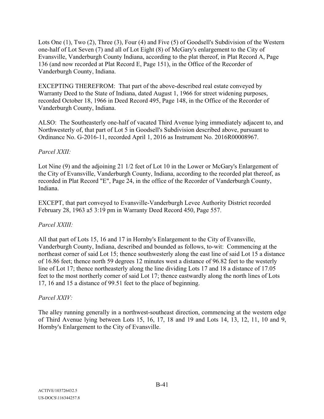
Lots One (1), Two (2), Three (3), Four (4) and Five (5) of Xxxxxxxx'x Subdivision of the Western one-half of Lot Seven (7) and all of Lot Eight (8) of XxXxxx'x enlargement to the City of Evansville, Vanderburgh County Indiana, according to the plat thereof, in Plat Record A, Page 136 (and now recorded at Plat Record E, Page 151), in the Office of the Recorder of Vanderburgh County, Indiana. EXCEPTING THEREFROM: That part of the above-described real estate conveyed by Warranty Deed to the State of Indiana, dated August 1, 1966 for street widening purposes, recorded October 18, 1966 in Deed Record 495, Page 148, in the Office of the Recorder of Vanderburgh County, Indiana. ALSO: The Southeasterly one-half of vacated Third Avenue lying immediately adjacent to, and Northwesterly of, that part of Lot 5 in Xxxxxxxx'x Subdivision described above, pursuant to Ordinance No. G-2016-11, recorded April 1, 2016 as Instrument No. 2016R00008967. Parcel XXII: Lot Nine (9) and the adjoining 21 1/2 feet of Lot 10 in the Lower or XxXxxx'x Enlargement of the City of Evansville, Vanderburgh County, Indiana, according to the recorded plat thereof, as recorded in Plat Record "E", Page 24, in the office of the Recorder of Vanderburgh County, Indiana. EXCEPT, that part conveyed to Evansville-Vanderburgh Levee Authority District recorded February 28, 1963 a5 3:19 pm in Warranty Deed Record 450, Page 557. Parcel XXIII: All that part of Lots 15, 16 and 17 in Hornby's Enlargement to the City of Evansville, Vanderburgh County, Indiana, described and bounded as follows, to-wit: Commencing at the northeast corner of said Lot 15; thence southwesterly along the east line of said Lot 15 a distance of 16.86 feet; thence north 59 degrees 12 minutes west a distance of 96.82 feet to the westerly line of Lot 17; thence northeasterly along the line dividing Lots 17 and 18 a distance of 17.05 feet to the most northerly corner of said Lot 17; thence eastwardly along the north lines of Lots 17, 16 and 15 a distance of 99.51 feet to the place of beginning. Parcel XXIV: The alley running generally in a northwest-southeast direction, commencing at the western edge of Third Avenue lying between Lots 15, 16, 17, 18 and 19 and Lots 14, 13, 12, 11, 10 and 9, Xxxxxx'x Enlargement to the City of Evansville. B-41 ACTIVE/103726432.5 US-DOCS\116344257.8
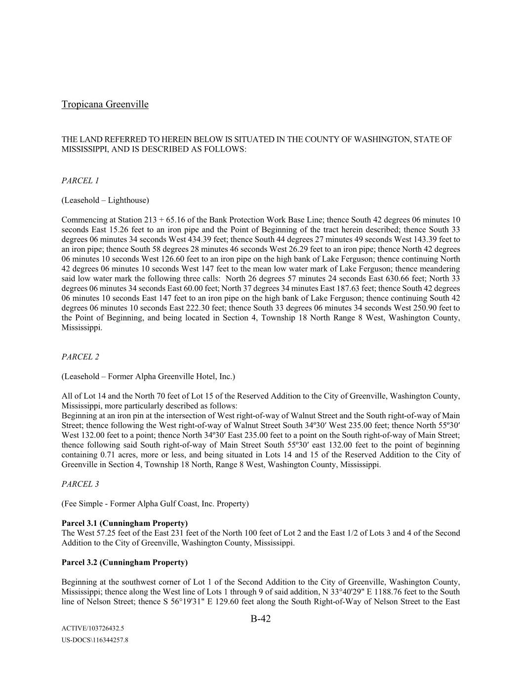
Tropicana Greenville THE LAND REFERRED TO HEREIN BELOW IS SITUATED IN THE COUNTY OF WASHINGTON, STATE OF MISSISSIPPI, AND IS DESCRIBED AS FOLLOWS: PARCEL 1 (Leasehold – Lighthouse) Commencing at Station 213 + 65.16 of the Bank Protection Work Base Line; thence South 42 degrees 06 minutes 10 seconds East 15.26 feet to an iron pipe and the Point of Beginning of the tract herein described; thence South 33 degrees 06 minutes 34 seconds West 434.39 feet; thence South 44 degrees 27 minutes 49 seconds West 143.39 feet to an iron pipe; thence South 58 degrees 28 minutes 46 seconds West 26.29 feet to an iron pipe; thence North 42 degrees 06 minutes 10 seconds West 126.60 feet to an iron pipe on the high bank of Lake Xxxxxxxx; thence continuing North 42 degrees 06 minutes 10 seconds West 147 feet to the mean low water mark of Lake Xxxxxxxx; thence meandering said low water mark the following three calls: North 26 degrees 57 minutes 24 seconds East 630.66 feet; North 33 degrees 06 minutes 34 seconds East 60.00 feet; North 37 degrees 34 minutes East 187.63 feet; thence South 42 degrees 06 minutes 10 seconds East 147 feet to an iron pipe on the high bank of Lake Xxxxxxxx; thence continuing South 42 degrees 06 minutes 10 seconds East 222.30 feet; thence South 33 degrees 06 minutes 34 seconds West 250.90 feet to the Point of Beginning, and being located in Section 4, Township 18 North Range 8 West, Washington County, Mississippi. PARCEL 2 (Leasehold – Former Alpha Greenville Hotel, Inc.) All of Lot 14 and the North 70 feet of Lot 15 of the Reserved Addition to the City of Greenville, Washington County, Mississippi, more particularly described as follows: Beginning at an iron pin at the intersection of West right-of-way of Walnut Street and the South right-of-way of Main Street; thence following the West right-of-way of Walnut Street South 34º30ʹ West 235.00 feet; thence North 55º30ʹ West 132.00 feet to a point; thence North 34º30ʹ East 235.00 feet to a point on the South right-of-way of Main Street; thence following said South right-of-way of Main Street South 55º30ʹ east 132.00 feet to the point of beginning containing 0.71 acres, more or less, and being situated in Lots 14 and 15 of the Reserved Addition to the City of Greenville in Section 4, Township 18 North, Range 8 West, Washington County, Mississippi. PARCEL 3 (Fee Simple - Former Alpha Gulf Coast, Inc. Property) Parcel 3.1 (Xxxxxxxxxx Property) The West 57.25 feet of the East 231 feet of the North 100 feet of Lot 2 and the East 1/2 of Lots 3 and 4 of the Second Addition to the City of Greenville, Washington County, Mississippi. Parcel 3.2 (Xxxxxxxxxx Property) Beginning at the southwest corner of Lot 1 of the Second Addition to the City of Greenville, Washington County, Mississippi; thence along the West line of Lots 1 through 9 of said addition, N 33°40'29" E 1188.76 feet to the South line of Xxxxxx Street; thence S 56°19'31" E 129.60 feet along the South Right-of-Way of Xxxxxx Street to the East B-42 ACTIVE/103726432.5 US-DOCS\116344257.8
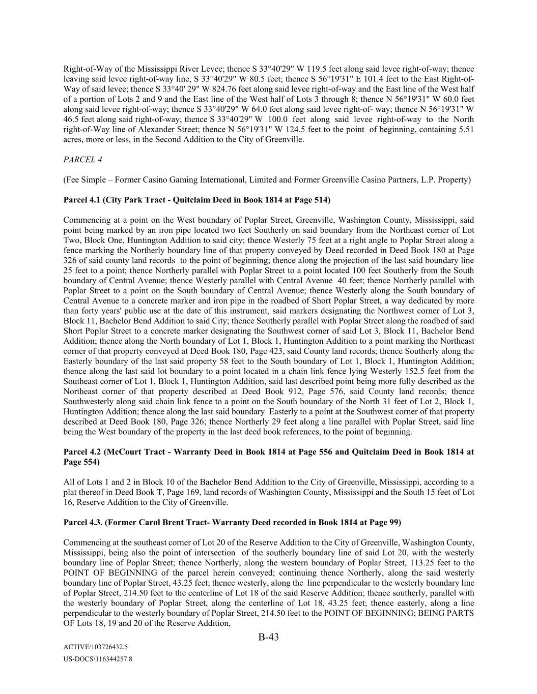
Right-of-Way of the Mississippi River Levee; thence S 33°40'29" W 119.5 feet along said levee right-of-way; thence leaving said levee right-of-way line, S 33°40'29" W 80.5 feet; thence S 56°19'31" E 101.4 feet to the East Right-of- Way of said xxxxx; thence S 33°40' 29" W 824.76 feet along said levee right-of-way and the East line of the West half of a portion of Lots 2 and 9 and the East line of the West half of Lots 3 through 8; thence N 56°19'31" W 60.0 feet along said levee right-of-way; thence S 33°40'29" W 64.0 feet along said levee right-of way; thence N 56°19'31" W 46.5 feet along said right-of-way; thence S 33°40'29" W 100.0 feet along said levee right-of-way to the North right-of-Way line of Alexander Street; thence N 56°19'31" W 124.5 feet to the point of beginning, containing 5.51 acres, more or less, in the Second Addition to the City of Greenville. PARCEL 4 (Fee Simple – Former Casino Gaming International, Limited and Former Greenville Casino Partners, L.P. Property) Parcel 4.1 (City Park Tract - Quitclaim Deed in Book 1814 at Page 514) Commencing at a point on the West boundary of Poplar Street, Greenville, Washington County, Mississippi, said point being marked by an iron pipe located two feet Southerly on said boundary from the Northeast corner of Lot Two, Block One, Huntington Addition to said city; thence Westerly 75 feet at a right angle to Poplar Street along a fence marking the Northerly boundary line of that property conveyed by Deed recorded in Deed Book 180 at Page 326 of said county land records to the point of beginning; thence along the projection of the last said boundary line 25 feet to a point; thence Northerly parallel with Poplar Street to a point located 100 feet Southerly from the South boundary of Central Avenue; thence Westerly parallel with Central Avenue 40 feet; thence Northerly parallel with Poplar Street to a point on the South boundary of Central Avenue; thence Westerly along the South boundary of Central Avenue to a concrete marker and iron pipe in the roadbed of Short Poplar Street, a way dedicated by more than forty years' public use at the date of this instrument, said markers designating the Northwest corner of Lot 3, Block 11, Bachelor Bend Addition to said City; thence Southerly parallel with Poplar Street along the roadbed of said Short Poplar Street to a concrete marker designating the Southwest corner of said Lot 3, Block 11, Bachelor Bend Addition; thence along the North boundary of Lot 1, Block 1, Huntington Addition to a point marking the Northeast corner of that property conveyed at Deed Book 180, Page 423, said County land records; thence Southerly along the Easterly boundary of the last said property 58 feet to the South boundary of Lot 1, Block 1, Huntington Addition; thence along the last said lot boundary to a point located in a chain link fence lying Westerly 152.5 feet from the Southeast corner of Lot 1, Block 1, Huntington Addition, said last described point being more fully described as the Northeast corner of that property described at Deed Book 912, Page 576, said County land records; thence Southwesterly along said chain link fence to a point on the South boundary of the North 31 feet of Lot 2, Block 1, Huntington Addition; thence along the last said boundary Easterly to a point at the Southwest corner of that property described at Deed Book 180, Page 326; thence Northerly 29 feet along a line parallel with Poplar Street, said line being the West boundary of the property in the last deed book references, to the point of beginning. Parcel 4.2 (XxXxxxx Tract - Warranty Deed in Book 1814 at Page 556 and Quitclaim Deed in Book 1814 at Page 554) All of Lots 1 and 2 in Block 10 of the Bachelor Bend Addition to the City of Greenville, Mississippi, according to a plat thereof in Deed Book T, Page 169, land records of Washington County, Mississippi and the South 15 feet of Lot 16, Reserve Addition to the City of Greenville. Parcel 4.3. (Former Xxxxx Xxxxx Tract- Warranty Deed recorded in Book 1814 at Page 99) Commencing at the southeast corner of Lot 20 of the Reserve Addition to the City of Greenville, Washington County, Mississippi, being also the point of intersection of the southerly boundary line of said Lot 20, with the westerly boundary line of Poplar Street; thence Northerly, along the western boundary of Poplar Street, 113.25 feet to the POINT OF BEGINNING of the parcel herein conveyed; continuing thence Northerly, along the said westerly boundary line of Poplar Street, 43.25 feet; thence westerly, along the line perpendicular to the westerly boundary line of Poplar Street, 214.50 feet to the centerline of Lot 18 of the said Reserve Addition; thence southerly, parallel with the westerly boundary of Poplar Street, along the centerline of Lot 18, 43.25 feet; thence easterly, along a line perpendicular to the westerly boundary of Poplar Street, 214.50 feet to the POINT OF BEGINNING; BEING PARTS OF Lots 18, 19 and 20 of the Reserve Addition, B-43 ACTIVE/103726432.5 US-DOCS\116344257.8
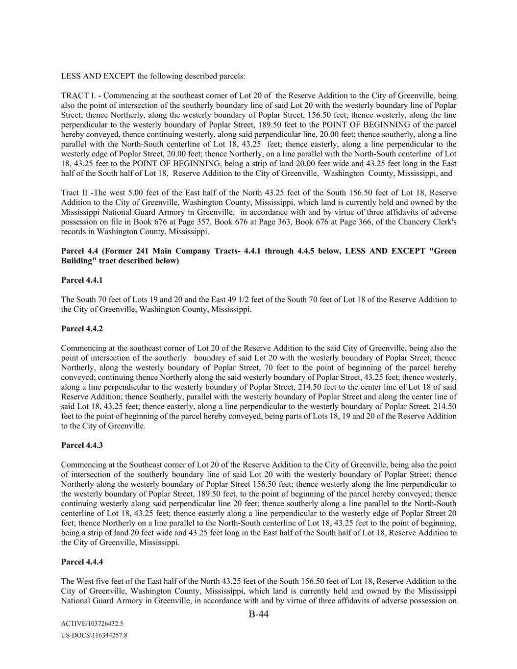
LESS AND EXCEPT the following described parcels: TRACT I. - Commencing at the southeast corner of Lot 20 of the Reserve Addition to the City of Greenville, being also the point of intersection of the southerly boundary line of said Lot 20 with the westerly boundary line of Poplar Street; thence Northerly, along the westerly boundary of Poplar Street, 156.50 feet; thence westerly, along the line perpendicular to the westerly boundary of Poplar Street, 189.50 feet to the POINT OF BEGINNING of the parcel hereby conveyed, thence continuing westerly, along said perpendicular line, 20.00 feet; thence southerly, along a line parallel with the North-South centerline of Lot 18, 43.25 feet; thence easterly, along a line perpendicular to the westerly edge of Poplar Street, 20.00 feet; thence Northerly, on a line parallel with the North-South centerline of Lot 18, 43.25 feet to the POINT OF BEGINNING, being a strip of land 20.00 feet wide and 43.25 feet long in the East half of the South half of Lot 18, Reserve Addition to the City of Greenville, Washington County, Mississippi, and Tract II -The west 5.00 feet of the East half of the North 43.25 feet of the South 156.50 feet of Lot 18, Reserve Addition to the City of Greenville, Washington County, Mississippi, which land is currently held and owned by the Mississippi National Guard Armory in Greenville, in accordance with and by virtue of three affidavits of adverse possession on file in Book 676 at Page 357, Book 676 at Page 363, Book 676 at Page 366, of the Chancery Clerk's records in Washington County, Mississippi. Parcel 4.4 (Former 241 Main Company Tracts- 4.4.1 through 4.4.5 below, LESS AND EXCEPT "Green Building" tract described below) Parcel 4.4.1 The South 70 feet of Lots 19 and 20 and the East 49 1/2 feet of the South 70 feet of Lot 18 of the Reserve Addition to the City of Greenville, Washington County, Mississippi. Parcel 4.4.2 Commencing at the southeast corner of Lot 20 of the Reserve Addition to the said City of Greenville, being also the point of intersection of the southerly boundary of said Lot 20 with the westerly boundary of Poplar Street; thence Northerly, along the westerly boundary of Poplar Street, 70 feet to the point of beginning of the parcel hereby conveyed; continuing thence Northerly along the said westerly boundary of Poplar Street, 43.25 feet; thence westerly, along a line perpendicular to the westerly boundary of Poplar Street, 214.50 feet to the center line of Lot 18 of said Reserve Addition; thence Southerly, parallel with the westerly boundary of Poplar Street and along the center line of said Lot 18, 43.25 feet; thence easterly, along a line perpendicular to the westerly boundary of Poplar Street, 214.50 feet to the point of beginning of the parcel hereby conveyed, being parts of Lots 18, 19 and 20 of the Reserve Addition to the City of Greenville. Parcel 4.4.3 Commencing at the Southeast corner of Lot 20 of the Reserve Addition to the City of Greenville, being also the point of intersection of the southerly boundary line of said Lot 20 with the westerly boundary of Poplar Street; thence Northerly along the westerly boundary of Poplar Street 156.50 feet; thence westerly along the line perpendicular to the westerly boundary of Poplar Street, 189.50 feet, to the point of beginning of the parcel hereby conveyed; thence continuing westerly along said perpendicular line 20 feet; thence southerly along a line parallel to the North-South centerline of Lot 18, 43.25 feet; thence easterly along a line perpendicular to the westerly edge of Poplar Street 20 feet; thence Northerly on a line parallel to the North-South centerline of Lot 18, 43.25 feet to the point of beginning, being a strip of land 20 feet wide and 43.25 feet long in the East half of the South half of Lot 18, Reserve Addition to the City of Greenville, Mississippi. Parcel 4.4.4 The West five feet of the East half of the North 43.25 feet of the South 156.50 feet of Lot 18, Reserve Addition to the City of Greenville, Washington County, Mississippi, which land is currently held and owned by the Mississippi National Guard Armory in Greenville, in accordance with and by virtue of three affidavits of adverse possession on B-44 ACTIVE/103726432.5 US-DOCS\116344257.8
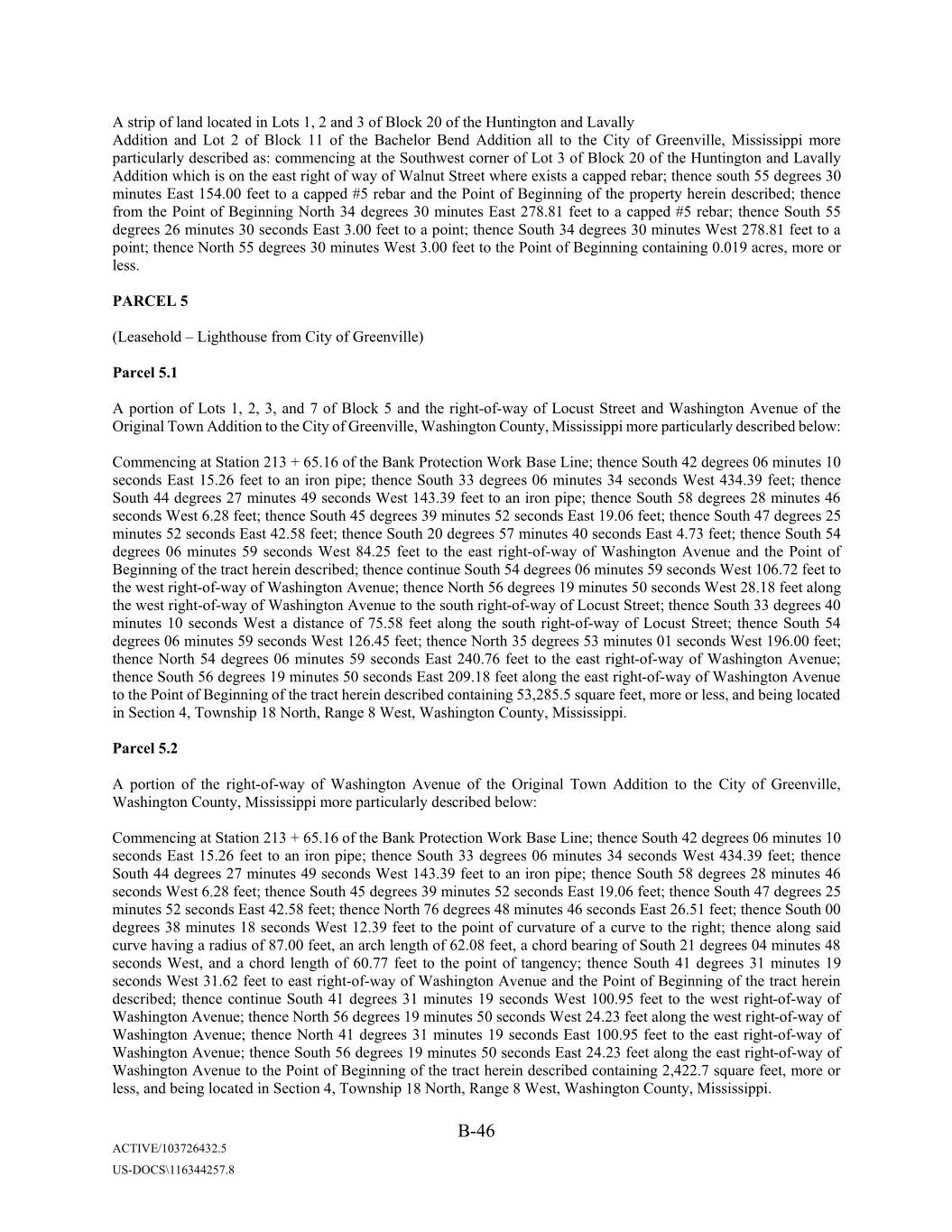
A strip of land located in Lots 1, 2 and 3 of Block 20 of the Huntington and Lavally Addition and Lot 2 of Block 11 of the Bachelor Bend Addition all to the City of Greenville, Mississippi more particularly described as: commencing at the Southwest corner of Lot 3 of Block 20 of the Huntington and Lavally Addition which is on the east right of way of Walnut Street where exists a capped rebar; thence south 55 degrees 30 minutes East 154.00 feet to a capped #5 rebar and the Point of Beginning of the property herein described; thence from the Point of Beginning North 34 degrees 30 minutes East 278.81 feet to a capped #5 rebar; thence South 55 degrees 26 minutes 30 seconds East 3.00 feet to a point; thence South 34 degrees 30 minutes West 278.81 feet to a point; thence North 55 degrees 30 minutes West 3.00 feet to the Point of Beginning containing 0.019 acres, more or less. PARCEL 5 (Leasehold – Lighthouse from City of Greenville) Parcel 5.1 A portion of Lots 1, 2, 3, and 7 of Block 5 and the right-of-way of Locust Street and Washington Avenue of the Original Town Addition to the City of Greenville, Washington County, Mississippi more particularly described below: Commencing at Station 213 + 65.16 of the Bank Protection Work Base Line; thence South 42 degrees 06 minutes 10 seconds East 15.26 feet to an iron pipe; thence South 33 degrees 06 minutes 34 seconds West 434.39 feet; thence South 44 degrees 27 minutes 49 seconds West 143.39 feet to an iron pipe; thence South 58 degrees 28 minutes 46 seconds West 6.28 feet; thence South 45 degrees 39 minutes 52 seconds East 19.06 feet; thence South 47 degrees 25 minutes 52 seconds East 42.58 feet; thence South 20 degrees 57 minutes 40 seconds East 4.73 feet; thence South 54 degrees 06 minutes 59 seconds West 84.25 feet to the east right-of-way of Washington Avenue and the Point of Beginning of the tract herein described; thence continue South 54 degrees 06 minutes 59 seconds West 106.72 feet to the west right-of-way of Washington Avenue; thence North 56 degrees 19 minutes 50 seconds West 28.18 feet along the west right-of-way of Washington Avenue to the south right-of-way of Locust Street; thence South 33 degrees 40 minutes 10 seconds West a distance of 75.58 feet along the south right-of-way of Locust Street; thence South 54 degrees 06 minutes 59 seconds West 126.45 feet; thence North 35 degrees 53 minutes 01 seconds West 196.00 feet; thence North 54 degrees 06 minutes 59 seconds East 240.76 feet to the east right-of-way of Washington Avenue; thence South 56 degrees 19 minutes 50 seconds East 209.18 feet along the east right-of-way of Washington Avenue to the Point of Beginning of the tract herein described containing 53,285.5 square feet, more or less, and being located in Section 4, Township 18 North, Range 0 Xxxx, Xxxxxxxxxx Xxxxxx, Xxxxxxxxxxx. Parcel 5.2 A portion of the right-of-way of Washington Avenue of the Original Town Addition to the City of Greenville, Washington County, Mississippi more particularly described below: Commencing at Station 213 + 65.16 of the Bank Protection Work Base Line; thence South 42 degrees 06 minutes 10 seconds East 15.26 feet to an iron pipe; thence South 33 degrees 06 minutes 34 seconds West 434.39 feet; thence South 44 degrees 27 minutes 49 seconds West 143.39 feet to an iron pipe; thence South 58 degrees 28 minutes 46 seconds West 6.28 feet; thence South 45 degrees 39 minutes 52 seconds East 19.06 feet; thence South 47 degrees 25 minutes 52 seconds East 42.58 feet; thence North 76 degrees 48 minutes 46 seconds East 26.51 feet; thence South 00 degrees 38 minutes 18 seconds West 12.39 feet to the point of curvature of a curve to the right; thence along said curve having a radius of 87.00 feet, an arch length of 62.08 feet, a chord bearing of South 21 degrees 04 minutes 48 seconds West, and a chord length of 60.77 feet to the point of tangency; thence South 41 degrees 31 minutes 19 seconds West 31.62 feet to east right-of-way of Washington Avenue and the Point of Beginning of the tract herein described; thence continue South 41 degrees 31 minutes 19 seconds West 100.95 feet to the west right-of-way of Washington Avenue; thence North 56 degrees 19 minutes 50 seconds West 24.23 feet along the west right-of-way of Washington Avenue; thence North 41 degrees 31 minutes 19 seconds East 100.95 feet to the east right-of-way of Washington Avenue; thence South 56 degrees 19 minutes 50 seconds East 24.23 feet along the east right-of-way of Washington Avenue to the Point of Beginning of the tract herein described containing 2,422.7 square feet, more or less, and being located in Section 4, Township 18 North, Range 8 West, Washington County, Mississippi. B-46 ACTIVE/103726432.5 US-DOCS\116344257.8
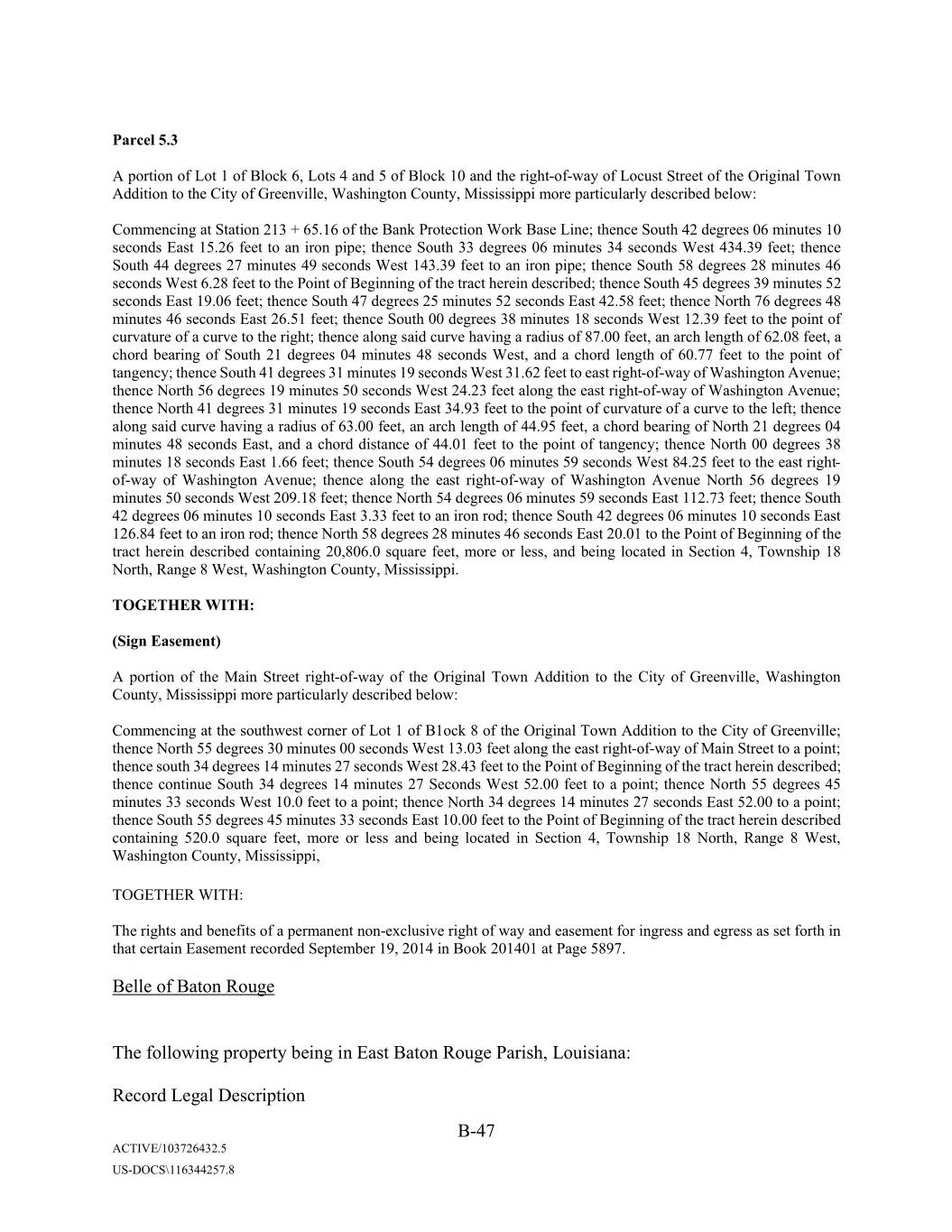
Parcel 5.3 A portion of Lot 1 of Block 6, Lots 4 and 5 of Block 10 and the right-of-way of Locust Street of the Original Town Addition to the City of Greenville, Washington County, Mississippi more particularly described below: Commencing at Station 213 + 65.16 of the Bank Protection Work Base Line; thence South 42 degrees 06 minutes 10 seconds East 15.26 feet to an iron pipe; thence South 33 degrees 06 minutes 34 seconds West 434.39 feet; thence South 44 degrees 27 minutes 49 seconds West 143.39 feet to an iron pipe; thence South 58 degrees 28 minutes 46 seconds West 6.28 feet to the Point of Beginning of the tract herein described; thence South 45 degrees 39 minutes 52 seconds East 19.06 feet; thence South 47 degrees 25 minutes 52 seconds East 42.58 feet; thence North 76 degrees 48 minutes 46 seconds East 26.51 feet; thence South 00 degrees 38 minutes 18 seconds West 12.39 feet to the point of curvature of a curve to the right; thence along said curve having a radius of 87.00 feet, an arch length of 62.08 feet, a chord bearing of South 21 degrees 04 minutes 48 seconds West, and a chord length of 60.77 feet to the point of tangency; thence South 41 degrees 31 minutes 19 seconds West 31.62 feet to east right-of-way of Washington Avenue; thence North 56 degrees 19 minutes 50 seconds West 24.23 feet along the east right-of-way of Washington Avenue; thence North 41 degrees 31 minutes 19 seconds East 34.93 feet to the point of curvature of a curve to the left; thence along said curve having a radius of 63.00 feet, an arch length of 44.95 feet, a chord bearing of North 21 degrees 04 minutes 48 seconds East, and a chord distance of 44.01 feet to the point of tangency; thence North 00 degrees 38 minutes 18 seconds East 1.66 feet; thence South 54 degrees 06 minutes 59 seconds West 84.25 feet to the east right- of-way of Washington Avenue; thence along the east right-of-way of Washington Avenue North 56 degrees 19 minutes 50 seconds West 209.18 feet; thence North 54 degrees 06 minutes 59 seconds East 112.73 feet; thence South 42 degrees 06 minutes 10 seconds East 3.33 feet to an iron rod; thence South 42 degrees 06 minutes 10 seconds East 126.84 feet to an iron rod; thence North 58 degrees 28 minutes 46 seconds East 20.01 to the Point of Beginning of the tract herein described containing 20,806.0 square feet, more or less, and being located in Section 4, Township 18 North, Range 0 Xxxx, Xxxxxxxxxx Xxxxxx, Xxxxxxxxxxx. TOGETHER WITH: (Sign Easement) A portion of the Main Street right-of-way of the Original Town Addition to the City of Greenville, Washington County, Mississippi more particularly described below: Commencing at the southwest corner of Lot 1 of B1ock 8 of the Original Town Addition to the City of Greenville; thence North 55 degrees 30 minutes 00 seconds West 13.03 feet along the east right-of-way of Main Street to a point; thence south 34 degrees 14 minutes 27 seconds West 28.43 feet to the Point of Beginning of the tract herein described; thence continue South 34 degrees 14 minutes 27 Seconds West 52.00 feet to a point; thence North 55 degrees 45 minutes 33 seconds West 10.0 feet to a point; thence North 34 degrees 14 minutes 27 seconds East 52.00 to a point; thence South 55 degrees 45 minutes 33 seconds East 10.00 feet to the Point of Beginning of the tract herein described containing 520.0 square feet, more or less and being located in Section 4, Township 18 North, Range 8 West, Washington County, Mississippi, TOGETHER WITH: The rights and benefits of a permanent non-exclusive right of way and easement for ingress and egress as set forth in that certain Easement recorded September 19, 2014 in Book 201401 at Page 5897. Belle of Baton Rouge The following property being in East Baton Rouge Parish, Louisiana: Record Legal Description B-47 ACTIVE/103726432.5 US-DOCS\116344257.8
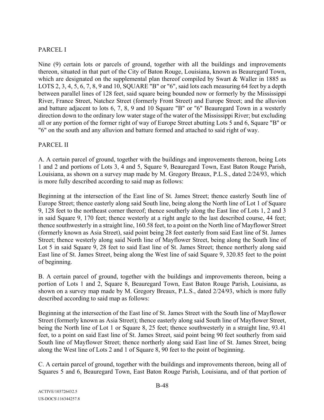
PARCEL I Nine (9) certain lots or parcels of ground, together with all the buildings and improvements thereon, situated in that part of the City of Baton Rouge, Louisiana, known as Xxxxxxxxxx Town, which are designated on the supplemental plan thereof compiled by Xxxxx & Xxxxxx in 1885 as LOTS 2, 3, 4, 5, 6, 7, 8, 9 and 10, SQUARE "B" or "6", said lots each measuring 64 feet by a depth between parallel lines of 128 feet, said square being bounded now or formerly by the Mississippi River, France Street, Natchez Street (formerly Front Street) and Europe Street; and the alluvion and batture adjacent to lots 6, 7, 8, 9 and 10 Square "B" or "6" Xxxxxxxxxx Town in a westerly direction down to the ordinary low water stage of the water of the Mississippi River; but excluding all or any portion of the former right of way of Europe Street abutting Lots 5 and 6, Square "B" or "6" on the south and any alluvion and batture formed and attached to said right of way. PARCEL II A. A certain parcel of ground, together with the buildings and improvements thereon, being Lots 1 and 2 and portions of Lots 3, 4 and 5, Square 9, Xxxxxxxxxx Town, East Baton Rouge Parish, Louisiana, as shown on a survey map made by X. Xxxxxxx Xxxxxx, P.L.S., dated 2/24/93, which is more fully described according to said map as follows: Beginning at the intersection of the East line of St. Xxxxx Street; thence easterly South line of Europe Street; thence easterly along said South line, being along the North line of Lot 1 of Square 9, 128 feet to the northeast corner thereof; thence southerly along the East line of Lots 1, 2 and 3 in said Square 9, 170 feet; thence westerly at a right angle to the last described course, 44 feet; thence southwesterly in a straight line, 160.58 feet, to a point on the North line of Mayflower Street (formerly known as Asia Street), said point being 28 feet easterly from said East line of St. Xxxxx Street; thence westerly along said North line of Mayflower Street, being along the South line of Lot 5 in said Square 9, 28 feet to said East line of St. Xxxxx Street; thence northerly along said East line of St. Xxxxx Street, being along the West line of said Square 9, 320.85 feet to the point of beginning. B. A certain parcel of ground, together with the buildings and improvements thereon, being a portion of Lots 1 and 2, Square 8, Xxxxxxxxxx Town, East Baton Rouge Parish, Louisiana, as shown on a survey map made by X. Xxxxxxx Xxxxxx, P.L.S., dated 2/24/93, which is more fully described according to said map as follows: Beginning at the intersection of the East line of St. Xxxxx Street with the South line of Mayflower Street (formerly known as Asia Street); thence easterly along said South line of Mayflower Street, being the North line of Lot 1 or Square 8, 25 feet; thence southwesterly in a straight line, 93.41 feet, to a point on said East line of St. Xxxxx Street, said point being 90 feet southerly from said South line of Mayflower Street; thence northerly along said East line of St. Xxxxx Street, being along the West line of Lots 2 and 1 of Square 8, 90 feet to the point of beginning. C. A certain parcel of ground, together with the buildings and improvements thereon, being all of Squares 5 and 6, Xxxxxxxxxx Town, East Baton Rouge Parish, Louisiana, and of that portion of B-48 ACTIVE/103726432.5 US-DOCS\116344257.8
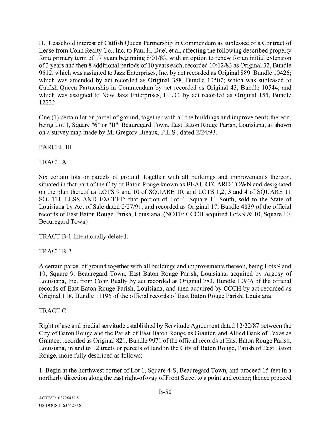
X. Xxxxxxxxx interest of Catfish Queen Partnership in Commendam as sublessee of a Contract of Lease from Conn Realty Co., Inc. to Xxxx X. Due', et al, affecting the following described property for a primary term of 17 years beginning 8/01/83, with an option to renew for an initial extension of 3 years and then 8 additional periods of 10 years each, recorded 10/12/83 as Original 32, Bundle 9612; which was assigned to Jazz Enterprises, Inc. by act recorded as Original 889, Bundle 10426; which was amended by act recorded as Original 388, Bundle 10507; which was subleased to Catfish Queen Partnership in Commendam by act recorded as Original 43, Bundle 10544; and which was assigned to New Jazz Enterprises, L.L.C. by act recorded as Original 155, Bundle 12222. One (1) certain lot or parcel of ground, together with all the buildings and improvements thereon, being Lot 1, Square "6" or "B", Xxxxxxxxxx Town, East Baton Rouge Parish, Louisiana, as shown on a survey map made by X. Xxxxxxx Xxxxxx, P.L.S., dated 2/24/93. PARCEL III TRACT A Six certain lots or parcels of ground, together with all buildings and improvements thereon, situated in that part of the City of Baton Rouge known as XXXXXXXXXX TOWN and designated on the plan thereof as LOTS 9 and 10 of SQUARE 10, and LOTS 1,2, 3 and 4 of SQUARE 11 SOUTH. LESS AND EXCEPT: that portion of Lot 4, Square 11 South, sold to the State of Louisiana by Act of Sale dated 2/27/91, and recorded as Original 17, Bundle 4839 of the official records of East Baton Rouge Parish, Louisiana. (NOTE: CCCH acquired Lots 9 & 10, Square 10, Xxxxxxxxxx Town) TRACT B-1 Intentionally deleted. TRACT B-2 A certain parcel of ground together with all buildings and improvements thereon, being Lots 9 and 00, Xxxxxx 0, Xxxxxxxxxx Xxxx, Xxxx Xxxxx Xxxxx Xxxxxx, Xxxxxxxxx, acquired by Argosy of Louisiana, Inc. from Xxxx Realty by act recorded as Original 783, Bundle 10946 of the official records of East Baton Rouge Parish, Louisiana, and then acquired by CCCH by act recorded as Original 118, Bundle 11196 of the official records of East Baton Rouge Parish, Louisiana. TRACT C Right of use and predial servitude established by Servitude Agreement dated 12/22/87 between the City of Baton Rouge and the Parish of East Baton Rouge as Grantor, and Allied Bank of Texas as Grantee, recorded as Original 821, Bundle 9971 of the official records of East Baton Rouge Parish, Louisiana, in and to 12 tracts or parcels of land in the City of Baton Rouge, Parish of East Baton Rouge, more fully described as follows: 1. Begin at the northwest corner of Lot 1, Square 4-S, Xxxxxxxxxx Town, and proceed 15 feet in a northerly direction along the east right-of-way of Front Street to a point and corner; thence proceed B-50 ACTIVE/103726432.5 US-DOCS\116344257.8
in an easterly direction a distance of 128 feet parallel to the north property lines of Lots 1 and 2, Square 4-S, Xxxxxxxxxx Town, to the right-of-way of St. Xxxxx Street projected, for point and corner; thence proceed in a southerly direction 15 feet to the northeast corner of Lot 2, Square 4- S, Xxxxxxxxxx Town for point and corner; thence proceed in a westerly direction along the north property lines of Lots 2 and 1, Square 4-S, a distance of 128 feet to the point of beginning. 2. Begin at the northwest corner of Lot 1, Square 11-S, Xxxxxxxxxx Town, and proceed in a northerly direction along the East right-of-way line of St. Xxxxx Street, projected, a distance of 6 feet to a point and corner; thence proceeding an easterly direction a distance of 238 feet along a line parallel to the north property lines of Lots 1, 2, 3 and 4, Square 11-S, Xxxxxxxxxx Town, to a point which is 6 feet north of the north property line of Lot 4, Square 11-S, Xxxxxxxxxx Town; thence proceed 6 feet in a southeasterly direction to a point which is 6.68 feet west of the northeast corner of Lot 4; thence proceed in a westerly direction along the north property lines of Lot 4, a distance of 249.32 feet to the point of beginning. 3. Begin at the southwest corner of Lot 1, Square 11-S, Xxxxxxxxxx Town, and proceed 15 feet in a southerly direction along the right-of-way of St. Xxxxx Street to a point and corner; thence proceed 256 feet in an easterly direction along a line parallel to the south property lines of Lots 1, 2, 3 and 4, Square 11-S, Xxxxxxxxxx Town, to the right of-way line of St. Xxxxxx Street for a point and corner; thence proceed in a northerly direction along the west right-of-way line of St. Xxxxxx Street a distance of 15 feet to the southeast corner of Lot 4, Square 11-S, Xxxxxxxxxx Town, for point and corner; thence proceed in a westerly direction along the south property lines of Lots 1, 2, 3 and 4, Square 11-S, a distance of 256 feet to the point of beginning. 4. Begin at the southwest corner of Lot 1, Square 4-S, Xxxxxxxxxx Town, and proceed 15 feet in a southerly direction along the right-of-way line of Front Street to a point and corner; thence proceed 128 feet in an easterly direction along a line parallel to the south property lines of Lots 1 and 2, Square 4-S, Xxxxxxxxxx Town, to the right-of-way line of St. Xxxxx Street for point and corner; thence proceed in a northerly direction a distance of 15 feet to the southeast corner of Lot 2, Square 4-S, Xxxxxxxxxx Town, for point and corner; thence proceed in a westerly direction along the south property lines of Lots 1 and 2, Square 4-S, Xxxxxxxxxx Town to the point of beginning. 5. Begin at the northwest corner of Lot 1, Square 10, Xxxxxxxxxx Town, and proceed 8/10 of one foot in a westerly direction along the right-of-way of France Street to a point and corner; thence proceed in a southerly direction a distance of 128 feet along a line parallel to the west property lines of Lots 1 and 2, Square 10, Xxxxxxxxxx Town, to a point and corner; thence proceed in an easterly direction 8/10 of one foot to the southwest corner of Lot 2, Square 10, Xxxxxxxxxx Town; thence proceed in a northerly direction 128 feet along the west property lines of Lots 1 and 2, Square 10, Xxxxxxxxxx Town to the point of beginning. 6. Begin at the southeast corner of Lot 2, Square 4-S, Xxxxxxxxxx Town, and proceed in a southerly direction along the extension of the right-of-way of St. Xxxxx Street a distance of 15 feet to a point and corner; thence proceed in an easterly direction a distance of 53 1/3 feet to a point and corner; thence proceed in a northerly direction a distance of 15 feet to the southwest corner of Lot 1, Square 11-S, Xxxxxxxxxx Town, for 112.67 feet along the east right-of-way of St. Xxxxx Street, projected, to a point and corner; thence proceed in a westerly direction a distance of 53 1/3 feet B-51 ACTIVE/103726432.5 US-DOCS\116344257.8
parallel to the south right-of-way of Old Government Street to a point and corner; thence proceed in a southerly direction along the west right-of-way of St. Xxxxx Street, projected, a distance of 112.67 feet, to the point of beginning. 7. All of St. Xxxxx Street bounded on the North by South right-of-way of France Street, on the south by the North right-of-way of South Boulevard, on the East by Square 8, Square 9 and Square 10 of Xxxxxxxxxx Town and Mayflower and Europe Streets, and on the West by Square 5, Square 6 and Square 7 of Xxxxxxxxxx Town and Mayflower, and the western (revoked) portion of Europe Street. 8. All of Europe Street from the East right of way line of St. Xxxxx Street to the West right-of-way line of St. Xxxxxxx Street. (NOTE: Portion of Europe Street servitude between Lot 6, Square 10 and Lot 10, Square 9 was acquired by CCCH) 9. Mayflower (formerly Asia) Street from the East right-of-way line of Front Street to the West right-of-way line of St. Xxxxx Street. 10. Mayflower (formerly Asia) Street, from the intersection of the East right-of-way line of St. Xxxxx Street and the South line of Mayflower Street, for the point of beginning; thence easterly along the South right-of-way line of Mayflower Street for a distance of 25 feet; thence in a northerly direction a distance of 53.41 feet to the North right-of-way line of Mayflower Street, for point and corner; thence in a westerly direction along the North right-of-way line of Mayflower Street 28 feet to point and corner, being the intersection of the East right-of-way line of St. Xxxxx Street and Mayflower Street; thence in a southerly direction a distance of 53.33 feet to the point of beginning. 11. The eastern 33.3 feet of Front or Natchez Street, bounded on the South by the North right-of- way line of South Boulevard and on the North by a line beginning 38.33 feet North of the intersection of the South right-of-way line of France Street and East right-of-way of Front or Natchez Street and extending in a westerly direction into the right-of-way of Front or Natchez Street a distance of 33.3 feet, and bounded on the East by Squares 5, 6, and 7 and Mayflower and France Streets, and on the West by the western 20 feet of Front or Natchez Street. 12. The south 38.33 feet of France Street, from the East right-of-way line of Front or Natchez Street to the West right-of-way line of St. Xxxxxx Street, and being bounded on the South by Lot 1 of Square 5 and Lots 1 and 10 of Square 10 of Xxxxxxxxxx Town, and on the North by the northern 15 feet of France Street; it being understood that this servitude as to France Street and Front or Natchez Street shall be subject to the condition that the said affected area of France Street and of Front or Natchez Street shall remain open to the public for pedestrian and vehicular traffic. The above rights of use and predial servitudes run in favor of the remaining lands described in Parcel III and the lands described in Parcel II above. PARCEL IV B-52 ACTIVE/103726432.5 US-DOCS\116344257.8
copy of which is attached to the act recorded as Original 57, Bundle 544 of the official records of East Baton Rouge Parish, Louisiana, said lots showing such measurements and dimensions as shown on the aforesaid map, together with all the buildings and improvements thereon; and A certain lot or parcel of ground, together with buildings and improvements thereon, situated in that subdivision of East Baton Rouge Parish, Louisiana, known as COMMERCIAL PLACE, and being designated as LOT 8 according to a plan of said subdivision, dated 11/14/25, laid out for X. X. Xxxxxxx by X. X. Xxxxxxxxx, C.E. and Surveyor, on file in the office of the Clerk and Recorder of East Baton Rouge Parish, said lot measuring according to said plan 61.49 feet front along the east side of River Road and having a depth between parallel lines of 210.4 feet along its northern boundary and of 192.8 feet along its southern boundary, extending through to a railroad spur in the rear. PARCEL IX INTENTIONALLY DELETED PROPERTY SOLD BY ACT RECORDED AS ORIGINAL 202, BUNDLE 12518. PARCEL X Leasehold interest of Catfish Queen Partnership in Commendam in Lease of Air Space dated 6/29/94 between the City of Baton Rouge and the Parish of East Baton Rouge as Lessor, and Catfish Queen Partnership in Commendam as Lessee, affecting the following described property for a primary term of 25 years commencing on the date as provided therein with an option to renew for another 25 years as provided therein, which was recorded on 7/01/94 as Original 248, Bundle 10522 of the official records of East Baton Rouge Parish, Louisiana, affecting the following: A certain portion of air space, hereinafter described and being immediately contiguous and adjacent to Lots 1 and 2, Square 6 or , and Lots 1 and 2, Square 5 of Xxxxxxxxxx Town Subdivision, extending between said squares, and more particularly described as follows: Commencing in a horizontal plane above Front Street, at an elevation of 55.25 feet above N.G.V.D. (determined by reference to City Paris Benchmark, located at the south concrete pier supporting the steel truss under the east bound lane of the Interstate Highway 10 Bridge over the Mississippi River, having an elevation of 35.20 feet above N.G.V.D.) and extending upward for a distance of 26.75 feet to an elevation of 82.00 feet above N.G.V.D., and being bounded on the north by a line 60.75 feet south of the south right of way line of France Street and on the south by a line 99.75 feet south of the right-of-way line of France Street. PARCEL XI Leasehold interest of Catfish Queen Partnership in Commendam under a Lease Agreement dated 8/15/12 between Front Street, L.L.C. as Lessor and Catfish Queen Partnership in Commendam as Xxxxxx, as evidenced by that certain Notice of Lease recorded as Original 102, Bundle 12437 of the official records of East Baton Rouge Parish, affecting the following described property: Lots 1 through 10, Square 3, and Lots 1 through 12, Square 4, Xxxxxxxxxx Town, East Baton Rouge Parish, Louisiana, according to the X. Xxxxx official map of Baton Rouge, dated 1910, together B-54 ACTIVE/103726432.5 US-DOCS\116344257.8
with all of Lessor's ownership and rights in and to the portions of those areas designated as Europe Street and Asia Street located between Square 6, 3 and/or 4, Xxxxxxxxxx Town, East Baton Rouge Parish, Louisiana. PARCEL XII INTENTIONALLY DELETED Said property is also described as follows (Surveyed Legal Description) The following property being in East Baton Rouge Parish, Louisiana: PARCEL I Commencing at the intersection of the southernmost right-of-way for France Street and the westernmost right-of-way for Front Street; thence, in a southerly direction along said westernmost right-of-way for Front Street, South 1 degree 52 minutes 02 seconds East, a distance of 64.00 feet to the southeast corner of Lot 1, Square 6 or B, Xxxxxxxxxx Town Subdivision and the Point-of- Beginning; thence, continuing in a southerly direction along said westernmost right-of-way for Front Street, South 1 degree 52 minutes 02 seconds East, a distance of 256.03 feet to the former northernmost right-of-way for Europe Street; thence, in a westerly direction along said former northernmost right-of-way for Europe Street, South 88 degrees 19 minutes 15 seconds West, a distance of 256.00 feet to the westernmost boundary of Square 6 or B, Xxxxxxxxxx Town Subdivision; thence, in a northerly direction along said westernmost boundary of said Square 6 or B, North 1 degree 52 minutes 02 seconds West, a distance of 319.97 feet to the southernmost right- of-way for France Street; thence, in an easterly direction along said southernmost right-of-way for France Street, North 88 degrees 18 minutes 34 seconds East, a distance of 128.00 feet to the westernmost boundary of said Lot 1; thence, in a southerly direction along said westernmost boundary of Lot 1, South 1 degree 52 minutes 02 seconds East, a distance of 64.00 feet to the southernmost boundary of said Lot 1; thence, in an easterly direction along said southernmost boundary of Lot 1, North 88 degrees 18 minutes 34 seconds East, a distance of 128.00 feet to the Point-of-Beginning; encompassing an area of 1.692 acres (73,727 square feet); additionally including the Alluvion and Batture adjacent to Lots 6, 7, 8, 9 and 10 of Square 6 or B, Xxxxxxxxxx Town Subdivision and extending to the ordinary low water line of the Mississippi River; and all as more fully described on the Plat of Survey by Xxxxxxx Xxxxxxxxx, P.E., P.L.S. dated XX June 2018. PARCEL II (2A) Commencing and Point-of-Beginning at the intersection of the southernmost right-of-way for Europe Street and the easternmost right-of-way for Saint Xxxxx Street; thence, in an easterly direction along said southernmost right-of- way for Europe Street, North 88 degrees 17 minutes 23 seconds East, a distance of 128.00 feet to the westernmost boundary of Lot 10, Square 9, Xxxxxxxxxx Town Subdivision; thence, in a southerly direction along said westernmost boundary of Lot 10 and continuing as the westernmost boundary of Lot 9 and a portion of Lot 8, South 1 degree 52 minutes 02 seconds East, a distance of 170.00 feet to a half-inch diameter iron rod; thence, in a westerly direction, South 88 degrees 17 minutes 23 seconds West, a distance of 44.00 feet; thence, in a southerly direction, South 18 degrees 31 minutes 41 seconds West, a distance of B-55 ACTIVE/103726432.5 US-DOCS\116344257.8
160.69 feet to the northernmost right-of-way for Mayflower Street; thence, in a westerly direction along said northernmost right-of-way for Mayflower Street, South 88 degrees 07 minutes 30 seconds West, a distance of 28.00 feet to the easternmost right-of-way for Saint Xxxxx Street; thence, in a northerly direction along said easternmost right-of-way for Saint Xxxxx Street, North 1 degree 52 minutes 02 seconds West, a distance of 320.85 feet to the Point-of-Beginning; encompassing an area of 0.693 acres (30,204 square feet); and all as more fully described on the Plat of Survey by Xxxxxxx Xxxxxxxxx, P.E., P.L.S. dated XX June 2018. PARCEL II (2B) Commencing and Point-of-Beginning at the intersection of the southernmost right-of-way for Mayflower Street and the easternmost right-of-way for Saint Xxxxx Street; thence, in an easterly direction along said southernmost right-of-way for Mayflower Street, North 88 degrees 17 minutes 30 seconds East, a distance of 25.00 feet to a half-inch diameter iron rod; thence, in a southerly direction, South 13 degrees 39 minutes 32 seconds West, a distance of 93.41 feet to the easternmost right-of-way for Saint Xxxxx Street; thence, in a northerly direction along said easternmost right- of-way for Saint Xxxxx Street, North 1 degree 52 minutes 02 seconds West, a distance of 90.00 feet to the Point-of-Beginning; encompassing an area of 0.026 acres (1,125 square feet); and all as more fully described on the Plat of Survey by Xxxxxxx Xxxxxxxxx, P.E., P.L.S. dated XX June 2018. PARCEL II (2C) Commencing and Point-of-Beginning at the intersection of the southernmost right-of-way for France Street and the easternmost right-of-way for Front Street; thence, in an easterly direction along said southernmost right-of- way for France Street, North 88 degrees 20 minutes 10 seconds East, a distance of 128.00 feet to the westernmost right-of-way for Saint Xxxxx Street; thence, in a southerly direction along said westernmost right-of-way for Saint Xxxxx Street, South 1 degree 52 minutes 02 seconds East, a distance of 694.46 feet to the northernmost right-of-way for Mayflower Street; thence, in a westerly direction along said northernmost right-of-way for Mayflower Street, South 88 degrees 07 minutes 30 seconds West, a distance of 128.00 feet to the easternmost right- of-way for Front Street; thence, in a northerly direction along said easternmost right-of-way for Front Street, North 1 degrees 52 minutes 02 seconds West, a distance of 694.93 feet to the Point- of-Beginning; encompassing an area of 2.041 acres (88,921 square feet); and all as more fully described on the Plat of Survey by Xxxxxxx Xxxxxxxxx, P.E., P.L.S. dated XX June 2018. PARCEL II (2D) Commencing and Point-of-Beginning at the intersection of the southernmost right-of-way for Mayflower Street and the easternmost right-of-way for Front Street; thence, in an easterly direction along said southernmost right-of- way for Mayflower Street, North 88 degrees 07 minutes 30 seconds East, a distance of 128.00 feet to the westernmost right-of-way for Saint Xxxxx Street; thence, in a southerly direction along said westernmost right-of-way for Saint Xxxxx Street, South 1 degree 52 minutes 02 seconds East, a distance of 319.76 feet to the northernmost right-of-way for South Boulevard; thence, in a westerly direction along said northernmost right-of-way for South Boulevard, South 88 degrees 13 minutes 26 seconds West, a distance of 128.00 feet to the easternmost right-of-way for Front Street; thence, in a northerly direction along said easternmost right-of-way for Front Street, North 1 degrees 52 minutes 02 seconds West, a distance of 319.54 feet to the Point-of-Beginning; encompassing an area of 0.939 acres (40,915 square feet); and all B-56 ACTIVE/103726432.5 US-DOCS\116344257.8
as more fully described on the Plat of Survey by Xxxxxxx Xxxxxxxxx, P.E., P.L.S. dated XX June 2018. PARCEL II (2E) Commencing and Point-of-Beginning at the intersection of the southernmost right-of-way for France Street and the easternmost right-of-way for Saint Xxxxx Street; thence, in an easterly direction along said southernmost right-of-way for France Street, North 88 degrees 20 minutes 10 seconds East, a distance of 128.00 feet to the westernmost boundary of Lot 10, Square 10, Xxxxxxxxxx Town Subdivision; thence, in a southerly direction along said westernmost boundary of Lot 10 and continuing as the westernmost boundary of Lot 9, Square 10, Xxxxxxxxxx Town Subdivision, South 1 degrees 52 minutes 02 seconds West, a distance of 128.02 feet to the northernmost boundary of Lot 3, Square 10, Xxxxxxxxxx Town subdivision; thence, in a westerly direction along said northernmost boundary of Lot 3, South 88 degrees 20 minutes 10 seconds West, a distance of 128.00 feet to the easternmost right-of-way for Saint Xxxxx Street; thence, in a northerly direction along said easternmost right-of-way for Saint Xxxxx Street, North 1 degrees 52 minutes 02 seconds West, a distance of 128.02 feet to the Point-of-Beginning; encompassing an area of 0.376 acres (16,386 square feet); and all as more fully described on the Plat of Survey by Xxxxxxx Xxxxxxxxx, P.E., P.L.S. dated XX June 2018. PARCEL II (2F) Commencing and Point-of-Beginning at the intersection of the northernmost right-of-way for Europe Street and the westernmost right-of-way for Saint Xxxxxxx Street; thence, in a westerly direction along said northernmost right-of-way for Europe Street, South 88 degrees 17 minutes 23 seconds West, a distance of 128.00 feet to the easternmost boundary of Lot 5, Square 10, Xxxxxxxxxx Town Subdivision; thence, in a northerly direction along said easternmost boundary of said Lot 5 and continuing as the easternmost boundary of Lots 4 and 3, Square 10, Xxxxxxxxxx Town Subdivision, North 1 degree 52 minutes 02 seconds West, a distance of 192.13 feet to the southernmost boundary of Lot 9, Square 10, Xxxxxxxxxx Town Subdivision; thence, in an easterly direction along said southernmost boundary of Lot 9, North 88 degrees 19 minutes 37 seconds East, a distance of 128.00 feet to the westernmost right-of-way for Saint Xxxxxxx Street; thence, in a southerly direction along said westernmost boundary of Saint Xxxxxxx Street, South 1 degree 52 minutes 02 seconds East, a distance of 192.05 feet to the Point-of-Beginning; encompassing an area of 0.564 acres (24,587 square feet); and all as more fully described on the Plat of Survey by Xxxxxxx Xxxxxxxxx, P.E., P.L.S. dated XX June 2018. PARCEL II (2H) Commencing and Point-of-Beginning at the intersection of the southernmost right-of-way for France Street and the westernmost right-of-way for Front Street; thence, in a southerly direction along said westernmost right-of-way for Front Street, South 1 degrees 52 minutes 02 seconds East, a distance of 64.00 feet to the northernmost boundary of Lot 2, Square 6 or X. Xxxxxxxxxx Town Subdivision; thence, in a westerly direction along said northernmost boundary of Lot 2, South 88 degrees 18 minutes 34 seconds West, a distance of 128.00 feet to the easternmost boundary of Lot 10, Square 6 or B, Xxxxxxxxxx Town subdivision; thence, in a northerly direction along said easternmost boundary of Lot 10, North 1 degree 52 minutes 02 seconds West, a distance of 64.00 feet to the southernmost right-of-way for France Street; thence, in an easterly direction along said southernmost right-of-way for France Street, North 88 degrees 18 minutes 34 seconds East, a B-57 ACTIVE/103726432.5 US-DOCS\116344257.8
distance of 128.00 feet to the Point-of-Beginning; encompassing an area of 0.188 acres (8,192 square feet); and all as more fully described on the Plat of Survey by Xxxxxxx Xxxxxxxxx, P.E., P.L.S. dated XX June 2018. PARCEL III, TRACT A SQUARE 11: Commencing and Point-of-Beginning at the intersection of the northernmost right-of-way for France Street and the westernmost right-of-way for Saint Xxxxxxx Street; thence in a westerly direction along said northernmost right-of-way for France Street, South 88 degrees 20 minutes 10 seconds West, a distance of 256.03 feet to the easternmost right-of-way for Saint Xxxxx Street; thence, in a northerly direction along said easternmost right-of-way for Saint Xxxxx Street, North 1 degrees 52 minutes 02 seconds West, a distance of 106.66 feet to the southernmost right-of-way for Government Street; thence, in an easterly direction along said southernmost right-of-way for Government Street, North 88 degrees 20 minutes 10 seconds East, a distance of 249.31 feet to the westernmost right-of-way for Saint Xxxxxxx Street; thence in a southerly direction along said westernmost right-of-way for Saint Xxxxxxx Street following a curved line having a radius of 70.00 feet and the radius center to the west, a distance of 13.03 feet, that same line having the chord bearing of South 32 degrees 57 minutes 01 seconds East and a chord length of 13.01 feet; thence, continuing in a southerly direction along said westernmost right-of-way for Saint Xxxxxxx Street, South 1 degree 52 minutes 02 seconds East, a distance of 95.54 feet to the Point-of-Beginning; encompassing an area of 0.626 acres (27,273 square feet); and all as more fully described on the Plat of Survey by Xxxxxxx Xxxxxxxxx, P.E., P.L.S. dated XX June 2018. SQUARE 10: Commencing and Point-of-Beginning at the intersection of the southernmost right-of-way for France Street and the westernmost right-of-way for Saint Xxxxxxx Street; thence, in a southerly direction along said westernmost right-of-way for Saint Xxxxxxx Street, South 1 degree 52 minutes 02 seconds East, a distance of 128.00 feet to the northernmost boundary of Lot 8, Square 10, Xxxxxxxxxx Town Subdivision; thence, in a westerly direction along said northernmost boundary of Lot 8, South 88 degrees 19 minutes 37 seconds West, a distance of 128.00 feet to the easternmost boundary of Lot 2, Square 10, Xxxxxxxxxx Town Subdivision; thence, in a northerly direction along said easternmost boundary of Lot 2 and continuing as the easternmost boundary of Lot 1, Square 10, Xxxxxxxxxx Town Subdivision, North 1 degree 52 minutes 02 seconds West, a distance of 128.02 feet to the southernmost right-of-way for France Street; thence, in an easterly direction along said southernmost right-of-way for France Street, North 88 degrees 20 minutes 10 seconds East, a distance of 128.00 feet to the Point-of-Beginning; encompassing an area of 0.376 acres (16,385 square feet); and all as more fully described on the Plat of Survey by Xxxxxxx Xxxxxxxxx, P.E., P.L.S. dated XX June 2018. PARCEL III, TRACT B-2 Commencing and Point-of-Beginning at the intersection of the southernmost right-of-way for Europe Street and the westernmost right-of-way for Saint Xxxxxxx Street; thence, in a southerly direction along said westernmost right-of-way for Saint Xxxxxxx Street, South 1 degree 52 minutes 02 seconds East, a distance of 128.00 feet to the northernmost boundary of Lot 8, Square 9, Xxxxxxxxxx Town subdivision; thence, in a westerly direction along said northernmost boundary of Lot 8, South 88 degrees 17 minutes 23 seconds West, a distance of 128.00 feet to the easternmost boundary of Lot 2, Square 9, Xxxxxxxxxx Town Subdivision; thence, in a northerly direction along B-58 ACTIVE/103726432.5 US-DOCS\116344257.8
said easternmost boundary of Lot 2 and continuing as the easternmost boundary of Lot 1, Square 9, Xxxxxxxxxx Town Subdivision, North 1 degree 52 minutes 02 seconds West, a distance of 128.00 feet to the southernmost right-of-way for Europe Street; thence, in an easterly direction along said southernmost right-of-way for Europe Street, North 88 degrees 17 minutes 23 seconds East, a distance of 128.00 feet to the Point-of-Beginning; encompassing an area of 0.376 acres (16,383 square feet); and all as more fully described on the Plat of Survey by Xxxxxxx Xxxxxxxxx, P.E., P.L.S. dated XX June 2018. PARCEL III, TRACT C Right of use and predial servitude and all rights set forth therein established by Servitude Agreement dated 12/22/87 between the City of Baton Rouge and the Parish of East Baton Rouge as Grantor, and Allied Bank of Texas as Grantee, recorded as Original 821, Bundle 9971 of the official records of East Baton Rouge Parish, Louisiana, in and to 12 tracts or parcels of land in the City of Baton Rouge, Parish of East Baton Rouge, more fully described as follows: 1. Begin at the northwest corner of Lot 1, Square 4-S, Xxxxxxxxxx Town, and proceed 15 feet in a northerly direction along the east right-of-way of Front Street to a point and corner; thence proceed in an easterly direction a distance of 128 feet parallel to the north property lines of Lots 1 and 2, Square 4-S, Xxxxxxxxxx Town, to the right-of-way of St. Xxxxx Street projected, for point and corner; thence proceed in a southerly direction 15 feet to the northeast corner of Lot 2, Square 4- S, Xxxxxxxxxx Town for point and corner; thence proceed in a westerly direction along the north property lines of Lots 2 and 1, Square 4-S, a distance of 128 feet to the point of beginning. 2. Begin at the northwest corner of Lot 1, Square 11-S, Xxxxxxxxxx Town, and proceed in a northerly direction along the East right-of-way line of St. Xxxxx Street, projected, a distance of 6 feet to a point and corner; thence proceeding an easterly direction a distance of 238 feet along a line parallel to the north property lines of Lots 1, 2, 3 and 4, Square 11-S, Xxxxxxxxxx Town, to a point which is 6 feet north of the north property line of Lot 4, Square 11-S, Xxxxxxxxxx Town; thence proceed 6 feet in a southeasterly direction to a point which is 6.68 feet west of the northeast corner of Lot 4; thence proceed in a westerly direction along the north property lines of Lot 4, a distance of 249.32 feet to the point of beginning. 3. Begin at the southwest corner of Lot 1, Square 11-S, Xxxxxxxxxx Town, and proceed 15 feet in a southerly direction along the right-of-way of St. Xxxxx Street to a point and corner; thence proceed 256 feet in an easterly direction along a line parallel to the south property lines of Lots 1, 2, 3 and 4, Square 11-S, Xxxxxxxxxx Town, to the right of-way line of St. Xxxxxx Street for a point and corner; thence proceed in a northerly direction along the west right-of-way line of St. Xxxxxx Street a distance of 15 feet to the southeast corner of Lot 4, Square 11-S, Xxxxxxxxxx Town, for point and corner; thence proceed in a westerly direction along the south property lines of Lots 1, 2, 3 and 4, Square 11-S, a distance of 256 feet to the point of beginning. 4. Begin at the southwest corner of Lot 1, Square 4-S, Xxxxxxxxxx Town, and proceed 15 feet in a southerly direction along the right-of-way line of Front Street to a point and corner; thence proceed 128 feet in an easterly direction along a line parallel to the south property lines of Lots 1 and 2, Square 4-S, Xxxxxxxxxx Town, to the right-of-way line of St. Xxxxx Street for point and corner; B-59 ACTIVE/103726432.5 US-DOCS\116344257.8
thence proceed in a northerly direction a distance of 15 feet to the southeast corner of Lot 2, Square 4-S, Xxxxxxxxxx Town, for point and corner; thence proceed in a westerly direction along the south property lines of Lots 1 and 2, Square 4-S, Xxxxxxxxxx Town to the point of beginning. 5. Begin at the northwest corner of Lot 1, Square 10, Xxxxxxxxxx Town, and proceed 8/10 of one foot in a westerly direction along the right-of-way of France Street to a point and corner; thence proceed in a southerly direction a distance of 128 feet along a line parallel to the west property lines of Lots 1 and 2, Square 10, Xxxxxxxxxx Town, to a point and corner; thence proceed in an easterly direction 8/10 of one foot to the southwest corner of Lot 2, Square 10, Xxxxxxxxxx Town; thence proceed in a northerly direction 128 feet along the west property lines of Lots 1 and 2, Square 10, Xxxxxxxxxx Town to the point of beginning. 6. Begin at the southeast corner of Lot 2, Square 4-S, Xxxxxxxxxx Town, and proceed in a southerly direction along the extension of the right-of-way of St. Xxxxx Street a distance of 15 feet to a point and corner; thence proceed in an easterly direction a distance of 53 1/3 feet to a point and corner; thence proceed in a northerly direction a distance of 15 feet to the southwest corner of Lot 1, Square 11-S, Xxxxxxxxxx Town, for 112.67 feet along the east right-of-way of St. Xxxxx Street, projected, to a point and corner; thence proceed in a westerly direction a distance of 53 1/3 feet parallel to the south right-of-way of Old Government Street to a point and corner; thence proceed in a southerly direction along the west right-of-way of St. Xxxxx Street, projected, a distance of 112.67 feet, to the point of beginning. 7. All of St. Xxxxx Street bounded on the North by South right-of-way of France Street, on the south by the North right-of-way of South Boulevard, on the East by Square 8, Square 9 and Square 10 of Xxxxxxxxxx Town and Mayflower and Europe Streets, and on the West by Square 5, Square 6 and Square 7 of Xxxxxxxxxx Town and Mayflower, and the western (revoked) portion of Europe Street. 8. All of Europe Street from the East right of way line of St. Xxxxx Street to the West right-of-way line of St. Xxxxxxx Street. (NOTE: Portion of Europe Street servitude between Lot 6, Square 10 and Lot 10, Square 9 was acquired by CCCH) 9. Mayflower (formerly Asia) Street from the East right-of-way line of Front Street to the West right-of-way line of St. Xxxxx Street. 10. Mayflower (formerly Asia) Street, from the intersection of the East right-of-way line of St. Xxxxx Street and the South line of Mayflower Street, for the point of beginning; thence easterly along the South right-of-way line of Mayflower Street for a distance of 25 feet; thence in a northerly direction a distance of 53.41 feet to the North right-of-way line of Mayflower Street, for point and corner; thence in a westerly direction along the North right-of-way line of Mayflower Street 28 feet to point and corner, being the intersection of the East right-of-way line of St. Xxxxx Street and Mayflower Street; thence in a southerly direction a distance of 53.33 feet to the point of beginning. 11. The eastern 33.3 feet of Front or Natchez Street, bounded on the South by the North right-of- way line of South Boulevard and on the North by a line beginning 38.33 feet North of the B-60 ACTIVE/103726432.5 US-DOCS\116344257.8
intersection of the South right-of-way line of France Street and East right-of-way of Front or Natchez Street and extending in a westerly direction into the right-of-way of Front or Natchez Street a distance of 33.3 feet, and bounded on the East by Squares 5, 6, and 7 and Mayflower and France Streets, and on the West by the western 20 feet of Front or Natchez Street. 12. The south 38.33 feet of France Street, from the East right-of-way line of Front or Natchez Street to the West right-of-way line of St. Xxxxxx Street, and being bounded on the South by Lot 1 of Square 5 and Lots 1 and 10 of Square 10 of Xxxxxxxxxx Town, and on the North by the northern 15 feet of France Street; it being understood that this servitude as to France Street and Front or Natchez Street shall be subject to the condition that the said affected area of France Street and of Front or Natchez Street shall remain open to the public for pedestrian and vehicular traffic. The above rights of use and predial servitudes run in favor of the remaining lands described in Parcel III and the lands described in Parcel II above. PARCEL IV (4A) Commencing and Point-of-Beginning at the intersection of the northernmost right-of-way for Mayflower Street and the westernmost right-of-way for Saint Louis Street; thence, in a westerly direction along said northernmost right-of-way for Mayflower Street, South 88 degrees 07 minutes 30 seconds West, a distance of 128.00 feet to the easternmost boundary of Lot 5, Square 20, Xxxxxxxxxx Town Subdivision; thence, in a northerly direction along said easternmost boundary of Lot 5, North 1 degree 52 minutes 30 seconds West, a distance of 64.00 feet to the southernmost boundary of Lot 7, Square 20, Xxxxxxxxxx Town Subdivision; thence, in an easterly direction along said southernmost boundary of Lot 7, North 88 degrees 07 minutes 30 seconds East, a distance of 128.00 feet to the westernmost right-of-way for Saint Louis Street; thence, in a southerly direction along said westernmost right-of-way for Saint Louis Street, South 1 degree 52 minutes 30 seconds East, a distance of 64.00 feet to the Point-of-Beginning; encompassing an area of 0.188 acres (8,192 square feet); and all as more fully described on the Plat of Survey by Xxxxxxx Xxxxxxxxx, P.E., P.L.S. dated XX June 2018. PARCEL IV (4B) Commencing at the intersection of the northernmost right-of-way for Mayflower Street and the westernmost right-of-way for Saint Louis Street; thence, in a northerly direction along said westernmost right-of-way for Saint Louis Street, North 1 degree 52 minutes 30 seconds West, a distance of 64.00 feet to the northernmost boundary of Lot 6, Square 20, Xxxxxxxxxx Town Subdivision and the Point-of-Beginning; thence, in a westerly direction along said northernmost boundary of Lot 6, South 88 degrees 07 minutes 30 seconds West, a distance of 128.00 feet to the easternmost boundary of Lot 4, Square 20, Xxxxxxxxxx Town Subdivision; thence, in a northerly direction along said easternmost boundary of Lot 4, North 1 degree 52 minutes 30 seconds West, a distance of 64.00 feet to the southernmost boundary of Lot 8, Square 20, Xxxxxxxxxx Town Subdivision; thence, in an easterly direction along said southernmost boundary of Lot 8, North 88 degrees 7 minutes 30 seconds East, a distance of 128.00 feet to the westernmost right-of-way for Saint Louis Street; thence, in a southerly direction along said westernmost right-of-way for Saint Louis Street, South 1 degree 52 minutes 30 seconds East, a distance of 64.00 feet to the Point-of- Beginning; encompassing an area of 0.188 acres (8,192 square feet); and all as more fully described on the Plat of Survey by Xxxxxxx Xxxxxxxxx, P.E., P.L.S. dated XX June 2018. B-61 ACTIVE/103726432.5 US-DOCS\116344257.8
PARCEL V Commencing and Point-of-Beginning at the intersection of the southernmost right-of-way for South Boulevard and the easternmost right-of-way for Front Street; thence, in an easterly direction along said southernmost right-of-way for South boulevard, North 88 degrees 13 minutes 26 seconds East, a distance of 51.00 feet; thence, in a southerly direction, South 1 degree 46 minutes 34 seconds East, a distance of 51.00 feet; thence, in a westerly direction, South 88 degrees 13 minutes 26 seconds West, a distance of 51.00 feet to the easternmost right-of-way for Front Street; thence, in a northerly direction along said easternmost right-of-way for Front Street, North 1 degree 46 minutes 34 seconds West, a distance of 51.00 feet to the Point-of-Beginning; encompassing an area of 0.060 acres (2,601 square feet); less than and except that portion of the described property subject to a servitude for Interstate Route No. I-10, as previously granted by the former Illinois Central Railroad company in favor of the Louisiana Department of Highways by document dated 1/31/64; and all as more fully described on the Plat of Survey by Xxxxxxx Xxxxxxxxx, P.E., P.L.S. dated XX June 2018. PARCEL VI (6A) Commencing and Point-of-Beginning at the intersection of the southernmost right-of-way for South Boulevard and the westernmost right-of-way for Highland Road; thence, in a southerly direction along said westernmost right-of-way for Highland Road, South 2 degrees 06 minutes 25 seconds East, a distance of 103.17 feet to the northernmost right-of-way for Interstate Highway Number 10 (I-10); thence, in a westerly direction along said northernmost right-of-way for I-10, South 89 degrees 24 minutes 52 seconds West, a distance of 170.02 feet; thence, in a northerly direction, North 2 degrees 06 minutes 25 seconds West, a distance of 14.10 feet to the southernmost right-of-way for the I-10 approach ramp; thence, in a northerly direction along said right-of-way for I-10 following a curved line having a radius of 497.75 feet and the radius center to the north, a distance of 57.83 feet, that same line having a chord bearing of North 54 degrees 43 minutes 29 seconds East and a chord length of 57.80 feet; thence, continuing along a curved line having a radius of 357.75 feet and a radius center to the north, a distance of 78.14 feet, that same line having a chord bearing of North 45 degrees 08 minutes 29 seconds East and a chord length of 77.98 feet to the southernmost right-of-way for South Boulevard; thence, in an easterly direction along said southernmost right-of-way for the South Boulevard, North 87 degrees 53 minutes 35 seconds East, a distance of 64.36 feet to the Point-of-Beginning; encompassing an area of 0.279 acres (12,170 square feet); and all as more fully described on the Plat of Survey by Xxxxxxx Xxxxxxxxx, P.E., P.L.S. dated XX June 2018. PARCEL VI (6B) Commencing and Point-of-Beginning at the intersection of the southernmost right-of-way for Interstate Highway Number 10 (I-10); and the westernmost right-of-way for Highland Road; thence, in a southerly direction along said westernmost right-of-way for Highland Road, South 2 degrees 04 minutes 04 seconds East, a distance of 69.00 feet; thence, in a westerly direction, South 88 degrees 06 minutes 56 seconds West, a distance of 125.00 feet; thence, in a northerly direction, North 2 degrees 04 minutes 04 seconds West, a distance of 68.60 feet to southernmost right-of- way for Interstate Highway Number 10 (I-10); thence, in an easterly direction along said southernmost right-of-way for I-10, North 87 degrees 55 minutes 56 seconds East, a distance of 125.00 feet to the Point-of-Beginning; encompassing an area of 0.197 acres (8,600 square feet); B-62 ACTIVE/103726432.5 US-DOCS\116344257.8
and all as more fully described on the Plat of Survey by Xxxxxxx Xxxxxxxxx, P.E., P.L.S. dated XX June 2018. PARCEL VIII (8-A EAST) Commencing and Point-of-Beginning at the intersection of the southernmost boundary of Lot 14, Commercial Place Subdivision and the westernmost right-of-way for Emma Street; thence, in a westerly direction along said southernmost boundary of Lot 14, South 87 degrees 31 minutes 00 seconds West, a distance of 139.06 feet to the easternmost boundary of an abandoned railroad right-of-way; thence, in a northerly direction along said easternmost boundary of an abandoned railroad right-of-way, North 4 degrees 42 minutes 00 seconds East, a distance of 51.68 feet; thence, continuing in a northerly direction along said easternmost boundary of an abandoned railroad right- of-way, North 12 degrees 07 minutes 28 seconds East, a distance of 51.54 feet; thence, continuing in a northerly direction along said easternmost boundary of an abandoned railroad right-of-way, North17 degrees 28 minutes 45 seconds East, a distance of 53.01 feet; thence, continuing in a northerly direction along said easternmost boundary of an abandoned railroad right-of-way, North 21 degrees 50 minutes 06 seconds East, a distance of 54.63 feet; thence, continuing in a northerly direction along said easternmost boundary of an abandoned railroad right-of-way, North 28 degrees 57 minutes 45 seconds East, a distance of 58.27 feet; thence, continuing in a northerly direction along said easternmost boundary of an abandoned railroad right-of-way, North 25 degrees 53 minutes 55 seconds East, a distance of 56.54 feet; thence, continuing in a northerly direction along said easternmost boundary of an abandoned railroad right-of-way, North 25 degrees 02 minutes 06 seconds East, a distance of 56.10 feet to the westernmost right-of-way for Emma Street; thence, in a southerly direction along said westernmost right-of-way for Emma Street, South 1 degree 47 minutes 44 seconds East, a distance of 350.00 feet to the Point-of- Beginning; encompassing an area of 0.673 acres (29,345 square feet); and all as more fully described on the Plat of Survey by Xxxxxxx Xxxxxxxxx, P.E., P.L.S. dated XX June 2018. PARCEL VIII (8-A WEST) Commencing at the intersection of the northernmost boundary of Lot 8, Commercial Place Subdivision and the westernmost right-of-way for Emma Street; thence, in a southerly direction along the westernmost boundary of an abandoned railroad right-of-way, South 23 degrees 44 minutes 48 seconds West, a distance of 66.59 feet to the southernmost boundary of said Lot 8 and the Point-of-Beginning; thence, continuing along said westernmost boundary of an abandoned railroad right-of-way, South 28 degrees 00 minutes 15 seconds West, a distance of 57.70 feet; thence, continuing along said westernmost boundary of an abandoned railroad right-of-way, South 28 degrees 49 minutes 37 seconds West, a distance of 58.19 feet; thence, continuing along said westernmost boundary of an abandoned railroad right-of-way, South 27 degrees 12 minutes 29 seconds West, a distance of 57.25 feet; thence, continuing along said westernmost boundary of an abandoned railroad right-of-way, South 21 degrees 41 minutes 53 seconds West, a distance of 54.58 feet; thence, continuing along said westernmost boundary of an abandoned railroad right- of-way, South 16 degrees 12 minutes 10 seconds West, a distance of 53.99 feet to the northernmost boundary of Lot 2, Commerce Place Subdivision; thence, in a westerly direction along said northernmost boundary of Lot 2, South 87 degrees 53 minutes 55 seconds West, a distance of 114.76 feet to the easternmost right-of-way for River Road; thence, in a northerly direction along said easternmost right-of-way for River Road, North 8 degrees 39 minutes 06 seconds East, a distance of 256.00 feet to the southernmost boundary of said Lot 8; thence, in an easterly direction B-63 ACTIVE/103726432.5 US-DOCS\116344257.8
along said southernmost boundary of Lot 8, North 88 degrees 03 minutes 52 seconds East, a distance of 192.85 feet to the Point-of-Beginning; encompassing an area of 0.849 acres (37,000 square feet); and all as more fully described on the Plat of Survey by Xxxxxxx Xxxxxxxxx, P.E., P.L.S. dated XX June 2018. PARCEL VIII (8B) Commencing and Point-of-Beginning at the intersection of the northernmost boundary of Lot 7, Commercial Place Subdivision and the easternmost right-of-way for River Road; thence, in a northerly direction along said easternmost right-of-way for River Road, North 8 degrees 39 minutes 06 seconds East, a distance of 61.22 feet; thence, in an easterly direction, North 88 degrees 06 minutes 40 seconds East, a distance of 210.46 feet to the westernmost right-of-way for Emma Street at the westernmost boundary of an abandoned railroad right-of-way; thence, in a southerly direction along said westernmost boundary of an abandoned railroad right-of-way, South 23 degrees 44 minutes 48 seconds West, a distance of 66.59 feet to the said northernmost boundary of Lot 7; thence, in a westerly direction along said northernmost boundary of Lot 7, South 88 degrees 03 minutes 52 seconds West, a distance of 192.85 feet to the Point-of-Beginning; encompassing an area of 0.278 acres (12,120 square feet); and all as more fully described on the Plat of Survey by Xxxxxxx Xxxxxxxxx, P.E., P.L.S. dated XX June 2018. PARCEL X Leasehold interest of Catfish Queen Partnership in Commendam in Lease of Air Space dated 6/29/94 between the City of Baton Rouge and the Parish of East Baton Rouge as Lessor, and Catfish Queen Partnership in Commendam as Lessee, affecting the following described property for a primary term of 25 years commencing on the date as provided therein with an option to renew for another 25 years as provided therein, which was recorded on 7/01/94 as Original 248, Bundle 10522 of the official records of East Baton Rouge Parish, Louisiana, affecting the following: A certain portion of air space, hereinafter described and being immediately contiguous and adjacent to Lots 1 and 2, Square 6 or , and Lots 1 and 2, Square 5 of Xxxxxxxxxx Town Subdivision, extending between said squares, and more particularly described as follows: Commencing in a horizontal plane above Front Street, at an elevation of 55.25 feet above N.G.V.D. (determined by reference to City Paris Benchmark, located at the south concrete pier supporting the steel truss under the east bound lane of the Interstate Highway 10 Bridge over the Mississippi River, having an elevation of 35.20 feet above N.G.V.D.) and extending upward for a distance of 26.75 feet to an elevation of 82.00 feet above N.G.V.D., and being bounded on the north by a line 60.75 feet south of the south right of way line of France Street and on the south by a line 99.75 feet south of the right-of-way line of France Street. PARCEL XI Commencing and Point-of-Beginning at the intersection of the northernmost right-of-way for South boulevard and the westernmost right-of-way for Front Street; thence, in a westerly direction along said northernmost right-of-way for South Boulevard, South 88 degrees 19 minutes 15 seconds West, a distance of 320.00 feet to the westernmost boundary of Square 4, Xxxxxxxxxx Town Subdivision; thence, in a northerly direction along said westernmost boundary of said Square 4, North 1 degree 52 minutes 02 seconds West, a distance of 321.33 feet to the northernmost boundary of Square 4; thence, in an easterly direction along said northernmost boundary of Square B-64 ACTIVE/103726432.5 US-DOCS\116344257.8
4, North 88 degrees 19 minutes 15 seconds East, a distance of 64.00 feet to the westernmost boundary of the former Mayflower Street right-of-way; thence, in a northerly direction along said westernmost boundary of the former Mayflower Street right-of-way, continuing as the westernmost boundary of Square 3, Xxxxxxxxxx Town Subdivision and the westernmost boundary of the former Europe Street right-of-way, North 1 degrees 52 minutes 02 seconds West, a distance of 424.90 feet to the southernmost boundary of Square 6 or B, Xxxxxxxxxx Town Subdivision; thence, in an easterly direction along said southernmost boundary of Square 6 or B, North 88 degrees 19 minutes 15 seconds East, a distance of 256.00 feet to the westernmost right-of-way for Front Street; thence, in a southerly direction along said westernmost boundary of Front Street, South 1 degree 52 minutes 02 seconds East, a distance of 746.23 feet to the Point-of-Beginning; encompassing an area of 4.858 acres (211,600 square feet); and all as more fully described on the Plat of Survey by Xxxxxxx Xxxxxxxxx, P.E., P.L.S. dated XX June 2018. Tropicana Xxxxxxxx Parcel 1A: (APN: 264-13-301-003) That portion of the South Half (S ½) of Section 13,Township 32 South, Range 66 East M.D.M., described as follows: Lot Two (2) as shown by map thereof on file in File 53 of Parcel Maps, Page 53 in the Office of the County Recorder, Xxxxx County, Nevada. Excepting therefrom that portion lying within the boundaries of that certain parcel described in Quitclaim Deed to Xxxxx County for roadway and public improvements recorded August 20, 1992 in Book 920820 as Document No. 00522, Official Records. Said parcel being also described as follows: Commencing at the Northwest corner (NW) of the Southwest Quarter (SW ¼) of said Section 13; Thence South 89°59’42” East, along the North line of the South Half (S ½) of said Section 13, a distance of 297.82 feet; Thence South 01°35’03” West, a distance of 800.08 feet to the Point of Beginning; Thence South 01°35’01” West, a distance of 799.78 feet; Thence South 89°59’51” East, a distance of 1561.32 feet to a point on the Westerly right-of-way line of Casino Drive, said point being a point on a curve concave Westerly, having a radius of 490.00 feet, a radial line to said point bears North 87°52’39” East; Thence Northerly along said curve through a central angle of 03°05’07”, for an arc distance of 26.39 feet; Thence North 05°12’28” West, a distance of 349.20 feet; Thence North 06°38’24” West, a distance of 120.04 feet; Thence North 05°12’28” West, a distance of 166.84 feet to the point of curvature concave Southwesterly, having a radius of 33.00 feet; Thence Northwesterly along said curve through a central angle of 64°17’09”, for an arc distance of 37.03 feet to a point on a non-tangent line; Thence North 05°12’28” West, a distance of 87.95 feet to a point on a curve concave Northerly and having a radius of 25.00 feet, a radial line of said point bears South 06°35’43” West; Thence Northeasterly along said curve through a central angle of 53°18’40”, for an arc distance of 23.26 feet to a point of tangency; Thence North 05°12’28” West, a distance of 16.88 feet; B-65 ACTIVE/103726432.5 US-DOCS\116344257.8
Thence departing said Westerly right-of-way line, North 89°59’51” West, a distance of 1467.06 feet to the Point of Beginning. Legal description provided by: Xxxx X. Xxxxxxx, Nevada PLS No. 17019 Xxxxxx & Xxxxxx Civil Engineers 0000 Xxxxx Xxxxx Xxxxxxxxx Xxxxx 000 Xxx Xxxxx, XX 00000 Xxxxxx 0X: An undivided 31.667% interest in and to that certain non-exclusive 30.00 foot access easement as described in that certain License Agreement recorded February 15, 1985 in Book 1689 as Document No. 1648776, Official Records, affecting the following described property: That portion of Government Lot Four (4) in Section 13, Township 32 South, Range 66 East, M.D.M., situate within the County of Xxxxx, State of Nevada described as follows: A strip of land thirty (30) feet in width lying Northerly of and contiguous to Line One (1) and Line Two (2) hereinafter described: Commencing at the Northwest corner (NW) of said Government Lot Four (4); Thence South 88°59’51” East, a distance of 377.85 feet to a point; Thence South 10°49’28” West, a distance of 132.17 feet to the Southeast corner (SE) of Parcel Two (2) as shown on file in File 30 of Parcel Maps, Page 48, Xxxxx County, Nevada records, the True Point of Beginning; said True Point of Beginning hereinafter referred to as Point “A”. Line One (1): Commencing at Point “A”; Thence North 89°59’51” West along the Southerly line of said Parcel Two (2) and the Westerly prolongation thereof to a point on the Easterly line of Rio Alta Vista Drive, as shown on File 39 of Surveys, Page 73, Xxxxx County, Nevada records, the point of terminus of Line One (1). Line Two (2): Commencing at Point “A”; Thence South 89°59’51” East, a distance of 645.36 feet, more or less, to a point in the Westerly line of Colorado River, the point of terminus of Line Two (2). Such easement being subject to the provisions contained in the above License Agreement. Parcel 1C: Non-exclusive easements and other rights as set forth and established in that certain “Memorandum of Understanding” by and between the Ramada Express Hotel and Casino and Tres Hombres, a Delaware limited liability company, recorded May 25, 2005 in Book 20050525 as Document No. 02601, Official Records. B-66 ACTIVE/103726432.5 US-DOCS\116344257.8
Parcel 2A: (APN: 264-13-301-007) That portion of the South Half (S ½) of Section 13, Township 32 South, Range 66 East, M.D.M., described as follows: Lot Three (3) as shown by map thereof on file in File 98 of Parcel Maps, Page 17 in the Office of the County Recorder, Xxxxx County, Nevada. Said parcel being also described as follows: Commencing at the Northwest corner (NW) of the Southwest Quarter (SW ¼) of said Section 13; Thence South 89°59’42” East, a distance of 297.82 feet; Thence South 01°35’03” West, a distance of 800.08 feet; Thence South 89°59’51” East, a distance of 654.14 feet to the Point of Beginning; Thence from said True Point of Beginning and continuing Southeasterly along said line South 89°59’51” East, a distance of 650.04 feet; Thence North 00°38’33” West, a distance of 269.65 feet; Thence North 88°05’32” West, a distance of 30.03 feet; Thence South 00°38’33” East, a distance of 70.64 feet; Thence North 89°59’51” West, a distance of 620.04 feet; Thence South 00°38’33” East, a distance of 200.01 feet to the Point of Beginning. Legal description provided by: Xxxx X. Xxxxxxx, Nevada PLS No. 17019 Xxxxxx & Xxxxxx Civil Engineers 0000 Xxxxx Xxxxx Xxxxxxxxx Xxxxx 000 Xxx Xxxxx, XX 00000 Parcel 2B: Non-exclusive easements for pedestrian and vehicular ingress and egress, utilities and drainage as set forth and established in that certain “Declaration of Reserved Easements for Access and Utilities” recorded May 26, 2000 in Book 20000526 as Document No. 00932, Official Records. Parcel 2C: Non-exclusive easements for pedestrian and vehicular ingress and egress, utilities and drainage as set forth and established in that certain “Easement Agreement” recorded May 26, 2000 in Book 20000526 as Document No. 00936, Official Records. Parcel 3A: (APN: 264-13-401-003) That portion of the Southwest Quarter (SW ¼) of Section 13, Township 32 South, Range 66 East, M.D.M., Xxxxx County, Nevada, more particularly described as follows: Parcel Four (4) as shown by map thereof on file in File 98 of Parcel Maps, Page 17, in the Office of the County Recorder, Xxxxx County, Nevada. Parcel 3B: B-67 ACTIVE/103726432.5 US-DOCS\116344257.8

Non-exclusive easements for driveways, utilities and drainage, as disclosed by that certain Declaration of Easements recorded May 26, 2000 in Book 20000526 as Document No. 00932, of Official Records, Xxxxx County, Nevada, subject to the terms, provisions and conditions set forth in said instrument. Parcel 3C: Non-exclusive easements for driveways, utilities and drainage, as disclosed by that certain Easement Agreement recorded May 26, 2000 in Book 20000526 as Document No. 00935, of Official Records, Xxxxx County, Nevada, subject to the terms, provisions and conditions set forth in said instrument. Parcel 3D: Revocable license for egress and ingress for the sole purpose of launching private small boat craft, retrieving the same and incidental parking, as disclosed by that certain License Agreement recorded February 15, 1983 in Book 1689 as Document No. 1648776, of Official Records, Xxxxx County, Nevada, subject to the terms, provision and conditions set forth in said instrument. B-68 ACTIVE/103726432.5 US-DOCS\116344257.8
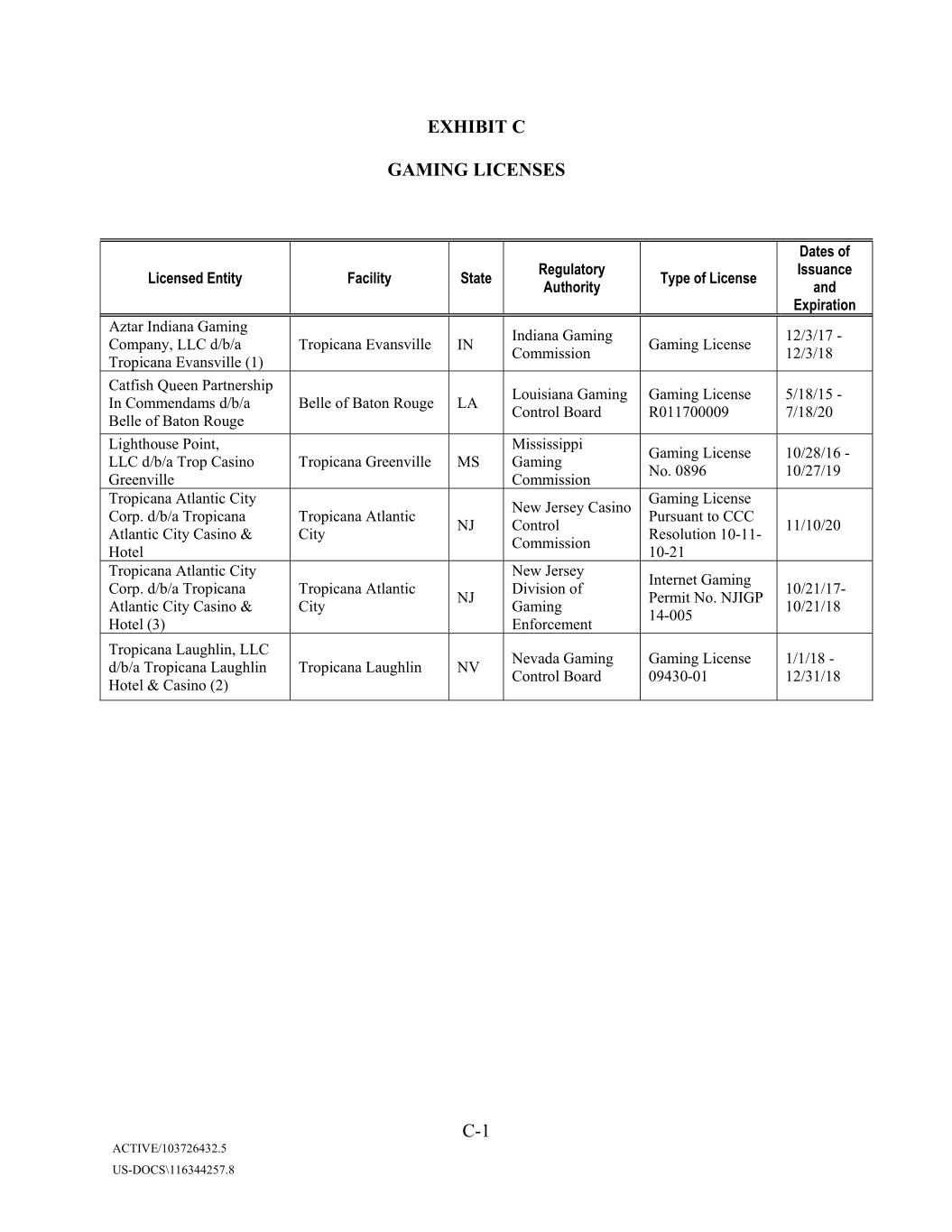
EXHIBIT C GAMING LICENSES Dates of Regulatory Issuance Licensed Entity Facility State Type of License Authority and Expiration Aztar Indiana Gaming Indiana Gaming 12/3/17 - Company, LLC d/b/a Tropicana Evansville IN Gaming License Commission 12/3/18 Tropicana Evansville (1) Catfish Queen Partnership Louisiana Gaming Gaming License 5/18/15 - In Commendams d/b/a Belle of Baton Rouge LA Control Board R011700009 7/18/20 Belle of Baton Rouge Lighthouse Point, Mississippi Gaming License 10/28/16 - LLC d/b/a Trop Casino Tropicana Greenville MS Gaming No. 0896 10/27/19 Greenville Commission Tropicana Atlantic City Gaming License New Jersey Casino Corp. d/b/a Tropicana Tropicana Atlantic Pursuant to CCC NJ Control 11/10/20 Atlantic City Casino & City Resolution 10-11- Commission Hotel 10-21 Tropicana Atlantic City New Jersey Internet Gaming Corp. d/b/a Tropicana Tropicana Atlantic Division of 10/21/17- NJ Permit No. NJIGP Atlantic City Casino & City Gaming 10/21/18 14-005 Hotel (3) Enforcement Tropicana Xxxxxxxx, LLC Nevada Gaming Gaming License 1/1/18 - d/b/a Tropicana Xxxxxxxx Tropicana Laughlin NV Control Board 09430-01 12/31/18 Hotel & Casino (2) C-1 ACTIVE/103726432.5 US-DOCS\116344257.8
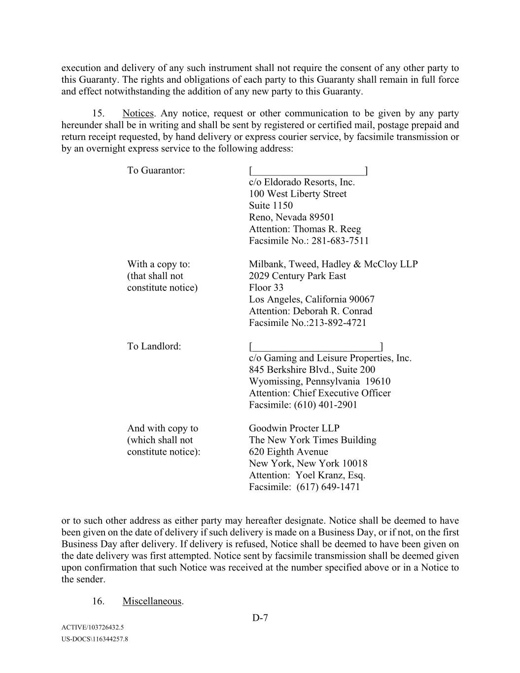
execution and delivery of any such instrument shall not require the consent of any other party to this Guaranty. The rights and obligations of each party to this Guaranty shall remain in full force and effect notwithstanding the addition of any new party to this Guaranty. 15. Notices. Any notice, request or other communication to be given by any party hereunder shall be in writing and shall be sent by registered or certified mail, postage prepaid and return receipt requested, by hand delivery or express courier service, by facsimile transmission or by an overnight express service to the following address: To Guarantor: [______________________] c/o Eldorado Resorts, Inc. 000 Xxxx Xxxxxxx Xxxxxx Xxxxx 0000 Xxxx, Xxxxxx 00000 Attention: Xxxxxx X. Xxxx Facsimile No.: 000-000-0000 With a copy to: Milbank, Tweed, Xxxxxx & XxXxxx LLP (that shall not 2029 Century Park East constitute notice) Floor 00 Xxx Xxxxxxx, Xxxxxxxxxx 00000 Attention: Xxxxxxx X. Xxxxxx Xxxxxxxxx No.:000-000-0000 To Landlord: [_________________________] c/o Gaming and Leisure Properties, Inc. 000 Xxxxxxxxx Xxxx., Xxxxx 000 Xxxxxxxxxx, Xxxxxxxxxxxx 19610 Attention: Chief Executive Officer Facsimile: (000) 000-0000 And with copy to Xxxxxxx Procter LLP (which shall not The New York Times Building constitute notice): 000 Xxxxxx Xxxxxx Xxx Xxxx, Xxx Xxxx 00000 Attention: Xxxx Xxxxx, Esq. Facsimile: (000) 000-0000 or to such other address as either party may hereafter designate. Notice shall be deemed to have been given on the date of delivery if such delivery is made on a Business Day, or if not, on the first Business Day after delivery. If delivery is refused, Notice shall be deemed to have been given on the date delivery was first attempted. Notice sent by facsimile transmission shall be deemed given upon confirmation that such Notice was received at the number specified above or in a Notice to the sender. 16. Miscellaneous. D-7 ACTIVE/103726432.5 US-DOCS\116344257.8
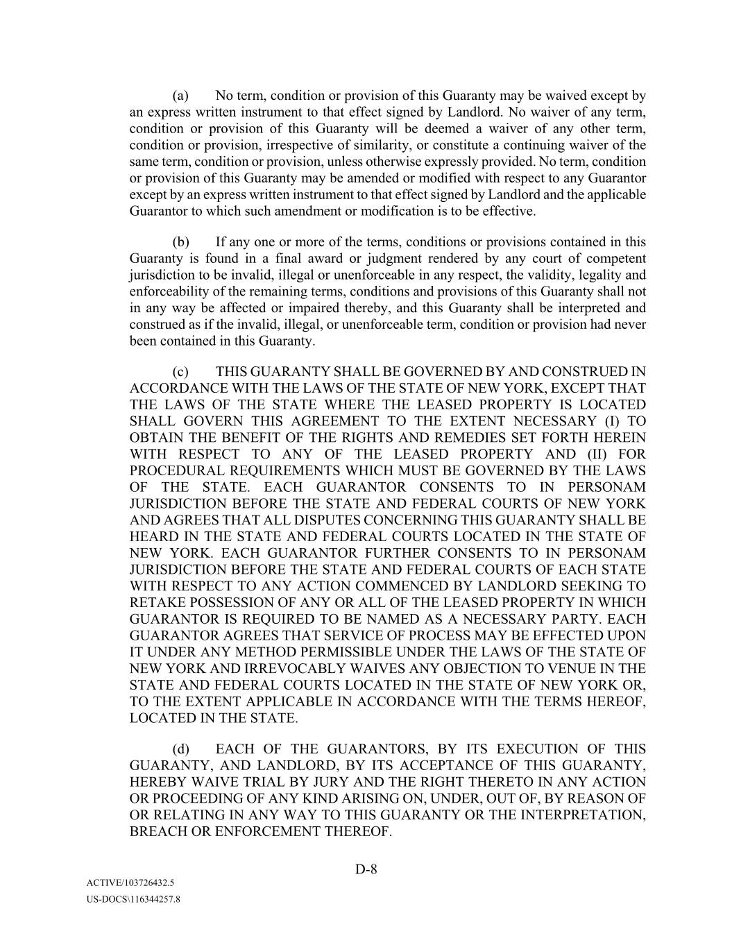
(a) No term, condition or provision of this Guaranty may be waived except by an express written instrument to that effect signed by Landlord. No waiver of any term, condition or provision of this Guaranty will be deemed a waiver of any other term, condition or provision, irrespective of similarity, or constitute a continuing waiver of the same term, condition or provision, unless otherwise expressly provided. No term, condition or provision of this Guaranty may be amended or modified with respect to any Guarantor except by an express written instrument to that effect signed by Landlord and the applicable Guarantor to which such amendment or modification is to be effective. (b) If any one or more of the terms, conditions or provisions contained in this Guaranty is found in a final award or judgment rendered by any court of competent jurisdiction to be invalid, illegal or unenforceable in any respect, the validity, legality and enforceability of the remaining terms, conditions and provisions of this Guaranty shall not in any way be affected or impaired thereby, and this Guaranty shall be interpreted and construed as if the invalid, illegal, or unenforceable term, condition or provision had never been contained in this Guaranty. (c) THIS GUARANTY SHALL BE GOVERNED BY AND CONSTRUED IN ACCORDANCE WITH THE LAWS OF THE STATE OF NEW YORK, EXCEPT THAT THE LAWS OF THE STATE WHERE THE LEASED PROPERTY IS LOCATED SHALL GOVERN THIS AGREEMENT TO THE EXTENT NECESSARY (I) TO OBTAIN THE BENEFIT OF THE RIGHTS AND REMEDIES SET FORTH HEREIN WITH RESPECT TO ANY OF THE LEASED PROPERTY AND (II) FOR PROCEDURAL REQUIREMENTS WHICH MUST BE GOVERNED BY THE LAWS OF THE STATE. EACH GUARANTOR CONSENTS TO IN PERSONAM JURISDICTION BEFORE THE STATE AND FEDERAL COURTS OF NEW YORK AND AGREES THAT ALL DISPUTES CONCERNING THIS GUARANTY SHALL BE HEARD IN THE STATE AND FEDERAL COURTS LOCATED IN THE STATE OF NEW YORK. EACH GUARANTOR FURTHER CONSENTS TO IN PERSONAM JURISDICTION BEFORE THE STATE AND FEDERAL COURTS OF EACH STATE WITH RESPECT TO ANY ACTION COMMENCED BY LANDLORD SEEKING TO RETAKE POSSESSION OF ANY OR ALL OF THE LEASED PROPERTY IN WHICH GUARANTOR IS REQUIRED TO BE NAMED AS A NECESSARY PARTY. EACH GUARANTOR AGREES THAT SERVICE OF PROCESS MAY BE EFFECTED UPON IT UNDER ANY METHOD PERMISSIBLE UNDER THE LAWS OF THE STATE OF NEW YORK AND IRREVOCABLY WAIVES ANY OBJECTION TO VENUE IN THE STATE AND FEDERAL COURTS LOCATED IN THE STATE OF NEW YORK OR, TO THE EXTENT APPLICABLE IN ACCORDANCE WITH THE TERMS HEREOF, LOCATED IN THE STATE. (d) EACH OF THE GUARANTORS, BY ITS EXECUTION OF THIS GUARANTY, AND LANDLORD, BY ITS ACCEPTANCE OF THIS GUARANTY, HEREBY WAIVE TRIAL BY JURY AND THE RIGHT THERETO IN ANY ACTION OR PROCEEDING OF ANY KIND ARISING ON, UNDER, OUT OF, BY REASON OF OR RELATING IN ANY WAY TO THIS GUARANTY OR THE INTERPRETATION, BREACH OR ENFORCEMENT THEREOF. D-8 ACTIVE/103726432.5 US-DOCS\116344257.8
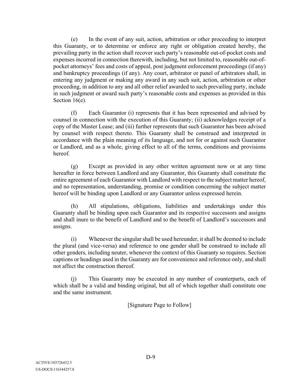
(e) In the event of any suit, action, arbitration or other proceeding to interpret this Guaranty, or to determine or enforce any right or obligation created hereby, the prevailing party in the action shall recover such party’s reasonable out-of-pocket costs and expenses incurred in connection therewith, including, but not limited to, reasonable out-of- pocket attorneys’ fees and costs of appeal, post judgment enforcement proceedings (if any) and bankruptcy proceedings (if any). Any court, arbitrator or panel of arbitrators shall, in entering any judgment or making any award in any such suit, action, arbitration or other proceeding, in addition to any and all other relief awarded to such prevailing party, include in such judgment or award such party’s reasonable costs and expenses as provided in this Section 16(e). (f) Each Guarantor (i) represents that it has been represented and advised by counsel in connection with the execution of this Guaranty; (ii) acknowledges receipt of a copy of the Master Lease; and (iii) further represents that such Guarantor has been advised by counsel with respect thereto. This Guaranty shall be construed and interpreted in accordance with the plain meaning of its language, and not for or against such Guarantor or Landlord, and as a whole, giving effect to all of the terms, conditions and provisions hereof. (g) Except as provided in any other written agreement now or at any time hereafter in force between Landlord and any Guarantor, this Guaranty shall constitute the entire agreement of each Guarantor with Landlord with respect to the subject matter hereof, and no representation, understanding, promise or condition concerning the subject matter hereof will be binding upon Landlord or any Guarantor unless expressed herein. (h) All stipulations, obligations, liabilities and undertakings under this Guaranty shall be binding upon each Guarantor and its respective successors and assigns and shall inure to the benefit of Landlord and to the benefit of Xxxxxxxx’s successors and assigns. (i) Whenever the singular shall be used hereunder, it shall be deemed to include the plural (and vice-versa) and reference to one gender shall be construed to include all other genders, including neuter, whenever the context of this Guaranty so requires. Section captions or headings used in the Guaranty are for convenience and reference only, and shall not affect the construction thereof. (j) This Guaranty may be executed in any number of counterparts, each of which shall be a valid and binding original, but all of which together shall constitute one and the same instrument. [Signature Page to Follow] D-9 ACTIVE/103726432.5 US-DOCS\116344257.8
EXECUTED as of the date first set forth above. GUARANTOR: By: Name: Title: LANDLORD: By: Name: Title: S-1 ACTIVE/103726432.5 US-DOCS\116344257.8
Appendix A SUPPLEMENT NO. ______ dated as of _____________ (this “Supplement”), to the GUARANTY OF MASTER LEASE (as amended, restated, supplemented or replaced, the “Guaranty”), dated as of _____ day of __________, 20__ by and between ____________, a ________________, ____________, a ________________ and ____________, a ________________ (each, “Guarantor”, and collectively, the “Guarantors”) and ____________________ (“Landlord”). A. Reference is made to that certain Master Xxxxx, dated as of [______________], (the “Master Lease”), between Landlord and [_______________] (“Tenant”). B. Capitalized terms used herein and not otherwise defined shall have the meanings assigned to such terms in the Guaranty. C. The Guarantors have entered into the Guaranty in order to induce the Landlord to enter into the Master Lease. Section 14 of the Guaranty provides that additional Subsidiaries of the Tenant may become Guarantors under the Guaranty by execution and delivery of an instrument in the form of this Supplement. The undersigned subsidiary of Tenant (the “New Subsidiary”) is executing this Supplement in accordance with the requirements of the Master Lease to become a Guarantor under the Guaranty. Accordingly, Landlord and the New Subsidiary agree as follows: SECTION 1. In accordance with Section 14 of the Guaranty, the New Subsidiary by its signature below becomes a Guarantor under the Guaranty with the same force and effect as if originally named therein as a Guarantor, and the New Subsidiary hereby (a) agrees to all the terms and provisions of the Guaranty applicable to it as a Guarantor thereunder, and (b) represents and warrants that the representations and warranties made by it as a Guarantor thereunder are true and correct, in all material respects, on and as of the date hereof. Each reference to a “Guarantor” in the Guaranty shall be deemed to include the New Subsidiary. The Guaranty is hereby incorporated herein by reference. SECTION 2. The New Subsidiary represents and warrants to the Landlord that this Supplement has been duly authorized, executed and delivered by it and constitutes its legal, valid and binding obligation, enforceable against it in accordance with its terms, subject to (i) the effects of bankruptcy, insolvency, moratorium, reorganization, fraudulent conveyance or other similar laws affecting creditors’ rights generally, (ii) general principles of equity (regardless of whether such enforceability is considered in a proceeding in equity or at law) and (iii) implied covenants of good faith and fair dealing. SECTION 3. This Supplement may be executed in two or more counterparts, each of which shall constitute an original but all of which when taken together shall constitute but one contract. This Supplement shall become effective when (a) the Landlord shall have received a counterpart of this Supplement that bears the signature of the New Subsidiary, and (b) the Landlord has executed a counterpart hereof. Appendix A-1 ACTIVE/103726432.5 US-DOCS\116344257.8
period under any term, covenant or condition of the Lease and (b) will be bound by the provisions of Article XVII of the Lease for the benefit of each Permitted Leasehold Mortgagee. In addition, Lender or any person prosecuting such rights and remedies agrees that so long as the Lease has not been terminated on account of Tenant’s default that has continued beyond applicable notice and cure periods, Lender or such other person, as the case may be, shall not name or join Tenant as a defendant in any exercise of Xxxxxx’s or such person’s rights and remedies arising upon a default under the Mortgage unless applicable law requires Tenant to be made a party thereto as a condition to proceeding against Landlord. In the latter case, Lender or any person prosecuting such rights and remedies may join Tenant as a defendant in such action only for such purpose and not to terminate the Lease or otherwise adversely affect Tenant’s rights under the Lease or this Agreement in such action. 2. If, at any time Lender (or any person, or such person’s successors or assigns, who acquires the interest of Landlord under the Lease through foreclosure of the Mortgage or otherwise) shall succeed to the rights of Landlord under the Lease as a result of a default or event of default under the Mortgage, Tenant shall attorn to and recognize such person so succeeding to the rights of Landlord under the Lease (herein sometimes called “Successor Landlord”) as Tenant’s landlord under the Lease, said attornment to be effective and self-operative without the execution of any further instruments. 3. Xxxxxxxx authorizes and directs Tenant to honor any written demand or notice from Xxxxxx instructing Tenant to pay rent or other sums to Lender rather than Landlord (a “Payment Demand”), regardless of any other or contrary notice or instruction which Tenant may receive from Landlord before or after Xxxxxx’s receipt of such Payment Demand. Tenant may rely upon any notice, instruction, Payment Demand, certificate, consent or other document from, and signed by, Xxxxxx and shall have no duty to Landlord to investigate the same or the circumstances under which the same was given. Any payment made by Tenant to Lender or in response to a Payment Demand shall be deemed proper payment by Tenant of such sum pursuant to the Lease. 4. If Lender shall become the owner of the Property or the Property shall be sold by reason of foreclosure or other proceedings brought to enforce the Mortgage or if the Property shall be transferred by deed in lieu of foreclosure, Lender or any Successor Landlord shall not be: (a) liable for any act or omission of any prior landlord (including Landlord) or bound by any obligation to make any payment to Tenant which was required to be made prior to the time Lender succeeded to any prior landlord (including Landlord); or (b) obligated to cure any defaults of any prior landlord (including Landlord) which occurred, or to make any payment to Tenant which was required to be paid by any prior landlord (including Landlord), prior to the time that Lender or any Successor Landlord succeeded to the interest of such landlord under the Lease; or (c) obligated to perform any construction obligations of any prior landlord (including Landlord) under the Lease or liable for any defects (latent, patent or otherwise) in the design, workmanship, materials, construction or otherwise with respect to improvements and buildings constructed on the Property; or E-2 ACTIVE/103726432.5 US-DOCS\116344257.8
(d) subject to any offsets, defenses or counterclaims which Tenant may be entitled to assert against any prior landlord (including Landlord); or (e) bound by any payment of rent or additional rent by Tenant to any prior landlord (including Landlord) for more than one month in advance; or (f) bound by any amendment, modification, termination or surrender of the Lease made without the written consent of Lender. Notwithstanding the foregoing, Tenant reserves its right to any and all claims or causes of action (i) against Landlord for prior losses or damages and (ii) against the Successor Landlord for all losses or damages arising from and after the date that such Successor Landlord takes title to the Property. 5. Tenant hereby represents, warrants, covenants and agrees to and with Lender: (a) to deliver to Lender, by certified mail, return receipt requested, a duplicate of each notice of default delivered by Tenant to Landlord at the same time as such notice is given to Landlord and no such notice of default shall be deemed given by Tenant under the Lease unless and until a copy of such notice shall have been so delivered to Lender. Lender shall have the right (but shall not be obligated) to cure such default. Tenant shall accept performance by Xxxxxx of any term, covenant, condition or agreement to be performed by Landlord or its designee under the Lease with the same force and effect as though performed by Xxxxxxxx. Tenant further agrees to afford Lender or its designee a period of thirty (30) days beyond any period afforded to Landlord for the curing of such default during which period Lender or its designee may elect (but shall not be obligated) to seek to cure such default, or, if such default cannot be cured within that time, then such additional time as may be necessary to cure such default (including but not limited to commencement of foreclosure proceedings) during which period Lender or its designee may elect (but shall not be obligated) to seek to cure such default, prior to taking any action to terminate the Lease. If the Lease shall terminate for any reason, upon Xxxxxx’s written request given within thirty (30) days after such termination, Tenant, within fifteen (15) days after such request, shall execute and deliver to Lender (or its designee to the extent constituting a permitted successor landlord under the Lease) a new lease of the Premises for the remainder of the term of the Lease and upon all of the same terms, covenants and conditions of the Lease; (b) that Tenant is the sole owner of the leasehold estate created by the Lease; and (c) to promptly certify in writing to Lender, in connection with any proposed assignment of the Mortgage, whether or not any default on the part of Landlord then exists under the Lease and to deliver to Lender any tenant estoppel certificates required under the Lease. E-3 ACTIVE/103726432.5 US-DOCS\116344257.8
6. Tenant acknowledges that the interest of Landlord under the Lease is assigned to Lender solely as security for the Promissory Note3, and Lender shall have no duty, liability or obligation under the Lease or any extension or renewal thereof, unless Lender shall specifically undertake such liability in writing or Lender becomes and then only with respect to periods in which Lender becomes, the fee owner of the Property. 7. This Agreement shall be governed by and construed in accordance with the laws of the State of New York4. 8. This Agreement and each and every covenant, agreement and other provisions hereof shall be binding upon and shall inure to the benefit of the parties hereto and their respective successors and assigns (including, without limitation, any successor holder of the Promissory Note5) and may be amended, supplemented, waived or modified only by an instrument in writing executed by the party against which enforcement of the termination, amendment, supplement, waiver or modification is sought. Each Permitted Leasehold Mortgagee (as defined in the Lease) (for so long as such Permitted Leasehold Mortgagee (as defined in the Lease) holds a Permitted Leasehold Mortgage (as defined in the Lease)) is an intended third party beneficiary of Section 1(b) entitled to enforce the same as if a party to this Agreement. 9. All notices to be given under this Agreement shall be in writing and shall be deemed served upon receipt by the addressee if served personally or, if mailed, upon the first to occur of receipt or the refusal of delivery as shown on a return receipt, after deposit in the United States Postal Service certified mail, postage prepaid, addressed to the address of Landlord, Tenant or Lender appearing below. Such addresses may be changed by notice given in the same manner. If any party consists of multiple individuals or entities, then notice to any one of same shall be deemed notice to such party. To Lender: [___________________] [___________________] [___________________] [___________________] With a copy to: [___________________] (that shall not [___________________] constitute notice) [___________________] [___________________] 3Subject to modification to reflect terms of debt. 4Subject to modification solely and to the extent the law of any jurisdiction in which the Premises are located is required to govern the subordination of Tenant’s interests in such jurisdiction. 5Subject to modification to reflect terms of debt. E-4 ACTIVE/103726432.5 US-DOCS\116344257.8
To Tenant: ______________________ ______________________ ______________________ Attention: Facsimile: With a copy to: Milbank, Tweed, Xxxxxx & XxXxxx LLP (that shall not 2029 Century Park East constitute notice) Floor 00 Xxx Xxxxxxx, Xxxxxxxxxx 00000 Attention: Xxxxxxx X. Xxxxxx Xxxxxxxxx No.:000-000-0000 To Landlord: [_________________________] c/o Gaming and Leisure Properties, Inc. 000 Xxxxxxxxx Xxxx., Xxxxx 000 Xxxxxxxxxx, Xxxxxxxxxxxx 00000 Attention: Chief Executive Officer Facsimile: (000) 000-0000 And with copy to Xxxxxxx Procter LLP (which shall not The New York Times Building constitute notice): 000 Xxxxxx Xxxxxx Xxx Xxxx, Xxx Xxxx 00000 Attention: Xxxx Xxxxx, Esq. Facsimile: (000) 000-0000 10. If this Agreement conflicts with the Lease, then this Agreement shall govern as between the parties and any Successor Landlord, including upon any attornment pursuant to this Agreement. This Agreement supersedes, and constitutes full compliance with, any provisions in the Lease that provide for subordination of the Lease to, or for delivery of nondisturbance agreements by the holder of, the Mortgage. 11. In the event Lender shall acquire Xxxxxxxx’s interest in the Premises, Tenant shall look only to the estate and interest, if any, of Lender in the Property for the satisfaction of Tenant’s remedies for the collection of a judgment (or other judicial process) requiring the payment of money in the event of any default by Xxxxxx as a Successor Landlord under the Lease or under this Agreement, and no other property or assets of Lender shall be subject to levy, execution or other enforcement procedure for the satisfaction of Tenant’s remedies under or with respect to the Lease, the relationship of the landlord and tenant under the Lease or Tenant’s use or occupancy of the Premises or any claim arising under this Agreement. 12. If any provision of this Agreement is held to be invalid or unenforceable by a court of competent jurisdiction, such provision shall be deemed modified to the extent necessary to be enforceable, or if such modification is not practicable, such provision shall be deemed deleted from this Agreement, and the other provisions of this Agreement shall remain in full force and effect, and shall be liberally construed in favor of Lender. E-5 ACTIVE/103726432.5 US-DOCS\116344257.8

13. This Agreement may be executed in any number of counterparts, each of which shall be deemed an original and all of which together shall constitute one and the same instrument. [REMAINDER OF XXXX INTENTIONALLY LEFT BLANK] E-6 ACTIVE/103726432.5 US-DOCS\116344257.8
purchase, right of first refusal to purchase or right of first offer to purchase the Property or any portion thereof) is hereby, and shall at all times continue to be, subordinated and made secondary and inferior in each and every respect to the Mortgage and the lien thereof, to all of the terms, conditions and provisions thereof and to any and all advances made or to be made thereunder, so that at all times the Mortgage shall be and remain a lien on the Property prior to and superior to the Lease for all purposes, subject to the provisions set forth herein. Subordination is to have the same force and effect as if the Mortgage and such renewals, modifications, consolidations, replacements and extensions had been executed, acknowledged, delivered and recorded prior to the Lease, any amendments or modifications thereof and any notice thereof. 2. Lender agrees that if Lender exercises any of its rights under the Mortgage, including entry or foreclosure of the Mortgage or exercise of a power of sale under the Mortgage, Lender, or any person who acquires any portion of the Property in a foreclosure or similar proceeding or in a transfer in lieu of any such foreclosure, (a) will not terminate or disturb Tenant’s right to use, occupy and possess the Premises, nor any of Tenant’s rights, privileges and options under the terms of the Lease, so long as Tenant is not in default beyond any applicable grace period under any term, covenant or condition of the Lease and (b) will be bound by the provisions of Article XVII of the Lease for the benefit of each Permitted Leasehold Mortgagee. In addition, Lender or any person prosecuting such rights and remedies agrees that so long as the Lease has not been terminated on account of Tenant’s default that has continued beyond applicable notice and cure periods, Lender or such other person, as the case may be, shall not name or join Tenant as a defendant in any exercise of Xxxxxx’s or such person’s rights and remedies arising upon a default under the Mortgage unless applicable law requires Tenant to be made a party thereto as a condition to proceeding against Landlord. In the latter case, Lender or any person prosecuting such rights and remedies may join Tenant as a defendant in such action only for such purpose and not to terminate the Lease or otherwise adversely affect Tenant’s rights under the Lease or this Agreement in such action. 3. If, at any time Lender (or any person, or such person’s successors or assigns, who acquires the interest of Landlord under the Lease through foreclosure of the Mortgage or otherwise) shall succeed to the rights of Landlord under the Lease as a result of a default or event of default under the Mortgage, Tenant shall attorn to and recognize such person so succeeding to the rights of Landlord under the Lease (herein sometimes called “Successor Landlord”) as Tenant’s landlord under the Lease, said attornment to be effective and self-operative without the execution of any further instruments. 4. Xxxxxxxx authorizes and directs Tenant to honor any written demand or notice from Xxxxxx instructing Tenant to pay rent or other sums to Lender rather than Landlord (a “Payment Demand”), regardless of any other or contrary notice or instruction which Tenant may receive from Landlord before or after Xxxxxx’s receipt of such Payment Demand. Tenant may rely upon any notice, instruction, Payment Demand, certificate, consent or other document from, and signed by, Xxxxxx and shall have no duty to Landlord to investigate the same or the circumstances under which the same was given. Any payment made by Tenant to Lender or in response to a Payment Demand shall be deemed proper payment by Tenant of such sum pursuant to the Lease. 5. If Xxxxxx shall become the owner of the Property or the Property shall be sold by reason of foreclosure or other proceedings brought to enforce the Mortgage or if the F-2 ACTIVE/103726432.5 US-DOCS\116344257.8
Property shall be transferred by deed in lieu of foreclosure, Lender or any Successor Landlord shall not be: (a) liable for any act or omission of any prior landlord (including Landlord) or bound by any obligation to make any payment to Tenant which was required to be made prior to the time Lender succeeded to any prior landlord (including Landlord); or (b) obligated to cure any defaults of any prior landlord (including Landlord) which occurred, or to make any payment to Tenant which was required to be paid by any prior landlord (including Landlord), prior to the time that Lender or any Successor Landlord succeeded to the interest of such landlord under the Lease; or (c) obligated to perform any construction obligations of any prior landlord (including Landlord) under the Lease or liable for any defects (latent, patent or otherwise) in the design, workmanship, materials, construction or otherwise with respect to improvements and buildings constructed on the Property; or (d) subject to any offsets, defenses or counterclaims which Tenant may be entitled to assert against any prior landlord (including Landlord); or (e) bound by any payment of rent or additional rent by Tenant to any prior landlord (including Landlord) for more than one month in advance; or (f) bound by any amendment, modification, termination or surrender of the Lease made without the written consent of Lender. Notwithstanding the foregoing, Tenant reserves its right to any and all claims or causes of action (i) against Landlord for prior losses or damages and (ii) against the Successor Landlord for all losses or damages arising from and after the date that such Successor Landlord takes title to the Property. 6. Tenant hereby represents, warrants, covenants and agrees to and with Lender: (a) to deliver to Lender, by certified mail, return receipt requested, a duplicate of each notice of default delivered by Tenant to Landlord at the same time as such notice is given to Landlord and no such notice of default shall be deemed given by Tenant under the Lease unless and until a copy of such notice shall have been so delivered to Lender. Lender shall have the right (but shall not be obligated) to cure such default. Tenant shall accept performance by Lender or its designee of any term, covenant, condition or agreement to be performed by Landlord under the Lease with the same force and effect as though performed by Xxxxxxxx. Tenant further agrees to afford Lender or the designee a period of thirty (30) days beyond any period afforded to Landlord or its designee for the curing of such default during which period Lender or its designee may elect (but shall not be obligated) to seek to cure such default, or, if such default cannot be cured within that time, then such additional time as may be necessary to cure such default (including but not limited to commencement of foreclosure proceedings) during which period Lender or its designee may elect (but shall not be obligated) to seek to cure such default, prior to taking F-3 ACTIVE/103726432.5 US-DOCS\116344257.8
any action to terminate the Lease. If the Lease shall terminate for any reason, upon Xxxxxx’s written request given within thirty (30) days after such termination, Tenant, within fifteen (15) days after such request, shall execute and deliver to Lender (or its designee to the extent constituting a permitted successor landlord under the Lease) a new lease of the Premises for the remainder of the term of the Lease and upon all of the same terms, covenants and conditions of the Lease; (b) that Tenant is the sole owner of the leasehold estate created by the Lease; and (c) to promptly certify in writing to Lender, in connection with any proposed assignment of the Mortgage, whether or not any default on the part of Landlord then exists under the Lease and to deliver to Lender any tenant estoppel certificates required under the Lease. 7. Tenant acknowledges that the interest of Landlord under the Lease is assigned to Lender solely as security for the Promissory Note8, and Lender shall have no duty, liability or obligation under the Lease or any extension or renewal thereof, unless Lender shall specifically undertake such liability in writing or Lender becomes and then only with respect to periods in which Lender becomes, the fee owner of the Property. 8. This Agreement shall be governed by and construed in accordance with the laws of the State of New York.9 9. This Agreement and each and every covenant, agreement and other provisions hereof shall be binding upon and shall inure to the benefit of the parties hereto and their respective successors and assigns (including, without limitation, any successor holder of the Promissory Note10) and may be amended, supplemented, waived or modified only by an instrument in writing executed by the party against which enforcement of the termination, amendment, supplement, waiver or modification is sought. Each Permitted Leasehold Mortgagee (as defined in the Lease) (for so long as such Permitted Leasehold Mortgagee (as defined in the Lease) holds a Permitted Leasehold Mortgage (as defined in the Lease)) is an intended third party beneficiary of Section 2(b) entitled to enforce the same as if a party to this Agreement. 10. All notices to be given under this Agreement shall be in writing and shall be deemed served upon receipt by the addressee if served personally or, if mailed, upon the first to occur of receipt or the refusal of delivery as shown on a return receipt, after deposit in the United States Postal Service certified mail, postage prepaid, addressed to the address of Landlord, Tenant or Lender appearing below. Such addresses may be changed by notice given in the same manner. If any party consists of multiple individuals or entities, then notice to any one of same shall be deemed notice to such party. 8Subject to modification to reflect terms of debt. 9Subject to modification solely and to the extent the law of any jurisdiction in which the Premises are located is required to govern the subordination of Tenant’s interests in such jurisdiction. 10Subject to modification to reflect terms of debt. F-4 ACTIVE/103726432.5 US-DOCS\116344257.8
To Lender: [___________________] [___________________] [___________________] [___________________] With a copy to: [___________________] (that shall not [___________________] constitute notice) [___________________] [___________________] To Tenant: ______________________ ______________________ ______________________ Attention: Facsimile: With a copy to: ______________________ (that shall not ______________________ constitute notice) ______________________ Attention: Facsimile: To Landlord: [_________________________] c/o Gaming and Leisure Properties, Inc. 000 Xxxxxxxxx Xxxx., Xxxxx 000 Xxxxxxxxxx, Xxxxxxxxxxxx 19610 Attention: Chief Executive Officer Facsimile: (000) 000-0000 And with copy to Xxxxxxx Procter LLP (which shall not The New York Times Building constitute notice): 000 Xxxxxx Xxxxxx Xxx Xxxx, Xxx Xxxx 00000 Attention: Xxxx Xxxxx, Esq. Facsimile: (000) 000-0000 11. If this Agreement conflicts with the Lease, then this Agreement shall govern as between the parties and any Successor Landlord, including upon any attornment pursuant to this Agreement. This Agreement supersedes, and constitutes full compliance with, any provisions in the Lease that provide for subordination of the Lease to, or for delivery of nondisturbance agreements by the holder of, the Mortgage. 12. In the event Lender shall acquire Xxxxxxxx’s interest in the Premises, Tenant shall look only to the estate and interest, if any, of Lender in the Property for the satisfaction of Xxxxxx’s remedies for the collection of a judgment (or other judicial process) requiring the payment F-5 ACTIVE/103726432.5 US-DOCS\116344257.8
of money in the event of any default by Xxxxxx as a Successor Landlord under the Lease or under this Agreement, and no other property or assets of Lender shall be subject to levy, execution or other enforcement procedure for the satisfaction of Tenant’s remedies under or with respect to the Lease, the relationship of the landlord and tenant under the Lease or Tenant’s use or occupancy of the Premises or any claim arising under this Agreement. 13. If any provision of this Agreement is held to be invalid or unenforceable by a court of competent jurisdiction, such provision shall be deemed modified to the extent necessary to be enforceable, or if such modification is not practicable, such provision shall be deemed deleted from this Agreement, and the other provisions of this Agreement shall remain in full force and effect, and shall be liberally construed in favor of Lender. 14. This Agreement may be executed in any number of counterparts, each of which shall be deemed an original and all of which together shall constitute one and the same instrument. F-6 ACTIVE/103726432.5 US-DOCS\116344257.8
SCHEDULE A DISCLOSURE ITEMS Ground Leases Tropicana Xxxxxxxx None Tropicana Evansville Evansville Riverboat Landing Lease dated May 2, 1995, by and between City of Evansville, Redevelopment Commission, as landlord, and Landlord (as successor in interest to Aztar Gaming Company, LLC), as tenant, as amended by that certain Amendment to Evansville Riverboat Landing Lease dated December 1, 2001, as further amended by that certain Second Amendment to Evansville Riverboat Landing Lease dated August 27, 2003, as further amended by that certain Third Amendment to Evansville Riverboat Landing Lease dated July 19, 2005, as further amended by that certain Fourth Amendment to Lease Agreement dated May 3, 2006, as further amended by that certain Fourth Amendment No. 2 to Lease Agreement dated March 2, 2010, as further amended by that certain Fifth Amendment to Lease Agreement dated September 15, 2011, as further amended by that certain Sixth Amendment to Lease Agreement dated January 6, 2016, and as further amended by that certain Seventh Amendment to Lease Agreement dated as of the Commencement Date. Tropicana Atlantic City None Belle of Baton Rouge Lease Agreement dated August 1, 2013 by and between Xxxx Realty Co., Inc., as landlord, and Landlord (as successor in interests to Catfish Queen Partnership in Commendam), as tenant Contract of Lease dated August 29, 1982 by and between Xxxx Realty Co., Inc., as landlord, and Landlord (as successor in interest to Catfish Queen Partnership in Commendam, as successor in interest to New Jazz Enterprises, L.L.C., as successor in interest to Xxxx X. Xxx, Xxxxxxx X. Xxxxxx, Xxxx X. XxXxxxxxxxx, Xxxxx X. Xxxxxxxx and Xxxxxxx X. Xxxxxx), as tenant, as amended by that certain Assignment and Assumption of Leases dated March 8, 2010 Lease of Air Space dated June 29, 1994 by and between the City of Baton Rouge, as landlord, and Landlord (as successor in interest to the Parish of East Baton Rouge and Catfish Queen Partnership in Commendam), as tenant Schedule A-1 ACTIVE/103726432.5 US-DOCS\116344257.8
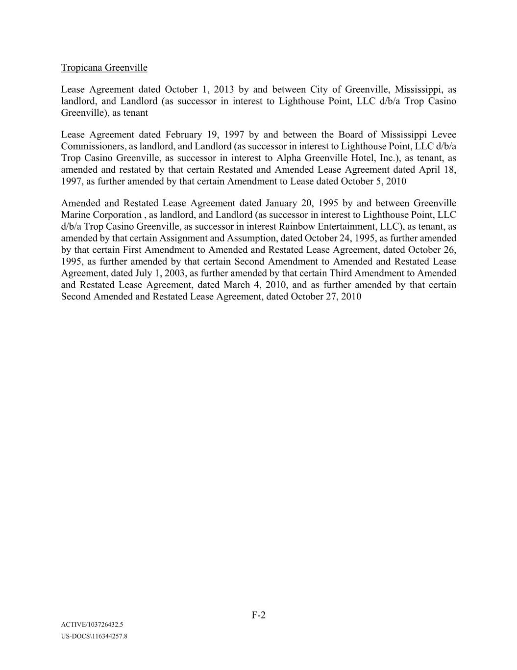
Tropicana Greenville Lease Agreement dated October 1, 2013 by and between City of Greenville, Mississippi, as landlord, and Landlord (as successor in interest to Lighthouse Point, LLC d/b/a Trop Casino Greenville), as tenant Lease Agreement dated February 19, 1997 by and between the Board of Mississippi Levee Commissioners, as landlord, and Landlord (as successor in interest to Lighthouse Point, LLC d/b/a Trop Casino Greenville, as successor in interest to Alpha Greenville Hotel, Inc.), as tenant, as amended and restated by that certain Restated and Amended Lease Agreement dated April 18, 1997, as further amended by that certain Amendment to Lease dated October 5, 2010 Amended and Restated Lease Agreement dated January 20, 1995 by and between Greenville Marine Corporation , as landlord, and Landlord (as successor in interest to Lighthouse Point, LLC d/b/a Trop Casino Greenville, as successor in interest Rainbow Entertainment, LLC), as tenant, as amended by that certain Assignment and Assumption, dated October 24, 1995, as further amended by that certain First Amendment to Amended and Restated Lease Agreement, dated October 26, 1995, as further amended by that certain Second Amendment to Amended and Restated Lease Agreement, dated July 1, 2003, as further amended by that certain Third Amendment to Amended and Restated Lease Agreement, dated March 4, 2010, and as further amended by that certain Second Amended and Restated Lease Agreement, dated October 27, 2010 F-2 ACTIVE/103726432.5 US-DOCS\116344257.8
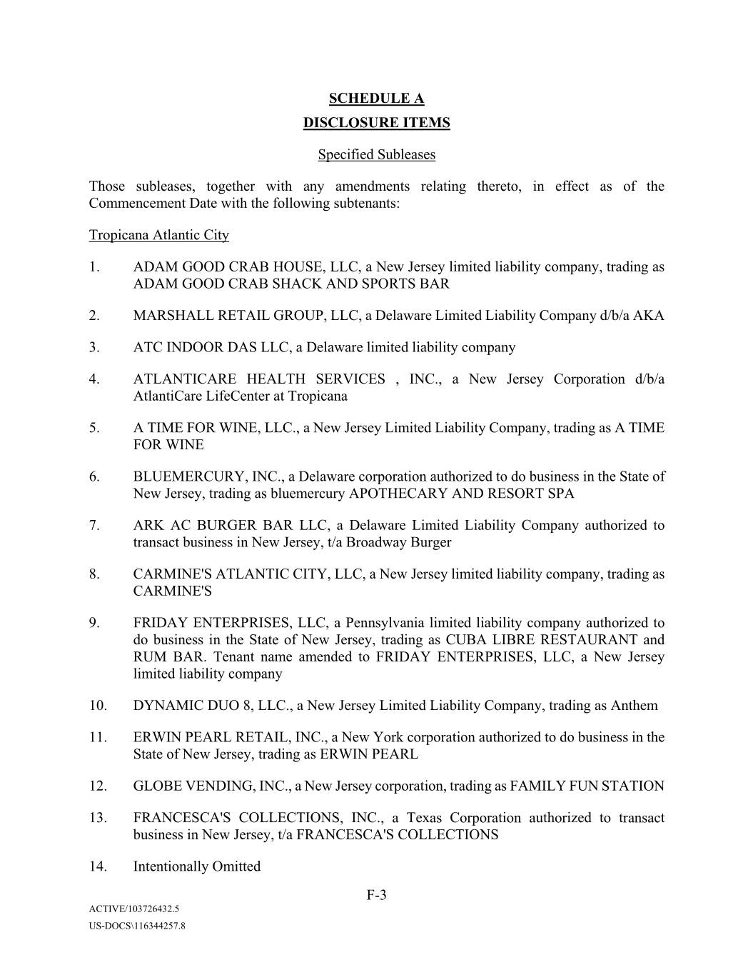
SCHEDULE A DISCLOSURE ITEMS Specified Subleases Those subleases, together with any amendments relating thereto, in effect as of the Commencement Date with the following subtenants: Tropicana Atlantic City 1. XXXX XXXX CRAB HOUSE, LLC, a New Jersey limited liability company, trading as XXXX XXXX CRAB SHACK AND SPORTS BAR 2. XXXXXXXX RETAIL GROUP, LLC, a Delaware Limited Liability Company d/b/a AKA 3. ATC INDOOR DAS LLC, a Delaware limited liability company 4. ATLANTICARE HEALTH SERVICES , INC., a New Jersey Corporation d/b/a AtlantiCare LifeCenter at Tropicana 5. A TIME FOR WINE, LLC., a New Jersey Limited Liability Company, trading as A TIME FOR WINE 6. BLUEMERCURY, INC., a Delaware corporation authorized to do business in the State of New Jersey, trading as bluemercury APOTHECARY AND RESORT SPA 7. ARK XX XXXXXX BAR LLC, a Delaware Limited Liability Company authorized to transact business in New Jersey, t/a Broadway Burger 8. CARMINE'S ATLANTIC CITY, LLC, a New Jersey limited liability company, trading as CARMINE'S 9. FRIDAY ENTERPRISES, LLC, a Pennsylvania limited liability company authorized to do business in the State of New Jersey, trading as CUBA LIBRE RESTAURANT and RUM BAR. Tenant name amended to FRIDAY ENTERPRISES, LLC, a New Jersey limited liability company 10. DYNAMIC DUO 8, LLC., a New Jersey Limited Liability Company, trading as Anthem 11. XXXXX XXXXX RETAIL, INC., a New York corporation authorized to do business in the State of New Jersey, trading as XXXXX XXXXX 12. GLOBE VENDING, INC., a New Jersey corporation, trading as FAMILY FUN STATION 13. XXXXXXXXX'S COLLECTIONS, INC., a Texas Corporation authorized to transact business in New Jersey, t/a XXXXXXXXX'S COLLECTIONS 14. Intentionally Omitted F-3 ACTIVE/103726432.5 US-DOCS\116344257.8
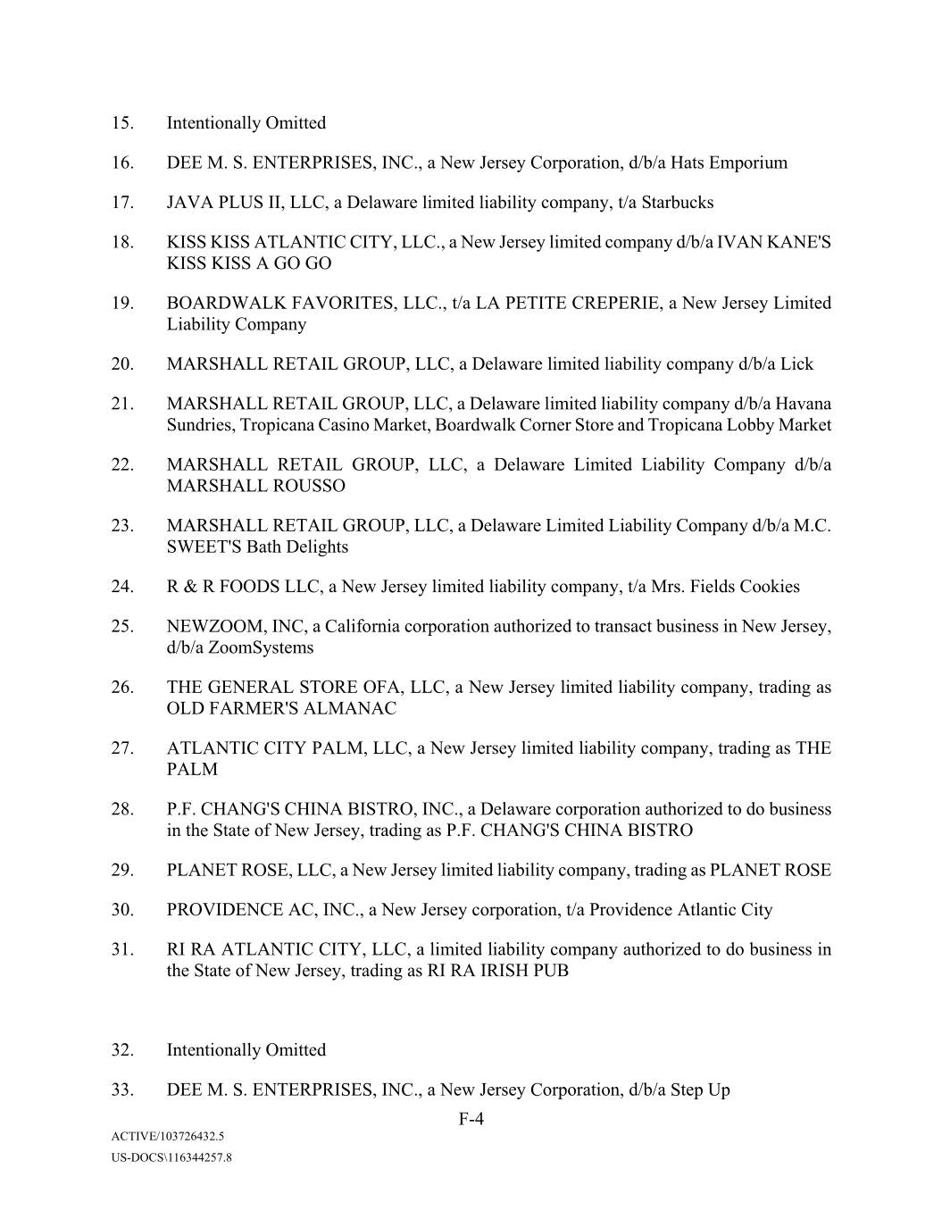
15. Intentionally Omitted 16. DEE M. S. ENTERPRISES, INC., a New Jersey Corporation, d/b/a Hats Emporium 17. JAVA PLUS II, LLC, a Delaware limited liability company, t/a Starbucks 18. KISS KISS ATLANTIC CITY, LLC., a New Jersey limited company d/b/a XXXX XXXX'X KISS KISS A GO GO 19. BOARDWALK FAVORITES, LLC., t/a LA PETITE CREPERIE, a New Jersey Limited Liability Company 20. XXXXXXXX RETAIL GROUP, LLC, a Delaware limited liability company d/b/a Lick 21. XXXXXXXX RETAIL GROUP, LLC, a Delaware limited liability company d/b/a Havana Sundries, Tropicana Casino Market, Boardwalk Corner Store and Tropicana Lobby Market 22. XXXXXXXX RETAIL GROUP, LLC, a Delaware Limited Liability Company d/b/a XXXXXXXX XXXXXX 23. XXXXXXXX RETAIL GROUP, LLC, a Delaware Limited Liability Company d/b/a M.C. SWEET'S Bath Delights 24. R & R FOODS LLC, a New Jersey limited liability company, t/a Xxx. Xxxxxx Cookies 25. NEWZOOM, INC, a California corporation authorized to transact business in New Jersey, d/b/a ZoomSystems 26. THE GENERAL STORE OFA, LLC, a New Jersey limited liability company, trading as OLD XXXXXX'X ALMANAC 27. ATLANTIC CITY PALM, LLC, a New Jersey limited liability company, trading as THE PALM 28. X.X. XXXXX'X CHINA BISTRO, INC., a Delaware corporation authorized to do business in the State of New Jersey, trading as X.X. XXXXX'X CHINA BISTRO 29. PLANET ROSE, LLC, a New Jersey limited liability company, trading as PLANET ROSE 30. PROVIDENCE AC, INC., a New Jersey corporation, t/a Providence Atlantic City 31. RI RA ATLANTIC CITY, LLC, a limited liability company authorized to do business in the State of New Jersey, trading as RI RA IRISH PUB 32. Intentionally Omitted 33. DEE M. S. ENTERPRISES, INC., a New Jersey Corporation, d/b/a Step Up F-4 ACTIVE/103726432.5 US-DOCS\116344257.8
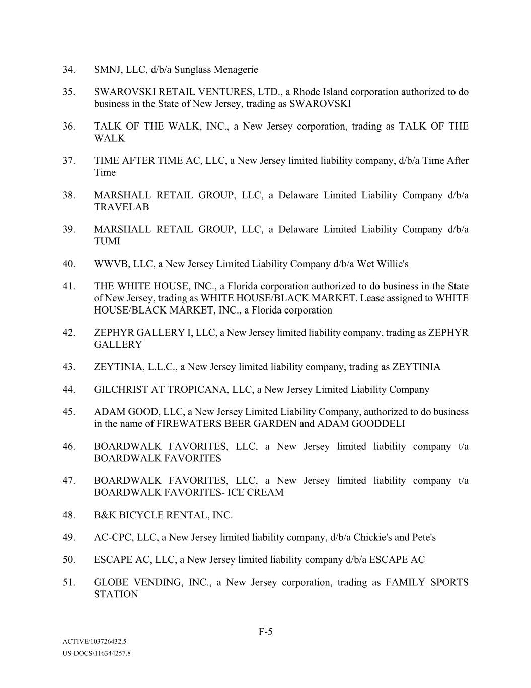
34. SMNJ, LLC, d/b/a Sunglass Menagerie 35. SWAROVSKI RETAIL VENTURES, LTD., a Rhode Island corporation authorized to do business in the State of New Jersey, trading as SWAROVSKI 36. TALK OF THE WALK, INC., a New Jersey corporation, trading as TALK OF THE WALK 37. TIME AFTER TIME AC, LLC, a New Jersey limited liability company, d/b/a Time After Time 38. XXXXXXXX RETAIL GROUP, LLC, a Delaware Limited Liability Company d/b/a TRAVELAB 39. XXXXXXXX RETAIL GROUP, LLC, a Delaware Limited Liability Company d/b/a TUMI 40. WWVB, LLC, a New Jersey Limited Liability Company d/b/a Wet Willie's 41. THE WHITE HOUSE, INC., a Florida corporation authorized to do business in the State of New Jersey, trading as WHITE HOUSE/BLACK MARKET. Lease assigned to WHITE HOUSE/BLACK MARKET, INC., a Florida corporation 42. ZEPHYR GALLERY I, LLC, a New Jersey limited liability company, trading as ZEPHYR GALLERY 43. XXXXXXXX, X.X.X., a New Jersey limited liability company, trading as ZEYTINIA 44. XXXXXXXXX AT TROPICANA, LLC, a New Jersey Limited Liability Company 45. XXXX XXXX, LLC, a New Jersey Limited Liability Company, authorized to do business in the name of FIREWATERS BEER GARDEN and XXXX XXXXXXXX 46. BOARDWALK FAVORITES, LLC, a New Jersey limited liability company t/a BOARDWALK FAVORITES 47. BOARDWALK FAVORITES, LLC, a New Jersey limited liability company t/a BOARDWALK FAVORITES- ICE CREAM 48. B&K BICYCLE RENTAL, INC. 49. AC-CPC, LLC, a New Jersey limited liability company, d/b/a Xxxxxxx's and Xxxx's 50. ESCAPE AC, LLC, a New Jersey limited liability company d/b/a ESCAPE AC 51. GLOBE VENDING, INC., a New Jersey corporation, trading as FAMILY SPORTS STATION F-5 ACTIVE/103726432.5 US-DOCS\116344257.8
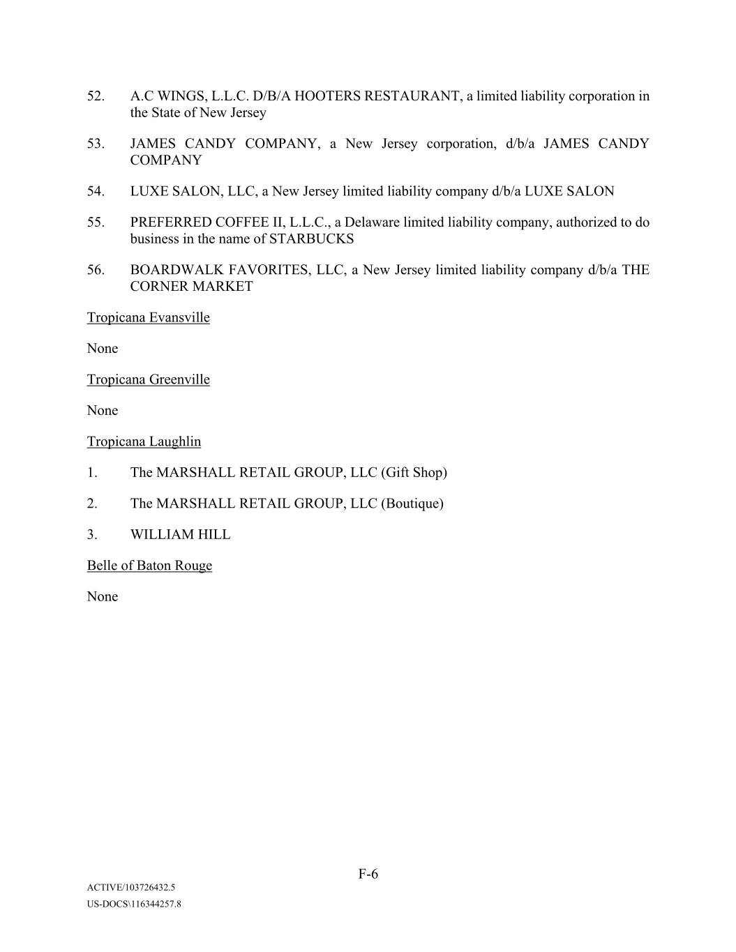
52. A.C WINGS, L.L.C. D/B/A HOOTERS RESTAURANT, a limited liability corporation in the State of New Jersey 53. JAMES CANDY COMPANY, a New Jersey corporation, d/b/a JAMES CANDY COMPANY 54. LUXE SALON, LLC, a New Jersey limited liability company d/b/a LUXE SALON 55. PREFERRED COFFEE II, L.L.C., a Delaware limited liability company, authorized to do business in the name of STARBUCKS 56. BOARDWALK FAVORITES, LLC, a New Jersey limited liability company d/b/a THE CORNER MARKET Tropicana Evansville None Tropicana Greenville None Tropicana Xxxxxxxx 1. The XXXXXXXX RETAIL GROUP, LLC (Gift Shop) 2. The XXXXXXXX RETAIL GROUP, LLC (Boutique) 3. XXXXXXX XXXX Xxxxx of Baton Rouge None F-6 ACTIVE/103726432.5 US-DOCS\116344257.8
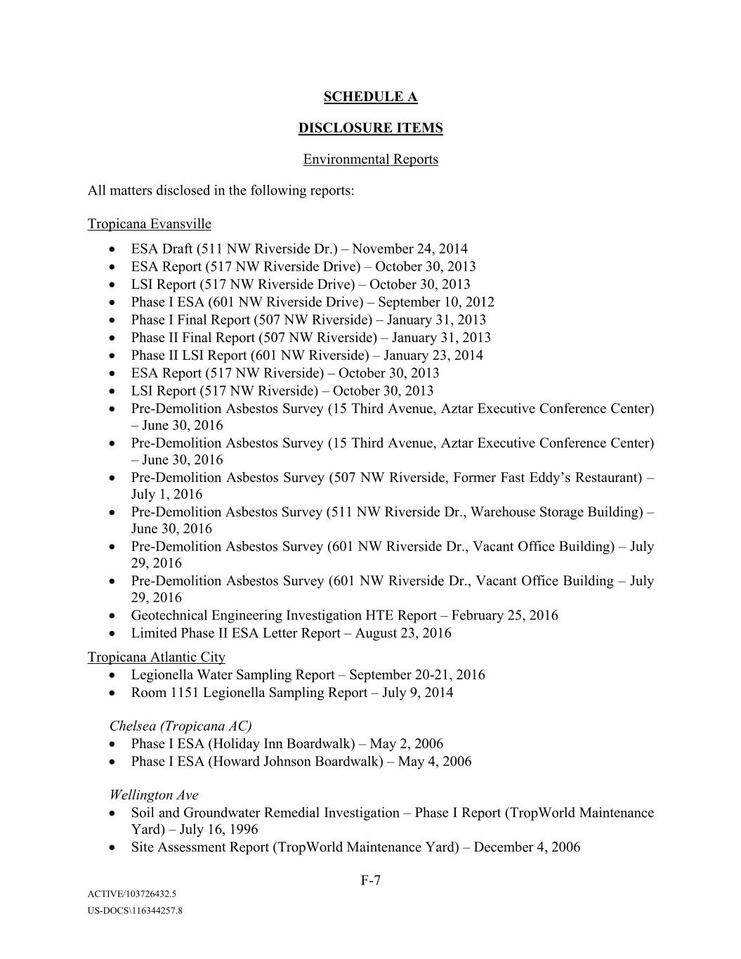
SCHEDULE A DISCLOSURE ITEMS Environmental Reports All matters disclosed in the following reports: Tropicana Evansville • ESA Draft (000 XX Xxxxxxxxx Xx.) – November 24, 2014 • ESA Report (000 XX Xxxxxxxxx Xxxxx) – October 30, 2013 • LSI Report (000 XX Xxxxxxxxx Xxxxx) – October 30, 2013 • Phase I ESA (000 XX Xxxxxxxxx Xxxxx) – September 10, 2012 • Phase I Final Report (507 NW Riverside) – January 31, 2013 • Phase II Final Report (507 NW Riverside) – January 31, 2013 • Phase II LSI Report (601 NW Riverside) – January 23, 2014 • ESA Report (517 NW Riverside) – October 30, 2013 • LSI Report (517 NW Riverside) – October 30, 2013 • Pre-Demolition Asbestos Survey (00 Xxxxx Xxxxxx, Xxxxx Executive Conference Center) – June 30, 2016 • Pre-Demolition Asbestos Survey (00 Xxxxx Xxxxxx, Xxxxx Executive Conference Center) – June 30, 2016 • Pre-Demolition Asbestos Survey (000 XX Xxxxxxxxx, Former Fast Xxxx’x Restaurant) – July 1, 2016 • Pre-Demolition Asbestos Survey (000 XX Xxxxxxxxx Xx., Warehouse Storage Building) – June 30, 2016 • Pre-Demolition Asbestos Survey (000 XX Xxxxxxxxx Xx., Xxxxxx Office Building) – July 29, 2016 • Pre-Demolition Asbestos Survey (000 XX Xxxxxxxxx Xx., Xxxxxx Office Building – July 29, 2016 • Geotechnical Engineering Investigation HTE Report – February 25, 2016 • Limited Phase II ESA Letter Report – August 23, 2016 Tropicana Atlantic City • Legionella Water Sampling Report – September 20-21, 2016 • Room 1151 Legionella Sampling Report – July 9, 2014 Chelsea (Tropicana AC) • Phase I ESA (Holiday Inn Boardwalk) – May 2, 2006 • Phase I ESA (Xxxxxx Xxxxxxx Boardwalk) – May 4, 2006 Wellington Ave • Soil and Groundwater Remedial Investigation – Phase I Report (TropWorld Maintenance Yard) – July 16, 1996 • Site Assessment Report (TropWorld Maintenance Yard) – December 4, 2006 F-7 ACTIVE/103726432.5 US-DOCS\116344257.8
• Site Assessment Report Addendum – December 28, 2006 • Sub-Slab Soil Gas & Indoor Air Sampling ARH Report – December 28, 2012 • Soil and Groundwater Remedial Investigation – Phase I Report (TropWorld Maintenance Yard) – July 16, 1996 Tropicana Xxxxxxxx • E26272 Legionella Potable Water Report – December 10, 2015 • E26319 Legionella Cooling Tower Report – December 17, 2015 • E26319 Legionella Potable Water Report – December 17, 2015 • Swan Hall Final Report – May 21, 2014 Belle of Baton Rouge None Tropicana Greenville None F-8 ACTIVE/103726432.5 US-DOCS\116344257.8
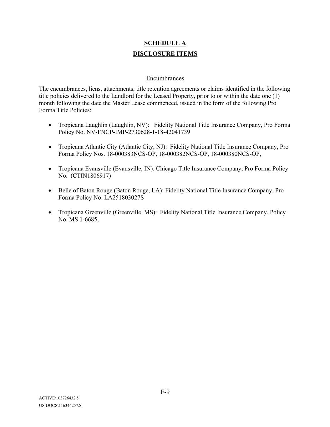
SCHEDULE A DISCLOSURE ITEMS Encumbrances The encumbrances, liens, attachments, title retention agreements or claims identified in the following title policies delivered to the Landlord for the Leased Property, prior to or within the date one (1) month following the date the Master Lease commenced, issued in the form of the following Pro Forma Title Policies: • Tropicana Xxxxxxxx (Laughlin, NV): Fidelity National Title Insurance Company, Pro Forma Policy No. NV-FNCP-IMP-2730628-1-18-42041739 • Tropicana Atlantic City (Atlantic City, NJ): Fidelity National Title Insurance Company, Pro Forma Policy Nos. 18-000383NCS-OP, 18-000382NCS-OP, 18-000380NCS-OP, • Tropicana Evansville (Evansville, IN): Chicago Title Insurance Company, Pro Forma Policy No. (CTIN1806917) • Belle of Baton Rouge (Baton Rouge, LA): Fidelity National Title Insurance Company, Pro Forma Policy No. LA251803027S • Tropicana Greenville (Greenville, MS): Fidelity National Title Insurance Company, Policy No. MS 1-6685, F-9 ACTIVE/103726432.5 US-DOCS\116344257.8

SCHEDULE B PROPERTY AGREEMENTS None. Schedule B ACTIVE/103726432.5 US-DOCS\116344257.8
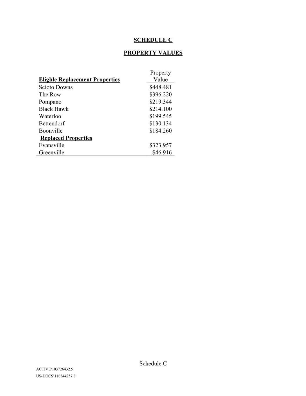
SCHEDULE C PROPERTY VALUES Property Eligble Replacement Properties Value Scioto Downs $448.481 The Row $396.220 Pompano $219.344 Black Hawk $214.100 Waterloo $199.545 Bettendorf $130.134 Boonville $184.260 Replaced Properties Evansville $323.957 Greenville $46.916 Schedule C ACTIVE/103726432.5 US-DOCS\116344257.8
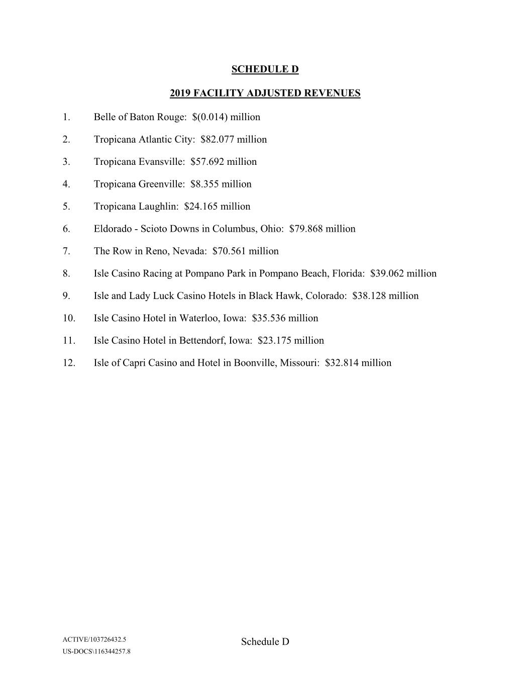
SCHEDULE D 2019 FACILITY ADJUSTED REVENUES 1. Belle of Baton Rouge: $(0.014) million 2. Tropicana Atlantic City: $82.077 million 3. Tropicana Evansville: $57.692 million 4. Tropicana Greenville: $8.355 million 5. Tropicana Xxxxxxxx: $24.165 million 6. Eldorado - Scioto Downs in Columbus, Ohio: $79.868 million 7. The Row in Reno, Nevada: $70.561 million 8. Isle Casino Racing at Pompano Park in Pompano Beach, Florida: $39.062 million 9. Isle and Lady Luck Casino Hotels in Black Hawk, Colorado: $38.128 million 10. Isle Casino Hotel in Waterloo, Iowa: $35.536 million 11. Isle Casino Hotel in Bettendorf, Iowa: $23.175 million 12. Isle of Capri Casino and Hotel in Boonville, Missouri: $32.814 million ACTIVE/103726432.5 Schedule D US-DOCS\116344257.8
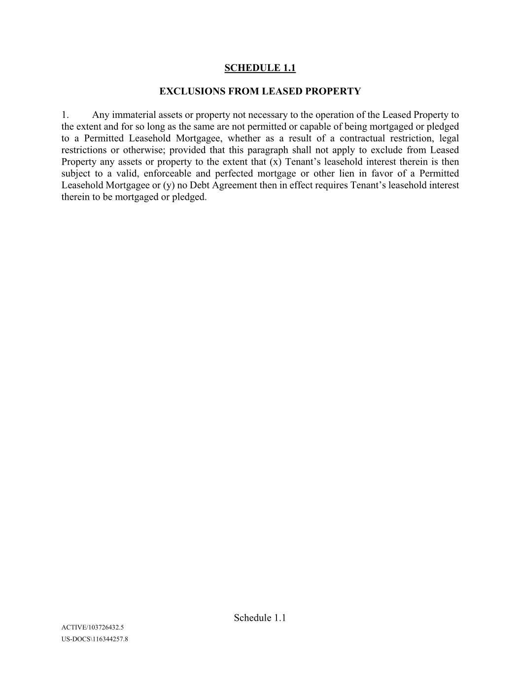
SCHEDULE 1.1 EXCLUSIONS FROM LEASED PROPERTY 1. Any immaterial assets or property not necessary to the operation of the Leased Property to the extent and for so long as the same are not permitted or capable of being mortgaged or pledged to a Permitted Leasehold Mortgagee, whether as a result of a contractual restriction, legal restrictions or otherwise; provided that this paragraph shall not apply to exclude from Leased Property any assets or property to the extent that (x) Tenant’s leasehold interest therein is then subject to a valid, enforceable and perfected mortgage or other lien in favor of a Permitted Leasehold Mortgagee or (y) no Debt Agreement then in effect requires Tenant’s leasehold interest therein to be mortgaged or pledged. Schedule 1.1 ACTIVE/103726432.5 US-DOCS\116344257.8

SCHEDULE 6.3 GUARANTORS UNDER THE MASTER LEASE Eldorado Resorts, Inc., a Nevada corporation Catfish Queen Partnership in Commendam, a Louisiana partnership in commendam Aztar Indiana Gaming Company, LLC, an Arizona limited liability company Lighthouse LLC, a Mississippi limited liability company Tropicana Xxxxxxxx, LLC, a Nevada limited liability company Schedule 6.3 ACTIVE/103726432.5 US-DOCS\116344257.8

