ILLINOIS COAL LEASE
Exhibit 10.21
| [*] | indicates that a confidential portion of the text of this agreement has been omitted. The non-public information has been filed separately with the Securities and Exchange Commission. |
| Prepared by: | TVA TRACT NO. XENC-3L | |||
| /s/ Xxxxxx X. Xxxxxx |
||||
| Xxxxxx X. Xxxxxx, Attorney Tennessee Valley Authority 0000 Xxxxxx Xxxxxx, XXX 0X Xxxxxxxxxxx, Xxxxxxxxx 00000-0000 (000) 000-0000 |
||||
THIS LEASE, effective the 1st day of July, 2002, between the UNITED STATES OF AMERICA (sometimes hereinafter referred to as the “Lessor”), acting herein by and through its legal agent, the Tennessee Valley Authority (hereinafter referred to as “TVA”), a corporation created and existing under an Act of Congress, known as the Tennessee Valley Authority Act of 1933, as amended, and ILLINOIS FUEL COMPANY, LLC, a Kentucky limited liability company (hereinafter referred to as “Lessee”);
WHEREAS TVA advertised said TVA Tract No. XENC-3L for sale at public auction; and
PAGE 1 OF COAL LEASE
TVA TRACT NO. XENC-3L
The coal rights hereby leased were acquired by the United States of America by virtue of the deeds referenced in said Exhibit C (hereinafter collectively referred to as the “Acquisition Deeds”), a copy of which is attached hereto and made a part hereof.
It is understood that this lease is granted subject to facts which would be disclosed by an accurate survey of the premises and to such defects in title as may be disclosed upon an examination thereof.
It is understood and agreed that this lease is subject to all the terms and conditions which were included in or incorporated by reference in Lessors Acquisition Deeds referred to above and that this lease grants the right to remove said seams of coal underlying the land described in said Exhibit A and shown on said Exhibit B, subject to any restrictions In the Acquisition Deeds whether included therein or incorporated by reference or by law, and to the following express conditions:
| 1. | Rights Granted |
Lessor grants the right to mine and remove the No. 5 and No. 6 seams of coal by underground mining methods only. Lessee agrees to conduct all mining activities in a manner that will avoid damage to the remaining coal resources as can be avoided by an ordinary prudent and practical operator. In addition, to the extent Lessor has such rights under its Acquisition Deeds or at law, Lessor grants to Lessee the nonexclusive right to use and to acquire the surface lands overlying the leased area and any adjoining land in which Lessor may have an interest by reason of uncertain boundaries, adverse possession, unrecorded deeds or otherwise as provided in said Acquisition Deeds.
This lease does not convey and Lessor hereby specifically reserves any and all interest it may have in and to the coalbed methane; provided, however, Lessee may release coalbed methane incident to the rights conveyed hereunder where it is necessary and reasonable to do so for the purposes of ventilation or safety.
| 2. | Mining Permit Application, General Mining Plans and Maps |
At the time Lessee applies to the Illinois Office of Mines and Minerals for a mining permit, Lessee shall provide TVA a copy of all documents and maps submitted in conjunction therewith.
Furthermore, Lessee shall develop and work its operations in accordance with a general mining plan which may be revised from time to time by mutual agreement. Lessee shall not Initiate or conduct any activities under a proposed general mining plan or any proposed revisions thereto prior to receiving TVA’s written approval which shall not be unreasonably withheld. Any general mining plan or proposed revisions will be reviewed by TVA in a timely manner. Unless Lessee receives written disapproval of the general mining plan or any revision thereto within twenty-eight (28) days, in the case of the initial plan, or fourteen (14) days, in the case of any revisions, of submittal to TVA, the plan or revisions shall be deemed to be approved.
PAGE 2 OF COAL LEASE
TVA TRACT NO. XENC-3L
If a general mining plan that meets TVA’s approval is not submitted within eighteen (18) months from the effective date hereof, then this agreement shall terminate at such time unless extended by TVA in writing. In the event of a termination for failure to timely submit an acceptable plan, TVA shall retain all lease payments previously made, and Lessee shall be obligated to make lease payments pursuant to section 3 of this agreement only for the period prior to termination, with payments for any partial royalty period (as defined in section 3 hereof) being calculated proportionately to the fraction of such royalty period. The preceding sentence applies only in the case of the initial plan. Notwithstanding the foregoing, if Lessee notifies TVA in writing within sixteen (16) months from the effective date hereof that it does not intend to submit a mining plan, TVA shall not have the option to extend this agreement beyond eighteen (18) months from the effective date hereof.
The general mining plan shall provide for maximum recovery of all coal that the Lessee as an ordinary prudent and practical operator can mine and sell at a reasonable profit as determined by industry standards (hereinafter the “minable and recoverable coal”).
Lessee shall conduct its mining operations thereunder in an efficient and workmanlike manner, in accordance with approved mining methods and practices in the vicinity, in accordance with the laws and regulations governing such operations, and in such manner as to recover the maximum amount of minable and recoverable coal and to prevent unnecessary harm to the remaining coal resources and coal reserves which are not mined by the Lessee.
Royalty will be paid on each ton of minable and recoverable coal lost where such loss is the result of the Lessee independently deviating from the currently approved general mining plan or of Lessee’s breach of any other obligations under this lease. Royalty will be due upon the discovery of such loss and the royalty will be calculated and paid in accordance with section 4 hereof.
Lessee shall keep mine maps as required by the State of Illinois and the U.S. Department of Interior.
True copies of mine production maps shall be delivered to TVA not later than the 15th day of the month following each royalty period and accurately reflect the mining conducted the previous royalty period and projected mining for the current royalty period.
Lessee shall provide for TVA’s review and approval a copy of any proposed mining and reclamation plan, showing all anticipated surface disturbance, at the time such plan is submitted to the appropriate regulatory authorities. Lessee may conduct only such operations hereunder as are in accordance with such an approved plan.
Notwithstanding anything herein to the contrary, Lessee shall not commence any mining activity pursuant to a mining plan or revisions thereto until satisfactory completion of all environmental and cultural resource reviews by TVA required for compliance with all applicable laws and regulations. Based on the results of such reviews, TVA may require the revision of any mining plan or revision theretofore approved or deemed approved; provided further, if such revisions require Lessee to undertake measures in excess of those required by law or regulation, TVA shall bear the cost of such measures. On the basis of such reviews, TVA may prohibit mining on a portion of, or all of, the leasehold. In the event such a prohibition precludes mining or further mining of the leasehold at a reasonable profit, this lease shall terminate. If such a termination occurs before commencement of mining under the initial general mining plan, TVA shall return to the Lessee all lease payments and any minimum royalty payments previously made. In case of a partial or total prohibition, after commencement of mining, an equitable adjustment shall be made in payments previously made (or thereafter otherwise payable If only a partial prohibition) based on the ratio of the minable and recoverable coal which TVA permits to be mined to the total amount of minable and recoverable coal otherwise minable and recoverable as of the effective date of this lease.
PAGE 3 OF COAL LEASE
TVA TRACT NO. XENC-3L
| 3. | Lease Payment and Minimum Royalty |
Upon execution of this lease, Lessee shall pay TVA the amount of [*]. Beginning with the first royalty period, Lessee shall pay TVA as a lease payment the sum of [*] per year [*], one-fourth (1/4) of which shall be paid each and every royalty period1 until that royalty period in which production begins, payment of which shall be made on or before the 25th day after the end of each royalty period, the first being due July 25th, 2002.
Beginning with the twenty-first (21st) royalty period or the royalty period in which production begins, whichever occurs first, in the event sufficient tonnage is not mined and removed to provide a minimum royalty payment of [*] per year [*], one-fourth (1/4) of which shall be paid each and every royalty period, Lessee shall pay to TVA, in addition to any production royalty payment under section 4, the difference by which the minimum royalty payment due exceeds any production royalty amount due for such period.
When production royalty payments for royalty period exceed the minimum royalty payment due, that amount in excess will be considered a carryover credit toward meeting the minimum requirement for the succeeding royalty period or periods.
Lease payments paid to TVA pursuant to the first paragraph of this section 3 for the first twenty (20) royalty periods shall be credited against any production royalty payments thereafter payable. Beginning with the twenty-first (21st) royalty period, any minimum payments made pursuant to the second paragraph of this section 3 shall be credited against any production royalty payments payable for the next four (4) royalty periods.
Payment of any minimum royalty due shall be made on or before the 25th day of the month following each royalty period.
| 1 | A royalty period is (with the exception of the first royalty period) three calendar months ending March 31, June 30, September 30, or December 31. The first royalty period may be less than three calendar months, commencing on the effective date hereof and ending on the next following of the above dates. |
PAGE 4 OF COAL LEASE
TVA TRACT NO. XENC-3L
| 4. | Production Royalty |
Lessee shall pay to TVA a basic tonnage royalty of [*}2, whichever is the greater amount, on each ton of 2,000 pounds on all coal mined and removed by Lessee from the leased premises.
Lessee agrees that TVA may, under the following situations, elect to disregard the gross selling price used by Lessee in calculating royalty and substitute reasonable gross selling price based on prevailing market data for coal of similar quality:
| A. | When in TVA’s reasonable judgment purchaser is not a bona fide purchaser; or |
| B. | When the blending of coal from the leased premises with coal of lower quality from other sources has an adverse effect on the ultimate sale price. |
Production royalty shall be paid on each raw, run-of-mine ton of coal mined and removed from the leased premises; provided, however, if cleaning shall be necessary to render the coal merchantable, royalty will be paid on each clean ton, except in circumstances governed by section 6 hereof.
Production royalty payments shall be made on or before the 25th day of the month following actual production.
| 5. | Recordkeeping |
Lessee shall keep accurate records and accounts, by such methods and in such forms as are acceptable to TVA, of the coal mined and removed by Lessee from the leased premises and shall furnish to TVA, on or before making royalty payments, a signed certification, in form satisfactory to TVA, setting forth all information required to compute the proper amount of such payment.
TVA, or its designee, shall have the right to inspect all such records and accounts, and Lessee shall furnish to TVA, upon request, such evidence of the correctness of such records, account, and certificates as TVA may from time to time require including certificates of weigh masters or other representatives of railroads, truckers, or tipples through which coal from the leased premises has been shipped by Lessee. No certification of Lessee shall be deemed conclusive, and TVA shall have the right at any time either before or after shipment, or before or after payment of the royalties, to verify the information set forth in such certification by such methods as TVA may deem appropriate, and any adjustments in royalties shown to be due by such verified information shall be paid within twenty (20) days after written demand by TVA. If, in TVA’s reasonable judgment, the records are inadequate for determining correct royalty due, TVA may
| 2 | [*} |
PAGE 5 OF COAL LEASE
TVA TRACT NO. XENC-3L
terminate this lease in accordance with section 15. TVA shall keep confidential all information, records and accounts Inspected or obtained by virtue of this lease, shall use it or them only for the purpose specified In this lease and shall not disclose it or them to others except as required by law.
| 6. | Calculated Tonnage |
If TVA, in its sole judgment, determines that the amount of coal mined and removed from the leased premises prior to the normal weighing of individual trucks by certified scales is not reasonably able to be determined due to the blending of coal extracted from the leased premises with coal from other sources, as referred to In section 4 hereof, then TVA will calculate the tonnage on which production royalty shall be due by means of accurate seam thickness, pit dimensions, and/or entry measurements supplied by Lessee, and any additional measurements which TVA representatives from time to time may take or obtain. Each cubic yard of coal and/or coal-like material (material in-place with a merchantable heat content) shall be deemed to be equivalent to 1.10 tons of coal. To compensate for losses of coal that normally occur through mining and preparation, Lessee shall be required to pay royalty on only ninety-five percent (95%) of the tonnage calculated under this paragraph when such calculated tonnage is the basis for determining royalty payment.
TVA may from time to time, at its own expense, conduct float-sink tests on sample material taken from portions of the coal seam to determine that portion of a particular one of material which should be included in the calculation of tonnage on which production royalty shall be due. In the event that float-sink tests are performed, any coal or coal-like material which floats at a gravity test of 1.52 shall be included in the calculation of tonnage on which production royalty shall be due. The basic tonnage royalty set forth in section 4 hereof will then be applied to the tonnage calculated in accordance with this section 6 to arrive at the production royalty payments (as used in section 4 hereof).
In taking the measurements provided for in this section 6, Lessee shall clearly xxxx the stations at which coal thickness measurements are taken, and coal thickness measurements shall be accurate to the nearest one quarter inch. Linear measurements shall be accurate to the nearest one-tenth of afoot and shall be taken as often as required to provide accurate calculations of the mined area. All calculations, tests, and measurements shall be performed using sound principles generally acceptable in the coal industry. If TVA elects to calculate the tonnage under this section 6, it will be taken into account in determining the form of recordkeeping and account keeping acceptable to TVA under section 5; however, all of the provisions contained In section 5, including, without limitation, recordkeeping, certification requirements, and inspection rights, will remain in effect and any measurements or other information provided by the Lessee under this section 6 shall be certified by the Lessee In accordance with said section 5.
| 7. | Term |
This lease shall be for a term of ten (10) years from the effective date hereof or until the minable and recoverable coal in the No. 5 and No. 6 seams of coal is exhausted, whichever occurs first; provided however, that if at the end of the initial ten (10) years Lessee is producing coal from the leased premises, the term shall automatically extend for so long as coal is being produced from the leased premises; provided, further, that If at the end of the initial ten (10) years, or at any time thereafter, coal is not being produced from the leased premises, the term of this lease may be extended at TVA’s sole option.
It Is understood that all or a portion of the land on which the right to mine and appurtenant rights are leased and granted in this lease shall be bonded with the appropriate state or federal
PAGE 6 OF COAL LEASE
TVA TRACT NO. XENC-3L
authority and that following the termination of the lease or removal of coal, it may be necessary to maintain the use of the bonded area until said bonds are released. It is agreed by the Lessor that it shall not condone, grant, allow or permit any use, activity or other action to occur on any affected or bonded part of the land which will In anyway interfere with or constitute noncompliance with the state or federal regulations. Lessor shall not prohibit or in any way interfere with Lessees access to and entry upon the land at all times during the required period for such purposes and activities as may be necessary to fulfill or comply with such governmental regulations. The Lessor agrees that It will sign post-mining land use change waivers or other such documents which will grant any needed or required consents to Lessee or others to allow silt structures or ponds and roads to remain upon the property after mining is completed and to allow the land to be returned to hayland/pastureland or fish and wildlife habitat.
| 8. | Removal of Personal Property and Land Restoration |
Lessee shall, if required by TVA, upon any partial or total relinquishment or the termination or expiration of this lease, restore the surface of the leased land to its former condition or to a condition permitted under law, including the removal of structures. The Lessee shall have the privilege, at any time within sixty (60) days after the termination or expiration of said lease, of removing from the leased premises all personal property which the Lessee placed upon the affected lands Any personal property which the Lessee fails to remove within such period of sixty (60) days and any structures the Lessee fails to remove as required above shall become the property of TVA at TVA’s option and/or may be removed at Lessees expense.
| 9. | Compliance With Laws and Environmental Protection |
Lessee shall obtain all required permits. All activities resulting from the exercise of rights granted under this lease shall be conducted In such manner so as to (a) comply with all applicable local, state, and federal laws and regulations and (b) protect the environment. TVA may direct activities for the protection of the environment or historical or archaeological resources in excess of those required by law provided TV bears the cost of such activities.
Without limiting the foregoing, Lessee shall not disturb or alter in anyway the existing state of any archeological sites, human remains, funerary objects, sacred objects, objects of cultural patrimony, or any other archeological resources which may be discovered or identified on or under the leased premises as provided for in the Native American Xxxxxx Protection and Repatriation Act and the Archeological Resources Protection Act Upon the discovery of any such items, Lessee shall immediately stop all activity in the area of the discovery, make a reasonable effort to protect such items, and notify TVA’s Cultural Resources staff by telephone at 000-000-0000. Lessee shall also provide written notification of such discovery to TVA, Cultural Resources, Xxxx Xxxxxx Xxx 0000, Xxxxxx, Xxxxxxxxx 00000. Lessee shall not resume work in the area of the discovery until approved by TVA.
Furthermore, without limiting the foregoing, Lessee shall secure for its employees the black lung benefits as provided for in the Federal Mine Safety and Health Act of 1977, as amended.
| 10. | Rights of Third Parties |
If the surface overlying said coal and/or oil and gas and/or other mineral rights in said land are owned by third parties and if any conflict between Lessee and such third parties results in litigation, then TVA shall have the right at its option to assume complete control of the conduct of such litigation at its expense, and Lessee agrees to cooperate fully with TVA in the conduct of the litigation. TVA does not warrant or guarantee that any such conflict will be resolved in a manner favorable to the Lessee.
PAGE 7 OF COAL LEASE
TVA TRACT NO. XENC-3L
| 11. | Indemnification |
Lessee shall indemnify and save harmless the United States of America, TVA, and their employees and agents against and from all claims, demands, suits, losses, and judgments for damages and injuries (including death) to persons, including employees of Lessee, or property which may result by reason of the Lessee exercising any rights hereby granted to the Lessee, such damages and injuries to Include but not be limited to those resulting from: explosions from any cause; mining accidents or disasters; flooding; pollution of streams, wells, ponds, watercourses; pollution of the atmosphere; trespass; nuisance; and surface subsidence affecting surface lands, streams, wells, ponds, watercourses, rights-of-way, telephone lines, powerlines, pipelines, oil and gas xxxxx, roads, railroads, or any object or structure located on the subsiding surface.
| 12. | Assignment and Insolvency |
Lessee shall not assign in whole or in part, any of the estate, right, or benefit accruing to it under the terms of this lease without the prior written consent of TVA, which consent shall not be unreasonably withheld, and in the event TVA shall give such consent, the same shall not be construed as waiver of this provision with respect to subsequent assignments. In the event Lessee shall be adjudged bankrupt, or if a receiver be appointed for it on the grounds of insolvency or threatened insolvency, or if any property of Lessee be advertised for sale, under process of law or by any decree or order of any court of competent jurisdiction, and such processes, decrees, and/or orders be not discharged and satisfied more than five (5) days prior to the date of such advertised sale, then in the case of the happening of any one of the foregoing contingencies, Lessee shall be conclusively deemed to have assigned this lease without the written consent of TVA and to be in default hereunder, and TVA shall have the right to immediately terminate this lease without further notice.
| 13. | Taxes |
The Lessee shall pay when due all taxes lawfully assessed and levied under the laws of the state of Illinois or the United States of America upon improvements, output of mines, or other rights, property, or assets of the Lessee.
| 14. | No Warranties |
It is understood and agreed that TVA has made no warranties as to the amount or quality of coal which may be contained In the leased premises or as to the methods which may be employed In mining such coal and has not made any commitment or given any assurance as to the minability or accessibility of any coal.
| 15. | Default and Termination |
If the Lessee fails to comply with any of the provisions of this lease, TVA may give the Lessee written notice to correct such default and, if such default is not corrected within thirty (30) days after the service of such written notice upon the Lessee, TVA may terminate this lease. The Lessee may, upon sixty (60) days’ written notice to TVA, terminate this lease after thirty (30) calendar months from the effective date hereof, subject to the terms of section 21 of this agreement.
Upon termination of this lease, title to all unmined coal shall remain the property of TVA as custodian for the United States of America, and Lessee shall (in addition to other lease payment and royalty obligations) pay TVA the basic tonnage royalty provided for in section 4 for each ton of coal mined but not removed from TVA Tract No. XENC-3L. Lessee will have 30 days from such termination date in which to make payment of all outstanding royalties and any other financial obligation which may have accrued under the terms of this agreement.
PAGE 8 OF COAL LEASE
TVA TRACT NO. XENC-3L
| 16. | Right of Entry |
TVA’s representatives shall have the right at all reasonable times to enter the lease area whether below or on the surface of the ground In order to inspect and examine same or for any other lawful purpose incident to or connected with its interest or its rights under this lease TVA shall have the right to inspect and to make surveys of the Lessees mines on the property and to examine the maps, engineering records, and production records of the Lessee The provisions of section II shall not apply to the exercise of any right under this section 16 or to any claims, demands, suits, losses, and judgments for damages or injuries (including death) which may result from the exercise of any such right and TVA shall indemnify and save harmless Lessee against and from all such matters except for any damages or injuries proximately caused by Lessees sole negligence.
| 17. | Administration |
TVA’s Executive Vice President, Fossil Power Group, or his designee, will administer this lease for TVA as its duly authorized representative Such designation shall continue until revoked or modified by TVA’s Executive Vice President, Fossil Power Group, by notice to the Lessee Any notice to Lessee deemed necessary under the terms of this lease shall be in writing and deposited postpaid in the United States mail addressed to the Lessee x/x Xxxx X. Xxxxx, Xx., Xxxxxxxxx, Xxxxxxxx Fuel Company, LLC, 0000 Xxxxx Xxx Xxx Xxxx, Xxxxxxx, Xxxxxxxx 00000, or such other addresses as subsequently designated in writing from time to time All payments required hereunder shall be deposited postpaid In the United States mail addressed to Tennessee Valley Authority, Attention Cash Management, Treasury Services, X.X. Xxx 000, Xxxxxxxxx, Xxxxxxxxx 00000-0000, with a copy of such payment and any written notices or correspondence required hereunder directed to the Tennessee Valley Authority, Fossil Power Group, Executive Vice President, 0000 Xxxxxx Xxxxxx, Xxxxxxx Xxxxx, 0X, Xxxxxxxxxxx, Xxxxxxxxx 37402-2801, or to such other addresses as TVA may subsequently designate in writing from time to time.
| 18. | No Right to Benefit |
No member of or delegate to Congress or Resident Commissioner ,or any officer, employee, special government employee, or agent of TVA shall be admitted to any share or part of this lease or to any benefit that may arise therefrom unless It be made with corporation for its general benefit, nor shall the Lessee offer or give, directly or indirectly, to any officer, employee, special government employee, or agent of TVA any gift, gratuity, favor, entertainment, loan, or any other thing of monetary value, except as provided in 5 C.F.R. Part 2635. Breach of this provision shall constitute material breach of this lease, and TVA shall have the right to exercise all remedies provided in this lease or at law.
| 19. | Force Majeure |
If as a result of a force majeure either of the parties hereto is unable to carry out fully or In part Its obligations hereunder, it shall give the other party prompt written notice of the force majeure with reasonably full particulars concerning it. Thereupon, except for accrued obligations to make payments of money or transfer property, the obligations of each party, so far as they are affected by the force majeure, shall be suspended during but no longer than, the continuance of the force majeure. The party claiming the suspension shall use all reasonable diligence to remove the force majeure as quickly as possible, but shall not be required to settle strikes or other labor difficulties against its best judgment The term “force majeure” as employed herein shall mean an
PAGE 9 OF COAL LEASE
TVA TRACT NO. XENC-3L
act of God, action of the elements, strike, lockout, or other industrial disturbance, act of the public enemy, war blockade, public riot, fire, lightning, earthquake, storm, flood, explosion, governmental restraint or delay, unavailability of equipment and any other cause, whether of the kind specifically enumerated or otherwise, which is not reasonably within the control of the party claiming the suspension. If any period of force majeure continues for more than one hundred and twenty (120) days, either party may terminate this lease by giving written notice.
| 20. | Discrimination |
Unless otherwise specifically exempted, this agreement will be performed by Lessee in full compliance with all applicable equal opportunity requirements including, but not limited to, the provisions of Executive Order No. 11246, as amended, and the provisions of the Equal Employment Opportunity clause set out in such order, which clause is incorporated herein by reference; the provisions of Chapter 60 of Title 41 of the Code of Federal Regulations, which provisions, including any future amendments thereof, are incorporated herein by reference and made a part hereof; the Vietnam Era Veterans’ Readjustment Assistance Act of 1979 relating to the employment of veterans; the Rehabilitation Act of 1973 relating to the employment of handicapped persons; Executive Order No. 11141 prohibiting discrimination on the basis of age; and all amendments thereto and all applicable regulations, rules, and orders issued thereunder.
| 21. | Survival of Obligations |
Notwithstanding any other provision of this lease or of any documents and instruments of any sort whatsoever made in connection with or pursuant to this lease, any obligations arising under this lease which obligations arise from matters or events occurring on or before expiration or earlier termination of this lease shall survive such expiration or earlier termination and shall remain In full force and effect following expiration or earlier termination of this lease.
| 22. | Waivers and Remedies |
No waiver of any default under this lease shall be held to be a waiver of any other default All remedies under this lease, including TVAs right to terminate under section 15, shall be in addition to every other remedy provided herein or by law.
TO HAVE AND TO HOLD said leased premises unto the Lessee, and TVA does hereby covenant that the United States of America is seized and possessed of the described premises; that TVA as legal agent of the United States of America is duly authorized to lease the above-described coal and that, subject to the conditions expressly mentioned above, it will warrant and defend the title thereto against the lawful demands of all persons claiming by, through, or under the United States of America but not further or otherwise.
PAGE 10 OF COAL LEASE
TVA TRACT NO. XENC-3L
IN WITNESS WHEREOF, the Tennessee Valley Authority, acting herein as legal agent of the United States of America and being duly authorized to do so, has caused this lease to be executed, In the name of the United States of America, by its authorized officers this the 6th day of June, 2002, and ILLINOIS FUEL COMPANY, LLC, a Kentucky limited liability company, has caused this lease to be executed by its duly authorized officer this the 30th day of June, 2002.
| LESSOR: | ||||||||||||
| UNITED STATES OF AMERICA | ||||||||||||
| By TENNESSEE VALLEY AUTHORITY, | ||||||||||||
| its legal agent | ||||||||||||
| ATTEST: | ||||||||||||
| /s/ J. Xxxxx Xxxxx |
/s/ Xxxxxxx X. Xxxxxxx |
|||||||||||
| J. XXXXX XXXXX | XXXXXXX X. XXXXXXX | |||||||||||
| Assistant Secretary | Manager, Realty Services | |||||||||||
| LESSEE: | ||||||||||||
| ILLINOIS FUEL COMPANY, LLC a Kentucky limited liability company |
||||||||||||
| /s/ Xxxx X. Xxxxx, Xx. |
||||||||||||
| Xxxx X. Xxxxx, Xx., President | ||||||||||||
| STATE OF TENNESSEE | ) | |||||||||||
| ) SS | ||||||||||||
| COUNTY OF XXXXXXXX | ) | |||||||||||
On the 6th day of June, 2002, before me personally app eared XXXXXXXX X. XXXXXXX and J. XXXXX XXXXX, to me personally known, who, being by me duly sworn, did say that they are the Manager, Realty Services, and Assistant Secretary, respectively, of the TENNESSEE VALLEY AUTHORITY, a corporation; that the seal affixed to the foregoing instrument is the corporate seal of said corporation, and that said instrument was signed, sealed, and delivered on behalf of said corporation, by authority of its Board of Directors, and as legal agent for the UNITED STATES OF AMERICA; and the said XXXXXXX X. XXXXXXX and J. XXXXX XXXXX acknowledged said instrument to be the free act and deed of the UNITED STATES OF AMERICA, as principal, and the TENNESEEE VALLEY AUTHORITY, as its agent.
WITNESS my hand and official seal of office in Chattanooga, Tennessee, the day and year aforesaid.
| /s/ Xxxx X. Xxxx |
My commission expires: | May 23, 2005 |
||||||||
| Notary Public | ||||||||||
PAGE 11 OF COAL LEASE
TVA TRACT NO. XENC-3L
| COMMONWEALTH OF KENTUCKY | ) | |||
| ) | SS | |||
| COUNTY OF XXXX | ) |
On the 30th day of June, 2002, before me personally app eared XXXX X. XXXXX, XX, to me personally known, who, being by me duly sworn, did say that he is the President of ILLINOIS FUEL COMPANY, LLC, a Kentucky limited liability company, and that the said instrument was signed and delivered on behalf of said limited liability company, by authority of its members, and he, as such officer, acknowledged said instrument to be the free act and deed of said limited liability company on the day and year herein mentioned.
WITNESS my hand and official seal of office in Chattanooga, Tennessee, the day and year aforesaid.
| /s/ Xxxxxxxxx Xxxxx |
My commission expires: | 6/28/06 |
||||||||
| Notary Public | ||||||||||
The name and address of the Lessee is:
Xxxx X. Xxxxx, Xx., President
Illinois Fuel Company, LLC
a Kentucky limited liability company
0000 Xxxxx Xxx Xxx Xxxx
Xxxxxxx, Xxxxxxxx 00000
Telephone No. 000-000-0000
The name and address of the Lessor is:
United States of America
Tennessee Valley Authority
c/o Realty Services
0000 Xxxxxx Xxxxxx, XXX0X
Xxxxxxxxxxx, Xxxxxxxxx 00000-0000
PAGE 12 OF COAL LEASE
EXHIBIT A
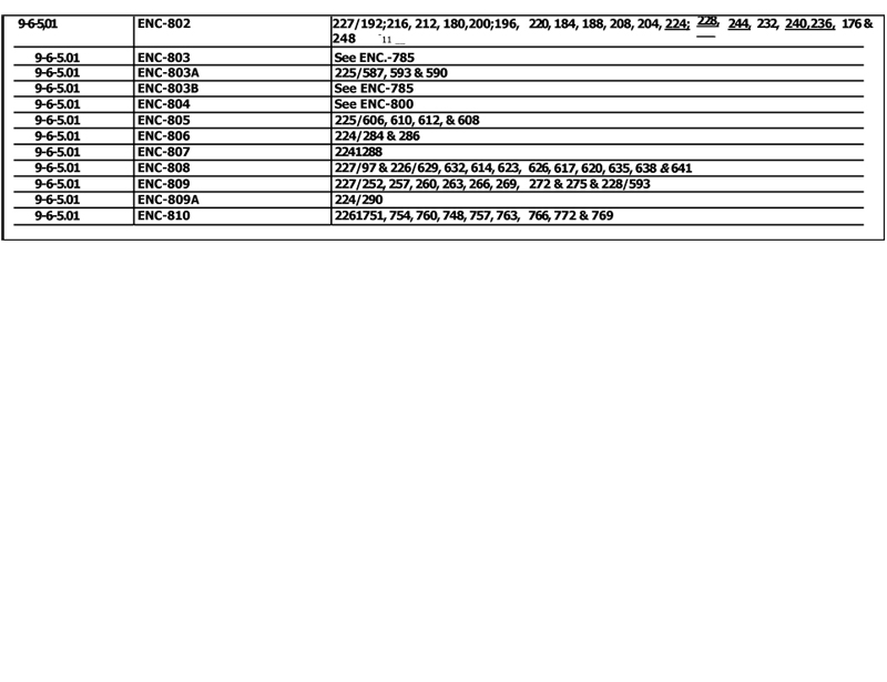
Recording information is in the process of being verified.
The final Exhibit B to the lease will contain all of the updated information
| Tract Symbol |
Recording Information |
Gross Acres |
Percent Coal Total |
|||||||||||
| 1-5-3.01 |
ENC-31 |
610.64 | 100 | All of Xxxxxxx 0, Xxxxxxxx 0 Xxxxx, Xxxxx 3 | ||||||||||
| 1-5-3.01 |
ENC-32 |
East, Franklin County, Illinois, less and | ||||||||||||
| 1-5-3.01 |
ENC-33 |
except a parcel described as beginning at | ||||||||||||
| 1-5-3.01 |
ENC-34 |
the SW corner of the SE 1/4SE1/4 | ||||||||||||
| 1-5-3.01 |
ENC-35 |
thence E 32 rods, thence North 10 rods, | ||||||||||||
| 1-5-3.01 |
ENC-36 |
thence West 32 rods, thence South 10 rods | ||||||||||||
| 1-5-3.01 |
ENEX-1 |
to the point of beginning (POB); and the partial | ||||||||||||
| 1-5-3.01 |
ENEX-1 |
interest described as Parcel 1.02 below; | ||||||||||||
| 1-5-3.02 |
ENC-36C |
43.07 | 89.11 | SE1/4NW1/4 | ||||||||||
| All of Xxxxxxx 0, Xxxxxxxx 0 Xxxxx, | ||||||||||||||
| Xxxxx 0 Xxxx, Xxxxxxxx Xxxxxx. Illinois, | ||||||||||||||
| described as follows: | ||||||||||||||
| 1-5-4.01 |
ENC-235A |
18.29 | 100 | N1/2NE1/4NW1/4; | ||||||||||
| 1-5-4.02 |
ENC-231 |
114.08 | 87.5 | N1/2NE1/4; NE1/4NW1/4; | ||||||||||
| 1-5-4.02 |
ENEX:1 |
|||||||||||||
| 1-5-4.03 |
ENCW-35 |
18.29 | 90.71 | S1/2NW 1/4NW1/4; | ||||||||||
| 1-5-4.04 |
ENC-232 |
470.66 | 100 | S1/2; S1/2N1/2 | ||||||||||
| 1-5-4.04 |
ENC-232A |
|||||||||||||
| 1-5-4.04 |
ENC-233 |
|||||||||||||
| 1-5-4.04 |
ENC-234 |
|||||||||||||
| 1-5-4.04 |
ENC-234A |
|||||||||||||
| 1-5-4.04 |
ENC-234B |
|||||||||||||
| 1-5-4.04 |
ENG235 |
|||||||||||||
| 1-5-4.04 |
ENC-235B |
|||||||||||||
| 1-5-4.04 |
ENC-235C |
|||||||||||||
| 1-5-4.04 |
ENC-235D |
|||||||||||||
| 1-5-4.04 |
ENEX-1 |
|||||||||||||
| 1-5-4.04 |
ENEX-1 |
|||||||||||||
PAGE 1 OF EXHIBIT A TO ILLINOIS COAL LEASE
EXHIBIT A
| Identifier |
Tract Symbol |
Recording Information |
Gross Acres |
Percent Coal Total |
Description | |||||||||
| 10-4-4.01 |
ICOR-1 |
78.47 | 100 | That portion of the S1/2NE1/4 of Section 10 | ||||||||||
| West of the Xxxxxxxx | ||||||||||||||
| Xxxxxxxx 0 Xxxxx | ||||||||||||||
| Xxxxx 0 Xxxx | ||||||||||||||
| Xxxxxxxxx Xxxxxx, Xxxxxxxx | ||||||||||||||
| 10-5-3.01 |
ENC-46 |
530.00 | 00 | All of Section 10 except the | ||||||||||
| 10-5-3.01 |
ENC-47 |
N1/2NE1/4, | ||||||||||||
| 10-5-3.01 |
XXX-00 |
Xxxxxxxx 0 Xxxxx, | ||||||||||||
| 00-0-0.00 |
ENC-49 |
Range-3 East | ||||||||||||
| 10-5-3.01 |
ENC-50 |
Franklin County, Illinios, and except the | ||||||||||||
| 10-5-3.01 |
ENC-51A |
- | partial interest described as Parcel 3.02 | |||||||||||
| 10-5-3.01 |
ENC-51B |
. |
below; | |||||||||||
| 10-5-3.01. |
ENC-51C |
|||||||||||||
| 10-5-3.01 |
ENC-51D |
|||||||||||||
| 10-5-3.01 |
ENCW-51 |
|||||||||||||
| 10-5-3.01 |
ENEX-1 |
|||||||||||||
| 10-5-3.01 |
ENEX-1 |
|||||||||||||
| 10-5-3.02 |
ENC-47A |
10.00 | -.50 | SW1/4NEl/4NW1/4 | ||||||||||
| 10-5-4.01 |
ENC-291 |
615.38 | 100 | All of Section 10, Township 5 South, | ||||||||||
| 10-5-4.01 |
XXX-000 |
Xxxxx 0 Xxxx, Xxxxxxxx Xxxxxx, Xxxxxxxx, | ||||||||||||
| 10-5-4.01 |
ENC-292A |
less and except that portion of the | ||||||||||||
| 10-5-4.01 |
ENC-293 |
SE1/4SW1/4 lying east of the Illinois Central | ||||||||||||
| 10-5-4.01 |
ENC-293A |
Railroad; and less and except the partial | ||||||||||||
| 10-5-4.01 |
ENC-294 |
interest described as Parcel 4.02 below; | ||||||||||||
| 10-5-4.01 |
ENC-295 |
|||||||||||||
| 10-5-4.01 |
ENC-296 |
|||||||||||||
| 10-5-4.01 |
ENC-297 |
|||||||||||||
| 10-5-4.01 |
ENC-298 |
|||||||||||||
| 10-5-4.01 |
ENC-298A |
|||||||||||||
| 10-5-4.01 |
ENC-299 |
|||||||||||||
| 10-5-4.01 |
ENC-300 |
|||||||||||||
| 10-5-4.01 |
ENC-301 |
|||||||||||||
PAGE 2 OF EXHIBIT A TO ILLINOIS COAL LEASE
EXHIBIT A
| Tract Symbol |
Recording Information |
Percent Coal Total |
Description | |||||||||||
| 10-5-4.01 |
ENEX-1 |
|||||||||||||
| 10-5-4.02 |
ENC-292 |
18.88 | 25 | The N1/2NE1/4NW1/4 less and except | ||||||||||
| a portion thereof (which portion was acquired | ||||||||||||||
| as a part of Parcel 4.01 above) described as: | ||||||||||||||
| Commencing at the intersection of the West | ||||||||||||||
| line of the r-o-w of the Southern Illinois and | ||||||||||||||
| Kentucky Railroad Company with the South | ||||||||||||||
| line of the public road running along the North | ||||||||||||||
| line of said Section 10, and thence West | ||||||||||||||
| along said South line 732 feet, thence Easterly | ||||||||||||||
| in a straight line to a point in said West | ||||||||||||||
| railroad r-o-w line that is 20 feet Southerly from | ||||||||||||||
| the point of beginning, thence Northerly along | ||||||||||||||
| said West railroad r-o-w line to the POB, | ||||||||||||||
| containing 0.17 acre, more or less | ||||||||||||||
| in said exception. | ||||||||||||||
| 10-5-5.01- |
ENC-560 |
640.00 | 100 | All of Section 10 | ||||||||||
| 110-5-5.0 |
ENC-561 |
Township 5 South, | ||||||||||||
| 10-5-5.01 |
XXX-000 |
Xxxxx 0 Xxxx, | ||||||||||||
| 00-0-0.00 |
XXX-000 |
Xxxxxxxx Xxxxxx, Xxxxxxxx | ||||||||||||
| 10-5-5.01 |
ENC-563A |
|||||||||||||
| 10-5-5.01 |
ENC-564 |
|||||||||||||
| 10-5-5.01 |
ENC-565 |
|||||||||||||
| 10-5-5.01 |
ENG566 |
|||||||||||||
| 10-5-5.01 |
ENC-566A |
|||||||||||||
| 10-5-5.01 |
ENC-566B |
|||||||||||||
| 10-5-5.01 |
ENC-566C |
|||||||||||||
| 11-4-4.01 |
ICOR-1 |
5.02 | 100 | A 160-foot wide strip of land in the | ||||||||||
| SW 1/4 NW 1/4 of Section 11, Township 4 | ||||||||||||||
| South, Range 4 East, Jefferson County, | ||||||||||||||
| Illinois, described as: | ||||||||||||||
| running in a Southwesterly direction, | ||||||||||||||
| the South line of same being the | ||||||||||||||
PAGE 3 OF EXHIBIT A TO ILLINOIS COAL LEASE
EXHIBIT A
| Identifier |
Tract Symbol |
Recording Information |
Gross Acres |
Percent Coal Total |
Description | |||||||||
| South line of the existing township road | ||||||||||||||
| r-o-w, said strip being more particularly | ||||||||||||||
| described as follows: Commencing | ||||||||||||||
| at a point 627 feet South of the NW corner | ||||||||||||||
| of the SW1/4NW1/4 of Section 11, | ||||||||||||||
| to a point on the South line of the existing | ||||||||||||||
| xxxxxxxx xxxx x-x-x , xxxxxx Xxxxx 00x0’ East | ||||||||||||||
| 1193.93 feet to a point on | ||||||||||||||
| the South line of the SW1/4NW1/4 | ||||||||||||||
| thence East 279.42 feet to a point, thence | ||||||||||||||
| North 55° 4’ West to the West line of the | ||||||||||||||
| SW 1/4NW 1/4 of said Section 11 to a point | ||||||||||||||
| being 195.16 feet North of the point of | ||||||||||||||
| beginning, thence South 195.16 feet to the | ||||||||||||||
| POB, containing 5.02 acre, more or less | ||||||||||||||
| 11-4-4.02 |
ICOR-1 |
12.42 | 50 | Two 160-foot wide strips of land in the | ||||||||||
| SW1/4 of said Section 11 described as: | ||||||||||||||
| Tract 1: Commencing at the XX xxxxx of the | ||||||||||||||
| SE1/4SW1/4 of Section 11, thence North | ||||||||||||||
| 1478.41 feet to a point on the South tine of the | ||||||||||||||
| existing township road r-o-w, thence North 55° | ||||||||||||||
| 4’ West along said South line of the r-o-w, | ||||||||||||||
| 195.16 feet to a point, thence South to the | ||||||||||||||
| South line of the SE1/4SW 1/4, thence East | ||||||||||||||
| 160 feet to the POB, containing 5.62 acres, | ||||||||||||||
| more or less. | ||||||||||||||
| Tract 2: Extending over and across the E3/4 | ||||||||||||||
| of the N1/2SW 1/4 of Section 11, the South | ||||||||||||||
| boundary being the South line of the existing | ||||||||||||||
| township road r-o-w, said strip being more | ||||||||||||||
| particularly described as follows: Commencing | ||||||||||||||
| at a point 1478.41 feet North of the SE corner | ||||||||||||||
| of the SE 1/4SW 1/4, to a point on the South | ||||||||||||||
| line of the existing r-o-w, thence North 55° 4’ | ||||||||||||||
| West along said South line of the r-o-w, | ||||||||||||||
PAGE 4 OF EXHIBIT A TO ILLINOIS COAL LEASE
EXHIBIT A
| Identifier |
Tract Symbol |
Recording Information |
Gross Acres |
Percent Coal Total |
Description | |||||||||
| 2015.07 feet to a point on the North line of the | ||||||||||||||
| NW1/4SWI/4, thence East a distance of | ||||||||||||||
| 279.42 feet to a point, thence South 55° 4’ | ||||||||||||||
| East to a point on the East line of the | ||||||||||||||
| NEI/4SW1/4, thence South 195.16 feet to the | ||||||||||||||
| POB, containing 6.8 acres, more or less | ||||||||||||||
| 11-5-3.01 |
ENC-52 |
590.00 | 100 | All of Section 11 | ||||||||||
| 11-5-3.01 |
ENC-53 |
except the | ||||||||||||
| 11-5-3.01 |
ENC-54 |
SE1/4NW1/4 | ||||||||||||
| 11-5-3.01 |
ENC-55 |
and the | ||||||||||||
| 11-5-3.01 |
ENG56 |
E1/2SE1/4SW1/4 | ||||||||||||
| 11-5-3.01 |
XXX-00 |
Xxxxxxxx 0 Xxxxx, | ||||||||||||
| 00-0-0.00 |
XXX00 |
Range 3.East, | ||||||||||||
| 11-5-3.01 |
ENC-59 |
Franklin County, Illinois. | ||||||||||||
| 11-5-3.01- |
ENC-60 |
|||||||||||||
| 11-5-3.01 |
ENG60A |
|||||||||||||
| 11-5-3.01 |
ENC-60B |
|||||||||||||
| 11-5-3.01 |
ENC-60C |
|||||||||||||
| 11-5-3.01 |
ENEX-1 |
|||||||||||||
| 11-5-3.01 |
ENEX-1 |
|||||||||||||
| 11-5-4.01 |
ENC-302 |
479.00 | 100 | All of Section 11 | ||||||||||
| 11-5-4.01 |
ENC-302A |
less and except I acre in the NE corner of | ||||||||||||
| 11-5-4.01 |
ENC-3028 |
the SE3/4SW1/4, | ||||||||||||
| 11-5-4.01 |
XXX-000X |
Xxxxxxxx 0 Xxxxx, | ||||||||||||
| 00-0-0.00 |
XXX-000X |
Range 4 East, | ||||||||||||
| 11-5-4.01 |
ENC-302E |
Franklin County, Illinois, | ||||||||||||
| 11-5-4.01 |
ENC-303 |
and except the partial interest | ||||||||||||
| 11-5-4.01 |
ENC-304 |
described as Parcel 4.02 below; | ||||||||||||
| 11-5-4.01 |
ENC-305 |
|||||||||||||
| 11-5-4.01 |
ENC-306 |
|||||||||||||
| 11-5-4.01 |
ENC-307 |
|||||||||||||
| 11-5-4.01 |
ENC-308B |
|||||||||||||
| 11-5-4.01 |
ENC-309 |
|||||||||||||
PAGE 5 OF EXHIBIT A TO ILLINOIS COAL LEASE
EXHIBIT A
TO ILLINOIS COAL LEASE
| Identifier |
Tract Symbol |
Recording Information |
Gross Acres |
Percent Coal Total |
Description | |||||||||
| 11-5-4.02 |
ENC-308 |
158.00 | 75 | SE1/4, less and except a tract described as | ||||||||||
| 11-5-4.02 |
ENEX-1 |
follows: Beginning at the Tamaroa- | ||||||||||||
| McCleansboro Road and, thence East with | ||||||||||||||
| the South line of the NE114SE114 Section line, | ||||||||||||||
| thence North to the said road, thence with the | ||||||||||||||
| road to the POB in the NE1/4SE1/4 | ||||||||||||||
| 11-5-5.01 |
ENC-567. |
80.00 | 100 | W1/2NW1/4 of | ||||||||||
| Section 00 | ||||||||||||||
| Xxxxxxxx 0 Xxxxx, Xxxxx 0 Xxxx, | ||||||||||||||
| Xxxxxxxx Xxxxxx, Xxxxxxxx | ||||||||||||||
| 12-5-3.01 |
ENC-61 |
638.00 | 100 | Section 12 | ||||||||||
| 12-5-3.01 |
ENC-62 |
less and except a tract in the | ||||||||||||
| 12-5-3.01 |
ENC-62A |
NE1/4NW 1/4NE1/4 for a cemetery described | ||||||||||||
| 12-5-3.01 |
ENEX-1 |
as follows: Commencing at a point 15 poles | ||||||||||||
| xxx Xxxx of the NE corner of NW1/4NE1/4 | ||||||||||||||
| of said Section 12, thence South with a | ||||||||||||||
| variation of 10° East 23 poles, thence West | ||||||||||||||
| 14 poles and 8 links, thence North 23 poles | ||||||||||||||
| with a variation of 10° East, thence East 14 | ||||||||||||||
| poles and 8 links to the POB, | ||||||||||||||
| containing 2 acres, more or less, | ||||||||||||||
| Xxxxxxxx 0 Xxxxx, | ||||||||||||||
| Xxxxx 0 Xxxx, | ||||||||||||||
| Xxxxxxxx Xxxxxx, Xxxxxxxx. | ||||||||||||||
| 12-5-4.01 |
ENC-310 |
599.00 | 100 | Ali of Section 12 | ||||||||||
| 12-5-4.01 |
ENG310A |
less and except a 1/2 acre strip off the- North | ||||||||||||
| 12-5-4.01 |
ENC-310B |
side of the SW1/4SE1/4; | ||||||||||||
| 12-54.01 |
XXX-000 |
Xxxxxxxx 0 Xxxxx, | ||||||||||||
| 00-0-0.00 |
XXX-000 |
Range 4. East, | ||||||||||||
| 12-5-4.01 |
ENC-312A |
Franklin County, Illinois | ||||||||||||
| 12-5-4.01 |
ENG313 |
|||||||||||||
| 12-5-4.01 |
ENG313A |
|||||||||||||
PAGE 6 OF EXHIBIT A TO ILLINOIS COAL LEASE
EXHIBIT A
TO ILLINOIS COAL LEASE
| Identifier |
Tract Symbol |
Recording Information |
Gross Acres |
Percent Coal Total |
Description | |||||||||
| 12-5-4.01 |
ENC-314 |
|||||||||||||
| 12-5-4.01 |
ENC-315, |
|||||||||||||
| 12-5-4.01 |
ENC-316 |
|||||||||||||
| 12-5-4.01 |
ENG317 |
|||||||||||||
| 12-5-4.01 |
ENG318 |
|||||||||||||
| 12-5-4.01 |
ENG318A |
|||||||||||||
| 12-5-4.01 |
ENC-319 |
|||||||||||||
| 12-5-4.01 |
ENC-320 |
|||||||||||||
| 12-5-4,01 |
ENC-321 |
|||||||||||||
| 12-5-4.01 |
ENC-322 |
|||||||||||||
| 12-5-4.01 |
ENC-.323 |
|||||||||||||
| 12-5-4.01 |
ENC-324 |
|||||||||||||
| 12-5-4.01 |
ENCG324A |
|||||||||||||
| 12-5-4.01 |
ENEX-1 |
|||||||||||||
| 12-5-4.01 |
ENEV1 |
|||||||||||||
| 12-5-4.02 |
ENEX-1 |
40.00 | 100 | (See above) | ||||||||||
| 13-4-4.01 |
ICOR-1 |
60.00 | 100 | S1/2SW1/4NW1/4 | ||||||||||
| & NW1/4SW1/4 of | ||||||||||||||
| Xxxxxxx 00, Xxxxxxxx 0 Xxxxx | ||||||||||||||
| Xxxxx 0 Xxxx | ||||||||||||||
| Xxxxxxxxx Xxxxxx, Xxxxxxxx. | ||||||||||||||
| 13-5-3.01 |
ENC-63 |
590.00 | 100 | Ali of Section 13, less and except the | ||||||||||
| 13-5-3.01 |
ENC-64 |
SW1/4SW1/4SW1/4; and except the partial | ||||||||||||
| 13-5-3.01 |
ENC-65 |
Interest described as Parcel 3.02 below, | ||||||||||||
| 13-5-3.01 |
ENC-66 |
Township 5 South, | ||||||||||||
| 13-5-3.01 |
XXX-00 |
Xxxxx 0 Xxxx, | ||||||||||||
| 00-0-0.00 |
XXX-00 |
Xxxxxxxx Xxxxxx, Xxxxxxxx; | ||||||||||||
| 13-5-3.01 |
ENC-69 |
|||||||||||||
| 13-5-3.01 |
ENC-69A |
|||||||||||||
| 13-5-3.01 |
ENC-70 |
|||||||||||||
| 13-5-3.01 |
ENC-71 |
|||||||||||||
| 13-5-3.01 |
ENC-71A |
|||||||||||||
| 13-5-3.01 |
ENC-72 |
|||||||||||||
PAGE 7 OF EXHIBIT A TO ILLINOIS COAL LEASE
EXHIBIT A
TO ILLINOIS COAL LEASE
| Identifier |
Tract Symbol |
Recording Information |
Gross Acres |
Percent Coal Total |
Description | |||||||||
| 13-5-3.01. |
ENC-72A |
- | ||||||||||||
| 13-5-3.01 |
ENG72C |
|||||||||||||
| 13-5-3.01 |
ENG72D |
|||||||||||||
| 13-5-3.01 |
ENEX-1 |
|||||||||||||
| 13-5-3.01 |
ENEX-1 |
|||||||||||||
| 13-5-3.02 |
ENEX-1 |
40.00 | 66.66 | SW1/4NE1/4 | ||||||||||
| 13-5-4.01 |
ENC-325 |
598.00 | 100 | All of Section 13 | ||||||||||
| 13-5-4.01 |
ENC-326 |
less and except the | ||||||||||||
| 13-5-4.01 |
ENC-326A |
NE1/4SE1/4 and except the partial interest | ||||||||||||
| 13-5-4.01 |
ENC-326B |
described as Parcel 4.02 below, | ||||||||||||
| 13-5-4.01 |
XXX-000X |
Xxxxxxxx 0 Xxxxx, | ||||||||||||
| 00-0-0.00 |
XXX-000X |
Range 4 East, | ||||||||||||
| 13-5-4.01 |
ENC-327 |
Franklin County, Illinios; | ||||||||||||
| 13-5-4.01 |
ENC-328 |
|||||||||||||
| 13-5-4.01 |
ENC-329 |
• | ||||||||||||
| 13-5-4.01 |
ENC-329A |
|||||||||||||
| 13-5-4.01 |
ENC-330 |
|||||||||||||
| 13-5-4.01 |
ENC-331 |
|||||||||||||
| 13-5-4.01 |
ENC-332 |
|||||||||||||
| 13-5-4.01 |
ENC-333 |
|||||||||||||
| 13-5-4.01 |
ENC-334 |
|||||||||||||
| 13-5-4.01 |
ENC-334A |
|||||||||||||
| 13-5-4.01 |
ENC-334B |
|||||||||||||
| 13-5-4.01 |
ENEX-1 |
|||||||||||||
| 13-5-4.02 |
ENC-327A |
2.00 | 50 | 2 acres in the Southeast corner | ||||||||||
| 13-5-4.02 |
ENC-327B |
of the SE1/4NE1/4 | ||||||||||||
| The following portions of Section 00, | ||||||||||||||
| Xxxxxxxx 0 Xxxxx, Xxxxx 0 Xxxx, | ||||||||||||||
| Xxxxxxxx Xxxxxx, Xxxxxxxx: | ||||||||||||||
| 13-5-5.01 |
ICOR-1 |
60.00 | 12.5 | NW1/4NW1/4; N1/2NE1/4NW1/4; | ||||||||||
| 13-5-5.02 |
lCOR-1 |
52.50 | 12.5 | NEI/4SW1/4; the South 12.5 acres of the | ||||||||||
| North 25’ acres of the NW1l4SW1/4; and ’ | ||||||||||||||
| the South 15 acres of the | ||||||||||||||
PAGE 8 OF EXHIBIT A TO ILLINOIS COAL LEASE
EXHIBIT A
TO ILLINOIS COAL LEASE
| Identifier |
Tract Symbol |
Recording Information |
Gross Acres |
Percent Coal Total |
Description | |||||||||
| NW 1/4SW 1/4 except the cemetery tract | ||||||||||||||
| described as-beginning at a point 22 poles | ||||||||||||||
| and 4 links East and 2-poles and 12 links | ||||||||||||||
| North of. the XX xxxxx of said NW1/4SW1/4’ | ||||||||||||||
| thence West 8-1/2 degrees South 28 feet, | ||||||||||||||
| thence North 8-1/2 degrees West 30 feet, | ||||||||||||||
| East 8-1/2 degrees North’ 28 feet, thence | ||||||||||||||
| South 8-1/2 degrees East 30 feet-to the | ||||||||||||||
| POB;. | ||||||||||||||
| 13-5-5.03 |
ICOR-1 |
54.00 | 50 | SW1/4SW1/4less 1 acre beginning at | ||||||||||
| a point 15 rods and 12 feet east of SW | ||||||||||||||
| corner of said Quarter Quarter Section, | ||||||||||||||
| thence North 10 rods, thence East 16 rods, | ||||||||||||||
| thence South 10 rods, thence West 16 rods | ||||||||||||||
| to the POB; . | ||||||||||||||
| 14-5-3.01 |
ENC-73 |
580.62 | 100 | The following portions of Section 14, | ||||||||||
| 14-5-3.01 |
ENC-74 |
Township 5 South, Range 3 East, | ||||||||||||
| 14-5-3.01 |
ENC-74A |
Franklin County, Illinois: | ||||||||||||
| 14-5-3.01 |
ENC-75 |
E1/2; SW 1/4 except the | ||||||||||||
| 14-5-3.01 |
ENC-76 |
W1/2 of the NW1/4SW1/4; E1/2NW1/4; | ||||||||||||
| 14-5-3.01 |
ENC-77 |
E1/2NWI/4NW1/4; | ||||||||||||
| 14-5-3.01 |
ENC-77A |
E1/2W1/2NW1/4NW1/4; | ||||||||||||
| 14-5-3.01 |
ENC-79 |
NE1/4SW1/4NW1/4; | ||||||||||||
| 14-5-3.01 |
ENC-80 |
NE1/4NW 1/4SW 1/4NWI/4; | ||||||||||||
| 14-5-3.01 |
ENC-81 |
That portion of the SE1/4SW1/4NW1/4 | ||||||||||||
| 14-5-3.01 |
ENC-82 |
substantially described as follows: | ||||||||||||
| 14-5-3.01 |
ENC-82A |
Commencing at a point at a 1/2 Section line | ||||||||||||
| 14-5-3.01 |
ENC-83 |
1156 feet East of a stone at the SW corner | ||||||||||||
| 14-5-3.01 |
ENC-83A |
of the NW1/4, thence North 436.37 feet, | ||||||||||||
| 14-5-3.01 |
ENC-838 |
thence South 88° 46-1/2’ West, 105 feet, | ||||||||||||
| 14-5-3.01 |
ENC-84 |
thence North 180 feet, thence South 88° | ||||||||||||
| 14-5-3.01 |
ENC-84A |
46-1/2’ West, 255 feet, thence North | ||||||||||||
| 14-5-3.01 |
ENC-84B |
approximately 44 feet, thence North 88° 48’ | ||||||||||||
| 14-5-3.01 |
ENC-84C |
East, approximately 660 feet, thence South | ||||||||||||
| 14-5-3.01 |
ENEX-1 |
00 18’ West an approximate distance of | ||||||||||||
PAGE 9 OF EXHIBIT A TO ILLINOIS COAL LEASE
EXHIBIT A
TO ILLINOIS COAL LEASE
| Identifier |
Tract Symbol |
Recording Information |
Gross Acres |
Percent Coal Total |
Description | |||||||||
| 174.35 feet, to the POB | ||||||||||||||
| 14-5-4.01 |
ENC-335 |
620.00 | 100 | All of Section 14, | ||||||||||
| 14-5-4.01 |
ENC-335A |
Township 5, South, Range 4 East, | ||||||||||||
| 14-5-4.01. |
ENC-336 |
Franklin County, Illinois, except the | ||||||||||||
| 14-5-4.01 |
ENC-338 |
partial interest described as Parcel 4.02 | ||||||||||||
| 14-5-4.01 |
ENC-339 |
below; | ||||||||||||
| 14-5-4.01 |
ENC-339A |
|||||||||||||
| 14-5-4.01 |
ENC-340 |
|||||||||||||
| 14-5-4.01 |
ENC-341 |
|||||||||||||
| 14-5-4.01 |
ENC-342 |
|||||||||||||
| 14-5-4.01 |
ENC-343 |
|||||||||||||
| 14-5-4.01 |
ENC-344 |
|||||||||||||
| 14-5-4.01 |
ENC-345 |
|||||||||||||
| 14-5-4.01 |
ENC-345A |
|||||||||||||
| 14-5-4.01 |
ENG346 |
|||||||||||||
| 14-5-4.01 |
ENC-347 |
|||||||||||||
| 14-5-4.01 |
ENC-348 |
|||||||||||||
| 14-5-4.01 |
ENC-349 |
|||||||||||||
| 14-5-4.01 |
ENC-351 |
|||||||||||||
| 14-5-4.01 |
ENC-351A |
|||||||||||||
| 14-5-4.01 |
ENC-351 B |
|||||||||||||
| 14-5-4.01 |
ENEX-1 |
|||||||||||||
| 14-5-4.02 |
ENC-336A |
20.00 | 94.4 | S1/2SE1/4NW1/4 | ||||||||||
| The following portions of Section 00, | ||||||||||||||
| Xxxxxxxx 0 Xxxxx, Xxxxx 0 Xxxx, | ||||||||||||||
| Xxxxxxxx Xxxxxx, Xxxxxxxx: | ||||||||||||||
| 14-5-5.01 |
ICOR-1 |
40.00 | 50 | SE1/4NW1/4; | ||||||||||
| 14-5-5.02 |
ENC-570 |
60.00 | 100 | NE1/4SW1/4; N1/2NWI/4SW1/4; | ||||||||||
| 14-5-5.02 |
ICOR-1 |
SE1/4SE1/4 of Section 14 | ||||||||||||
| 14-5-5.03 |
ICOR-1 |
40.00 | 50 | NW1/4SE1/4; | ||||||||||
| 14-5-5.04 |
ENC-568 |
20.00 | 100 | S1/2NW1/4SW1/4; | ||||||||||
| 14-5-5.05 |
ENC-569 |
35.00 | 100 | SE1/4SW 1/4 except the East 5 acres; | ||||||||||
| 14-5-5.05 |
ICOR-1 |
100 | ||||||||||||
| 14-5-5.06 |
ENC-569A |
5.00 | 100 | East 5 acres of the SE 1/4SW 1/4; | ||||||||||
| 14-5-5.06 |
ICOR-1 |
|||||||||||||
PAGE 10 OF EXHIBIT A TO ILLINOIS COAL LEASE
EXHIBIT A
TO ILLINOIS COAL LEASE
| Identifier |
Tract Symbol |
Recording Information |
Gross Acres |
Percent Coal Total |
Description | |||||||||
| 14-5-5.07 |
ICOR-1 |
40.00 | 100 | SE1/4SE1/4; | ||||||||||
| 14-5-5.08 |
ENCW-14 |
20.00 | 100 | S1/2SW1/4SW1/4 | ||||||||||
| 14-5-5.08 |
ICOR-1 |
|||||||||||||
| 15-5-3.01 |
ENC-85 |
503.12 | 100 | The following portions of Section 15; Township. | ||||||||||
| 15-5-3.01 |
XXX-00 |
0 Xxxxx, Xxxxx 0 Xxxx, Xxxxxxxx Xxxxxx, | ||||||||||||
| 15-5-3.01 |
ENC-86B |
Illinois: W1/2; NW1/4NE1/4; SW1/4NE1/4 | ||||||||||||
| 15-5-3.01 |
ENC-87 |
less and except the South 242.88 feet; | ||||||||||||
| 15-5-3.01 |
ENC-87A |
A portion of Xxx 0 xx xxx XX 0/0XX X0/0 | ||||||||||||
| 15-5-3.01 |
ENC-87B |
beginning at a’point-50 feet North of the SW | ||||||||||||
| 15-5-3.01 |
ENC-87C |
corner SW 1/4NE1/4, thence North along West | ||||||||||||
| 15-5-3.01 |
ENC-88 |
line of said NE1/4 192;88 feet, thence East | ||||||||||||
| 15-5-3.01 |
ENC-88A |
563.55 feet, thence South-222.88 feet to the | ||||||||||||
| 15-5-3.01 |
ENC-89 |
North r-o-w line of West’ Main Street, thence | ||||||||||||
| 15-5-3.01 |
ENC-89A |
West along said r-o-w 196.5 feet, thence | ||||||||||||
| 15-5-3.01 |
ENC-89B |
North along said r-o-w 30’feet, thence West | ||||||||||||
| 15-5-3:01 |
ENC-89C |
along said r-o-w.368.5 feet to the | ||||||||||||
| 15-5-3.01 |
ENC-89D |
POB; A portion of the S1/2NE1/4 NE 1/4 | ||||||||||||
| 15-5-3.01 |
ENC-89F |
described as:-Beginning at the NW | ||||||||||||
| 15.5-3.01 |
ENC-89G |
xxxxx thereof, thence South 230 feet, | ||||||||||||
| 15-5-3.01 |
ENC-89H |
- | thence East to the XX xxxxx of Xxx 0, | |||||||||||
| 00-0-0.00 |
XXX-00X |
- | Xxxxxxxx’s Addition to Xxxxx, thence North | |||||||||||
| 15-5-3.01 |
ENC-89K |
230 feet, thence West to the POB; | ||||||||||||
| 15-5-3.01 |
ENEX-1 |
A portion of the NE1/4NE1/4, described as: | ||||||||||||
| Lots I and .2 In Block “A” in Xxxxxxxx’x | ||||||||||||||
| Addition to Xxxxx, containing 1.5 acre | ||||||||||||||
| more or less; That portion of the | ||||||||||||||
| NW1/4NW1/4SE1/4’described as: | ||||||||||||||
| Xxxx 0, 0, 0, 0, 0; 0, 0, .0; 10,:14, 15, and 23 | ||||||||||||||
| in S:X. Xxxxxx’x Addition to the Village of Xxxxx | ||||||||||||||
| as shown by plat of record in Plat Record B, | ||||||||||||||
| page 158, containing 3.19 acres, more or less; | ||||||||||||||
| S1/2NE1/4SE1/4; S1/2SE1/4.less and except | ||||||||||||||
| 0.14.acre in the NE xxxxx thereof | ||||||||||||||
PAGE 11 OF EXHIBIT A TO ILLINOIS COAL LEASE
EXHIBIT A
TO ILLINOIS COAL LEASE
| Identifier |
Tract Symbol |
Recording Information |
Gross Acres |
Percent Coal Total |
Description | |||||||||
| 15-5-4.01 |
ENG-352 |
614.02 | 100 | The following portions of Section 15, | ||||||||||
| 15-5-4.01 |
ENC-353 |
Township 5 South, Range 4 East, | ||||||||||||
| 15-5-4.01 |
ENC-354 |
Franklin County, Illinois, described as: | ||||||||||||
| 15-5-4.01 |
ENC-354A |
All that portion of the N1/2N1/2 lying east and | ||||||||||||
| 15-5-4.01 |
ENC-355 |
west of the Southern Illinois and Kentucky | ||||||||||||
| 15-5-4.01 |
ENC-356 |
Railroad; S1/2NE1/4; SE1/4;SW1/4NW1/4; | ||||||||||||
| 15-5-4.01 |
ENC-357 |
SE1/4NW 1/4, less and except | ||||||||||||
| 15-5-4.01 |
ENC-358 |
2 tracts containing 1.74 acres, described as: | ||||||||||||
| 15-5-4.01 |
ENC-359 |
Tract 1: Beginning at the intersection of the | ||||||||||||
| 15-5-4.01 |
ENC-360 |
Easterly line of the railrod r-o-w with the South | ||||||||||||
| 15-5-4.01 |
ENC-361 |
line of the SE1/4NW1/4, and running East | ||||||||||||
| 15-5-4.01 |
ENEX-1 |
along said South line 60 feet, thence Northerly | ||||||||||||
| 393 feet, to a point in the Southeasterly | ||||||||||||||
| line of the public road that is 210 feet | ||||||||||||||
| Northeasterly from said Easterly r-o-w line, | ||||||||||||||
| measured along said Southeasterly tine of the | ||||||||||||||
| road, thence SW along said road 210 feet to | ||||||||||||||
| said Easterly r-o-w line, thence Southerly | ||||||||||||||
| along said Easterly r-o-w line 203 feet, to the | ||||||||||||||
| POB; Tract 2: Beginning at the intersection of | ||||||||||||||
| of the East line of the railroad r-o-w with the | ||||||||||||||
| North line of the SE1/4NW1/4 of said Section | ||||||||||||||
| 15, thence Southerly, along said East | ||||||||||||||
| r-o-w line 770 feet, thence Easterly, at a right | ||||||||||||||
| angle, 17 feet, thence Northerly parallel to said | ||||||||||||||
| r-o-w line, 771 feet, to said North line, thence | ||||||||||||||
| West, along said North line, 17 feet, more or | ||||||||||||||
| less to the POB; W1/2SW1/4; | ||||||||||||||
| S1/2NE1/4SW1/4; S1/2SE1/4SW1/4; | ||||||||||||||
| N1/2SE1/4SW1/4, less and except 1.57 | ||||||||||||||
| acres described as a strip of land 100 feet | ||||||||||||||
| wide, 43 feet in width on the East | ||||||||||||||
| side, and 57 feet in width on the West side | ||||||||||||||
| of the located centerline of the railroad r-o-w. | ||||||||||||||
| Said centerline intersects the North line | ||||||||||||||
| of said N1/2SE1/4Sw1/4 at a point 569 feet | ||||||||||||||
PAGE 12 OF EXHIBIT A TO ILLINOIS COAL LEASE
EXHIBIT A
TO ILLINOIS COAL LEASE
| Tract Symbol |
Recording Information |
Percent Coal Total |
Description | |||||||||||
| West of the NE corner thereof, and runs | ||||||||||||||
| thence South 4° 30’ West 683 feet, more | ||||||||||||||
| or less, to the South line of said land. | ||||||||||||||
| 15-5-5.01 |
ENC-571 |
560.00 | 100 | All of Section 15, | ||||||||||
| 15-5-5.01 |
ENC-571A |
Township 5 South, Range 5 East | ||||||||||||
| 15-5-5.01 |
ENC-571B |
except the partial interest | ||||||||||||
| 15-5-5.01 |
ENC-572 |
described as Parcel 5.02 below; | ||||||||||||
| 15-5-5.01 |
ENC-573 |
|||||||||||||
| 15-5-5.01 |
ENC-574 |
|||||||||||||
| 15-5-5.01 |
ENC-574A |
|||||||||||||
| 15-5-5.01 |
ENC-574B |
|||||||||||||
| 15-5-5.01 |
ENC-575 |
|||||||||||||
| 15-5-5.01 |
ENC-575A |
|||||||||||||
| 15-5-5.01 |
ENC-575B |
|||||||||||||
| 15-5-5.01 |
ENC-575C |
|||||||||||||
| 15-5-5.01 |
ENC-575D |
|||||||||||||
| 15-5-5.01 |
ENC-576 |
|||||||||||||
| 15-5-5.01 |
ENC-577 |
|||||||||||||
| 15-5-5.01 |
ENC-578’ |
|||||||||||||
| 15-5-5.02 |
ENC-572A |
80.00 | E1/2SW1/4 | |||||||||||
| The following portions of Xxxxxxx 00, | ||||||||||||||
| Xxxxxxxx 0 Xxxxx, Xxxxx 0 Xxxx, | ||||||||||||||
| Xxxxxxxx Xxxxxx, Xxxxxxxx: | ||||||||||||||
| 16-5-3.01 |
ENC-94 |
26.67 | 100 | West 26.67 acres of the NW1/4NW1/4; | ||||||||||
| 16-5-3.01 |
ENC-94A |
SE1/4NW1/4; N1/2NE1/4;SW1/4NE1/4: | ||||||||||||
| 16-5-3.02 |
ENC-90 |
460.00 | 100 | and S1/2 except the partial interest | ||||||||||
| 16-5-3.02 |
ENC-90A |
described as Parcel 3.03 below; | ||||||||||||
| 16-5-3.02 |
ENC-90B |
|||||||||||||
| 16-5-3.02 |
ENC-91 |
|||||||||||||
| 16-5-3.02 |
ENC-92 |
|||||||||||||
| 16-5-3.02 |
ENC-93 |
|||||||||||||
| 16-5-3.02 |
ENC-95 |
|||||||||||||
| 16-5-3.02 |
ENC-95B |
|||||||||||||
PAGE 13 OF EXHIBIT A TO ILLINOIS COAL LEASE
EXHIBIT A
TO ILLINOIS COAL LEASE
| Identifier |
Tract Symbol |
Recording Information |
Gross Acres |
Percent Coal Total |
Description | |||||||||
| 16-5-3.02 |
ENCW-37 |
|||||||||||||
| 16-5-3.03 |
ENC-95A |
20.00 | 83.33 | W1/2NE1/4SW1/4 | ||||||||||
| 16-5-4.01 |
ENC-362 |
640.00 | 100 | All of Section 16, | ||||||||||
| 16-5-4.01 |
ENC-363 |
Township 5 South, Range 0 Xxxx | ||||||||||||
| 00-0-0.00- |
XXX-000 |
Xxxxxxxx Xxxxxx, Xxxxxxxx | ||||||||||||
| 16-5-4.01 |
ENC-364A. |
|||||||||||||
| 16-5-4.01 |
ENC-36413 |
|||||||||||||
| 16-5-4.01 |
ENC-364C |
|||||||||||||
| 16-5-4.01 |
ENC-364D |
|||||||||||||
| 16-5-4.01 |
ENC-364E |
|||||||||||||
| 16-5-4.01 |
ENC-365 |
|||||||||||||
| 16-5-4.01 |
ENC-366 |
|||||||||||||
| 16-5-4.01 |
ENC-366A |
|||||||||||||
| 16-5-4.01 |
ENC-366B |
|||||||||||||
| 16-5-4.01- |
ENC-367 |
|||||||||||||
| 16-5 4.01 |
ENC-368 |
|||||||||||||
| 16-5-4.01 |
ENC-369A |
|||||||||||||
| 16-5-4.01 |
ENC-369B |
|||||||||||||
| 16-5-4.01 |
ENC-369C |
|||||||||||||
| 16-5-4.01 |
ENC-370 |
|||||||||||||
| 16-5.4.01 |
ENC-371 |
|||||||||||||
| 16-5-4.01 |
ENEX-1 |
|||||||||||||
| 16-5-5.01 |
ENC-579 |
535.00 | 100 | All of Section 16, Township 5 South, | ||||||||||
| 16-5-5.01 |
XXX-000 |
Xxxxx 0 Xxxx, Xxxxxxxx Xxxxxx, Xxxxxxxx, | ||||||||||||
| 16-5-5.01 |
ENC-581 |
except those partial interests described as | ||||||||||||
| 16-5-5.01 |
ENC-581A |
Parcels 5.02 and 5.03 below; | ||||||||||||
| 16-5-5.01 |
ENC-582A |
|||||||||||||
| 16-5-5.01 |
ENC-583 |
|||||||||||||
| 16-5-5.01 |
ENC-584 |
|||||||||||||
| 16-5-5.01 |
ENC-585 |
|||||||||||||
| 16-5-5.01 |
ENC-586 |
|||||||||||||
| 16-5-5.01 |
ENC-587 |
|||||||||||||
| 16-5-5.01 |
ENC-589 |
|||||||||||||
PAGE 14 OF EXHIBIT A TO ILLINOIS COAL LEASE
EXHIBIT A
TO ILLINOIS COAL LEASE
| Identifier |
Tract Symbol |
Recording Information |
Gross Acres |
Percent Coal Total |
Description | |||||||||
| 16-5-5.02 |
ENC-582 |
100.00 | 75 | E1/2SW1/4; N112SW1I4SE1/4 | ||||||||||
| 16-5-5,02 |
ENC-590 |
|||||||||||||
| 16-5-5.03 |
ENC-588 |
5.00 | 97.91 | 5 acres in the NW corner NW1/4SE1/4 | ||||||||||
| 16-6-5.01 |
ENC-811 |
476.00 | 100 | The following portions of Section 16, | ||||||||||
| 16-6-5.01 |
ENC-812 |
Township 6 South, Range 5 East, | ||||||||||||
| 16-6-5.01 |
ENC-813 |
Hamilton County, Illinois: - | ||||||||||||
| 16-6-5.01 |
ENC-814 |
N1/12; and the N1/2S1/2 except the partial | ||||||||||||
| 16-6-5.01 |
ENC-815 |
interest described as -Parcel 5.02- below; | ||||||||||||
| 16-6-5.01 |
ENC-816 |
|||||||||||||
| 16-6-5.01 |
ENC-817 |
|||||||||||||
| 16-6-5.01 |
ENC-817A |
|||||||||||||
| 16-6-5.01 |
ENC-819 |
|||||||||||||
| 16-6-5.01 |
ENC-820 |
|||||||||||||
| 16-6-5.01 |
ENC-620A |
|||||||||||||
| 16-6-5.01 |
ENC-821 |
|||||||||||||
| 16-6-5.02 |
ENC-820B |
4.00 | 95.56 | North 4acres of the S1/2NE1/4NW1/4SW1/4 | ||||||||||
| 17-5-3.01 |
ENC-97 |
218.30 | 100 | The following portions of Section 17, | ||||||||||
| 17-5-3.01 |
ENC-97A |
Township 5 South, Range 3 East, | ||||||||||||
| 17-5-3.01 |
ENC-97B |
Franklin County, Illinois: | ||||||||||||
| 17-5-3.01 |
ENC-98A |
N1/2NE1/4; SW1/4NE1/4; | ||||||||||||
| 17-5-3.01 |
ENC-98B |
N1/2SE1/4 less and except 1 acre | ||||||||||||
| 17-5-3.01 |
ENC-98C |
in the NW corner thereof; and | ||||||||||||
| 17-5-3.01 |
ENC-99 |
E1/2SW1/4SE1/4 | ||||||||||||
| 17-5-3.01 |
ENCW-8 |
|||||||||||||
| 17-5-4.01 |
ENC-373 |
619.00 | 100 | The following portions of-Section 17, | ||||||||||
| 17-5-4.01 |
ENC-374 |
Township 5-South,‘Range 4 East; | ||||||||||||
| 17-5-4.01 |
ENC-375 |
Franklin County,-Illinois | ||||||||||||
| 17-5-4.01 |
ENC-377 |
The W11/2 less and except I acre lying | ||||||||||||
| 17-5-4.01 |
ENC-377A |
In the SW corner of the NW 1/4; and | ||||||||||||
| 17-5-4.01 |
ENC-377A |
’ | except the partial interest described as . | |||||||||||
| 17-5-4.01 |
ENC-377B |
Parcel 4.02 below; | ||||||||||||
| 17-5-4.01 |
ENC-37.7C |
|||||||||||||
PAGE 15 OF EXHIBIT A TO ILLINOIS COAL LEASE
EXHIBIT A
TO ILLINOIS COAL LEASE
| Identifier |
Tract Symbol |
Recording Information |
Gross Acres |
Percent Coal Total |
Description | |||||||||
| 17-5-4.01 |
ENG377C |
’ |
• | |||||||||||
| 17-5-4.01 |
ENC.377D |
|||||||||||||
| 17-5-4.01 |
ENC-377E |
|||||||||||||
| 17-5-4.01 |
ENC-37.7F |
. |
||||||||||||
| 17-5-4.01 |
ENCW-38 |
|||||||||||||
| 17-5-4.01 |
ENCW-7 |
|||||||||||||
| 17-5-4.01 |
ENEX-1 |
|||||||||||||
| 17-5-4.01 |
ENEX-1 |
|||||||||||||
| 17-5-4.02 |
ENEX-1 |
20.00 | 50 | N1/2NW1/4NE1/4 | ||||||||||
| 17-5-5.01 |
ENC-591 |
360.00 | 100 | All of Section 17 | ||||||||||
| 17-5-5.01 |
ENC-591A |
Township 5 South, Range 5 East, | ||||||||||||
| 17-5-5.01 |
ENC-592 |
Xxxxxxxx County, Illinois | ||||||||||||
| 17-5-5.01 |
ENC-593 |
|||||||||||||
| 17-5-5.01 |
ENC-594 |
|||||||||||||
| 17-5-5.01 |
ENC-594A |
|||||||||||||
| 17-5-5.01 |
ENC-594 B |
|||||||||||||
| 17-5-5.01 |
ENC-595 |
|||||||||||||
| 17-5-5.01 |
ENC-595A |
|||||||||||||
| 17-5-5.01 |
ENCW-595D |
|||||||||||||
| 17-5-5.02 |
ENEX-2 |
80.00 | 100 | |||||||||||
| 17-6-5.01 |
5 ENC-822 |
477.00 | 100 | The following portions of Section 17, | ||||||||||
| 17-6-5.01 |
ENC-823 |
Township 6 South, Range 5 East, | ||||||||||||
| 17-6-5.01 |
ENC-824 |
Xxxxxxxx County, Illinois: | ||||||||||||
| 17-6-5.01 |
ENC-825 |
N1/2S1/2 and the N1/2 less and | ||||||||||||
| 17-6-5.01 |
ENC-826 |
except the North 5 acres of. | ||||||||||||
| 17-6-5.01 |
ENC-827 |
the SE1/4SE1/4NE1/4; | ||||||||||||
| 17-6-5.01 |
ENC-828’ |
|||||||||||||
| 17-6-5.01 |
ENC-829 |
|||||||||||||
| 17-6-5.01 |
ENC-830 |
|||||||||||||
| 17-6-5.01 |
ENC-831 |
|||||||||||||
| 17-6-5.01 |
ENC-833 |
|||||||||||||
| 17-6-5.01 |
ENC-834 |
|||||||||||||
| 17-6-5.01 |
ENC-835 |
|||||||||||||
PAGE 16 OF EXHIBIT A TO ILLINOIS COAL LEASE
EXHIBIT A
TO ILLINOIS COAL LEASE
| Identifier |
Tract Symbol |
Recording Information |
Gross Acres |
Percent Coal Total |
Description | |||||||||
| 17-6-5.01 |
ENC-836 |
|||||||||||||
| 17-6-5.01 |
ENC-837 |
|||||||||||||
| 17-6-6.01 |
ENC-837A |
- |
||||||||||||
| 17-6-5.01 |
ENC-837B |
|||||||||||||
| 17-6-5.01 |
ENC-837C |
|||||||||||||
| 17-6-5.01 |
ENC-837D |
|||||||||||||
| 18-5-4.01 |
ENC-378 |
639.43 | 100 | All of Section 18 | ||||||||||
| 18-5-4.01 |
ENC-379 |
Township 5 South, Range 4 East, | ||||||||||||
| 18-5-4.01 |
ENC-379A |
Franklin County, Illinois | ||||||||||||
| 18-5-4.01 |
ENC-379B |
|||||||||||||
| 18-5-4.01 |
ENC-379B |
|||||||||||||
| 18-5-4.01 |
ENC-380 |
|||||||||||||
| 18-5-4.01 |
ENC-381 |
|||||||||||||
| 18-5-4.01 |
ENC-382 |
|||||||||||||
| 18-5-4.01 |
ENC-383A |
|||||||||||||
| 18-5-4.01 |
ENC-383A |
|||||||||||||
| 18-5-4.01 |
ENC-384 |
|||||||||||||
| 18-5-4.01 |
ENC-385 |
|||||||||||||
| 18-5-4.01 |
ENC-385 |
|||||||||||||
| 18-5-4.01 |
ENC-389 |
|||||||||||||
| 18-5-4.01 |
ENC-389B |
|||||||||||||
| 18-5-4.01 |
ENC-389C |
|||||||||||||
| 18-5-4.01 |
ENC-389E |
|||||||||||||
| 18-5-4.01 |
ENEX-1 |
|||||||||||||
| 18-5-5.01. |
ENC-599 |
5.00 | 100 | All of Section 18, Township 5 South, | ||||||||||
| 18-5-5.02. |
ENEX-2 |
94.44 | 000 | Xxxxx 0 Xxxx, Xxxxxxxx Xxxxxx, Xxxxxxxx, | ||||||||||
| less and except the partial interests | ||||||||||||||
| described as Parcels 5.03 and 5.07.below; | ||||||||||||||
| 18-5-5.03 |
ENEX-2 |
55.00 | NW1/4NE1/4A N 15-acres of the | |||||||||||
| SW1/4NE1/4 | ||||||||||||||
| 18-5-5.04 |
ENC-596 |
40.00 | 100 | (See above) | ||||||||||
| 18-5-5.04 |
ENC-597 |
|||||||||||||
| 18-5-5.05 |
ENC-598 |
441.88 | 100 | (See above) | ||||||||||
PAGE 17 OF EXHIBIT A TO ILLINOIS COAL LEASE
EXHIBIT A
TO ILLINOIS COAL LEASE
| Identifier |
Tract Symbol |
Recording Information |
Gross Acres |
Percent Coal Total |
Description | |||||||||
| 18-5-5.05 |
ENC-600 |
|||||||||||||
| 18-5-5.05 |
ENC-601 |
|||||||||||||
| 18-5-5.05 |
ENC-602 |
|||||||||||||
| 18-5-5.05 |
ENO-602A |
|||||||||||||
| 18-5-5.05 |
ENC-604 |
|||||||||||||
| 18-5-5.05 |
ENC-605 |
|||||||||||||
| 18-5-5.05 |
ENC-606 |
|||||||||||||
| 18-5-5.05 |
ENC-606A |
|||||||||||||
| 18-5-5.05- |
ENC-607 |
|||||||||||||
| 18-5-5.05 |
ENC-608 |
|||||||||||||
| 18-5-5.05 |
ENEX-2 |
|||||||||||||
| 18-5-5.06 |
ENC-608B |
20.00 | 100 | (See above) | ||||||||||
| 18-5-5.06 |
ENEX-2 |
|||||||||||||
| 18-5-5.07 |
ENEX-2 |
20.00 | 50 | S1/2SE1/4NE1/4 | ||||||||||
| 18-5-5.08 |
ENEX-2 |
1.75 | 100 | (See above) | ||||||||||
| 18-6-5.01 |
ENC-838 |
478.87 | 100 | The following portions of Section 18, | ||||||||||
| 18-6-5.01 |
ENC-838A |
Township 6 South, Range 5 East, | ||||||||||||
| 18-6-5.01 |
ENC-840 |
Xxxxxxxx County, Illinois: | ||||||||||||
| 18-6-5.01 |
ENC-841 |
N 1/2; and N 1/2S1/2 less and except the | ||||||||||||
| 18-6-5.01 |
ENC-842 |
partial interest described as Parcel 5.02 | ||||||||||||
| 18-6-5.01 |
ENC-842A |
below; | ||||||||||||
| 18-6-5.01 |
ENC-844 |
|||||||||||||
| 18-6-5.01 |
ENC-845 |
|||||||||||||
| 18-6-5.01 |
ENC-845A |
|||||||||||||
| 18-6-5.01 |
ENC-846 |
|||||||||||||
| 18-6-5.01 |
ENC-847 |
|||||||||||||
| 18-6-5.01 |
ENC-848 |
|||||||||||||
| 18-6-5.01 |
ENC-848A |
|||||||||||||
| 18-6-5.01 |
ENC-850 |
|||||||||||||
| 18-6-5.01 |
ENC-851 |
|||||||||||||
| 18-6-5.01 |
ENC-852 |
|||||||||||||
| 18-6-5.02 |
ENC-852A |
1.50 | 96.43 | 1.5 acre in the SW corner of | ||||||||||
| NW1/4SW1/4 described as Commencing at | ||||||||||||||
| the SW corner, thence East to the brink of | ||||||||||||||
| the hill, thence NW on the brink of said | ||||||||||||||
PAGE 18 OF EXHIBIT A TO ILLINOIS COAL LEASE
EXHIBIT A
TO ILLINOIS COAL LEASE
| Identifier |
Tract Symbol |
Recording Information |
Gross Acres |
Percent Coal Total |
Description | |||||||||
| hill to the County line, thence South on the | ||||||||||||||
| County line to the POB | ||||||||||||||
| 19-5-4.01 |
ENC-386 |
645.71 | 100 | All of Section 19 | ||||||||||
| 19-5-4.01. |
ENC-387 |
Township 5 South Range 4 East, | ||||||||||||
| 19-5-4.01 |
ENC-387A |
Franklin County, Illinois. | ||||||||||||
| 19-5-4.01 |
ENC-387B |
|||||||||||||
| 19-5-4.01 |
ENC-387C |
|||||||||||||
| 19-5-4.01 |
ENC-387D |
|||||||||||||
| 19-5-4.01 |
ENC-387E |
|||||||||||||
| 19-5-4.01 |
ENC-388 |
|||||||||||||
| 19-5-4.01 |
ENC-388A |
|||||||||||||
| 19-5-4.01 |
ENG3888 |
|||||||||||||
| 19-5-4.01 |
ENC-388C |
|||||||||||||
| 19-5-4.01 |
ENG388D |
|||||||||||||
| 19-5-4;01 |
ENC-389 |
|||||||||||||
| 19-5-4.01 |
ENC-389D |
|||||||||||||
| 19-5-5.01 |
ENC-609 |
464.15 | 100 | All of Section 19, | ||||||||||
| 19-5-5.01 |
ENC-609A |
Township 5 South, Range 5 East, | ||||||||||||
| 19-5-5.01 |
ENC-611 |
Hamilton County, Illinois, | ||||||||||||
| 19-5-5.01 |
ENC-613 |
except those partial interests | ||||||||||||
| 19-5-5.01 |
ENC-615 |
described as Parcels 5.02, 5.03, 5.04, | ||||||||||||
| 19-5-5.01 |
ENC-616 |
and 5.06 below; | ||||||||||||
| 19-5-5.01 |
ENC-618 |
|||||||||||||
| 19-5-5.01 |
ENC-619 |
|||||||||||||
| 19-5-5.01 |
ENC-620A |
|||||||||||||
| 19-5-5.01 |
ENC-620C |
|||||||||||||
| 19-5-5.01 |
ENC-6200 |
|||||||||||||
| 19-5-5.01 |
ENC-620E |
|||||||||||||
| 19-5-5.01 |
ENC-620F |
|||||||||||||
| 19-5-5.01 |
ENC-621 |
|||||||||||||
| 19-5-5.01 |
ENC-621A |
|||||||||||||
| 19-5-5.01 |
ENC-621 B |
|||||||||||||
| 19-5-5.01 |
ENC-621C |
|||||||||||||
PAGE 19 OF EXHIBIT A TO ILLINOIS COAL LEASE
EXHIBIT A
TO ILLINOIS COAL LEASE
| Identifier |
Tract Symbol |
Recording Information |
Gross Acres |
Percent Coal Total |
Description | |||||||||
| 19-5-5.01 |
ENC-621D |
|||||||||||||
| 19-5-5.01 |
ENC-621E |
|||||||||||||
| 19-5-5.01 |
ENC-621F |
|||||||||||||
| 19-5-5.01 |
ENC-621G |
|||||||||||||
| 19-5-5.01 |
ENC-621H |
|||||||||||||
| 19-5-5.01 |
ENEX-2 |
|||||||||||||
| 19-5-5.01 |
ENEX-2 |
|||||||||||||
| 19-5-5.01 |
ENEX-2 |
|||||||||||||
| 19-5-5.02 |
ENC-610 |
44.61 | 98.79 | SW1/4NW1/4; | ||||||||||
| 19-5-5.03 |
ENC-612 |
24.61 | 97.92 | North 24.61 acres of the SE1/4NW1/4; | ||||||||||
| 19-5-5.04 |
ENC-614 |
40.00 | 95.74 | SW1/4NE1/4; | ||||||||||
| 19-5-5.05 |
ENEX-2 |
20.00 | 100 | (See above) | ||||||||||
| 19-5-5.05 |
ENC-617 |
85.71 | 95.94 | SW1/4SE1/4 | ||||||||||
| 19-5-5.06 |
ENC-617A |
|||||||||||||
| The following portions of Section 2, | ||||||||||||||
| Township 4 South; Range 4 East, | ||||||||||||||
| .. |
Jefferson County, Illinois: | |||||||||||||
| 2-4-4.01 |
ICOR-1 |
36.50 | 25 | SW1/4NW1/4 east of the railroad; | ||||||||||
| 2-4-4.02 |
ICOR-1 |
80.00 | 00 | X 0/0XX 1/4 | ||||||||||
| 2-5-3.01 |
ENC-23 |
418.16 | 100 | All of Section 2 less and except W1/2NW1/4, | ||||||||||
| 2-5-3.01 |
ENC-27 |
Township 5 South Range 3 East, | ||||||||||||
| 2-5-3.01 |
ENC-29 |
Franklin County, Illinois, | ||||||||||||
| 2-5-3.01 |
ENC-29A |
and except those partial interests | ||||||||||||
| 2-5-3.01 |
ENC-30 |
described as Parcels 3.03 and 3.04 below | ||||||||||||
| 2-5-3.01 |
ENCW-29 |
|||||||||||||
| 2-5-3.01 |
ENCW-36 |
|||||||||||||
| 2-5-3.01 |
ENEX-1 |
|||||||||||||
| 2-5-3.01 |
ENEX-1 |
|||||||||||||
| 2-5-3.01 |
ENEX-1 |
|||||||||||||
| 2-5-3.02 |
ENC-24 |
80.00 | 100 | (See above) | ||||||||||
| 2-5-3.02 |
ENC-24A |
|||||||||||||
| 2-5-3.02 |
ENC-26 |
|||||||||||||
| 2-5-3.02 |
ENC-30B |
|||||||||||||
PAGE 20 OF EXHIBIT A TO ILLINOIS COAL LEASE
EXHIBIT A
TO ILLINOIS COAL LEASE
| Identifier |
Tract Symbol |
Recording Information |
Gross Acres |
Percent Coal Total |
Description | |||||||||
| 2-5-3.03 |
ENC-28 |
30.00 | 75 | W1/2NE1/4SW1/4; E1/2W1/2SE1/4SW1/4; | ||||||||||
| 2-5-3.03 |
ENC-300 |
|||||||||||||
| 2-5-3.04 |
ENC-30A |
50.00 | 85 | S1/2S1/2SE1/4; S1/2S1/2N1/2S1/2SE1/4 | ||||||||||
| 2-5-4.01 |
ENC-236 |
598.81 | 100 | All of Section 2 | ||||||||||
| 2-5-4.01 |
ENC-236A |
Township 5 South, Range 4 East, | ||||||||||||
| 2-5-4.01 |
ENC-237 |
Franklin County, Illinois . | ||||||||||||
| 2-5-4.01 |
ENC-237A |
|||||||||||||
| 2-5-4.01 |
ENC-237B |
|||||||||||||
| 2-54,01 |
ENC-237C |
|||||||||||||
| 2-54.01 |
ENC-237D |
|||||||||||||
| 2-5-4.01 |
ENC-237E |
|||||||||||||
| 2-5-4.01 |
ENC-238 |
|||||||||||||
| 2-5-4.01 |
ENC-239 |
|||||||||||||
| 2-5-4.01 |
ENC-240 |
|||||||||||||
| 2-5-4.01 |
ENC-241 |
|||||||||||||
| 2-5-4.01 |
ENC-242 |
|||||||||||||
| 2-5-4.01 |
ENC-243 |
|||||||||||||
| 2-5-4.01 |
ENC-243A |
|||||||||||||
| 2-5-4.0.1 |
ENC-243B |
|||||||||||||
| 2-5-4.01 |
ENC-243C |
|||||||||||||
| 20-3-5.01 |
ICOR-1 |
80.00 | 100 | W1/2SW 1/4 of Section 00 | ||||||||||
| Xxxxxxxx 0 Xxxxx, Xxxxx 0 Xxxx, | ||||||||||||||
| Xxxxxxxx Xxxxxx, Xxxxxxxx | ||||||||||||||
| The following portions of Xxxxxxx 00, | ||||||||||||||
| Xxxxxxxx 0 Xxxxx, Xxxxx 0 Xxxx, | ||||||||||||||
| Xxxxxxxx County,- Illinois: | ||||||||||||||
| 20-4-5.01 |
ICOR-1 |
20.00 | 100 | S1/2SE1/4NE1/4; | ||||||||||
| 20-4-5.01 |
ICOR-1 |
|||||||||||||
| 20-4-5.02 |
ICOR-1 |
80.00 | 100 | W1/2SE1/4; | ||||||||||
| 20-4-5.03 |
ICOR-1 |
35.00 | 90.74 | N 1/2NE1/4SE1/4; SE1/4NE1/4SE1/4; | ||||||||||
| N1/2SW1/4NE1/4SE1/4; | ||||||||||||||
| 20-4-5.04 |
ICOR-1 |
10.00 | 100 | S1/2SW1/4NE1/4SE1/4; | ||||||||||
PAGE 21 OF EXHIBIT A TO ILLINOIS COAL LEASE
EXHIBIT A
TO ILLINOIS COAL LEASE
| Identifier |
Tract Symbol |
Recording Information |
Gross Acres |
Percent Coal Total |
Description | |||||||||
| 20-4-5.04 |
ICOR-1 |
N1/2NW1/4SE1/4SE1/4; | ||||||||||||
| 20-4-5.05 |
ICOR-1 |
6.00 | 86:67 | 6 acres in the NW corner of SE1/4SW1/4 | ||||||||||
| 20-4-5.05 |
ICOR-1 |
|||||||||||||
| 20-4-5.06 |
ICOR-1’ |
34.00 | 95 | SE 1/4SW 1/4 except 6 acres | ||||||||||
| 20-4-5.06 |
ICOR-1 |
in the NW corner acquired as Parcel 5.05 | ||||||||||||
| The following portions of Xxxxxxx 00, | ||||||||||||||
| Xxxxxxxx 0 Xxxxx, Xxxxx 0 Xxxx, | ||||||||||||||
| Xxxxxxxx Xxxxxx, Illinois: | ||||||||||||||
| 20-5-3.01 |
ENC-102 |
1.00 | 100 | 1 acre in the NW corner of the NW 1/4NE1/4; | ||||||||||
| 20-5-3.02 |
ENC-101 |
260.00 | 100 | E1/2NE1/4; SE1/4; E1/2SE1/4SW1/4 | ||||||||||
| 20-5-3.02 |
ENC-101A |
|||||||||||||
| 20-5-3,02 |
ENC-101B |
|||||||||||||
| 20-5-3.02 |
ENC-101C |
|||||||||||||
| 20-5-3.02 |
ENC-101D |
|||||||||||||
| 20-5-3.02 |
ENC-101E |
|||||||||||||
| 20-5-3.02 |
ENC-103 |
|||||||||||||
| 20-5-4.01 |
ENC-390 |
580.00 | 100 | All of Section 20 less and except the. | ||||||||||
| 20-5-4.01 |
ENC-390A |
NW1/4SE1/4 and less and except the, | ||||||||||||
| 20-5-4.01 |
ENC-391 |
E1/2NE1/4SW1/4. - | ||||||||||||
| 20-5-4.01 |
ENC-392 |
Township 5 South, Range 4 East, | ||||||||||||
| 20-5-4.01 |
ENC-392A. |
Franklin County; Illinois | ||||||||||||
| 20-5-4.01 |
ENC-392B |
|||||||||||||
| 20-5-4.01 |
ENC-392C |
|||||||||||||
| 20-5-4.01 |
ENC-393 |
|||||||||||||
| 20-5-4.01 |
ENC-395 |
|||||||||||||
| 20-5-0.01 |
ENC-396 |
|||||||||||||
| 20-5-4.01 |
ENC-396A |
|||||||||||||
| 20-5-4.01 |
ENC-397 |
|||||||||||||
| 20-5-4.01 |
ENC-398 |
|||||||||||||
| 20-5-4.01 |
ENEX-1’ |
|||||||||||||
| 20-5-5.01 |
ENC-622 |
600.00 | 100 | All of Section 20, | ||||||||||
| 20-5-5.01 |
ENC-623 |
Township 5 South, Range 5 East, | ||||||||||||
PAGE 22 OF EXHIBIT A TO ILLINOIS COAL LEASE
EXHIBIT A
TO ILLINOIS COAL LEASE
| Identifier |
Tract Symbol |
Recording Information |
Gross Acres |
Percent Coal Total |
Description | |||||||||
| 20-5-5.01 |
ENC-624 |
Xxxxxxxx County, Illinois, except the | ||||||||||||
| 20-5-5.01 |
ENC-624A |
partial interest described as Parcel 5.02 | ||||||||||||
| 20-5-5.01 |
ENC-624B |
below; | ||||||||||||
| 20-5-5.01 |
ENC-625 |
|||||||||||||
| 20-5-5.01 |
ENC-625A |
|||||||||||||
| 20-5-5.01 |
ENC-625B |
|||||||||||||
| 20-5-5.01 |
ENC-625C |
|||||||||||||
| 20-5-5.01 |
ENC-626 |
|||||||||||||
| 20-5-5.01 |
ENC-627 |
|||||||||||||
| 20-5-5.01 |
ENC-628 |
|||||||||||||
| 20-5-5.01 |
ENC-630 |
|||||||||||||
| 20-5-5.01 |
ENC-630A |
|||||||||||||
| 20-5-5.01 |
ENEX-2 |
|||||||||||||
| 20-5-5.02 |
ENC-629 |
40.00 | 97.96 | 97.96 | ||||||||||
| The following portions of Section 21; | ||||||||||||||
| Xxxxxxxx 0 Xxxxx, Xxxxx 0 Xxxx; | ||||||||||||||
| Xxxxxxxx Xxxxxx, Xxxxxxxx: | ||||||||||||||
| 21-4-5.01 |
ICOR-1 |
202.00 | 25 | B-12E1/2E1/2NW1/4; E1/2W112E1/2NW1/4; | ||||||||||
| W1/2SW1/4SE1/4NW1/4; SW1/4NE1/4; | ||||||||||||||
| NE1/4SW1/4; NW1/4SE1/4; | ||||||||||||||
| E1/2SE1/4SW1/4 | ||||||||||||||
| 21-4-5.02 |
ICOR-1 |
40.00 | 100 | S1/2SW1/4NW1/4 & N1/2NW1/4SW1/4 | ||||||||||
| 21-4-5.03 |
ICOR-1 |
40.00 | 37.5 | NE1/4SE1/4 | ||||||||||
| 21-4-5.04 |
ICOR-1 |
20.00 | 100 | S1/2NW1/4SW1/4 | ||||||||||
| 21-4-5.05 |
ICOR-1 |
40.00 | 100 | E1/2SW1/4SW1/4; W1/2SE1/4SW1/4 | ||||||||||
| The following portions of Xxxxxxx 00, | ||||||||||||||
| Xxxxxxxx 0 Xxxxx, Xxxxx 0 Xxxx, | ||||||||||||||
| Xxxxxxxx Xxxxxx, Xxxxxxxx: | ||||||||||||||
| 21-5-3.01 |
ENC-104 |
572.75 | 100 | ENC-110A,110B,104A | ||||||||||
| 21-5-3.01 |
ENC-105 |
N1/2; E1/2SE1/4; E1/2W1/2SE1/4; | ||||||||||||
| 21-5-3.01 |
XXX-000 |
XX 0/0XX 0/0; XX 0/0XX 1/4 less and | ||||||||||||
| 21-5-3.01 |
ENC-106B |
except 3.5 acres in the SE corner | ||||||||||||
| 21-5-3.01 |
ENC-106C |
thereof; | ||||||||||||
PAGE 23 OF EXHIBIT A TO ILLINOIS COAL LEASE
EXHIBIT A
TO ILLINOIS COAL LEASE
| Identifier |
Tract Symbol |
Recording Information |
Gross Acres |
Percent Coal Total |
Description | |||||||||
| 21-5-3.01 |
ENC-106D |
|||||||||||||
| 21-5-3.01 |
ENC-106E |
|||||||||||||
| 21-5-3.01 |
ENC-106F |
|||||||||||||
| 21-5-3.01 |
ENC-106G |
|||||||||||||
| 21-5-3.01 |
ENC-106H |
|||||||||||||
| 21-5-3.01 |
ENC-106I |
|||||||||||||
| 21-5-3.01 |
ENC-107 |
|||||||||||||
| 21-5-3.01 |
ENC-108 |
|||||||||||||
| 21-5-3.01 |
ENC-109 |
|||||||||||||
| 21-5-3.01 |
ENC-110 |
|||||||||||||
| 21-5-3.01 |
ENC-112 |
|||||||||||||
| 21-5-3.01 |
ENC-112A |
|||||||||||||
| 21-5-3.01 |
ENCW-9 |
|||||||||||||
| 21-5-3.01 |
ENEX-1 |
|||||||||||||
| 21-5-3.02 |
ENC-110B |
0.25 | 100 | 0.25 acre In the SE corner of the | ||||||||||
| NE1/4SW1/4 | ||||||||||||||
| 21-5-4.01 |
ENC-399 |
572/25 | 100 | All of Section 21 | ||||||||||
| 21-5-4.01 |
ENC-399A |
Township 5 South, Range 4 East; | ||||||||||||
| 21-5-4.01 |
ENC-399B |
except 5 acres in the NE corner of the | ||||||||||||
| 21-5-4.01 |
ENC-400 |
SE1/4SW3/4; | ||||||||||||
| 21-5-4.01 |
ENC-400A |
and except the partial | ||||||||||||
| 21-5-4.01 |
ENC-401 |
interests described as Parcels | ||||||||||||
| 21-5-4.01 |
ENC-403 |
4.02 and 4.03 below; | ||||||||||||
| 21-5-4.01 |
ENC-403A |
|||||||||||||
| 21-5-4.01 |
ENC-404 |
|||||||||||||
| 21-5-4.01 |
ENC-404A |
|||||||||||||
| 21-5-4.01 |
ENC-404B |
|||||||||||||
| 21-5-4.01 |
ENC-405 |
|||||||||||||
| 21-5-4.01 |
ENC-405A |
|||||||||||||
| 21-5-4.01 |
ENC-406 |
|||||||||||||
| 21-5-4.01 |
ENC-407 |
|||||||||||||
| 21-5-4.01 |
ENC-407A |
|||||||||||||
| 21-5-4.01 |
ENC-408 |
|||||||||||||
| 21-5-4.01 |
ENC-409 |
|||||||||||||
PAGE 24 OF EXHIBIT A TO ILLINOIS COAL LEASE
EXHIBIT A
TO ILLINOIS COAL LEASE
| Identifier |
Tract Symbol |
Recording Information |
Gross Acres |
Percent Coal Total |
Description | |||||||||
| 21-5-4.01 |
ENC-409A |
|||||||||||||
| 21-5-4.01 |
ENC-409D |
|||||||||||||
| 21-5-4.01 |
ENEX-1 |
|||||||||||||
| 21-5-4.01 |
ENC-402 |
60.00 | 99.5 | NE1/4SE1/4 & S1/2SE1/4NE1/4 | ||||||||||
| 21-5-4.01 |
ENC-409B |
2.75 | 93.3 | 2.75 acres in the NE corner | ||||||||||
| of the SE1/4SE1/4SE1/4 | ||||||||||||||
| 21-5-5.01 |
ENC-631 |
440/.00 | 100 | All of Section 21 | ||||||||||
| 21-5-5.01 |
ENC-631A |
Township 5 South, Range 5 East, | ||||||||||||
| 21-5-5.01 |
ENC-632 |
Hamilton County, Illinois, | ||||||||||||
| 21-5-5.01 |
ENC-633 |
except those partial interests | ||||||||||||
| 21-5-5.01 |
ENC-635 |
described as Parcels 5.02 and 5.03 below; | ||||||||||||
| 21-5-5.01 |
ENC-636 |
|||||||||||||
| 21-5-5.01 |
ENC-637 |
|||||||||||||
| 21-5-5.01 |
ENC-637A |
|||||||||||||
| 21-5-5.01 |
ENC-637B |
|||||||||||||
| 21-5-5.01 |
ENC-638 |
|||||||||||||
| 21-5-5.01 |
ENC-639 |
|||||||||||||
| 21-5-5.01 |
ENC-640 |
|||||||||||||
| 21-5-5.01 |
ENC-642 |
|||||||||||||
| 21-5-5.01 |
ENC-643 |
|||||||||||||
| 21-5-5.01 |
ENC-634 |
160.00 | 97.97 | SW1/4; | ||||||||||
| 21-5-5.01 |
ENC-641 |
40.00 | 98.2 | SW1/4SE1/4 | ||||||||||
| The following portions of Section 00, | ||||||||||||||
| Xxxxxxxx 0 Xxxxx, Xxxxx 0 Xxxx, | ||||||||||||||
| Xxxxxxxx Xxxxxx, Xxxxxxxx: | ||||||||||||||
| 22-4-5.01 |
ICOR-1 |
80.00 | 93.75 | N1/2SW1/4; | ||||||||||
| 22-4-5.02 |
ICOR-1 |
80.00 | 100 | W1/2SE1/4; | ||||||||||
| 22-4-5.02 |
ICOR-1 |
|||||||||||||
| 22-4-5.03 |
ICOR-1 |
80.00 | 68.75 | S1/2SW1/4 | ||||||||||
| 22-5-3.01 |
ENC-113 |
640.00 | 100 | All of Section 22, | ||||||||||
| 22-5-3.01 |
ENC-113A |
Township 5 South, Range 3 East, | ||||||||||||
| 22-5-3.01 |
ENC-114 |
Franklin County, Illinois | ||||||||||||
PAGE 25 OF EXHIBIT A TO ILLINOIS COAL LEASE
EXHIBIT A
TO ILLINOIS COAL LEASE
| Identifier |
Tract Symbol |
Recording Information |
Gross Acres |
Percent Coal Total |
Description | |||||||||
| 22-5-3.01 |
ENC-114A |
|||||||||||||
| 22-5-3.01 |
ENC-114B |
|||||||||||||
| 22-5-3.01 |
ENC-115 |
|||||||||||||
| 22-5-3.01 |
ENC-116 |
|||||||||||||
| 22-5-3.01 |
ENC-117 |
|||||||||||||
| 22-5-3.01 |
ENC-118 |
|||||||||||||
| 22-5-3.01 |
ENC-9 |
|||||||||||||
| 22-5-3.01 |
ENC-9A |
|||||||||||||
| 22-5-3.01 |
ENC-9B |
|||||||||||||
| 22-5-3.01 |
ENEX-1 |
|||||||||||||
| 22-5-3.01 |
ENEX-1 |
|||||||||||||
| 22-5-4.01 |
ENC-410 |
636.51 | 100 | All of Section 22 | ||||||||||
| 22-5-4.01 |
ENC-411 |
Township 5 South, Range 4 East, | ||||||||||||
| 22-5-4.01 |
ENC-412 |
Franklin County, Illinois, less and except 2 | ||||||||||||
| 22-5-4.01 |
ENC-413 |
tracts located in the NE1/4NW1/4 described | ||||||||||||
| 22-5-4.01 |
ENC-414 |
as: Tract 1: Beginning at the Intersection of | ||||||||||||
| 22-5-4.01 |
ENC-415 |
the North line of the public road along the | ||||||||||||
| 22-5-4.01 |
ENC-415A |
South line of said NE1/4SW 1/4 with the West | ||||||||||||
| 22-5-4.01 |
ENC-416 |
line of the r-o-w of the Southern Illinois and | ||||||||||||
| 22-5-4.01 |
ENC-417 |
Kentucky Railroad Company, thence North | ||||||||||||
| 22-5-4.01 |
ENC-417A |
along said West r-o-w line30 feet; thence | ||||||||||||
| 22-5-4.01 |
ENC-417B |
Southwesterly in a straight line to a point in | ||||||||||||
| 22-5-4.01 |
ENC-419 |
the North line of said public road that is 255 | ||||||||||||
| 22-5-4.01 |
ENC-420 |
feet from the POB, thence East along | ||||||||||||
| 22-5-4.01 |
ENC-420A |
said North line to the POB, containing 0.09 | ||||||||||||
| 22-5-4.01 |
ENC-420B |
acre, more or less; Tract 2: Beginning- at the | ||||||||||||
| 22-5-4.01 |
ENC-421A |
Intersection of the North line of said public | ||||||||||||
| 22-5-4.01 |
ENC-422 |
road With the East line of said r-o-w, thence | ||||||||||||
| 22-5-4.01 |
ENC-422B |
North along said East line 40 feet. thence | ||||||||||||
| 22-5-4.01 |
ENC-422D |
Southeasterly in a straight line to a point in | ||||||||||||
| 22-5-4.01 |
ENC-422E |
the North line of said road that is 492 feet | ||||||||||||
| 22-5-4.01 |
ENC-422F |
from the POB, thence West along said North | ||||||||||||
| 22-5-4.01 |
ENEX-1 |
line to the POB, containing 0.23 acre, more | ||||||||||||
| or less; and less and except 3.17 acres | ||||||||||||||
PAGE 26 OF EXHIBIT A TO ILLINOIS COAL LEASE
EXHIBIT A
TO ILLINOIS COAL LEASE
| Identifier |
Tract Symbol |
Recording Information |
Gross Acres |
Percent Coal Total |
Description | |||||||||
| located in the W1/2SE1/4SW1/4 | ||||||||||||||
| described as: A strip of land 100 feet wide, | ||||||||||||||
| said strip being 43 feet wide on the East side | ||||||||||||||
| and 57 feet on the West side of the | ||||||||||||||
| located centerline of the railroad, said | ||||||||||||||
| centerline intersect the North line of said | ||||||||||||||
| SE1/4SW1/4 at a point 905 feet West of the | ||||||||||||||
| NE xxxxx thereof, and runs thence South 4° | ||||||||||||||
| 30¨ West, 1382 feet, more or less to a point | ||||||||||||||
| in the South line of said SE1/4SW1/4, | ||||||||||||||
| 991 feet West of the SE corner thereof, | ||||||||||||||
| 22-5-5.01 |
ENC-645A |
1.00 | 100 | All of Section 22 | ||||||||||
| 22-5-5.02 |
ENC-645A |
29.00 | 100 | Township 5 South, Range 5 East, | ||||||||||
| 22-5-5.03 |
ENC-645B |
8.00 | 100 | Xxxxxxxx County, Illinois, less and | ||||||||||
| except the NE1/4NE1/4; the | ||||||||||||||
| NW1/4SE1/4 and the W1/2NE1/4SE1/4 | ||||||||||||||
| and except those partial interests | ||||||||||||||
| described as Parcels 5.04, 5.05, 5.06 and | ||||||||||||||
| 5.10 below: | ||||||||||||||
| 22-5-5.04 |
ENC-645C |
2.00 | 50 | 2 ac. in the NE corner of the NW1/4NW1/4 | ||||||||||
| 22-5-5.05 |
ENC-647B |
120.00 | 90.65 | E1/2NW1/4; NE1/4SW1/4 | ||||||||||
| 22-5-5.05 |
ICOR-1 |
80.00 | 1.25 | W1/2NE1/4 | ||||||||||
| 22-5-5.06 |
ENC-644 |
40.00 | 100 | (See above) | ||||||||||
| 22-5-5.07 |
ICOR-1 |
60.0 | 100 | (See above) | ||||||||||
| 22-5-5.08 |
ICOR-1 |
|||||||||||||
| 22-5-5.09 |
ENC-647A |
40.00 | 100 | (See above) | ||||||||||
| 22-5-5.10 |
ENC-647D |
60.00 | 50 | SW1/4SW1/4; W1/2SEI/4SW1/4 | ||||||||||
| 22-5-5.11 |
ENC-647C |
60.00 | 100 | (See above) | ||||||||||
| 22-5-5.12 |
ENC-647 |
40.00 | 100 | (See above) | ||||||||||
| 22-5-5.12 |
ICOR-1 |
|||||||||||||
| 23-3.4.01 |
ICOR-1 |
60.00 | 100 | The following portions of Sexxxxx 00, | ||||||||||
| Xxxxxxxx 0 Xxxxx, Xxxxx 0 Xxxx, | ||||||||||||||
| Xxxxxxxxx Xxxxxx, Illinois: | ||||||||||||||
PAGE 27 OF EXHIBIT A TO ILLINOIS COAL LEASE
EXHIBIT A
TO ILLINOIS COAL LEASE
| Identifier |
Tract Symbol |
Recording Information |
Gross Acres |
Percent Coal Total |
Description | |||||||||
| The SE1/4SE1/4 and the | ||||||||||||||
| E1/2SW1/4SE1/4 of | ||||||||||||||
| The following portions of Sexxxxx 00, | ||||||||||||||
| Xxxxxxxx 0 Xxxxx, Xxxxx 0 Xxxx, | ||||||||||||||
| Xxxxxxxxx Xxxxxx, Illinois, | ||||||||||||||
| 23-4-4.01 |
ICOR-1 |
80.00 | 46.51 | E1/2NE1/4; | ||||||||||
| 23-4-4.02 |
ICOR-1 |
130.00 | 100 | W1/2SW1/4; NE1/4SW1/4; | ||||||||||
| N1/2N1/2SE1/4SW1/4 | ||||||||||||||
| 23-4-5.01 |
ICOR-1 |
50.00 | 100 | 50 acres located Southwest of Highway 460 | ||||||||||
| in the SE1/4 of Sexxxxx 00, | ||||||||||||||
| Xxxxxxxx 0 Xxxxx, Xxxxx 0 Xxxx, | ||||||||||||||
| Xxxxxxxx Xxxxxx, Xxxxxxxx | ||||||||||||||
| W1/2; SE1/4; W112NE1/4 | ||||||||||||||
| of Sexxxxx 00, | ||||||||||||||
| Xxxxxxxx 0 Xxxxx, Xxxxx 0 Xxxx, | ||||||||||||||
| Xxxxxxxx Xxxxxx, Xxxxxxxx | ||||||||||||||
| 23-5-4.01 |
ENC-423 |
615.00 | 100 | All of Section 23 | ||||||||||
| 23-5-4.01 |
ENC-424 |
Township 5 South, Range 4 East, | ||||||||||||
| 23-5-4.01 |
ENC-425 |
Franklin County, Illinois, less and | ||||||||||||
| 23-5-4.01 |
ENC-426 |
except 1.38 acres referenced in Parcel 4.03 | ||||||||||||
| 23-5-4.01 |
ENC-427 |
below and except | ||||||||||||
| 23-5-4.01 |
ENC-428 |
those partial interests described as | ||||||||||||
| 23-5-4.01 |
ENC-428A |
Parcels 4.02 and 4.03 below; | ||||||||||||
| 23-5-4.01 |
ENC-428B |
|||||||||||||
| 23-5-4.01 |
ENC-428C |
|||||||||||||
| 23-5-4.01 |
ENC-428D |
|||||||||||||
| 23-5-4.01 |
ENC-428E |
|||||||||||||
| 23-5-4.01 |
ENC-429 |
|||||||||||||
| 23-5-4.01 |
ENC-430 |
|||||||||||||
| 23-5-4.01 |
ENC-431 |
|||||||||||||
PAGE 28 OF EXHIBIT A TO ILLINOIS COAL LEASE
EXHIBIT A
TO ILLINOIS COAL LEASE
| Identifier |
Tract Symbol |
Recording Information |
Gross Acres |
Percent Coal Total |
Description | |||||||||
| 23-5-4.01 |
ENC-432 |
|||||||||||||
| 23-5-4.01 |
ENC-433 |
|||||||||||||
| 23-5-4.01 |
ENC-434 |
|||||||||||||
| 23-5-4.01 |
ENC-434A |
|||||||||||||
| 23-5-4.01 |
ENC-435 |
|||||||||||||
| 23-5-4.01 |
ENC-437A |
|||||||||||||
| 23-5-4.01 |
ENC-438 |
- |
||||||||||||
| 23-5-4.01 |
ENC-439 |
|||||||||||||
| 23-5-4.01 |
ENC-441 |
|||||||||||||
| 23-5-4.01 |
ENEX-1 |
|||||||||||||
| 23-5-4.02 |
ENC-426A |
5.00 | 98.8 | The North 5 acres | ||||||||||
| of the NE1/4NE1/4NW1/4 | ||||||||||||||
| 23-5-4.03 |
ENC-431B |
18.62 | 96.66 | N1/2NWI/4NE1/4 less and except 1.38 | ||||||||||
| acres in the NE corner thereof | ||||||||||||||
| The following portions of Section 23, | ||||||||||||||
| Xxxxxxxx 0 Xxxxx, Xxxxx 0 Xxxx, | ||||||||||||||
| Xxxxxxxx Xxxxxx, Xxxxxxxx: | ||||||||||||||
| 23-5-5.01 |
ICOR-1 |
18:00 | SW1/4NE1/4NW1/4; Part of the | |||||||||||
| NW1/4NE1/4NW1/4 (See B-5) | ||||||||||||||
| 23-5-5.02 |
ICOR-1 |
40:00 | 50 | NW1/4NE1/4 | ||||||||||
| 23-5-5.03 |
ICOR-1 |
0 | ||||||||||||
| 23-5-5.04 |
ICOR-1 |
65.00 | 50 | SW1/4NW1/4; N1/2NW1/4SW1/4 & | ||||||||||
| That part of the SW0/0XX0/0XX0/0 Xxxx | ||||||||||||||
| xx Xxxxxx Xxxx; | ||||||||||||||
| 23-5-5.05 |
ICOR-1 |
200b | 15.63 | W1/2SE1/4NW1/4 | ||||||||||
| 23-5-5.06 |
ICOR-1 |
0 | ||||||||||||
| 23-5-5.07 |
ICOR-1 |
40.00 | 31.25 | N1/2NE1/4SW1/4; N1/2NW1/4SE1/4 | ||||||||||
| 23-5-5.08 |
ICOR-1 |
40.00 | 50 | NE1/4SE1/4 | ||||||||||
| 23-5-5.08 |
ICOR-1 |
|||||||||||||
| 23-5-5.09 |
ICOR-1 |
40.00 | 100 | 40 acres in the S3/0X0/0XX0/0 | ||||||||||
| Xxxx xx Xxxxxx Xx; | ||||||||||||||
| 23-5-5.10 |
ICOR-1 |
60.00 | 100 | SE1/4SW114; S1/2NE1/4SW1/4: | ||||||||||
PAGE 29 OF EXHIBIT A TO ILLINOIS COAL LEASE
EXHIBIT A
TO ILLINOIS COAL LEASE
| Identifier |
Tract Symbol |
Recording Information |
Gross Acres |
Percent Coal Total |
Description | |||||||||
| 23-5-5.11 |
ICOR-1 |
60.00 | 100 | SW1/4SE1/4; S1/2NW1/4SE1/4 | ||||||||||
| 23-5-5.12 |
ENC-648 |
12.50 | 75 | 12.50 acres in the SW0/0XX0/0 Xxxx | ||||||||||
| 00-0-0.00 |
XXXX-0 |
xx Xxxxxx Xxxx. | ||||||||||||
| 23-5-5.13 |
ICOR-1 |
38.00 | 100 | West 38 acres of the SE1/4SE1/4 | ||||||||||
| 23-5-5.14 |
ENC-648A |
2.50 | 100 | Part of the SW1/4SW1/4 lying West of the | ||||||||||
| public road described as: Beginning at the | ||||||||||||||
| center of the road 166 feet North of section | ||||||||||||||
| line, thence West 320 feet to a ditch, thence | ||||||||||||||
| in a Northeasterly direction following the ditch | ||||||||||||||
| to the road, thence Southeasterly following | ||||||||||||||
| the road to the POB | ||||||||||||||
| 24-3-4.01 |
ICOR-1 |
120.00 | 100 | S1/2NE1/4; NE1/4SW1/4; | ||||||||||
| 24-3-4.02 |
ICOR-1 |
40.00 | 100 | NE1/4 SW 1/4; | ||||||||||
| 24-3-4.03 |
ICOR-1 |
80.00 | 100 | W1/2SW1E1/4, all in Section 24 | ||||||||||
| Xxxxxxxx 0 Xxxxx, Xxxxx 0 Xxxx, | ||||||||||||||
| Xxxxxxxxx Xxxxxx, Xxxxxxxx | ||||||||||||||
| 24-4-4.01 |
ICOR-1- |
80.00 | 46.51 | W1/2NW1/4, all of Sexxxxx 00, | ||||||||||
| Xxxxxxxx 0 Xxxxx, Xxxxx 0 Xxxx, | ||||||||||||||
| Xxxxxxxxx Xxxxxx, Xxxxxxxx | ||||||||||||||
| 24-5-3.01 |
ENC-124 |
560.00 | 100 | E1/2; SW1/4; E1/2NW1/4 of | ||||||||||
| 24-5-3.01 |
ENC-124A |
Section 24 | ||||||||||||
| 24-5-3.01 |
ENC-124B |
Township 5 South, Range 3 East, | ||||||||||||
| 24-5-3.01 |
ENC-125 |
Franklin County, Illinois | ||||||||||||
| 24-5-3.01 |
ENEX-1 |
|||||||||||||
| 24-5-4.01 |
ENC-442- |
560.00 | 100 | All of Section 24 | ||||||||||
| 24-5-4.01 |
ENC-443 |
Township 5 South, Range 4 Xxxx | ||||||||||||
| 00-0-0.00 |
XXX-000 |
Xxxxxxxx Xxxxxx, Xxxxxxxx | ||||||||||||
| 24-5-4.01 |
ENC-445 |
|||||||||||||
| 24-5-4.01 |
ENC-446 |
|||||||||||||
| 24-5-4.01 |
ENC-446A. |
|||||||||||||
| 24-5-4.01 |
ENC-447 |
|||||||||||||
PAGE 30 OF EXHIBIT A TO ILLINOIS COAL LEASE
EXHIBIT A
TO ILLINOIS COAL LEASE
| Identifier |
Tract Symbol |
Recording Information |
Gross Acres |
Percent Coal Total |
Description | |||||||||
| 24-54.01 |
ENC-448 |
|||||||||||||
| 24-5-4.01 |
ENC-449 |
|||||||||||||
| 24-5-4.01 |
ENC-450 |
|||||||||||||
| 24-5-4.01 |
ENC-450A |
|||||||||||||
| 24-5.4.01 |
ENC-453 |
|||||||||||||
| 24-5-4.01 |
ENC-455 |
|||||||||||||
| 24-5-4.01 |
ENC-457 |
|||||||||||||
| 24-5-4.01 |
ENC-458 |
|||||||||||||
| 24-5-4.01 |
ENC-459A. |
|||||||||||||
| 24-5-4.01 |
ENC-459B |
|||||||||||||
| 24-5-4.01 |
ENC-459C |
|||||||||||||
| 24-5-4.01 |
ENC-460 |
|||||||||||||
| 24-54.01 |
ENEX-1 |
|||||||||||||
| 24-5-4.02 |
ENEX-1 |
40.00 | 100. | (See above) | ||||||||||
| 24-5-4.03 |
ENC-461 |
40.00 | 100 | (See above) | ||||||||||
| 24-5-4.03 |
ENEX-1 |
|||||||||||||
| Those portions of Section 24 | ||||||||||||||
| Xxxxxxxx 0 Xxxxx, Xxxxx 0 Xxxx | ||||||||||||||
| Xxxxxxxx Xxxxxx, Xxxxxxxx, described below: | ||||||||||||||
| 24-5-5.01 |
ICOR-1 |
140.00 | 50 | Part of the NW1/4NE1/4 described as | ||||||||||
| commencing at the NW corner and running | ||||||||||||||
| thence south 70 rods, thence east 4 rods | ||||||||||||||
| and 9-317ths feet, thence north 70 rods, | ||||||||||||||
| thence west 4 rods and 9-317ths feet to the | ||||||||||||||
| place of beginning and containing | ||||||||||||||
| 2 acres, more or less; E1/2NW1/4 less and | ||||||||||||||
| except 4 acres in the SE corner thereof; | ||||||||||||||
| the NW1/4NW 1/4 except a parcel | ||||||||||||||
| described as commencing | ||||||||||||||
| at the SW corner, thence east on quarter | ||||||||||||||
| section line 315 feet to a point; | ||||||||||||||
| thence north 1213.46 feet to a point, thence | ||||||||||||||
| west 315 feet to section tine, thence south | ||||||||||||||
| 1213.46 feet to the point of beginning, and | ||||||||||||||
PAGE 31 OF EXHIBIT A TO ILLINOIS COAL LEASE
EXHIBIT A
TO ILLINOIS COAL LEASE
| Tract Symbol |
Recording Information |
Percent Coal Total |
Description | |||||||||||
| except a parcel commencing at the NW | ||||||||||||||
| corner of the NW1/4NW1/4 thence east on | ||||||||||||||
| section line 315 feet to a point, thence | ||||||||||||||
| thence south 106.54 feet to a point; thence | ||||||||||||||
| west 315 feet to section tine, thence north | ||||||||||||||
| 106.54 feet to the NW corner of said tract to | ||||||||||||||
| the point of beginning. | ||||||||||||||
| 24-5-5.02 |
ICOR-1 |
0 | ||||||||||||
| 24-5-5.03 |
ICOR-1 |
90.00 | 50 | W1/2SW1/4; the West 8 acres of the | ||||||||||
| 24-5-5.03 |
ICOR-1 |
W1/2NE1/4SW1/4; 2 acres in the | ||||||||||||
| XX xxxxx SE1/4SW1/4 | ||||||||||||||
| 24-5-5.04 |
ICOR-1 |
50.00 | 100 | W1/2SE1/4; W1/2E1/2SW1/4 except | ||||||||||
| 24-5-5.05 |
ICOR-1 |
100.60 | 100 | the West 8 acres of the | ||||||||||
| W1/2NE1/4SW1/4 and except 2 acres | ||||||||||||||
| in the XX xxxxx SE1/4SW1/4 | ||||||||||||||
| A portion of Section 25, Township 3 South, | ||||||||||||||
| Range 4 East, Jefferson County, Illinois, | ||||||||||||||
| described in the referenced deeds | ||||||||||||||
| and generally described as follows: | ||||||||||||||
| 25-3-4.01 |
ICOR-1 |
140.00 | 100 | .NEI/4NE1/4 less and except 2 acres In the | ||||||||||
| NW corner thereof; | ||||||||||||||
| SW1/4NE1/4; SE1/4NE1/4; S1/2NW1/4NE1/4; | ||||||||||||||
| The South 2 acres N1/2NW1/4NE1/4 | ||||||||||||||
| 25-3-4.02- |
ICOR-1 |
160.00 | 50 | S1/2NW1/4; N1/2SW1/4 | ||||||||||
| 25-3-4.03 |
ICOR-1 |
100.00 | 100 | W1/2SE1/4; E1/2SE1/4SW1/4 | ||||||||||
| 25-3-4.04 |
ICOR-1 |
80.00 | 100 | E1/2SE1/4 | ||||||||||
| 25-3-4.05 |
ICOR-4 |
- |
40.00 | 100 | SW1/4SW1/4 | |||||||||
| 25-3-4.06 |
ICOR-1 |
20.00 | 100 | W1/2SE1/4SW1/4 | ||||||||||
| 25-4-4.01 |
ENC-160 |
40.00 | 46.51 | SW1/4SW1/4 of Section 25 | ||||||||||
| Xxxxxxxx 0 Xxxxx, Xxxxx 0 Xxxx, | ||||||||||||||
| Xxxxxxxxx Xxxxxx, Xxxxxxxx | ||||||||||||||
| All of Section 25, Township 5 South, | ||||||||||||||
PAGE 32 OF EXHIBIT A TO ILLINOIS COAL LEASE
EXHIBIT A
TO ILLINOIS COAL LEASE
| Identifier |
Tract Symbol |
Recording Information |
Gross Acres |
Percent Coal Total |
Description | |||||||||
| Range 3 East, Franklin County, Illinois, | ||||||||||||||
| described as follows: | ||||||||||||||
| 25-5-3.01 |
ENEX-1 |
26.66 | 100 | West 26.50 acres of NW1/4NW1/4 | ||||||||||
| 25-5-3.02 |
ENEX-1 |
33.33 | 33.33 | East 13.5 acres of the NW1/4NW1/4; West | ||||||||||
| 10 acres of the NE1/4NW1/4; North 10 | ||||||||||||||
| acres of the SW1/4NW1/4. | ||||||||||||||
| 25-5-3.03 |
ENCW-43 |
82.75 | 89.9 | East 30 ares’of the NE1/4NWI/4; | ||||||||||
| 25-5-3.03 |
ENCW-44 |
East-30 acres of the NEI/4NW1/4; | ||||||||||||
| South 14 acres of the NW1/4NE1/4; | ||||||||||||||
| South 10 acres NEI/4NE1/4; 0.75 acre | ||||||||||||||
| in the NE xxxxx-of the SEI/4NE1/4; | ||||||||||||||
| N1/2SW1/4NE1/4; West 8 acres, more or less, | ||||||||||||||
| of-the:SW1/4SW1/4NE1/4; | ||||||||||||||
| 25-5-3.04 |
ENC-128 |
56.00 | 100 | North-26 acres NW1/4NE1/4;North 30 | ||||||||||
| 25-5-3.04 |
ENEX-1 |
acres of the NE1/4NEII4 | ||||||||||||
| 25:5-3.05 |
ENC-127 |
441:25 | 100 | S1/2; SE1I4NW1/4; South 30 | ||||||||||
| 25-5-3.05 |
ENC-129 |
acres ofSW1/4NW1/4;-SE1/4NE1I4 | ||||||||||||
| 25-5-3.05 |
ENC-130 |
less and except 0.75 acre in the-NE:corner | ||||||||||||
| 25-5-3.05 |
ENC-130A |
as described in the referenced deed; | ||||||||||||
| 25-5-3.05 |
ENC-1308 |
12 acres, more or less, in the SW1/4NE1/4 | ||||||||||||
| 25-5-3.05 |
ENC-132 |
beginning at the SE: corner thereof, thence | ||||||||||||
| 25-5-3.05 |
ENC-132A |
North 40 rods, thence West 46 rods to the | ||||||||||||
| 25-5-3.05: |
ENC-132B |
little creek, thence South along said creek | ||||||||||||
| 25.5-3.05’ |
ENEX-1 |
40 rods, thence East 46 rods to the:’ | ||||||||||||
| ’ | point of beginning | |||||||||||||
| Those portions of Section 25, Township | ||||||||||||||
| 25-5-5.01 |
ICOR-1 |
200.00 | 100 | 5 South, Range 5 East, Xxxxxxxx County, | ||||||||||
| 25-5-5.01 |
ICOR-1 |
Illinois, described as follows: | ||||||||||||
| 25-5-5.01 |
ICOR-1 |
NW1/4; NW1/4NE1/4 | ||||||||||||
| 25-5-5.02 |
ICOR-1 |
43.33 | 11.57 | W1/2NW1/4SW1/4; NW1/4SE1/4SW1/4; | ||||||||||
| N1/4E213SW 1/4SW I/4; | ||||||||||||||
| N1/2W113SW1/4SW1/4 | ||||||||||||||
| The following portions of Section 26, | ||||||||||||||
PAGE 33 OF EXHIBIT A TO ILLINOIS COAL LEASE
EXHIBIT A
TO ILLINOIS COAL LEASE
| Identifier |
Tract Symbol |
Recording Information |
Gross Acres |
Percent Coal Total |
Description | |||||||||
| Toxxxxxx 0 Xxxxx, Xxxxx 0 Xxxx, | ||||||||||||||
| Xxxxxxxxx Xxxxxx, Xxxxxxxx: | ||||||||||||||
| 26-3-4.01 |
ICOR-1 |
158.00 | 100 | E1/2NW1/4; W1/2NE1/4 except 2 acres in | ||||||||||
| the Southwest corner thereof; | ||||||||||||||
| 26-3-4.02 |
ICOR-1 |
40.00 | 100 | 0 NE1/4NE1/4; | ||||||||||
| 26-3-4.03 |
ICOR-1 |
30.00 | 100 | West 30 acres of the SE1/4NEI14 | ||||||||||
| 26-3-4.04 |
ICOR-1 |
10.00 | 98.4 | East 10 acres of the SE1/4NEI/4 | ||||||||||
| 26-3-4.04 |
ICOR-1 |
|||||||||||||
| 26-3-4.05 |
ICOR-1 |
40.00 | 50 | NW1/4SE1/4; | ||||||||||
| 26-3-4.06 |
ICOR-1 |
39.00 | 100 | NE1/4SE1/4 except 1 acre In the | ||||||||||
| 26-3-4.06 |
ICOR-1 |
NE xxxxx thereof; . | ||||||||||||
| 26-3-4.07 |
ICOR-1 |
1.00 | 50 | f acre in the NE-corner of the NE1/4SE1/4 | ||||||||||
| Those portions of Section 26, Township | ||||||||||||||
| 4 South, Range 4 East, | ||||||||||||||
| Jefferson County, Illinois, described as | ||||||||||||||
| follows: | ||||||||||||||
| 26-4-4.01 |
iCOR-1 |
10.00 | 100 | The North 10 acres of the NW1/4NW1/4; | ||||||||||
| 26-4-4.02 |
ENC-161 |
318.00 | 100 | E1/2 except 2 acres in the XX xxxxx | ||||||||||
| 26-4-4.02 |
ENC-162 |
of the SE1/4SE1/4 as described | ||||||||||||
| 26-4-4.02 |
ENC-163 |
in the referenced deeds; | ||||||||||||
| 26-4-4.02 |
ENC-164 |
|||||||||||||
| 26-4-4.02 |
ENC-165 |
|||||||||||||
| 26-4-4.02 |
ENC-168A |
|||||||||||||
| 26-4-4.02 |
ENCW-168B |
|||||||||||||
| 26-4-4.03 |
ENC-166 |
80.00 | 100 | X 0/0XX 0/4 | ||||||||||
| 26-4-4.03 |
ENC-167 |
|||||||||||||
| 26-4-4.03 |
ENC-168 |
|||||||||||||
| 26-4-5.01 |
ICOR-1 |
160.00 | 100.00 | NE1/4 of Section 26, Xxxxxxxx 0 Xxxxx, | ||||||||||
| Xxxxx 0 Xxxx, Xxxxxxxx Xxxxxx, Xxxxxxxx | ||||||||||||||
PAGE 34 OF EXHIBIT A TO ILLINOIS COAL LEASE
EXHIBIT A
TO ILLINOIS COAL LEASE
| Identifier |
Tract Symbol |
Recording Information |
Gross Acres |
Percent Coal Total |
Description | |||||||||
| 26-5-3.01 |
ENC-133 |
560.00 | 100.00 | All of Section 26, Township 5 South, | ||||||||||
| 26-5-3.01 |
ENX-000 |
Xxxxx 0 Xxxx, Xxxxxxxx Xxxxxx, | ||||||||||||
| 26-5-3.01 |
ENC-135 |
Illinois, except the partial interest described | ||||||||||||
| 26-5-3.01 |
ENC-136 |
as Parce 3.02 below: | ||||||||||||
| 26-5-3.01 |
ENC-136A |
|||||||||||||
| 26-5-3.01 |
ENC-136B |
|||||||||||||
| 26-5-3.01 |
ENC-136C |
|||||||||||||
| 26-5-3.01 |
ENC-137 |
|||||||||||||
| 26-5-3.01 |
ENC-13B |
|||||||||||||
| 26-5-3.01 |
ENC-139 |
|||||||||||||
| 26-5-3.01 |
ENC-140 |
|||||||||||||
| 26-5-3.01 |
ENC-141 |
|||||||||||||
| 26-5-3.01 |
ENC-142 |
|||||||||||||
| 26-5-3.02 |
ENC-141A |
80.00 | 97.35 | SE1/4NW1/4 and the SW1/4NE1/4 | ||||||||||
| Those portions of Section 26; Township 5 | ||||||||||||||
| South, Range 5 East, Xxxxxxxx County, | ||||||||||||||
| Illinois, described as follows: | ||||||||||||||
| 26-5-5.01 |
ENC-649 |
35.00 | 100.00 | NW0/0XX0x0 Xxxx-xx Xxxxxx Xx.; and | ||||||||||
| 26-5-5.01 |
ICOR-1 |
10 acres in N1/2SW.1I4NW1/4 described as | ||||||||||||
| commencing at a point 19 rods, 8 links. | ||||||||||||||
| West of the NE xxxxx of SW 1/4NW1/4, | ||||||||||||||
| thence West 59 tods and .17 links, | ||||||||||||||
| thence South 40 rods, thence East 40 rods. | ||||||||||||||
| to the XX xxxxx of the Town of Mellonville; | ||||||||||||||
| thence along the boundary of said town | ||||||||||||||
| to the point of beginning; | ||||||||||||||
| 26-5-5.02 |
ICOR-1 |
135.00 | 100.00 | N1/2NE1/4; N1/0XX0/0 Xxxx’xx Xxxxxx Xx. | ||||||||||
| 26-5-5.03 |
ICOR-1 |
80.00 | 100.00 | NE1/4SE1/4; SE1/4NE1/4; | ||||||||||
| 26-5-5.03 |
ICOR-1 |
|||||||||||||
| 26-5-5.03 |
ICOR-1 |
|||||||||||||
| 26-5-5.04 |
ICOR-1 |
25.00 | 25.00 | West 25 acres of the SEI/4SEI/4 | ||||||||||
| 27-4-4.01 |
ENC-170 |
151.97 | 100.00 | Those portions of Section 27, Township | ||||||||||
| 27-4-4.01 |
ENG171 |
4 South, Range 4 East, Jefferson County, | ||||||||||||
| 27-4-4.01 |
ENC-171 W |
Illinois, described as follows: | ||||||||||||
| 27-4-4.01 |
ENC-172 |
N1/2NE1/4; SE1/4NE1/4; | ||||||||||||
| 27-4-4.01 |
ENC-172A |
West 31.97 acres of the | ||||||||||||
| 27-4-4.01 |
ENC-175A |
SW1/4NE1/4; | ||||||||||||
PAGE 35 OF EXHIBIT A TO ILLINOIS COAL LEASE
EXHIBIT A
TO ILLINOIS COAL LEASE
| Identifier |
Tract Symbol |
Recording Information |
Gross Acres |
Percent Coal Total |
Description | |||||||||
| 27-4-4.01 |
ENC-175B |
|||||||||||||
| 27-4-4.02 |
ENC-169 |
60.00 | 50.00 | SE1/4NW1/4; N1/2SW1/4NW1/4; | ||||||||||
| 27-4-4.02 |
ENC-175G |
|||||||||||||
| 27-4-4.03 |
ENC-175D |
100.00 | 75.00 | NWI/4SWI/4;SWI/4SW1/4; | ||||||||||
| W1/2SE1/4SW1/4 | ||||||||||||||
| 27-4-4.04 |
ENC-173 |
40.00 | 100.00 | NE1/4SW1/4; | ||||||||||
| 27-4-4.05 |
ENC-173A |
79.63 | 70.00 | N1/2SE1/4; | ||||||||||
| 27-4-4.05 |
ENC-173A(w) |
|||||||||||||
| 27-4-4.05 |
ENCW-32 |
|||||||||||||
| 27-4-4.06 |
ENC-173B |
80.37 | 100.00 | S1/2SE1/4 | ||||||||||
| 27-4-4.06 |
ENC-1 74 |
|||||||||||||
| 27-4-4.06 |
ENC-175 |
|||||||||||||
| 27-4-4.06 |
ENC-175C |
|||||||||||||
| Those portions of Section 26; Township 5 | ||||||||||||||
| South, Range 5 East, Xxxxxxxx County, | ||||||||||||||
| Illinois, described as follows: | ||||||||||||||
| 26-5-5.01 |
ENC-649 |
35.00 | 100.00 | NW0/0XX0x0 Xxxx-xx Xxxxxx Xx.; and | ||||||||||
| 26-5-5.01 |
ICOR-1 |
10 acres in N1/2SW1/4NW1/4 described as | ||||||||||||
| commencing at a.point 19 rods, 8 links. | ||||||||||||||
| West of the NE xxxxx of SW 1/4NW1/4, | ||||||||||||||
| thence West.59 tods and .17 links, | ||||||||||||||
| thence South 40 rods, thence East 40 rods. | ||||||||||||||
| to the XX xxxxx of the Town of Mellonville; | ||||||||||||||
| thence along the boundary of said town | ||||||||||||||
| to the point of beginning; . | ||||||||||||||
| 26-5-5.02 |
ICOR-1 |
135.00 | 100.00 | N1/2NE1/4; N1/2NW1/4 East of Goshen Rd.’ | ||||||||||
| 26-5-5.03 |
ICOR-1 |
80.00 | 100.00 | NE1/4SE1/4; SE1/4NE1/4; | ||||||||||
| 26-5-5.03: |
ICOR-1 |
|||||||||||||
| 26-5-5.03 |
ICOR-1 |
|||||||||||||
| 26-5-5.04 |
ICOR-1 |
25.00 | 25.00 | West 25 acres of the SEI/4SEI/4 | ||||||||||
| 27-4-4.01 |
ENC-170 |
151.97 | 100.00 | Those portions of Section 27, Township | ||||||||||
| 27-4-4.01 |
ENG171 |
4 South, Range 4 East, Jefferson County, | ||||||||||||
| 27-4-4.01 |
ENC-171 W |
Illinois, described as follows: | ||||||||||||
| 27-4-4.01 |
ENC-172 |
N1/2NE1/4; SE1/4NE1/4; | ||||||||||||
PAGE 36 OF EXHIBIT A TO ILLINOIS COAL LEASE
EXHIBIT A
TO ILLINOIS COAL LEASE
| Identifier |
Tract Symbol |
Recording Information |
Gross Acres |
Percent Coal Total |
Description | |||||||||
| 27-4-4.01 |
ENC-172A |
West 31.97 acres of the | ||||||||||||
| 27-4-4.01 |
ENC-175A |
SW1/4NE1/4; | ||||||||||||
| 27-4-4.01 |
ENC-175B |
|||||||||||||
| 27-4-4.02 |
ENC-169 |
60.00 | 50.00 | SE1/4NW1/4; N1/2SW1/4NW1/4; | ||||||||||
| 27-4-4.02 |
ENC-175G |
|||||||||||||
| 27-4-4.03 |
ENC-175D |
100.00 | 75.00 | NWI/4SWI/4;SWI/4SW1/4; | ||||||||||
| W1/2SE1/4SW1/4 | ||||||||||||||
| 27-4-4.04 |
ENC-173 |
40.00 | 100.00 | NE1/4SW1/4; | ||||||||||
| 27-4-4.05 |
ENC-173A |
79.63 | 70.00 | N1/2SE1/4; | ||||||||||
| 27-4-4.05 |
ENC-173A(w) |
|||||||||||||
| 27-4-4.05 |
ENCW-32 |
|||||||||||||
| 27-4-4.06 |
ENC-173B |
80.37 | 100.00 | S1/2SE1/4 | ||||||||||
| 27-4-4.06 |
ENC-1 74 |
|||||||||||||
| 27-4-4.06 |
ENC-175 |
|||||||||||||
| 27-4-4.06 |
ENC-175C |
|||||||||||||
| Those portions of Section 27, Xxxxxxxx 0 | ||||||||||||||
| Xxxxx, Xxxxx 0 Xxxx, Xxxxxxxx Xxxxxx; | ||||||||||||||
| Illinois, described as follows: | ||||||||||||||
| 27-4-5.01 |
ICOR-1 |
160.00 | 50 | N1/2NW1/4; W1/2NE1/4; | ||||||||||
| 27-4-5.02’ |
ICOR-1 |
84.00 | 60.71 | SW1/41W1/4; NW1/4SW1/4; | ||||||||||
| North 4 acres of the SW1/4SW1/4; | ||||||||||||||
| 27-4-5.03 |
ICOR-1 |
120.00 | 75 | SE1/4NW1/4; E1/2SW1/4; | ||||||||||
| 27-4-5.04 |
ICOR-1 |
40.00 | 100 | SE1/4NE1/4; | ||||||||||
| 27-4-6.04 |
ICOR-1 |
|||||||||||||
| 27-4-5.05 |
ICOR-1 |
20.00 | 50 | S1/2NE1/4SE1/4; | ||||||||||
| 27-4-5.06 |
ICOR-1 |
36.00 | 100 | South 36 acres of the SW-1/4SW 1/4 | ||||||||||
| 27-5-3.01 |
ENC-143 |
560.00 | 100.00 | Section 27, Township 5 South, | ||||||||||
| 27-5-3.01 |
ENC-145 |
Range 3 East, | ||||||||||||
| 27-5-3.01 |
ENC-145A |
Franklin County, Illinois, | ||||||||||||
| 27-5-3.01 |
ENC-146 |
N1/2; W1/2SW1/4; SE1/4SW1/4; | ||||||||||||
| 27-5-3.01 |
ENC-146A |
E1/2SE1/4; SW1/4SE1/4; | ||||||||||||
| 27-5-3.01 |
ENC-147 |
|||||||||||||
PAGE 37 OF EXHIBIT A TO ILLINOIS COAL LEASE
EXHIBIT A
TO ILLINOIS COAL LEASE
| Identifier |
Tract Symbol |
Recording Information |
Gross Acres |
Percent Coal Total |
Description | |||||||||
| 27-5-3.01 |
ENC-148 |
|||||||||||||
| 27-5-3.01 |
ENEX-1 |
|||||||||||||
| 27-5-3.01 |
ENEX-1 |
|||||||||||||
| 27-5-3.02 |
ENC-144 |
80.00 | 50.00 | NE1/4SW1/4; NW1/4SE1/4 | ||||||||||
| 27-5-5.01 |
ENC-650 |
140.00 | 100.00 | Section 27, Xxxxxxxx 0 Xxxxx, Xxxxx 0 East, | ||||||||||
| 27-5-5.01 |
ENC-651 |
Xxxxxxxx County, Illinois, | ||||||||||||
| 27-5-5.01 |
ENCW-4 |
N1/2N1/2; N1/2SE1/4NE1/4 | ||||||||||||
| 27-5-5.01 |
ICOR-1 |
|||||||||||||
| 27-5-5.02 |
ICOR-1 |
40.00 | 100.00 | |||||||||||
| Those portions of Section 28, Xxxxxxxx 0 | ||||||||||||||
| Xxxxx, Xxxxx 0 Xxxx, Xxxxxxxxx Xxxxxx, | ||||||||||||||
| Xxxxxxxx, described as follows: | ||||||||||||||
| 28-4-4.01 |
ENC-176 |
80.00 | 100.00 | N1/2NE1/4; | ||||||||||
| 28-4-4.01 |
ENC-176A |
|||||||||||||
| 28-4-4.02 |
ENC-182D |
20.00 | 98.82 | West 20 acres of the North 35 acres of the | ||||||||||
| 28-4-4.02 |
ENC-182D(w) |
NW1/4SW1/4; | ||||||||||||
| 28-4-4.03 |
ENC-182 |
85.00 | 100.00 | NE1/4SWI/4; SW1/4SW1/4; the | ||||||||||
| 28-4-4.03 |
ENX-000X |
Xxxxx 0 xxxxx xx xxx XX 0/4SW1/4; | ||||||||||||
| 28-4-4.03 |
ENC-182C(w) |
|||||||||||||
| 28-4-4.04 |
ENC-179 |
40.00 | 100.00 | SW1/4SE1/4; | ||||||||||
| 28-4-4.04 |
ENC-180 |
|||||||||||||
| 28-4-4.04 |
:ENC-181 |
|||||||||||||
| 28-4-4.04 |
ENC-181(w) |
|||||||||||||
| 28-4-4.05 |
ENC-182A |
40.00 | 70.37 | SE1/4SE/14 | ||||||||||
| 28-4-5.01 |
ICOR-1 |
40:00 | 100.00 | SE1/4NE1/4 of.Section-28, Toxxxxxx | ||||||||||
| 0 Xxxxx, Xxxxx 0 Xxxx, Xxxxxxxx.Xxxxxx; | ||||||||||||||
| Illinois | ||||||||||||||
| Those portions of Section 28, Township | ||||||||||||||
| 5 South, Range 3 East, Franklin County, | ||||||||||||||
| Illinois, described as follows: | ||||||||||||||
| 28-5-3.01 |
ENC-154A |
80.00 | 93.33 | W1/2NW1/4; | ||||||||||
PAGE 38 OF EXHIBIT A TO ILLINOIS COAL LEASE
EXHIBIT A
TO ILLINOIS COAL LEASE
| Identifier |
Tract Symbol |
Recording Information |
Gross Acres |
Percent Coal Total |
Description | |||||||||
| 28-5-3.02 |
ENC-150 |
557.91 | 100.00 | All of Section 28 except the partial interest | ||||||||||
| 28-5-3.02 |
ENC-150A |
described above as Parcel 3.01 and less | ||||||||||||
| 28-5-3.02 |
ENC-150B |
and except 2 acres, more or less, in the | ||||||||||||
| 28-5-3.02 |
ENC-150C |
XX xxxxx of the SE 1/4SE1/4, described as | ||||||||||||
| 28-5-3.02 |
ENC-151 |
beginning at the NW corner of said | ||||||||||||
| 28-5-3.02 |
ENC-151A |
SE1/4SE1/4, thence East 218 feet, thence | ||||||||||||
| 28-5-3.02 |
ENC-152 |
South 418 feet, thence West 218 feet, | ||||||||||||
| 28-5-3.02 |
ENC-153 |
thence North 418 feet, to the point of | ||||||||||||
| 28-5-3.02 |
ENC-153A |
beginning | ||||||||||||
| 28-5-3.02 |
ENC-154 |
|||||||||||||
| 28-5-3.02 |
ENCW-154B |
|||||||||||||
| 28-5-3.02 |
ENEX-1 |
|||||||||||||
| 28-5-3.02 |
ENEX 1 |
|||||||||||||
| 28-5-5.01 |
ENC-652 |
594.00 | 100.00 | All of Section 28, Township 5 South, | ||||||||||
| 28-5-5.01 |
ENX-000 |
Xxxxx 0 Xxxx, Xxxxxxxx Xounty,. | ||||||||||||
| 28-5-5.01 |
ENC-654. |
Illinois, except the partial interest described | ||||||||||||
| 28-5-5.01 |
ENC-656 |
as Parcel 5.02 below: | ||||||||||||
| 28-5-5.01 |
ENC-656A |
|||||||||||||
| 28-5-5.01 |
ENC-657 |
|||||||||||||
| 28-5-5.01 |
ENC-657A |
|||||||||||||
| 28-5-5.01 |
ENC-658 |
|||||||||||||
| 28-5-5.01 |
ENC-659 |
|||||||||||||
| 28-5-5.01 |
ENC-660 |
|||||||||||||
| 28-5-5.01 |
ENC-661 |
|||||||||||||
| 28-5-5.01 |
ENC-663 |
|||||||||||||
| 28-5-5.01 |
ENC-664 |
|||||||||||||
| 28-5-5.01 |
ENC-665 |
|||||||||||||
| 28-5-5.01 |
ENCW-665A |
|||||||||||||
| 28-5-5.02 |
ENC-655 |
46.00 | 99.59 | NE1/4NW1/4 & North-6 acres of- | ||||||||||
| SE1/4NW 1/4 | ||||||||||||||
| 29-3-5.01 |
ICOR-1 |
40.00 | 50.00 | The NW 1/4SW 1/4 of Section 29, | ||||||||||
| Xxxxxxxx 0 Xxxxx, Xxxxx 0 Xxxx, | ||||||||||||||
| Xxxxxxxx Xxxxxx, Xxxxxxxx | ||||||||||||||
PAGE 39 OF EXHIBIT A TO ILLINOIS COAL LEASE
EXHIBIT A
TO ILLINOIS COAL LEASE
| Identifier |
Tract Symbol |
Recording Information |
Gross Acres |
Percent Coal Total |
Description | |||||||||
| 29-4-4.01 |
ENC-183 |
120.00 | 50.00 | S1/2SE1/4; NE1/4.SW1/4 of Sexxxxx 00, | ||||||||||
| Xxxxxxxx 0 Xxxxx, Xxxxx 0 Xxxx, | ||||||||||||||
| Xxxxxxxxx Xxxxxx, Xxxxxxxx | ||||||||||||||
| The following portions of Sexxxxx 00, | ||||||||||||||
| Xxxxxxxx 0 Xxxxx, Xxxxx 0 Xxxx, | ||||||||||||||
| Xxxxxxxx Xounty, Illinois: NW1/4NE1/4; | ||||||||||||||
| 29-4-5.01 |
ICOR-1 |
20.00 | 100.00 | N1/2NE1/4NW1/4; | ||||||||||
| 29-4-5.01 |
ICOR-1 |
|||||||||||||
| 29-4-5.02 |
ICOR-1 |
40.00 | 100.00 | NW1/4NE1/4; | ||||||||||
| 29-4-5.03 |
ICOR-1 |
108.00 | 100.00 | All that part of the S1/2N1/2NW1/4 east of | ||||||||||
| the highway; E1/2SE1/4NW1/4; | ||||||||||||||
| South 40 acres of West 60 | ||||||||||||||
| acres of S1/2NW 1/4; | ||||||||||||||
| and West 15 acres of SW1/4NE1/4 | ||||||||||||||
| 29-5-3.01 |
ENG155 |
440.00 | 100.00 | The following portions of Section 29, | ||||||||||
| 29-5-3.01 |
ENC-156 |
Township 5.South, Range 3 East, | ||||||||||||
| 29-5-3.01 |
ENC-156A |
Franklin County; Illinois | ||||||||||||
| 29-5-3.01 |
EN -157 |
E1/2NE1/4NW1I4; S314E1/2W1/2; | ||||||||||||
| 29-5-3.01 |
ENG158 |
E1/2 except the partial Interest described as | ||||||||||||
| 29-5-3.01 |
ENC-159 |
Parcel 3.02 below; | ||||||||||||
| 29-5-3.01 |
ENC-159A |
|||||||||||||
| 29-5-3.01 |
ENC-159B |
|||||||||||||
| 29-5-3.01 |
ENC-159C |
|||||||||||||
| 29-5-3.02 |
ENCW-28 |
20.00 | 87.50 | N1/2NW1/4NE1/4 | ||||||||||
| 29-5-5.01 |
ENC-666 |
640.00 | 100.00 | All of Section 29, Township 5 South, | ||||||||||
| 29-5-5.01 |
ENX-000 |
Xxxxx 0 Xxxx, Xxxxxxxx Xounty, | ||||||||||||
| 29-5-5.01 |
ENC-668 |
Illinois | ||||||||||||
| 29-5-5.01 |
ENC-669 |
|||||||||||||
| 29-5-5.01 |
ENC-670 |
|||||||||||||
| 29-5-5.01 |
ENC-671 |
|||||||||||||
| 29-5-5.01 |
ENC-672 |
|||||||||||||
| 29-5-5.01 |
ENC-673 |
|||||||||||||
PAGE 40 OF EXHIBIT A TO ILLINOIS COAL LEASE
EXHIBIT A
TO ILLINOIS COAL LEASE
| Identifier |
Tract Symbol |
Recording Information |
Gross Acres |
Percent Coal Total |
Description | |||||||||
| 29-5-5.01 |
ENC-674 |
|||||||||||||
| 29-5-5.01 |
ENC-675 |
|||||||||||||
| 29-5-5.01 |
ENC-676 |
|||||||||||||
| 29-5-5.01 |
ENC-677 |
|||||||||||||
| 29-5-5.01 |
ENC-678 |
|||||||||||||
| 3-4-4.01 |
ICOR-1 |
40.00 | 25.00 | SE1/4NE1/4 of Xxxxxxx 0, Xxxxxxxx 0 Xxxxx | ||||||||||
| Xxxxx 0 Xxxx, Xxxxxxxxx Xxxxxx, Xxxxxxxx | ||||||||||||||
| 3-5-3.01 |
ENC-16 |
470.78 | 100.00 | The following portions of Xxxxxxx 0, | ||||||||||
| 0-0-0.00 |
XXX-00 |
Xxxxxxxx 0 Xxxxx, Xxxxx 3 East, | ||||||||||||
| 3-5-3.01 |
ENC-17A |
Franklin County, Illinos: | ||||||||||||
| 3-5-3.01 |
ENC-1 7B |
SW1/4NW 1/4; N1/2SW1/4; | ||||||||||||
| 3-5-3.01 |
ENC-18 |
SW1/4SW1/4; W1/2SE1/4SW1/4; | ||||||||||||
| 3-5-3.01 |
ENC-18A |
NE1/4SE1/4; E1/2NE1/4; | ||||||||||||
| 3-5-3.01 |
ENC-19 |
SW1/4NE1/4; Part of the NW1/4NE1/4 | ||||||||||||
| 3-5-3:01 |
ENCG20 |
lying South and West of the Public | ||||||||||||
| 3-5-3.01 |
ENC-21 |
Highway running from Xxxxxx to | ||||||||||||
| 3-5-3.01 |
ENCW-50 |
Mt. Xxxxxx | ||||||||||||
| 3-5-3.01 |
ENEX-1 |
|||||||||||||
| 3-5-4.01 |
ENC-244, |
475.00 | 100.00 | The following portions of Section 3, | ||||||||||
| 3-5-4.01 |
ENC-246 |
Township 5 South; Range 4 East, | ||||||||||||
| 3-5-4.01 |
ENC-246A |
Franklin County, Illinois: | ||||||||||||
| 3-5-4.01 |
ENC-2468 |
E11SE1/4SW1/4; N1/2SW1/4; | ||||||||||||
| 3-5-4.01 |
ENG246C |
E1/2E1/2E1/2NW1/4; | ||||||||||||
| 3-5-4.01 |
ENG246D |
the South 30 acres of the NW 1/4 | ||||||||||||
| 3-5-4.01 |
ENC-246E |
lying West of the E1/2SE1/4SE1/4NW1/4 | ||||||||||||
| 3-5-4.01 |
ENC-247 |
|||||||||||||
| 3-5-4.01 |
ENC-247A |
|||||||||||||
| 3-5-4.01 |
ENC-247B |
|||||||||||||
| 3-5-4.01 |
ENC-248 |
|||||||||||||
| 3-5-4.01 |
ENC-249 |
|||||||||||||
| 3-5-5.01 |
ENC-536 |
87.36 | 100.00 | N1/2NW1/4 and SW 1/4 of | ||||||||||
PAGE 41 OF EXHIBIT A TO ILLINOIS COAL LEASE
EXHIBIT A
TO ILLINOIS COAL LEASE
| Identifier |
Tract Symbol |
Recording Information |
Gross Acres |
Percent Coal Total |
Description | |||||||||
| 3-5-5.01 |
ENC-537 |
Section 3, Township 5 South, Range 5 East, | ||||||||||||
| 3-5-5.02 |
ENC-538 |
160.00 | 100.00 | Xxxxxxxx County, Illinois | ||||||||||
| 3-5-5.02 |
ENC-538A |
|||||||||||||
| 3-5-5.02 |
ENC-538B |
|||||||||||||
| 3-5-5.02 |
ENC-538C |
|||||||||||||
| 30-3-5.01 |
ICOR.1. |
120.00 | 100.00 | The following portions of Section 30, | ||||||||||
| 30-3-5.02 |
ICOR-1 |
79.00 | 100.00 | Xxxxxxxx 0 Xxxxx, Xxxxx 0 Xxxx, | ||||||||||
| Xxxxxxxx Xxxxxx.’lllinois: | ||||||||||||||
| W 1/2NW 1/4;’SW 1/4NW1/4; | ||||||||||||||
| N1/2SE1/4-less I acre 16-1/2’ wide on’the | ||||||||||||||
| north side thereof | ||||||||||||||
| The folowing portions of Xxxxxxx 00, | ||||||||||||||
| Xxxxxxxx 0 Xxxxx, Xxxxx 0 Xxxx, | ||||||||||||||
| Xxxxxxxxx Xxxxxx, Illinois: | ||||||||||||||
| 30-4-4.01 |
ENC-188C |
20.00 | 50.00 | N1/2NW1/4NWI/4; | ||||||||||
| 30-4-4.02 |
ENC-184 |
60.00 | 100.00 | S1/2NW1/4NW1/4: SW1/4NW1/4; | ||||||||||
| 30-4-4.02 |
ENC-184A |
|||||||||||||
| 30-4-4.02 |
ENC-1 85 |
|||||||||||||
| 30-4-4.03 |
ENC-188A |
60.00 | 63.64 | SEI/4NEI/4; E1/2SW1/4NEI/4; | ||||||||||
| 30-4-4.03 |
ENC-188B |
|||||||||||||
| 30-4-4.04 |
ENC-1881 |
32.00 | 66.67 | The North 32 acres of the N1/2N1/2SE1/4 | ||||||||||
| 30-4-4.05 |
ENC-1 87 |
64.00 | 63.64 | The South 8 acres of the N1/2N1/2SE1/4; | ||||||||||
| 30-4-4.05 |
ENC-188D |
S1/2N1/2SE1/4; | ||||||||||||
| The North 16 acres of the N1/2S1/2SE1/4; | ||||||||||||||
| 30-4-4.06 |
ENC-188E |
62.66 | 66.67 | The South 64 acres of the S1/2SE1/4 less | ||||||||||
| 30-4-4.06 |
ENC-188F |
and except the 1.33 acre partial interest | ||||||||||||
| 30-4-4.06 |
ENC-188H |
described as Parcel 4.08 below; | ||||||||||||
| 30-4-4.07 |
ENC-188 |
10.43 | 100.00 | SE1/4SE1/4SW1/4; | ||||||||||
| 30-4-4.08 |
ENC-188G |
1.33 | 57.57 | 1.33 acres lying immediately between the | ||||||||||
| following described tracts of land to wit: | ||||||||||||||
| 20 acres off the East end and 10-2/3 acres | ||||||||||||||
| off the West end of the 32 acres off the South | ||||||||||||||
| side of the S1/2SE1I4 | ||||||||||||||
PAGE 42 OF EXHIBIT A TO ILLINOIS COAL LEASE
EXHIBIT A
TO ILLINOIS COAL LEASE
| Identifier |
Tract Symbol |
Recording Information |
Gross Acres |
Percent Coal Total |
Description | |||||||||
| The following portions of Xxxxxxx 00, | ||||||||||||||
| Xxxxxxxx 0 Xxxxx, Xxxxx.0 Xxxx, | ||||||||||||||
| Xxxxxxxx Xxxxxx, Xxxxxxxx: | ||||||||||||||
| 30-5-4.01 |
ENC-462 |
574.16 | 100.00. | N1/2; SW 1/4; W 1/2SE1/4; | ||||||||||
| 30-5-4.01 |
ENC-464 |
S1/2SE1/4SE1/4 | ||||||||||||
| 30-5-4.01 |
ENC-464A |
|||||||||||||
| 30-5-4.01 |
ENC-465 |
|||||||||||||
| 30-5-0.01 |
ENC-465A |
|||||||||||||
| 30-5-4.01 |
ENC-465C |
|||||||||||||
| 30.5-4.01 |
ENC-465D |
|||||||||||||
| 30-5-4.01 |
ENEX-1 |
|||||||||||||
| 30-5-4.02 |
ENC-463 |
59.00 | 50.00 | N1/2SE1/4SE1/4; NE1/4SE1/4 less | ||||||||||
| 30-5-4.02 |
ENC-463A |
and except I acre in the NE corner thereof | ||||||||||||
| 30-5-4.02 |
EN EX-1 |
|||||||||||||
| 30-5-5.01 |
ENC-679 |
416.91 | 100.00 | Those portions of Section 30, Township 5 | ||||||||||
| 30-5-5.01 |
ENC-680 |
South, Range 5 East, Xxxxxxxx County, | ||||||||||||
| 30-5-5.01 |
ENC-682 |
Illinois described as follows: | ||||||||||||
| 30-5-5.01 |
ENC-686 |
N1/2NW1/4, SW 1/4NW1/4 | ||||||||||||
| 30-5-5.01 |
ENC-686A |
|||||||||||||
| 30-5-5.01 |
ENC-686B |
|||||||||||||
| 30-5-5.01 |
ENC-688A |
|||||||||||||
| 30-5-5.01 |
ENC-688E |
|||||||||||||
| 30-5-5.02 |
ENC-681A |
171.43 | 100.00 | SE1/4NW1/4; N1/2SW1/4; A part of the | ||||||||||
| 30-5-5.02 |
ENC-688C |
SW1/4SW1/4 described as beginning at a | ||||||||||||
| 30-5-5.02 |
ENC-688D |
stone at the SE corner of said SW1/4SW1/4, | ||||||||||||
| 30-5-5.03 |
ENC-688B |
45.69 | 100.00 | thence West along section lines 1049.4 feet, | ||||||||||
| thence North 0° 35’ West 948 feet, thence | ||||||||||||||
| West 176 feet, thence North 2° 19’ West | ||||||||||||||
| 373.2 feet, thence East 1,254 feet, thence | ||||||||||||||
| South 0° 15’ East 1,326.6 feet to the point of | ||||||||||||||
| beginning; A part of the N1/2SW1/4SW 1/4 | ||||||||||||||
| descrbibed as beginning 120 feet North of the | ||||||||||||||
| SW corner of said tract, thence East 245 | ||||||||||||||
PAGE 43 OF EXHIBIT A TO ILLINOIS COAL LEASE
EXHIBIT A
TO ILLINOIS COAL LEASE
| Identifier |
Tract Symbol |
Recording Information |
Gross Acres |
Percent Coal Total |
Description | |||||||||
| feet, thence South 120 feet; thence East 199 | ||||||||||||||
| feet, thence North 296 feet, thence West | ||||||||||||||
| 444 feet, thence South 176 feet to the point | ||||||||||||||
| of beginning; | ||||||||||||||
| 30-5-5.04 |
ENC-681B |
40.00 | 98.20 | SW1/4SE1/4 | ||||||||||
| The following portions of Section 31, | ||||||||||||||
| Township 3 South, Range 5 East; | ||||||||||||||
| Xxxxxxxx County, Illinois: | ||||||||||||||
| 31-3-5.01 |
ICOR-1 |
380.00 | 50.00 | E1/2 less and except E1/2NE1/4NE1/4 and | ||||||||||
| less and except 1 acre on the | ||||||||||||||
| West side of NWIASWIIMSE1/4 | ||||||||||||||
| NE1/4NW1/4; NE1/4SW1/4; | ||||||||||||||
| The following portions of Xxxxxxx 00, | ||||||||||||||
| Xxxxxxxx 0 Xxxxx, Xxxxx 0 Xxxx, | ||||||||||||||
| Xxxxxxxxx Xxxxxx, Xxxxxxxx: | ||||||||||||||
| 31-4-4.01 |
ENC-189 |
120.00 | 100.00 | NE1/4NW1/4; W1/2NE1/4; | ||||||||||
| 31-4-4.01 |
ENC-191 |
N1/2NE1/4NE1/4; | ||||||||||||
| 31-4-4.02 |
ENC-191A |
20.00 | 99.38 | S1/2NE1/4NE1/4; | ||||||||||
| 31-4-4.02 |
ENC-191A(w) |
|||||||||||||
| 31-4-4.03 |
ENC-191B |
120.00 | 63.64 | SE1/4NE1I4; E1/2SE1/4 | ||||||||||
| 31-4-4.03 |
ENC-191 D |
|||||||||||||
| 31-4-5.01 |
ENC-506 |
49.05 | 100.00 | All of Section 31. Township 4 South, | ||||||||||
| 31-4-5.01 |
XXXX-0 |
Xxxxx 0 Xxxx, Xxxxxxxx County, | ||||||||||||
| 31-4-5.02 |
ENG501590.95 |
100.00 | Illinois | |||||||||||
| 31-4-5.02 |
ENC-502 |
|||||||||||||
| 31-4-5.02 |
ENC-502A |
|||||||||||||
| 31-4-5.02 |
ENC-503 |
|||||||||||||
| 31-4-5.02 |
ENC-504 |
|||||||||||||
| 31-4-5.02 |
ENC-504A |
|||||||||||||
| 31-4-5.02 |
ENC-505 |
|||||||||||||
| 31-4-5.02 |
ENC-507 |
|||||||||||||
| 31-4-5.02 |
ENCW-34 |
|||||||||||||
PAGE 44 OF EXHIBIT A TO ILLINOIS COAL LEASE
EXHIBIT A
TO ILLINOIS COAL LEASE
| Identifier |
Tract Symbol |
Recording Information |
Gross Acres |
Percent Coal Total |
Description | |||||||||
| 31-4-5.02 |
ENEX-2 |
|||||||||||||
| The following portions of Section 00, | ||||||||||||||
| Xxxxxxxx 0 Xxxxx, Xxxxx 0 Xxxx, | ||||||||||||||
| Xxxxxxxx Xxxxxx, Xxxxxxxx: | ||||||||||||||
| 31-5-5.01 |
ENC-688 |
487.83 | 100.00 | S1/2NE1I4 less and except 5 acres on the | ||||||||||
| 31-5-5.01 |
ENC-689 |
West side as described in Parcel 6.02 below; | ||||||||||||
| 31-5-5.01 |
ENC-691 |
NW1/4NE1/4; S1/2; | ||||||||||||
| 31-5-5.01 |
ENC-692 |
All that part of the NE1/4NW1/4 lying north | ||||||||||||
| 31-5-5.01 |
ENC-693 |
of the Xxxxxx and McLeansboro Road, except | ||||||||||||
| 31-5-5.01 |
ENC-694 |
1.556 acres in the SW corner thereof; | ||||||||||||
| 31-5-5.01 |
ENG694A |
|||||||||||||
| 31-5-5.01 |
ENC-695 |
|||||||||||||
| 31-5-5.01 |
ENC-696 |
|||||||||||||
| 31-5-5.02 |
ENC-690 |
40.00 | 98.61 | NEI14NE1/4; | ||||||||||
| 31-5-5.03 |
ENCW-6 |
1.34 | 100.00 | 1.34 acres in the NW corner | ||||||||||
| SE1/4NW1/4NW1/4 as described in | ||||||||||||||
| referenced deed: | ||||||||||||||
| 31-5-5.04 |
ENC-697B |
9.91 | 100.00 | NW1/4SW1/4NW1/4; | ||||||||||
| 31-5-5.05 |
ENC-697C |
81.74 | 95.46 | SW1/4SW1/4NW1/4; E1/2SW1/4NW1/4; | ||||||||||
| SE1/4NW1/4; | ||||||||||||||
| 31-5-5.06 |
ENC-697A |
5.00 | 66.00 | 5 acres on the West side SW 1/4NE1/4; | ||||||||||
| The following portions of Xxxxxxx 00, | ||||||||||||||
| Xxxxxxxx 0 Xxxxx, Xxxxx 0 Xxxx, | ||||||||||||||
| Xxxxxxxxx Xxxxxx, Xxxxxxxx: | ||||||||||||||
| 32-4-4.01 |
ENC-192 |
29.00 | 100.00 | N1/2NW1/4NW1/4; North 9 acres | ||||||||||
| of the S1/2NW.1/4NW 1/4 ENC-192 | ||||||||||||||
| 32-4-4.02 |
ENG194 |
80.00 | 100.00 | E1/2NE1/4; | ||||||||||
| 32-4-4.02 |
ENC-195 |
|||||||||||||
| 32-4-4.02 |
ENC-196 |
|||||||||||||
| 32-4-4.03 |
ENC-199A |
80.00 | 63.64 | W 1/2SW 1/4; | ||||||||||
| 32-4-4.04 |
ENC-198 |
80.00 | 100,00 | E1/2SW1/4; | ||||||||||
| 32-4-4.04 |
ENG199 |
|||||||||||||
| 32-4-4.05 |
ENG197 |
40:00 | 50.00 | SW1/4SE1/4: | ||||||||||
PAGE 45 OF EXHIBIT A TO ILLINOIS COAL LEASE
EXHIBIT A
TO ILLINOIS COAL LEASE
| Identifier |
Tract Symbol |
Recording Information |
Gross Acres |
Percent Coal Total |
Description | |||||||||
| 32-4-5.01 |
ENC-509 |
560.00 | 100.00 | All of Section 32, Township 4 South, | ||||||||||
| 32-4-5.01 |
XXX-000 |
Xxxxx 0 Xxxx, Xxxxxxxx County, | ||||||||||||
| 32-4-5.01 |
ENC-511 |
Illinois, less and except the | ||||||||||||
| 32-4-5.01 |
ENC-512 |
N1/2NE1/4 | ||||||||||||
| 32-4-5.01 |
ENC-512A |
|||||||||||||
| 32-4-5.01 |
ENC-513 |
|||||||||||||
| 32-4-5.01 |
ENC-514 |
|||||||||||||
| 32-4-5.01 |
ENEX-2 |
|||||||||||||
| 32-5-5.01 |
ENC-699 |
615.821 | 100.00 | All of Section 32, Township 5 South, | ||||||||||
| 32-5-5.01 |
XXX-000 |
Xxxxx 0 Xxxx, | ||||||||||||
| 00-0-0.00 |
XXX-000X |
Xxxxxxxx Xxxxxx, Xxxxxxxx. less and except | ||||||||||||
| 32-5-5.01 |
ENC-701 |
SW1/4NE1/4NE1/4 and less and except | ||||||||||||
| 32-5-5.01 |
ENC-702 |
1.39 acres in the XX xxxxx of the | ||||||||||||
| 32-5-5,01 |
ENC-704 |
NW1/4NE1/4NE1/4 ENC-703 | ||||||||||||
| 32-5-5.01 |
ENC-705 |
ENC-704 & 7148 and less and except | ||||||||||||
| 32-5-5.01 |
ENC-706 |
those partial interests described | ||||||||||||
| 32-5-5.01 |
ENC-707 |
below; | ||||||||||||
| 32-5-5.01 |
ENC-708 |
|||||||||||||
| 32-5-5.01 |
ENC-709 |
|||||||||||||
| 32-5-5.01 |
ENC-710 |
|||||||||||||
| 32-5-5.01 |
ENC-711 |
. | ||||||||||||
| 32-5-5.01 |
ENC-711A |
|||||||||||||
| 32-5-5.01 |
ENC-7.11B |
|||||||||||||
| 32-5-5.01 |
ENC-712 |
|||||||||||||
| 32-5-5.01 |
ENC-714 |
|||||||||||||
| 32-5-5.01 |
ENC-714B |
|||||||||||||
| 32-5-5.02 |
ENC-7008 |
2.80 | 97.86 | 2.8 acres in the NE corner of the | ||||||||||
| NW1/4NW1/4 (See ENC-700B) | ||||||||||||||
| 32-5-5.03 |
ENC-714A |
10.00 | 92.10 | SW1/4SWI/4SWI/4 - | ||||||||||
| The following portions of Xxxxxxx 00, | ||||||||||||||
| Xxxxxxxx 0 Xxxxx, Xxxxx 0 Xxxx, | ||||||||||||||
| Xxxxxxxxx Xxxxxx, Illinois: | ||||||||||||||
PAGE 46 OF EXHIBIT A TO ILLINOIS COAL LEASE
EXHIBIT A
TO ILLINOIS COAL LEASE
| Identifier |
Tract Symbol |
Recording Information |
Gross Acres |
Percent Coal Total |
Description | |||||||||
| 33-3-4.01 |
ICOR-1 |
126.00 | 100.00 | S1/2NW1/4; NW1/4SW1/4; 6 acres | ||||||||||
| off of the West side of the NE 1/4SW 1/4; | ||||||||||||||
| 33-3-4.02 |
ICOR-1 |
80.00 | 50.00 | N1/2SE1/4; | ||||||||||
| 33-3-4.03 |
ICOR-1 |
80.00 | 100.00 | S1/2SE1/4 | ||||||||||
| The following portions of Xxxxxxx 00, | ||||||||||||||
| Xxxxxxxx 0 Xxxxx, Xxxxx 0 Xxxx; | ||||||||||||||
| Xxxxxxxxx Xxxxxx, Xxxxxxxx: | ||||||||||||||
| 33-4-4.01 |
ENC-200 |
120.00 | 100.00 | W 1/2NW 1/4; NW 1/4SW 1/4; | ||||||||||
| 33-4-4.01 |
ENC-200A |
- |
||||||||||||
| 33-4-4.01 |
ENC:206 |
|||||||||||||
| 33-4-4.02 |
ENC-208B |
80.00 | E1/2NW1/4; | |||||||||||
| 33-4-4.03 |
ENG20 |
20.00 | 100.00 | N1/2NW1/4NE1/4; | ||||||||||
| 33-4-4.03 |
ENC-201(w) |
|||||||||||||
| 33-4-4.03 |
ENC-202 |
|||||||||||||
| 33-4-4.04 |
ENC-208A |
40:00 | 70:37 | NE1/4NE1/4; | ||||||||||
| 33-4-4.05 |
ENC-207 |
40.00 | 100.00 | SW 1/4SW 1/4; | ||||||||||
| 33-4-4.05 |
ENC-208 |
. |
||||||||||||
| 33-4-4.06 |
ENC-205 |
40.00 | 100.00 | SE1/4SW1/4; | ||||||||||
| 33-4-4.07 |
ENC-204 |
37.00 | 50.00 | SE1/4SE1/41ess and except 3 acres in | ||||||||||
| out of the XX xxxxx; being .12 rods East | ||||||||||||||
| and West and 40 rods North and South | ||||||||||||||
| The following portions of Section 00, | ||||||||||||||
| Xxxxxxxx 0 Xxxxx, Xxxxx 0 Xxxx, | ||||||||||||||
| Xxxxxxxx Xxxxxx, Xxxxxxxx: | ||||||||||||||
| 33-4-5.01 |
ENEX-2 |
280.00 | 100 | SW1/4; W1/2SE1/4; SE1/4SE1/4 | ||||||||||
| All of Section 33, Township 5 South, | ||||||||||||||
| ’ |
Range 5 East, Xxxxxxxx County, | |||||||||||||
| Illinois, described as follows; | ||||||||||||||
| 33-5-5.01 |
ENC-715 |
513.50 | 100.00 | N1/2; W1/2SW1/4;. | ||||||||||
| 33-5-5.01 |
XXX-000X |
Xxxxx 00 xxxxx xx xxx XXX00XX 1/4; | ||||||||||||
| 33-5-5.01 |
ENC-716 |
E1/2SE1/4; E 16-1/2 acres of the | ||||||||||||
| 33-5-5.01 |
ENC-717 |
NW1/4SE1/4; | ||||||||||||
PAGE 47 OF EXHIBIT A TO ILLINOIS COAL LEASE
EXHIBIT A
TO ILLINOIS COAL LEASE
| Identifier |
Tract Symbol |
Recording Information |
Gross Acres |
Percent Coal Total |
Description | |||||||||
| 33-5-5.01 |
ENC-717A |
|||||||||||||
| 33-5-5.01 |
ENC-720 |
|||||||||||||
| 33-5-5.01 |
ENC-721A |
|||||||||||||
| 33-5-5.01 |
ENC-721B |
|||||||||||||
| 33-5-5.02 |
ENC-821C |
52.00 | 75.00 | The South 25 acres of the NE1/4SW1/4; | ||||||||||
| N 1/2SE1/4SW 1/4; East 4 acres of the | ||||||||||||||
| S1/2SE1/4SW1/4; West 3 acres of the | ||||||||||||||
| NW1/4SE1/4 | ||||||||||||||
| 33-5-5.03 |
ENC-718 |
38.50 | 77.33 | E1/2SW1/4SE1/4; WI/2 of the East 37 acres | ||||||||||
| of the NW1/4SE1/4; | ||||||||||||||
| 33-5-5.04. |
ENC-719 |
20.00 | 100.0 | W1/2SW1/4SE1/4; | ||||||||||
| 33-5-5.05 |
ENC-721 |
16.00 | 85.94 | West 16 acres S1/2SE1/4SW1/4; | ||||||||||
| The following portions of Xxxxxxx 00, | ||||||||||||||
| Xxxxxxxx 0 Xxxxx, Xxxxx 0 Xxxx, | ||||||||||||||
| Xxxxxxxxx Xxxxxx, Xxxxxxxx: | ||||||||||||||
| 34-4-3.01 |
ENC-1 |
220.00 | 100.00 | E1/2NE1/4; SW 1/4NE1/4; | ||||||||||
| 34-4-3.01 |
ENC-4A |
N1/2SE1/4; E1/2SE1/4SE1/4 | ||||||||||||
| 34-4-3.01 |
ENC-2 |
|||||||||||||
| 34-4-3.01 |
ENCW-2 |
|||||||||||||
| 34-4-3.01 |
ENCW-3 |
|||||||||||||
| The following portions of-Section 00, | ||||||||||||||
| Xxxxxxxx 0 Xxxxx, Xxxxx 4 East; | ||||||||||||||
| Jefferson County, Illinois: | ||||||||||||||
| 34-4-4.01 |
ENC-214A |
60:00 | 75 | NW1/4NWI/4; W1/2NE1/4NW1/4; | ||||||||||
| 34-0-0.02 |
ENC-209 |
491.00 | 100.00 | E1/2; SE1/4NW1/4; NEII4SW.1/4; | ||||||||||
| 34-4-4.02 |
ENC-209A |
SW1/4SWIY4; SE1/4SW1/4 except.10 acres | ||||||||||||
| 34-4-4.02 |
ENC-209B |
off the South-side thereof; 9 acre | ||||||||||||
| 34-4-4.02 |
ENC-210 |
in the XX xxxxx-of the NW 1/4SW 1/4 | ||||||||||||
| 34-4-4.02 |
ENC-211 |
|||||||||||||
| 34-4-4.02 |
ENC-211A |
|||||||||||||
| 34-4-4.02 |
ENC-211B |
|||||||||||||
| 34-4-4.02 |
ENC-211C |
|||||||||||||
PAGE 48 OF EXHIBIT A TO ILLINOIS COAL LEASE
EXHIBIT A
TO ILLINOIS COAL LEASE
| Identifier |
Tract Symbol |
Recording Information |
Gross Acres |
Percent Coal Total |
Description | |||||||||
| 34-4-4.02 |
ENC-212 |
|||||||||||||
| 34-4-4.02 |
ENC-212A |
. | ||||||||||||
| 34-4-4.02 |
ENC-213 |
|||||||||||||
| 34-4-4.02 |
ENC-214 |
|||||||||||||
| 34-4-4.02 |
ENC-214A |
|||||||||||||
| 34-4-4.02 |
ENC-214B |
|||||||||||||
| 34-4-4.02 |
ENC-214D |
|||||||||||||
| 34-4-4.02 |
ENC-214E |
|||||||||||||
| 34-4-5.01 |
ENC-698 |
120.00 | 100.00 | N1/2SW 1/4; SW 1/4SW 1/4 of | ||||||||||
| 34-4-5.01 |
ENC-698A |
Section 34, Township 4 South, | ||||||||||||
| 34-4-5.01 |
XXXX-00 |
Xxxxx 0 Xxxx, Xxxxxxxx Xxxxxx, Xxxxxxxx | ||||||||||||
| 35-4-3.01 |
ENC-10 |
540.00 | 100.00 | The following portions of Section 35, | ||||||||||
| 35-4-3.01 |
ENC-10B |
Township 4 South, Range 3 East, | ||||||||||||
| 35-4-3.01 |
ENC-4 |
Jefferson County, Illinois: | ||||||||||||
| 35-4-3.01 |
ENC-5 |
W1/2; SE1/4; W1/2NW1t4NEI/4; | ||||||||||||
| 35-4-3.01 |
ENG-6 |
SW1/4NEI14; | ||||||||||||
| 35-4-3.01 |
ENC-7. |
|||||||||||||
| 35-4-3.01 |
ENC-8 |
|||||||||||||
| 35-4-3.01 |
ENCW-2 |
|||||||||||||
| 35-4-3.01 |
ENCW-3 |
|||||||||||||
| 35-4-3.01 |
ENEX-3. |
|||||||||||||
| 35-4-3.02 |
ENEX-3 |
20.001 | 50.00 | E1/2NWI/4NE1/4 | ||||||||||
| 35-4-4.01 |
ENC-215 |
620.50 | 100.00 | The following portions of Section 35, | ||||||||||
| 35-4-4.01 |
ENC-215A |
Township 4 South, Range 4 East, | ||||||||||||
| 35-4-4.01 |
ENC-216 |
Jefferson County, Illinois: | ||||||||||||
| 35-4-4.01 |
ENC-217 |
W1/2; W1/2E1/2; S314E1/2E1/2; | ||||||||||||
| 35-4-4.01 |
ENC-218 |
That portion of the NE1/4NE1/4 | ||||||||||||
| 35-4-4.01 |
ENC-219 |
lying Southwest of the road | ||||||||||||
| 35-4-4.01 |
ENC-220 |
|||||||||||||
| 35-4-4.01 |
ENC-221 |
|||||||||||||
| 35-4-4.01 |
ENC-222 |
|||||||||||||
| 35-4-4.01 |
ENC-223 |
|||||||||||||
PAGE 49 OF EXHIBIT A TO ILLINOIS COAL LEASE
EXHIBIT A
TO ILLINOIS COAL LEASE
| Identifier |
Tract Symbol |
Recording Information |
Gross Acres |
Percent Coal Total |
Description | |||||||||
| 35-4-4.01 |
ENCW-30 |
|||||||||||||
| 35-4-4.02 |
ENC-217A |
0.18 | 100.00 | |||||||||||
| 35-5-5.01 |
ICOR-1 |
20.00 | 25.00 | The N1/2NW1/4NE1/4 of Section 35; | ||||||||||
| Xxxxxxxx 0 Xxxxx, Xxxxx 0 Xxxx, | ||||||||||||||
| Xxxxxxxx Xxxxxx, Xxxxxxxx: | ||||||||||||||
| The following portions of Xxxxxxx 00, | ||||||||||||||
| Xxxxxxxx 0 Xxxxx, Xxxxx 0 Xxxx, | ||||||||||||||
| Xxxxxxxxx Xxxxxx, Xxxxxxxx: | ||||||||||||||
| 36-3-4.01 |
ICOR-1 |
80.00 | 100.00 | E1/2N W 1/4; | ||||||||||
| 36-3-4.02 |
JCOR-1 |
30.00 | 100.00 | West 30 acres NE1/4NE1/4; | ||||||||||
| 36-3-4.02 |
ICOR-1 |
|||||||||||||
| 36-3-4.03 |
ICOR-1 |
20.00 | 100.00 | SW 1/4 N W 1/4; | ||||||||||
| 36-3-4.03 |
ICOR-1 |
|||||||||||||
| 36-3-4.03 |
ICOR-1 |
|||||||||||||
| 36-3-4.04 |
ICOR-1 |
0.00 | ||||||||||||
| 36-3-4.05 |
ICOR-1 |
20.00 | 100.00 | E 1/2SW 1/4N E 1/4; | ||||||||||
| 36-3-4.05 |
ICOR-1 |
|||||||||||||
| 36-3-4.06 |
ICOR-1 |
40.00 | 100.00 | SE1/4NE1/4; | ||||||||||
| 36-3-4.07 |
ICOR-1 |
60.00 | 50.00 | NW1/4SW1/4 | ||||||||||
| 36-4-3.01 |
ENC-11 |
120.00 | The S1/2 of Section 36, | |||||||||||
| 36-4-3.01 |
ENC-11A |
Township 4 South, Range 3 East, | ||||||||||||
| 36-4-3.01 |
ENC-11B |
Jefferson County, Illinois | ||||||||||||
| 36-4-3.01 |
ENC-12 |
|||||||||||||
| 36-4-3.01 |
ENC-13 |
|||||||||||||
| 36-4-3.01 |
ENC.14 |
|||||||||||||
| 36-4:3.01 |
XXX-00 |
|||||||||||||
| 00-0-0.00 |
XXXX-0 |
- |
||||||||||||
| 00-0-0.00 |
XXXX-0 |
|||||||||||||
PAGE 50 OF EXHIBIT A TO ILLINOIS COAL LEASE
EXHIBIT A
TO ILLINOIS COAL LEASE
| Identifier |
Tract Symbol |
Recording Information |
Gross Acres |
Percent Coal Total |
Description | |||||||||
| The following portions of Xxxxxxx 00, | ||||||||||||||
| Xxxxxxxx 0 Xxxxx, Xxxxx 0 Xxxx, | ||||||||||||||
| Xxxxxxxxx Xxxxxx, Xxxxxxxx: | ||||||||||||||
| 36-4-4.01 |
ENC-230D |
10.37 | 100.00 | A tract of land located In NW 1/4 described as | ||||||||||
| follows: Beginning at a stone in the SW | ||||||||||||||
| corner of the NW 1/4NW 1/4, thence South | ||||||||||||||
| 627 feet to a stone in the section line, | ||||||||||||||
| thence North 77° East, 296-1/4 feet to a stone | ||||||||||||||
| in the center of old road, thence South 43° | ||||||||||||||
| East, 347 feet to the center of said road, | ||||||||||||||
| thence North 839 feet to the South line | ||||||||||||||
| of NW1/4NW1/4, thence North 264 feet to a | ||||||||||||||
| stone, thence West 495 feet to a stone, | ||||||||||||||
| thence South 264 feet to the POB; | ||||||||||||||
| 36-4-4.02 |
ENC-230A |
28.77 | 75.00 | West 1/4 of the SE1/4NW1/4; SW 1/4NW 1/4 | ||||||||||
| lying North and East of the road, except 7.37 | ||||||||||||||
| acres for cemetery; West 1/4 of the | ||||||||||||||
| NE1/4SW1/4 tying North and East of the road; | ||||||||||||||
| 36-4-4.03 |
ENC-225 |
358.86 | 100.00 | South 30 acres of the | ||||||||||
| 36-4-4.03 |
ENC-226 |
SW1/4NE1/4; SE1/4; SE1/4SW1/4; | ||||||||||||
| 36-4-4.03 |
XXX-000 |
Xxxx 0/0 XX0/0XX0/0; A portion of the | ||||||||||||
| 36-4-4.03 |
ENC-228 |
NE1/4SW1/4, described as follows: beginning | ||||||||||||
| 36-4-4.03 |
ENC-230 |
at the NE xxxxx of said NE1/4SW1/4, thence | ||||||||||||
| 36-4-4.03 |
ENC-230E |
West along the North line of said NE1/4SW1/4 | ||||||||||||
| to an existing fence, thence south along said | ||||||||||||||
| fence line to the point of intersection of said | ||||||||||||||
| fence line with the North line of the | ||||||||||||||
| Mt. Xxxxxx-Shawneetown Road, thence in | ||||||||||||||
| a Southeasterly direction along the North | ||||||||||||||
| boundary line of said road to the intersection | ||||||||||||||
| of the North line of said road with the East | ||||||||||||||
| line of said NE1/4SW 1/4; thence North along | ||||||||||||||
| East line of said NE1/4SW1/4 to the point | ||||||||||||||
| of beginning; N 1/2SW 1/4SW 1/4; | ||||||||||||||
| 36-4-4.04 |
ENC-229(w) |
15.00 | 25.00 | 15 acres in the NE1/4SW1/4 lying Southwest | ||||||||||
| of the Mt. Vemon-Shawneetown Road (See | ||||||||||||||
| ENCW-229) | ||||||||||||||
| 36-4-4.05 |
ENC-2308 |
20.00 | 50.00 | S1/2SW1/4SW1/4 | ||||||||||
PAGE 51 OF EXHIBIT A TO ILLINOIS COAL LEASE
EXHIBIT A
TO ILLINOIS COAL LEASE
| Identifier |
Tract Symbol |
Recording Information |
Gross Acres |
Percent Coal Total |
Description | |||||||||
| 4-4-4.0 |
ICOR-1 |
50.00 | 100.00 | The SE1/43E1/4; S1/2NE1/4SE1/4 | ||||||||||
| of Xxxxxxx0, Xxxxxxxx 0 Xxxxx, | ||||||||||||||
| Xxxxx 0 Xxxx, Xxxxxxxxx Xxxxxx, Xxxxxxxx | ||||||||||||||
| The following portion of Xxxxxxx 0, | ||||||||||||||
| Xxxxxxxx 0 Xxxxx, Xxxxx 0 Xxxx, | ||||||||||||||
| Xxxxxxxx Xxxxxx, Xxxxxxxx: | ||||||||||||||
| 4-5-3.01 |
ENC-9 |
39.06 | 100.00 | Part of the NE1/4NW1/4 described as: | ||||||||||
| 4-5-3.01 |
ENC-9A |
Beginning at the SE corner of said | ||||||||||||
| quarter quarter section thence North 31 poles, | ||||||||||||||
| thence West 52 poles, thence South 31 poles, | ||||||||||||||
| thence East 52 poles to the POB; | ||||||||||||||
| N1/2SE1/4NW 1/4; | ||||||||||||||
| N1/2S1/2SE1I4NW 1/4 | ||||||||||||||
| The following portions of Section 4; . | ||||||||||||||
| Township 5 South, Range 4 East, | ||||||||||||||
| Franklin County, Illinois: ’ | ||||||||||||||
| 4-5-4.01 |
ENC-259D |
4.44 | 100.00 | Part of the NE1/4NWI/4 lying West of the | ||||||||||
| center of the public road known as Frisco Rd. | ||||||||||||||
| 4-5-4.02 |
ENC-250 |
352.38 | 100.00 | SE1/4NW1/4, W1/2NEI/4; N314E1/2NE1/4; | ||||||||||
| 4-5-4.02 |
ENC-251 |
SW1/4SE1/4; W1/2NW1/4SE1/4; | ||||||||||||
| 4-5-4.02 |
ENC-251A |
E1I2SWI/4; S1/2SWI/4 except the | ||||||||||||
| 4-5-4.02 |
ENC-251B |
partial interest | ||||||||||||
| 4-5-4.02 |
ENC-255 |
described as Parcel 4.04 below; | ||||||||||||
| 4-5-4.02 |
ENC-256 |
|||||||||||||
| 4-5-4.02 |
ENC-257 |
|||||||||||||
| 4-5-4.02 |
ENC-258 |
|||||||||||||
| 4-5-4.02 |
ENC-259 |
|||||||||||||
| 4-5-4.02 |
ENC-259A |
|||||||||||||
| 4-5-4.03 |
ENC-252 |
17.97 | 75.00 | S1/2SE1/4NEl14; | ||||||||||
| 4-5-4.04 |
ENC-259B |
1.50 | 83.30 | 1-1/2 acres in the SW1/4SW1/4 lying West | ||||||||||
| of the centerline.of the Xxxxxx and | ||||||||||||||
| Belle Rive public road | ||||||||||||||
PAGE 52 OF EXHIBIT A TO ILLINOIS COAL LEASE
EXHIBIT A
TO ILLINOIS COAL LEASE
| Identifier |
Tract Symbol |
Recording Information |
Gross Acres |
Percent Coal Total |
Description | |||||||||
| 4-5-5.01 |
ENC-516 |
251.44 | 100.00 | All of Section 4, Township 5 South, | ||||||||||
| 4-5-5.01 |
XXX-000 |
Xxxxx 0 Xxxx, Xxxxxxxx Xxxxxx, Xxxxxxxx, | ||||||||||||
| 4-5-5.01 |
ENC-518 |
less and except 1 acre in the SW | ||||||||||||
| 4-5-5.01 |
ENC-518A |
corner thereof, and less and except those | ||||||||||||
| 4-5-5.01 |
ENC-518B |
partial interests described below: | ||||||||||||
| 4-5-5.01 |
ENC-518C |
|||||||||||||
| 4-5-5.01 |
ENC-519 |
|||||||||||||
| 4-5-5.01 |
ENC-521A |
|||||||||||||
| 4-5-5.01 |
ENC-521C |
|||||||||||||
| 4-5-5.01 |
ENC-521D |
|||||||||||||
| 4-5-5.01 |
ENEX-2 |
|||||||||||||
| 4-5-5.02 |
ENC-515 |
89.00 | 94.44 | S1/2NW1/4; | ||||||||||
| 4-5-5.03 |
ENEX-2 |
79.00 | 100.00 | (See above) | ||||||||||
| 4-5-5.04 |
ENEX-2 |
40.00 | 100.00 | (See above) | ||||||||||
| 4-5-5.05 |
ENEX-2 |
40.00 | 100.00 | (See above) | ||||||||||
| 4-5-5.06 |
ENC-520 |
80.00 | 50.00 | N1/2SE1/4 | ||||||||||
| 4-5-5.07 |
ENC-521 |
80.00 | 100.00 | |||||||||||
| 4-5-5.07 |
ENC-521B |
|||||||||||||
| 4-6-5.01 |
ENC-722 |
439.16 | 100.00 | The following portions of Section-4, | ||||||||||
| 4-6-5.01 |
ENC-724 |
Township 6 South. Range 5 East, | ||||||||||||
| 4-6-5.01 |
ENC-725 |
.. |
Xxxxxxxx County, Illinois: ’ | |||||||||||
| 4-6-5.01 |
ENC-729 |
51/2; S1/2NW1/4; NW1/4NW1/4 | ||||||||||||
| 4-6-5.01 |
ENC-730 |
|||||||||||||
| 4-6-5.01 |
ENC-731 |
|||||||||||||
| 4-6-5.01 |
ENC-732 |
|||||||||||||
| 4-6-5.01 |
ENC-733 |
|||||||||||||
| 4-6-5.01 |
ENC-734 |
|||||||||||||
| 4-6-5.01 |
ENC-735 |
|||||||||||||
| 4-6-5.01 |
ENC-735A |
|||||||||||||
| 4-6-5.02 |
ENC-735B |
W1/2NEI/4NW1/4; | ||||||||||||
| 4-6-5.03 |
ENC-723 |
E1/2NE1/4NW1/4; | ||||||||||||
| 4-6-5.04 |
ENC-726 |
38.15 | 100.00 | NW1l4NE1/4; | ||||||||||
| 4-6-5.05 |
ENC-727 |
76.31 | 937.5 | W1/2NE1/4; | ||||||||||
| 4-6-5.06 |
ENC-728 |
38:15 | 94.55 | SW1/4NE1/4 | ||||||||||
PAGE 53 OF EXHIBIT A TO ILLINOIS COAL LEASE
EXHIBIT A
TO ILLINOIS COAL LEASE
| Identifier |
Tract Symbol |
Recording Information |
Gross Acres |
Percent Coal Total |
Description | |||||||||
| The following portions of Xxxxxxx 0, | ||||||||||||||
| Xxxxxxxx 0 Xxxxx, Xxxxx 0 Xxxx, | ||||||||||||||
| Xxxxxxxx Xxxxxx, Illinois: | ||||||||||||||
| 5-5-4.01 |
ENC-260 |
` |
69.46 | 50.00 | N1/2NW1/4; | |||||||||
| 5-5-4.02 |
ENC-262 |
59.49 | 100.00 | NW1/4NE1/4; the North 26.4 acres | ||||||||||
| 5-5-4.02 |
ENC-263 |
of the SW 1/4NE1/4; | ||||||||||||
| 5-5-4.03 |
ENC-264 |
56.00 | 100.00 | NE1/4SW1/4; and the South 16 acres of | ||||||||||
| NW 1/4SE1/4; | ||||||||||||||
| 5-5-4.03 |
ENC-264B |
|||||||||||||
| 5-5-4.03 |
ENC-268 |
|||||||||||||
| 5-5-4.03 |
ENC-269 |
|||||||||||||
| 5-5-4.04 |
ENC-267 |
40.00 | 50.00 | SW 1/4SE1/4; the West 6 acres of the | ||||||||||
| SE1/4SE1/4; | ||||||||||||||
| 5-5-4.05 |
ENC-259C |
33.63 | 100.00 | SE1/4SE1/4 less and except the West | ||||||||||
| 5-5-4.05 |
ENC-266 |
6 acres described above and less and | ||||||||||||
| 5-5-4.05 |
ENC-271A |
except 0.37 acre in the SW corner | ||||||||||||
| 5-5-4.05 |
ENC-271B |
of the SE1/4SE1/4SE1/4 (See ENC-271 E) | ||||||||||||
| 5-5-4.05 |
ENC-271 C |
|||||||||||||
| 5-5-4.05 |
ENC-271 D |
|||||||||||||
| 5-5-5.01 |
ENC-522 |
639.00 | 100.00 | All of Section 5, Township 5 South, | ||||||||||
| 5-5-5.01 |
ENC-523 |
Range 5 East; Xxxxxxxx County, | ||||||||||||
| ENC-523A |
Illinois, less and except 1 acre in the | |||||||||||||
| 5-5-5.01 |
ENC-523C |
Southeast xxxxx thereof | ||||||||||||
| 5-5-5.01 |
ENC-523E |
|||||||||||||
| 5-5-5.01 |
ENC-524 |
|||||||||||||
| 5-5-5.01 |
ENC-525 |
|||||||||||||
| 5-5-5.01 |
ENC-526 |
|||||||||||||
| 5-5-5.01 |
ENC-527 |
|||||||||||||
| 5-5-5.01 |
ENC-528 |
|||||||||||||
| 5-5-5.01 |
ENC-529 |
|||||||||||||
| 5-5-5.01 |
ENC-530 |
|||||||||||||
| 5-5-5.01 |
ENEX-2 |
|||||||||||||
PAGE 54 OF EXHIBIT A TO ILLINOIS COAL LEASE
EXHIBIT A
TO ILLINOIS COAL LEASE
| Identifier |
Tract Symbol |
Recording Information |
Gross Acres |
Percent Coal Total |
Description | |||||||||
| All of Section 5, Xxxxxxxx 0 Xxxxx, | ||||||||||||||
| Xxxxx 0 Xxxx, Xxxxxxxx Xxxxxx, Xxxxxxxx, | ||||||||||||||
| described as follows: | ||||||||||||||
| 5-6-5.01 |
ENC-755B |
9.52 | 92.10 | NW1/4NW1/4NW1/4; | ||||||||||
| 5-6-5.02 |
ENC-736 |
519.51 | 100.00 | All of said Section 5 except those | ||||||||||
| 5-6-5.02 |
ENC-737 |
partial interests described as Parcel 5.01 | ||||||||||||
| 5-6-5.02 |
ENC-738 |
above and Parcel 5.03, 5.04 and 5.05 below; | ||||||||||||
| 5-6-5.02 |
ENC-739 |
|||||||||||||
| 5-6-5.02 |
ENC-740 |
|||||||||||||
| 5-6-5.02 |
ENC-741A |
|||||||||||||
| 5-6-5.02 |
ENC-742 |
|||||||||||||
| 5-6-5.02 |
ENC-743 |
|||||||||||||
| 5-6-5.02 |
ENC-744 |
|||||||||||||
| 5-6-5.02 |
ENC-744A |
|||||||||||||
| 5-6-5.02 |
ENC-745 |
|||||||||||||
| 5-6-5.02 |
ENC-746 |
|||||||||||||
| 5-6-5.02 |
ENC-747 |
|||||||||||||
| 5-6-5.02 |
ENC-748 |
|||||||||||||
| 5-6-5.02 |
ENC-749 |
|||||||||||||
| 5-6-5.02 |
ENC-750 |
|||||||||||||
| 5-6-5.02 |
ENC-751 |
|||||||||||||
| 5-6-5.02 |
ENC-762 |
|||||||||||||
| 5-6-5.02 |
ENC-753 |
|||||||||||||
| 5-6-5.02 |
ENC-754 |
|||||||||||||
| 5-6-5.02 |
ENC-755A |
|||||||||||||
| 5-6-5.03 |
ENC-741 |
49.39 | 89.90 | SW1/4NE1/4; South 11 acres, more or less, | ||||||||||
| of the NW 1/4NE11/4 (See ENC-741) | ||||||||||||||
| 5-6-5.04 |
ENC-755 |
40.00 | 98.20 | NW1/4SW1/4; | ||||||||||
| 5-6-5.05 |
ENC-748 |
6.67 | 60.00 | 6.67 acres in the SE corner of the | ||||||||||
| SE1/4NE1/4SE1/4; | ||||||||||||||
| The following portions of Section 6; | ||||||||||||||
| Township 5 South, Range 4 East, | ||||||||||||||
| Franklin County, Illinois:.. | ||||||||||||||
| 6-5-4.01 |
ENC-272 |
218.25 | 100.00 | The North 28 acres of the NW1/4NW1/4; | ||||||||||
| 6-5-4.01 |
ENC-273 |
E1/2NW1/4; NE1/4SW1/4; | ||||||||||||
PAGE 55 OF EXHIBIT A TO ILLINOIS COAL LEASE
EXHIBIT A
TO ILLINOIS COAL LEASE
| Identifier |
Tract Symbol |
Recording Information |
Gross Acres |
Percent Coal Total |
Description | |||||||||
| 6-5-4.01 |
ENC-274 |
NW1/4NW1/4SE1/4; W1/2NW1/4SE1/4; | ||||||||||||
| 6-5-4.01 |
ENC-274A |
NE1/4SE1/4 | ||||||||||||
| 6-5-4.01 |
ENC-274B |
|||||||||||||
| All of Section 6, Xxxxxxxx 0 Xxxxx, Xxxxx | ||||||||||||||
| 0 Xxxx, Xxxxxxxx Xxxxxx, Xxxxxxxx, | ||||||||||||||
| described as follows: | ||||||||||||||
| 6-5-5.01 |
ENC-531 |
545.82 | 100.00 | All of said Section 6 except those | ||||||||||
| 6-5-5.01 |
ENC-532 |
partial interests described as Parcels | ||||||||||||
| 6-5-5.01 |
ENC-533 |
5.02 and 5.03 below; | ||||||||||||
| 6-5-5.01 |
ENC-533A |
|||||||||||||
| 6-5-5.01 |
ENC-534 |
|||||||||||||
| 6-5-5.01 |
ENC-535A |
|||||||||||||
| 6-5-5.01 |
ENCW-34 |
|||||||||||||
| 6-5-5.01 |
ENEX-2 |
|||||||||||||
| 6-5-5.02 |
ENC-531A |
61.50 | 50.00 | NWIL4SE1/4; ENC-531A | ||||||||||
| 6-5-5.03 |
ENC-535A |
84.94 | 88.56 | SE1/4SW1/4; SWIf4SE1/4 | ||||||||||
| All of Section 6, Township 6 South; | ||||||||||||||
| Range 5 East of Xxxxxxxx County, | ||||||||||||||
| Illinois, described as follows: | ||||||||||||||
| 6-6-5.01 |
ENC-756 |
532.74 | 100.00 | All of said Section 6 except | ||||||||||
| 6-6-5.01 |
ENC-757 |
those partial Interests described | ||||||||||||
| 6-6-5.01 |
ENC-758 |
as Parcels 5.02 to 5.05 below; | ||||||||||||
| 6-6-5.01 |
ENO-759 |
|||||||||||||
| 6-6-5.01 |
ENC-760 |
|||||||||||||
| 6-6-5.01 |
ENC-761 |
. | ||||||||||||
| 6-6-5.01 |
ENC-762 |
|||||||||||||
| 6-6-5.01 |
ENC-763 |
|||||||||||||
| 6-6-5.01 |
ENC-763A |
.. | ||||||||||||
| 6-6-5.01 |
ENC-764 |
|||||||||||||
| 6-6-5.01 |
ENC-765 |
|||||||||||||
| 6-6-5.01 |
ENC-766 |
|||||||||||||
| 6-6-5.01 |
ENC-767 |
|||||||||||||
| 6-6-5.01 |
ENC-768 |
|||||||||||||
| 6-6-5.01 |
ENC-770 |
|||||||||||||
PAGE 56 OF EXHIBIT A TO ILLINOIS COAL LEASE
EXHIBIT A
TO ILLINOIS COAL LEASE
| Identifier |
Tract Symbol |
Recording Information |
Gross Acres |
Percent Coal Total |
Description | |||||||||
| 6-6-5.02 |
ENC-769 |
20.38 | 50.00 | W1/2NE1/4SW1/4; | ||||||||||
| 6-6-5.03 |
ENC-771 |
20.38 | 50.00 | N1/2SW1/4SW1/4: | ||||||||||
| 6-6-5.04 |
ENC-773 |
40.76 | 93:89 | SE1/4SW 1/4 | ||||||||||
| 6-6-5.05 |
ENC-772 |
20.38 | 100.00 | S1/2SW1/4SW1/4; | ||||||||||
| The following portions of Sexxxxx 0, | ||||||||||||||
| Xxxxxxxx 0 Xxxxx, Xxxxx 0 Xxxx, | ||||||||||||||
| Xxxxxxxx Xxxxxx, Illinois: | ||||||||||||||
| 7-5-4.01 |
ENC-276 |
86.65 | 16.66 | S1/2NW1/4; | ||||||||||
| 7-5-4.02 |
ENC-277A |
120.00 | 52.30 | SW1/4NE1/4; E1/2NW1/4SE1/4; | ||||||||||
| NE1/4SE1/4; E1/2SE1/4SE1/4; | ||||||||||||||
| 7-5-4.03 |
ENC-276A |
137.82 | 50.00 | W1/2SW1/4; S1/2SE1/4SW1/4; | ||||||||||
| 7-5-4.04 |
ENC-277 |
58.69 | 92.06 | SW1/4SE1/4 | ||||||||||
| 7-5-5.01 |
ENC-539 |
549.11 | 100.00 | All of Section 7, Township 5 South, | ||||||||||
| 7-5-5.01 |
ENX-000 |
Xxxxx 0 Xxxx,-Xxxxxxxx Xxxxxx; | ||||||||||||
| 7-5-5.01 |
ENC-541A |
Illinois, described as follows: | ||||||||||||
| 7-5-5.01 |
ENC-541B |
. |
E1/2 and the W1/2 except those partial | |||||||||||
| 7-5-5.01 |
ENC-541C |
interests described as | ||||||||||||
| 7-5-5.01 |
ENC-541D |
Parcels 5.02 and 5:03 below; | ||||||||||||
| 7-5-5.01 |
ENC-542 |
|||||||||||||
| 7-5-5.01 |
ENC-542A |
|||||||||||||
| 7-5-5.01 |
ENC-543 |
|||||||||||||
| 7-5-5.01 |
ENC-544 |
|||||||||||||
| 7-5-5.01 |
ENC-545 |
|||||||||||||
| 7-5-5.01 |
ENC-5458 |
|||||||||||||
| 7-5-5.01 |
ENC-545C |
|||||||||||||
| 7-5-5.01 |
ENEX-2 |
|||||||||||||
| 7-5-5.02 |
ENEX-2 |
0.01 | 50.00 | .009 acre In the NE1/4NE1/4NE1/4 | ||||||||||
| (See ENG545A) | ||||||||||||||
| 7-5-5.03 |
ENC-546 |
44.04 | 88.56 | NE1/4NW1/4’ | ||||||||||
| 7-5-5.03 |
ENEX-2 |
• |
||||||||||||
| 7-5-5.04 |
ENC-540 |
85.66 | 100.00 | (See above) | ||||||||||
| 7-5-5.04 |
ENEX-2 |
- |
||||||||||||
PAGE 57 OF EXHIBIT A TO ILLINOIS COAL LEASE
EXHIBIT A
TO ILLINOIS COAL LEASE
| Identifier |
Tract Symbol |
Recording Information |
Gross Acres |
Percent Coal Total |
Description | |||||||||
| 7-6-5.01 |
ENC-774 |
521.35 | 100.00 | All of Section 7, Township 6 South, | ||||||||||
| 7-6-5.01 |
ENX-000 |
Xxxxx 0 Xxxx, Xxxxxxxx Xxxxxx, Xxxxxxxx, | ||||||||||||
| 7-6-5.01 |
ENC-776A |
except the partial interest described as | ||||||||||||
| 7-6-5.01 |
ENC-7768 |
Parcel 5.02 below; and | ||||||||||||
| 7-6-5.01 |
ENC-777 |
|||||||||||||
| 7-6-5.01 |
ENC-778 |
|||||||||||||
| 7-6-5.01 |
ENC-779 |
|||||||||||||
| 7-6-5.01 |
ENC-780 |
|||||||||||||
| 7-6-5.01 |
ENC-781 |
|||||||||||||
| 7-6-5.01 |
ENC-782 |
|||||||||||||
| 7-6-5.01 |
ENC-783 |
|||||||||||||
| 7-6-5.01 |
ENC-783A |
|||||||||||||
| 7-6-5.01 |
ENC-783B |
|||||||||||||
| 7-6-5.02 |
ENC-776 |
120.69 | 83.33 | SE1/4NW1/4; E1/2SW1/4 | ||||||||||
| 8-5-3.01 |
ENC-37 |
20.00 | 100.00 | The E1/2SW 1/4SE1/4 of Section 8; | ||||||||||
| Toxxxxxx 0 Xxxxx, Xxxxx 0 Xxxx, | ||||||||||||||
| Xxxxxxxx Xxxxxx, Xxxxxxxx | ||||||||||||||
| All of Sexxxxx 0, Xxxxxxxx 0 Xxxxx, | ||||||||||||||
| Xxxxx 0 Xxxx, Xxxxxxxx Xxxxxx, Illinois, | ||||||||||||||
| except the partial interest described | ||||||||||||||
| as Parcel 4.03 below; | ||||||||||||||
| 8-5-4.01 |
ENC-278 |
30.00 | 100.00 | (See above) | ||||||||||
| 8-5-4.01 |
ENC-278A |
|||||||||||||
| 8-5-4.02 |
ENC-279 |
29.92 | 100.00 | (See above) | ||||||||||
| 8-5-4.02 |
ENC-279A |
|||||||||||||
| 8-5-4.02 |
ENC-279B |
|||||||||||||
| 8-5-4.02 |
ENC-279C |
|||||||||||||
| 8-5-4.02 |
ENC-279D |
|||||||||||||
| 8-5-4.02 |
ENC-281 |
|||||||||||||
| 8-5-4.03 |
ENC-277A |
40.00 | 52.30 | NE1/4SW1/4 | ||||||||||
| 8-5-4.04 |
ENC-282 |
120.00 | 100.00 | (See above) | ||||||||||
| 8-5-5.01 |
ENC-547 |
639.98 | 100.00 | All of Sexxxxx 0, Xxxxxxxx 0 Xxxxx, | ||||||||||
XXXX 08 OF EXHIBIT A TO ILLINOIS COAL LEASE
EXHIBIT A
TO ILLINOIS COAL LEASE
| Identifier |
Tract Symbol |
Recording Information |
Gross Acres |
Percent Coal Total |
Description | |||||||||
| 8-5-5.01 |
ENX-000 |
Xxxxx 0 Xxxx, Xxxxxxxx Xounty, | ||||||||||||
| 8-5-5.01 |
ENC-548A |
Illinois. | ||||||||||||
| 8-5-5.01 |
ENC-5488 |
|||||||||||||
| 8-5-5.01 |
ENC-548C |
. | ||||||||||||
| 8-5-5.01 |
ENC-546D |
|||||||||||||
| 8-5-5.01 |
ENC-549 |
|||||||||||||
| 8-5-5.01 |
ENC-550 |
. | ||||||||||||
| 8-5-5.01 |
ENC-551 |
|||||||||||||
| 8-5-5.01 |
ENC-551A |
|||||||||||||
| 8-5-5.01 |
ENC-551 B |
|||||||||||||
| 8-5-5.01 |
ENC-552 |
. |
||||||||||||
| 8-5-5.01 |
ENC-552A |
|||||||||||||
| 8-5-5.01 |
ENC-552C |
’ |
||||||||||||
| 8-5-5.01 |
ENEX-2 |
|||||||||||||
| Those portions of Sexxxxx 0, Xxxxxxxx | ||||||||||||||
| Xxxxxxxx 0 Xxxxx, Xxxxx 0 East, | ||||||||||||||
| Xxxxxxxx County, Illinois, described as | ||||||||||||||
| follows: | ||||||||||||||
| 8-6-5.01 |
ENC-784 |
40.00 | 97.14 | NW1/4NW1/4; | ||||||||||
| 8-6-5.02 |
ENC-784A |
20.00 | 99.30 | N1/2NE1/4NW1/4 | ||||||||||
| 8-6-5.03 |
ENC-785 |
520.00 | 100.00 | E1/2; S1/2NE1/4NW1/4; S1/2NW1/4; | ||||||||||
| 8-6-5.03 |
ENC-786 |
W 1/2SW 1/4; W1/2NE1/4SW 1/4; | ||||||||||||
| 8-6-5.03 |
ENC-787 |
|||||||||||||
| 8-6-5.03 |
ENC-788 |
|||||||||||||
| 8-6-5.03 |
ENC-789 |
|||||||||||||
| 8-6-5.03 |
ENC-790 |
|||||||||||||
| 8-6-5.03 |
ENC-790A |
|||||||||||||
| 8-6-5.03 |
ENC-791 |
|||||||||||||
| 8-6-5.03 |
ENC-792 |
|||||||||||||
| 8-6-5.03 |
ENC-794 |
|||||||||||||
| 8-6-5.03 |
ENC-795 |
|||||||||||||
| 8-6-5.04 |
ENC-793 |
60.00 | 90.83 | E1/2NE1/4SW1/4; SE1/4SW1/4. | ||||||||||
PAGE 59 OF EXHIBIT A TO ILLINOIS COAL LEASE
EXHIBIT A
TO ILLINOIS COAL LEASE
| Identifier |
Tract Symbol |
Recording Information |
Gross Acres |
Percent Coal Total |
Description | |||||||||
| 9-4-4.0l |
ICOR-1 |
75.37 | 50.00 | That portion of the E1/2SW1/4 lying. | ||||||||||
| Southwest of Shawneetown Road, | ||||||||||||||
| Section 9, Township 4 South, | ||||||||||||||
| Range 4 East; | ||||||||||||||
| Jefferson County, Illinois. | ||||||||||||||
| The following portions of Sexxxxx 0, | ||||||||||||||
| Xxxxxxxx 0 Xxxxx, Xxxxx 0 Xxxx, | ||||||||||||||
| Xxxxxxxx Xxxxxx, Xxxxxxxx: | ||||||||||||||
| 9-5-3.01 |
ENC-38 |
40.00 | 100.00 | NW1/4NW1/4; | ||||||||||
| 9-5-3.02 |
ENC-39 |
20.00 | 100.00 | South 10 acres of the E314SE1/4NE1/4; | ||||||||||
| 9-5-3.02 |
ENC-40A |
West 10 acres of the SE1/4NE1/4 | ||||||||||||
| 9-5-3.03 |
ENC-41 |
30.00 | 100.00 | S1/2SW 1/4SE1/4; | ||||||||||
| 9-5-3.03 |
ENC-43 |
NW1/4SW1/4SE1/4 | ||||||||||||
| 9-5-3.04 |
ENEX-1 |
10.00 | 50.00 | NE1/4SW1/4SE1/4 | ||||||||||
| 9-5-4.01 |
ENC-283 |
535.00 | 100.00 | All of Sexxxxx 0, Xxxxxxxx 0 Xxxxx, | ||||||||||
| 0-0-0.00 |
XXX-000 |
Xxxxx 0-East, Franklin County, | ||||||||||||
| 9-5-4.01 |
ENC-264A |
Illinois; except the N1/2SW1/.4 and | ||||||||||||
| 9-5-4.01 |
ENC-285 |
the South 25 acres of the | ||||||||||||
| 9-5-4.01 |
ENC-286 |
- |
-. | SW1/4SW1/4 | ||||||||||
| 9-5-4.01 |
ENC-287 |
|||||||||||||
| 9-5-4.01 |
ENC-288 |
- | ||||||||||||
| 9-5-4.01 |
ENC-289 |
|||||||||||||
| 9-5-4.01 |
ENC-290 |
|||||||||||||
| 9-5-4.01 |
ENG290A |
|||||||||||||
| 9-5-5.01 |
ENEX-2 |
40.00 | 100.00 | All of Section 9, Township 5 South, | ||||||||||
| 9-5-5.02 |
ENEX-2 |
60.00 | 100.00 | Range 5 East, Xxxxxxxx County, Illinois, | ||||||||||
| 9-5-5.03 |
ENC-553 |
499.24 | 100.00 | less and except a parcel of land in the | ||||||||||
| 9-5-5.03 |
ENC-553A |
N1/2NW1/4SW1/4 and the S1/2SW1/4NW1/4 | ||||||||||||
| 9-5-5.03 |
ENC-554 |
beginning at the NW corner of the SW 1/4, | ||||||||||||
| 9-5-5.03 |
ENC-555 |
thence East 31 rods to the point of beginning, | ||||||||||||
| 9-5-5.03 |
ENC-555A |
thence North 4 rods, thence East 6 rods, | ||||||||||||
| 9-5-5.03 |
ENC-555B |
thence South 7 rods, thence West 6 rods, | ||||||||||||
| 9-5-5.03 |
ENC-555C |
thence North 3 rods to the point of beginning | ||||||||||||
PAGE 60 OF EXHIBIT A TO ILLINOIS COAL LEASE
EXHIBIT A
TO ILLINOIS COAL LEASE
| Identifier |
Tract Symbol |
Recording Information |
Gross Acres |
Percent Coal Total |
Description | |||||||||
| 9-5-5.03 |
ENC-555D |
|||||||||||||
| 9-5-5.03 |
ENC-556 |
|||||||||||||
| 9-5-5.03 |
ENC-557 |
|||||||||||||
| 9-5-5.03 |
ENC-558 |
|||||||||||||
| 9-5-5.03 |
ENC-559 |
|||||||||||||
| 9-5-5.03 |
ENC-559A |
|||||||||||||
| 9-5-5.03 |
ENC-5596 |
|||||||||||||
| 9-5-5.03 |
ENEX-2 |
|||||||||||||
| 9-5-5.04 |
ENEX-2 |
40.50 | 100.00 | |||||||||||
| 9-6-5.01 |
ENC-796 |
640,00 | 100.00 | All of Section 9, Township 6 South, | ||||||||||
| 9-6-5.01 |
ENX-000 |
Xxxxx 0 Xxxx. | ||||||||||||
| 0-0-0.00 |
XXX-000 |
Xxxxxxxx Xxxxxx, Xxxxxxxx. | ||||||||||||
| 9-6-5.01 |
ENC-799 |
|||||||||||||
| 9-6-5.01 |
ENC-800 |
|||||||||||||
| 9-6-5.01 |
ENC-801 |
|||||||||||||
| 9-6-5.01 |
ENC-802 |
|||||||||||||
| 9-6-5.01 |
ENC-803 |
|||||||||||||
| 9-6-5.01 |
ENC-803A |
|||||||||||||
| 9-6-5.01 |
ENC-803B |
|||||||||||||
| 9-6-5.01 |
ENC-804 |
|||||||||||||
| 9-6-5.01 |
ENC-805 |
|||||||||||||
| 9-6-5.01 |
ENC-806 |
|||||||||||||
| 9-6-5.01 |
ENC-807 |
|||||||||||||
| 9-6-5.01 |
ENC-808 |
; | ||||||||||||
| 9-6-5.01 |
ENC-809 |
|||||||||||||
| 9-6-5.01 |
ENC-809A |
|||||||||||||
| 9-6-5.01 |
ENC-810 |
|||||||||||||
|
|
|
|||||||||||||
| TOTAL ACERAGE | 58,224.49 | |||||||||||||
|
|
|
|||||||||||||
PAGE 61 OF EXHIBIT A TO ILLINOIS COAL LEASE
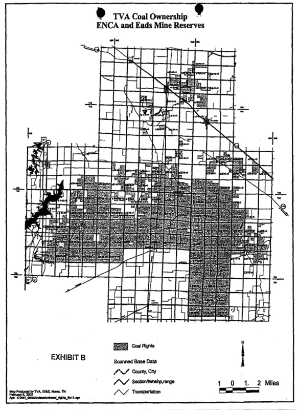
| EXHIBIT C TO ILLINOIS COAL LEASE |
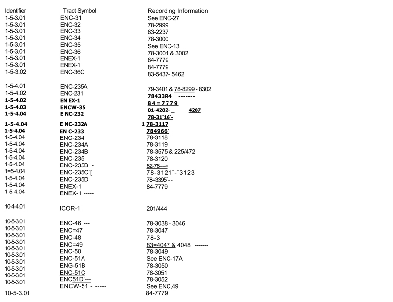
| EXHIBIT C TO ILLINOIS COAL LEASE |
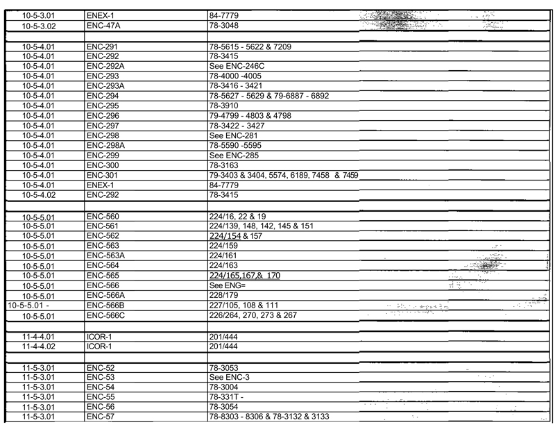
PAGE 2 OF EXHIBIT C TO COAL LEASE
| EXHIBIT C TO ILLINOIS COAL LEASE |
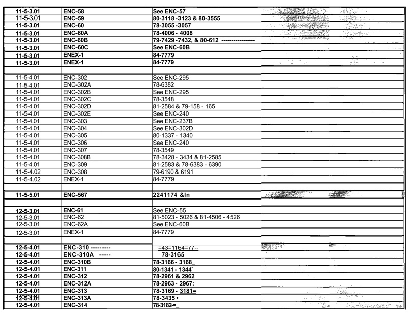
| EXHIBIT C TO ILLINOIS COAL LEASE |
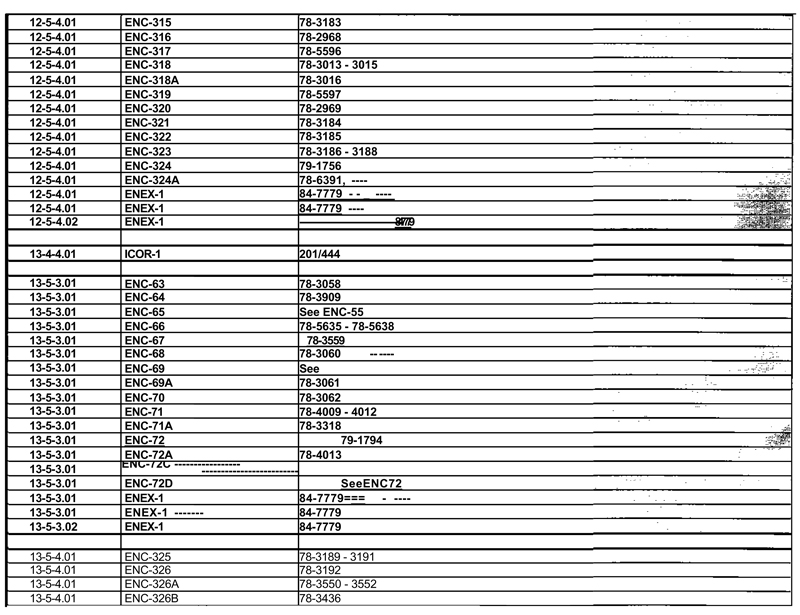
| EXHIBIT C TO ILLINOIS COAL LEASE |
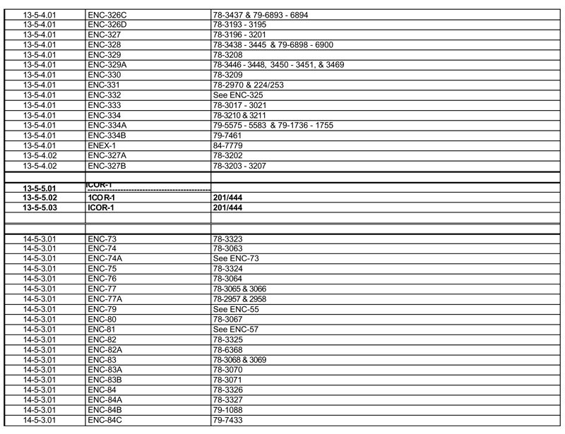
| EXHIBIT C TO ILLINOIS COAL LEASE |
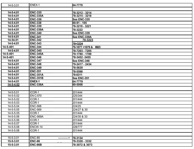
| EXHIBIT C TO ILLINOIS COAL LEASE |
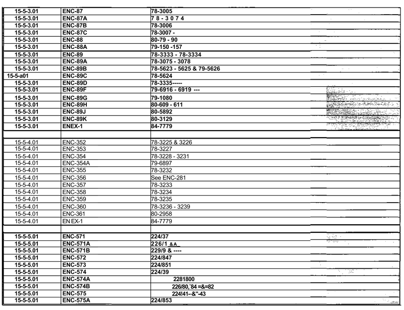
| EXHIBIT C TO ILLINOIS COAL LEASE |
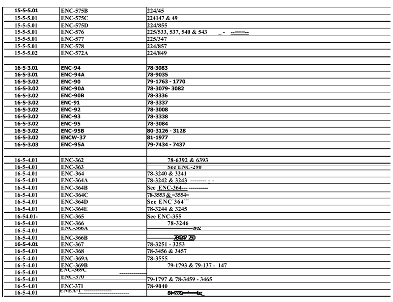
| EXHIBIT C TO ILLINOIS COAL LEASE |
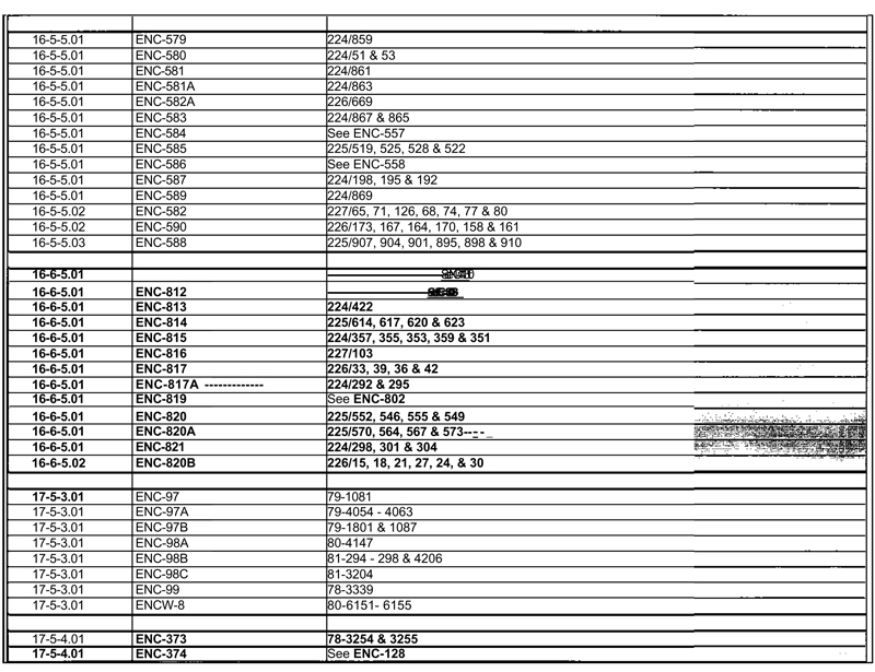
| EXHIBIT C TO ILLINOIS COAL LEASE |
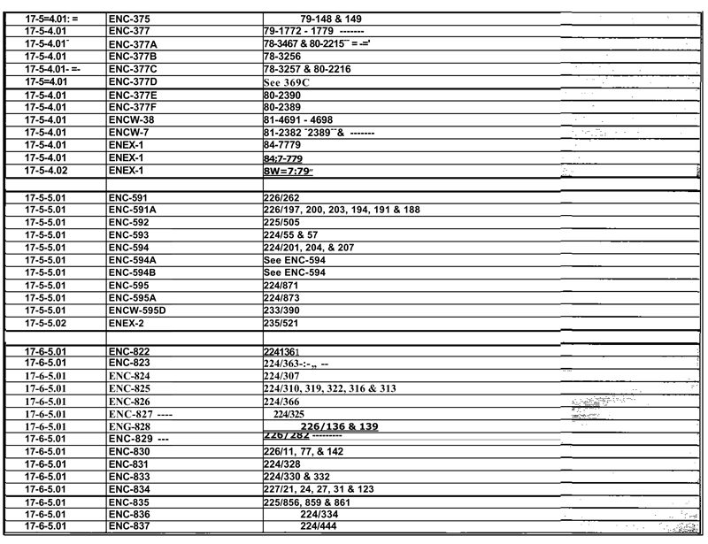
| EXHIBIT C TO ILLINOIS COAL LEASE |
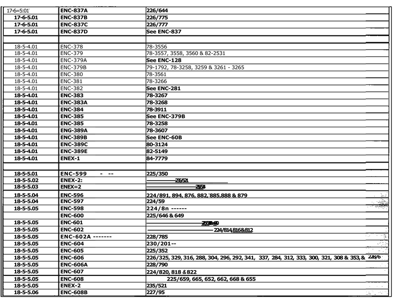
| EXHIBIT C TO ILLINOIS COAL LEASE |
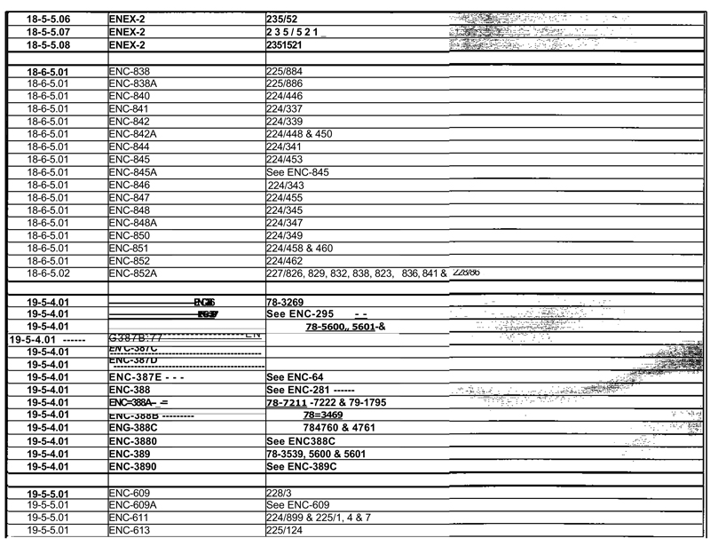
| EXHIBIT C TO ILLINOIS COAL LEASE |
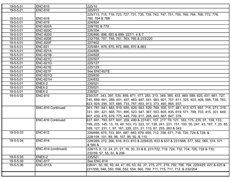
| EXHIBIT C TO ILLINOIS COAL LEASE |
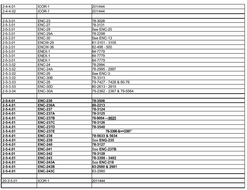
| EXHIBIT C TO ILLINOIS COAL LEASE |

| EXHIBIT C TO ILLINOIS COAL LEASE |
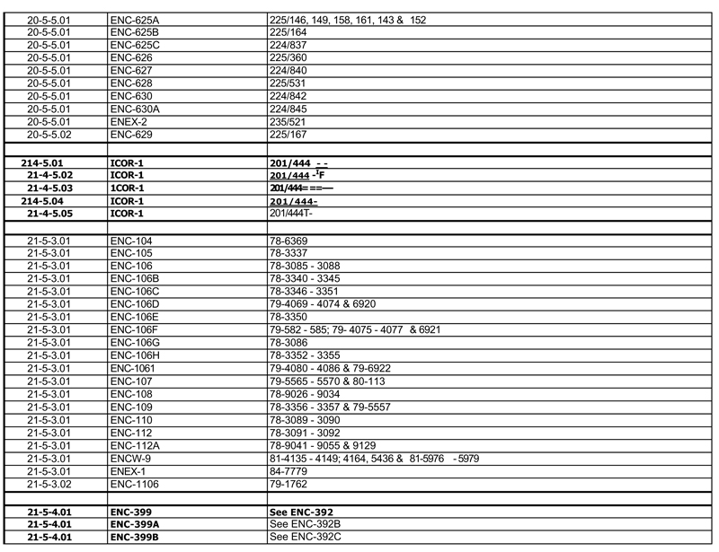
| EXHIBIT C TO ILLINOIS COAL LEASE |
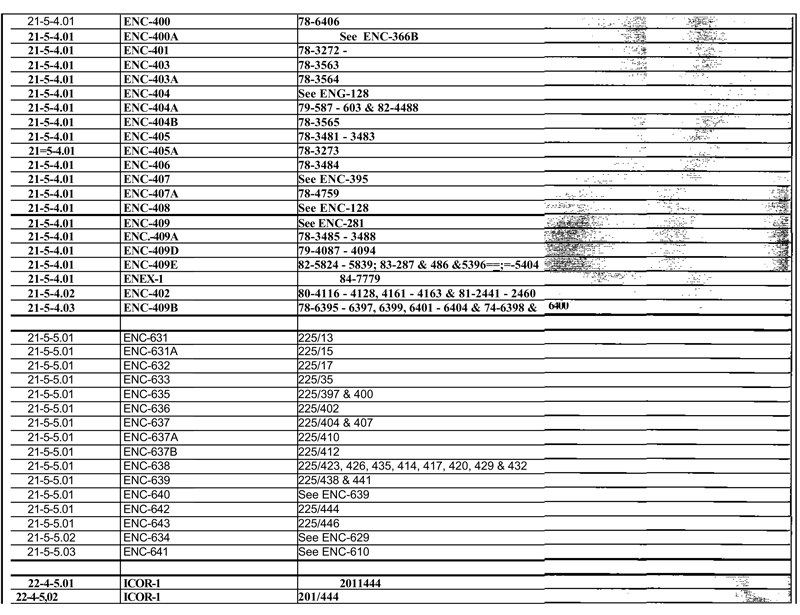
| EXHIBIT C TO ILLINOIS COAL LEASE |
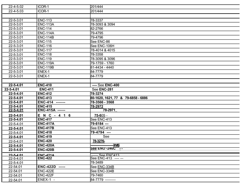
| EXHIBIT C TO ILLINOIS COAL LEASE |
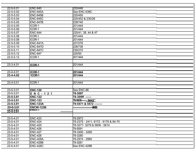
| EXHIBIT C TO ILLINOIS COAL LEASE |
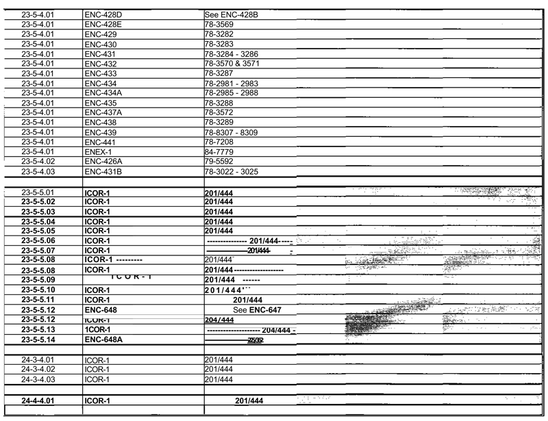
| EXHIBIT C TO ILLINOIS COAL LEASE |
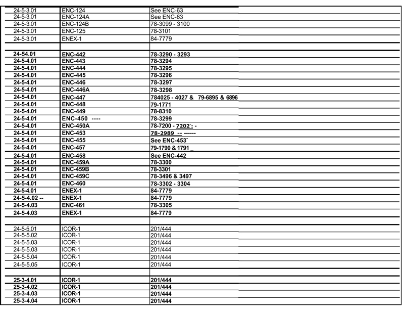
| EXHIBIT C TO ILLINOIS COAL LEASE |
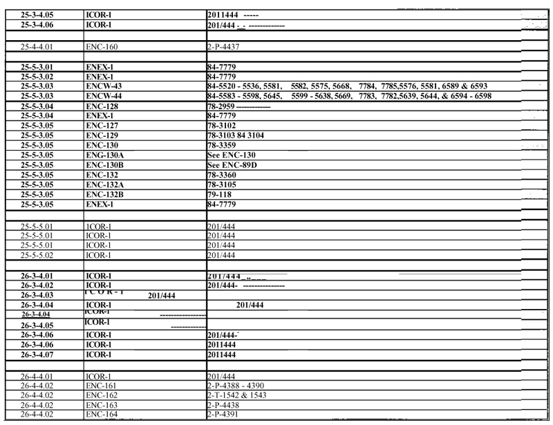
| EXHIBIT C TO ILLINOIS COAL LEASE |

| EXHIBIT C TO ILLINOIS COAL LEASE |
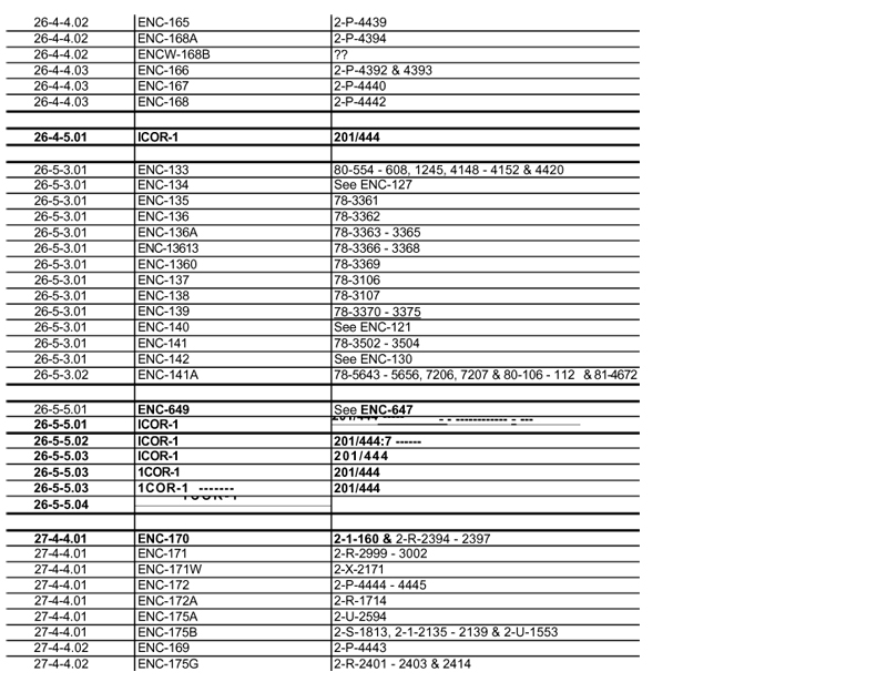
| EXHIBIT C TO ILLINOIS COAL LEASE |
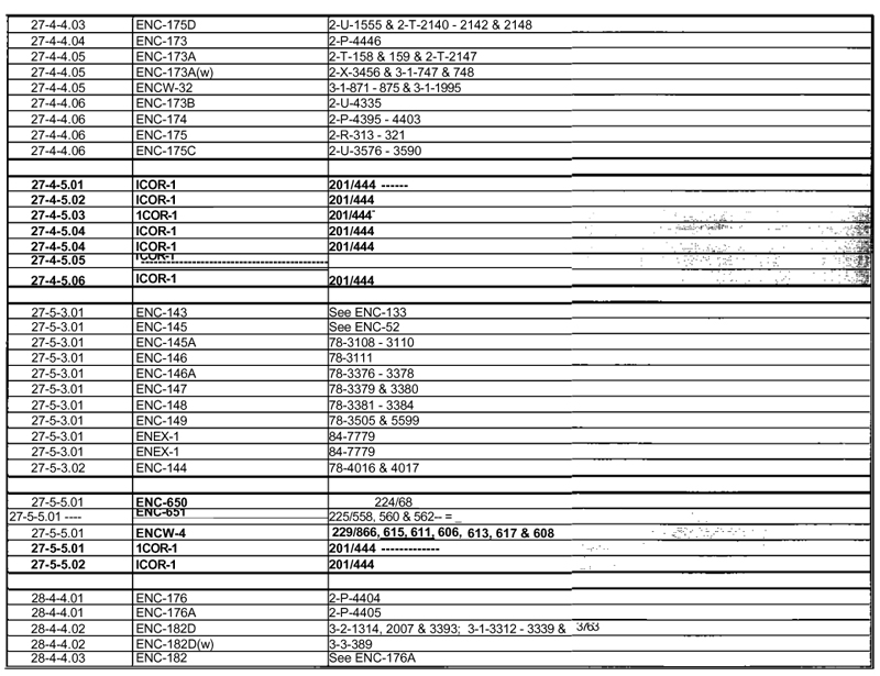
| EXHIBIT C TO ILLINOIS COAL LEASE |
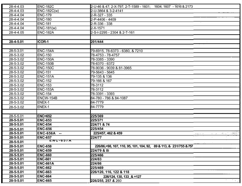
| EXHIBIT C TO ILLINOIS COAL LEASE |
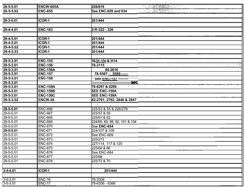
| EXHIBIT C TO ILLINOIS COAL LEASE |
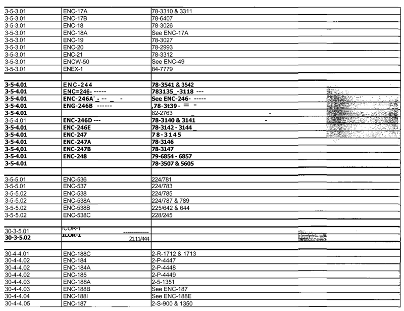
PAGE 27 OF EXHIBIT C TO COAL LEASE
| EXHIBIT C TO ILLINOIS COAL LEASE |
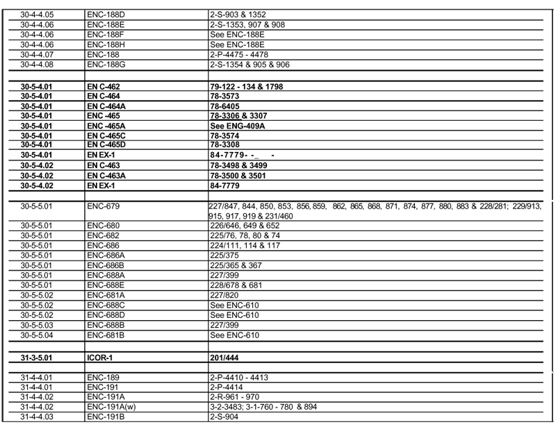
| EXHIBIT C TO ILLINOIS COAL LEASE |
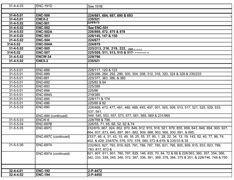
| EXHIBIT C TO ILLINOIS COAL LEASE |
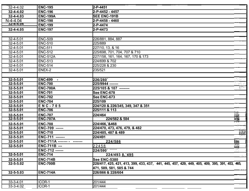
| EXHIBIT C TO ILLINOIS COAL LEASE |
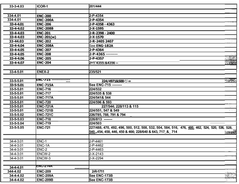
| EXHIBIT C TO ILLINOIS COAL LEASE |
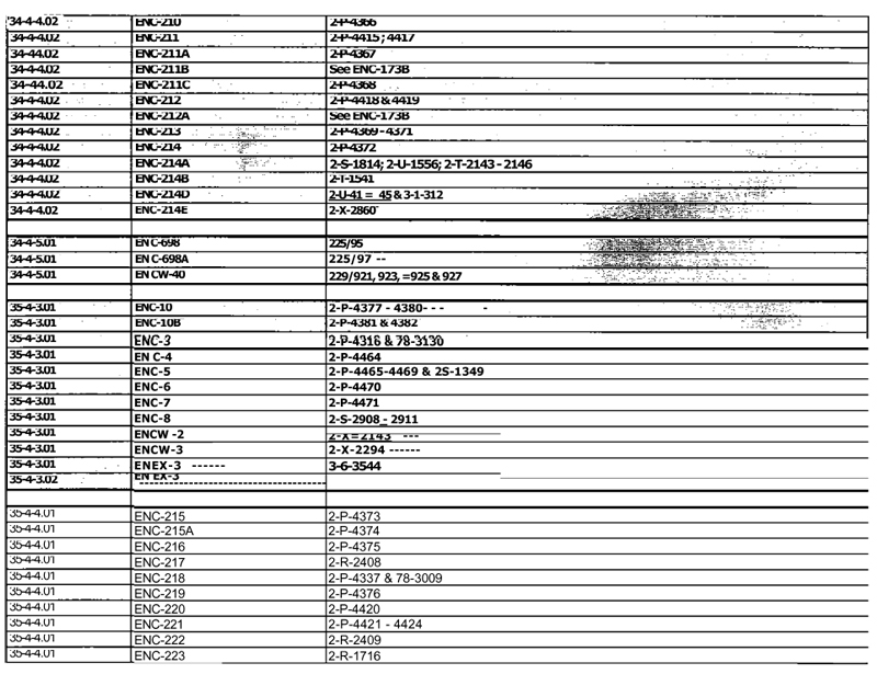
PAGE 32 OF EXHIBIT C TO COAL LEASE
| EXHIBIT C TO ILLINOIS COAL LEASE |
| EXHIBIT C TO ILLINOIS COAL LEASE |
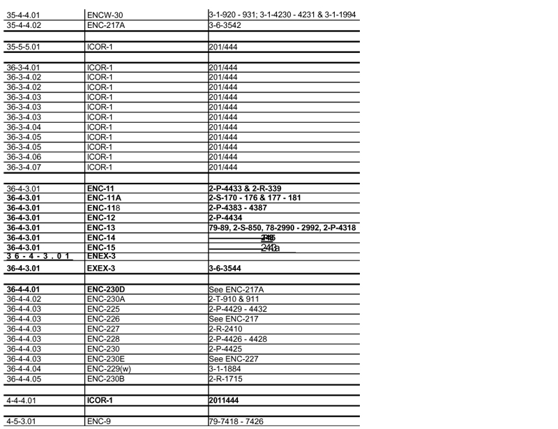
| EXHIBIT C TO ILLINOIS COAL LEASE |
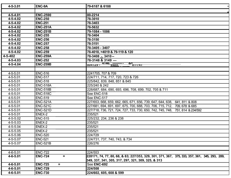
| EXHIBIT C TO ILLINOIS COAL LEASE |
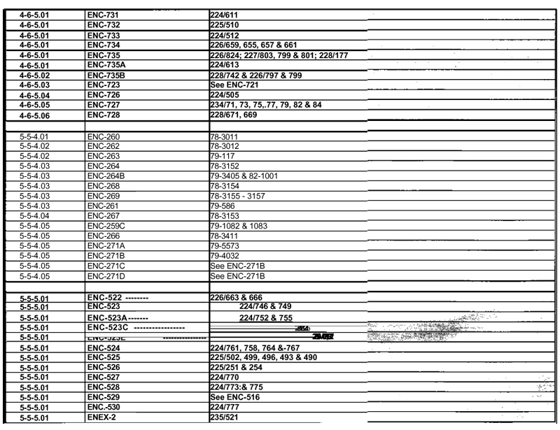
| EXHIBIT C TO ILLINOIS COAL LEASE |
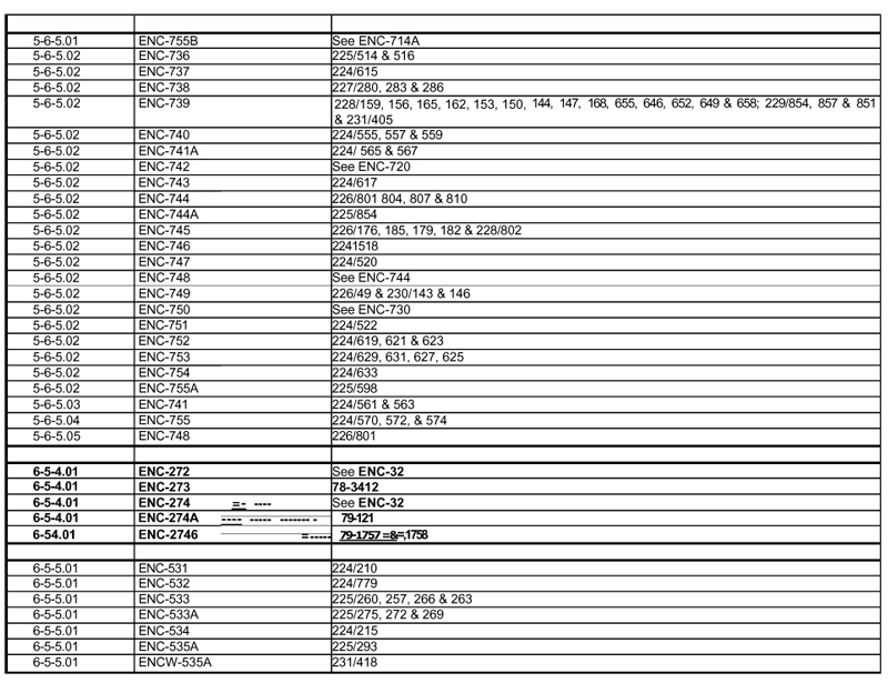
| EXHIBIT C TO ILLINOIS COAL LEASE |
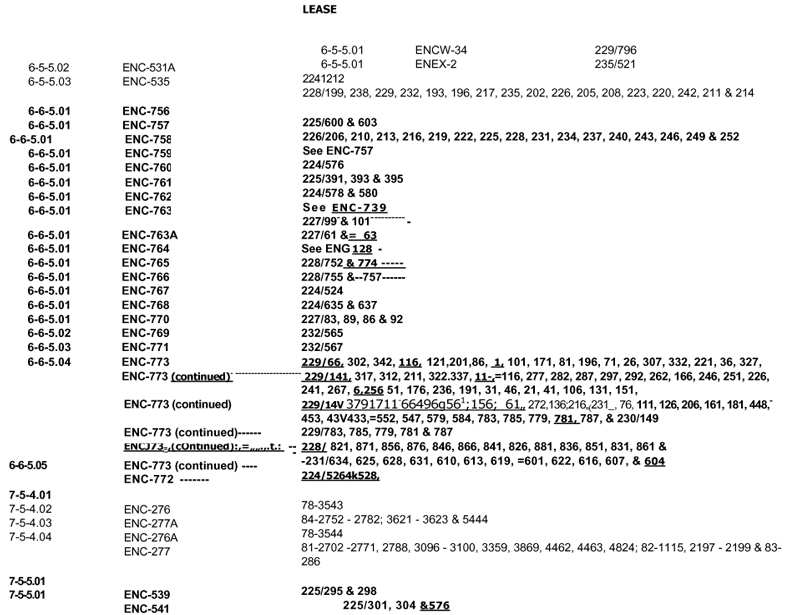
| EXHIBIT C TO ILLINOIS COAL LEASE |
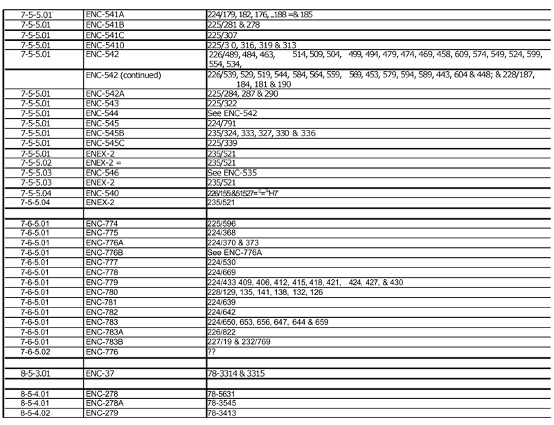
| EXHIBIT C TO ILLINOIS COAL LEASE |
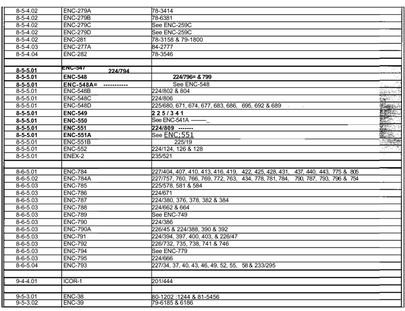
| EXHIBIT C TO ILLINOIS COAL LEASE |
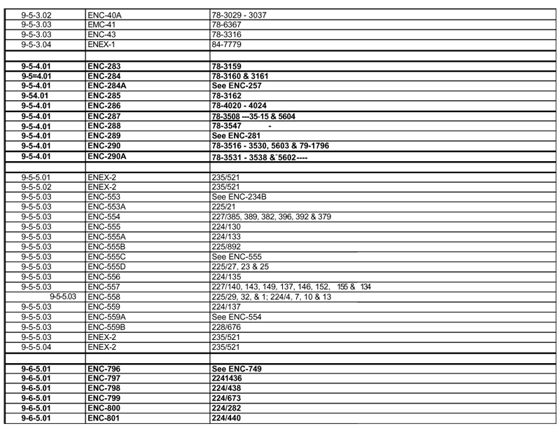
| EXHIBIT C TO ILLINOIS COAL LEASE |
